Severe Weather Possible for the Carolinas
Special Stories
26 Sep 2018 10:11 AM
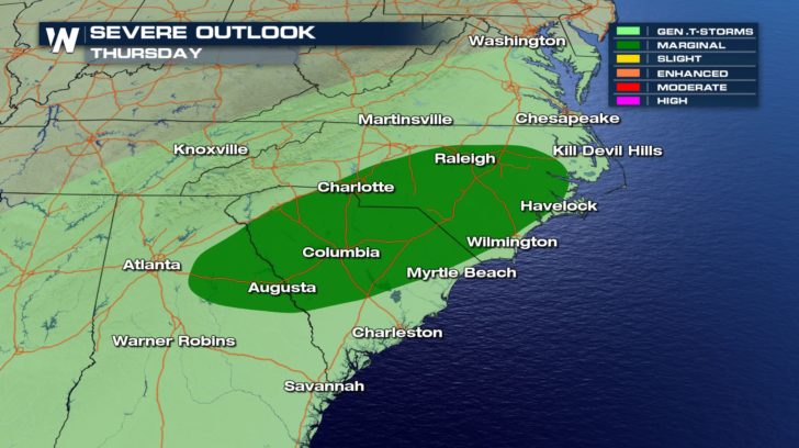 North Carolina, South Carolina, and Georgia are under a marginal risk of severe weather for Thursday. This means isolated severe thunderstorms will be possible during the day.
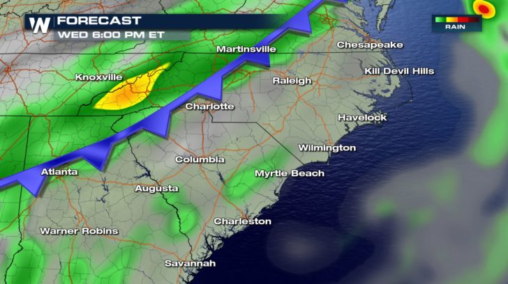
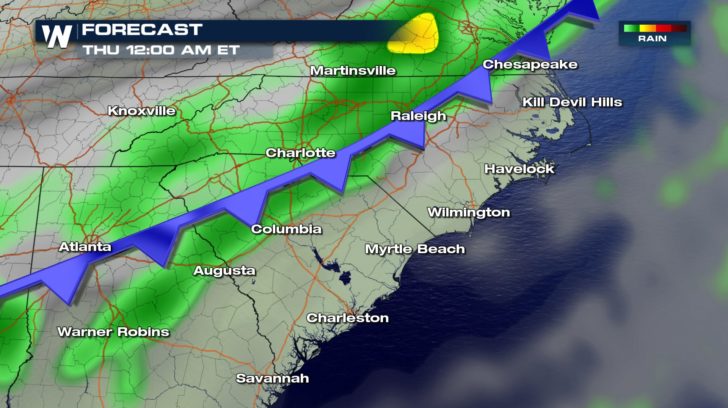
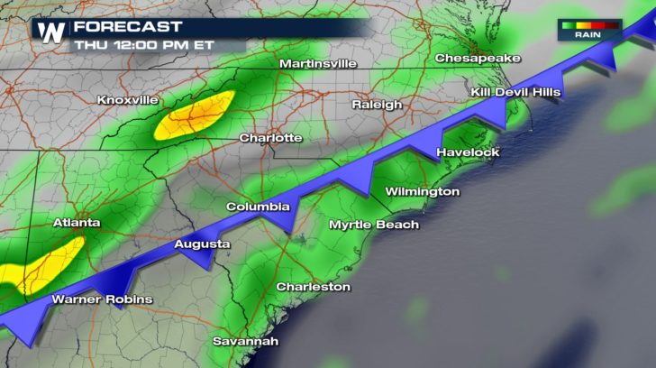 The reason for the possible severe weather is a cold front moving in from the west. This system could bring in heavy rain, as well. Rain will start up today and continue for the next several days.
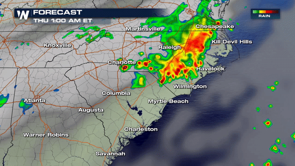
 Over the next few days, this cold front could bring several inches of rain to the southeast. Stay weather aware, everyone! Ponding or flooding on roads could be possible.
All Weather News
More
Fronts Continue To Spark Severe Weather Across the Plains
A cold front that brought record lows to the
18 Jul 2025 10:40 PM

Extreme Heat Impacts for the East Coast & South
Extreme heat continues to impact several area
18 Jul 2025 10:05 PM

Flooding Threat Remains Elevated in the East
A cold front pushing through the Eastern Seab
18 Jul 2025 9:10 PM

EF-2 Firenado from the Deer Creek Fire in Utah
A fire tornado was spotted near La Sal, Utah
18 Jul 2025 7:30 AM

Tropical System Brings Flood Risk to the Central Gulf
Time has run out for notable tropical develop
18 Jul 2025 3:05 AM

Heavy Rain, Flooding Threat Returns to Florida
Keep the rain boots handy in Florida - heavy
13 Jul 2025 12:50 PM

Severe Storm Risk Pushes into the Great Lakes, Ohio Valley
Friday was another busy day with severe weath
12 Jul 2025 8:00 PM