Severe Weather Possible in the High Plains and Upper Midwest
Special Stories
9 Jul 2018 8:59 AM
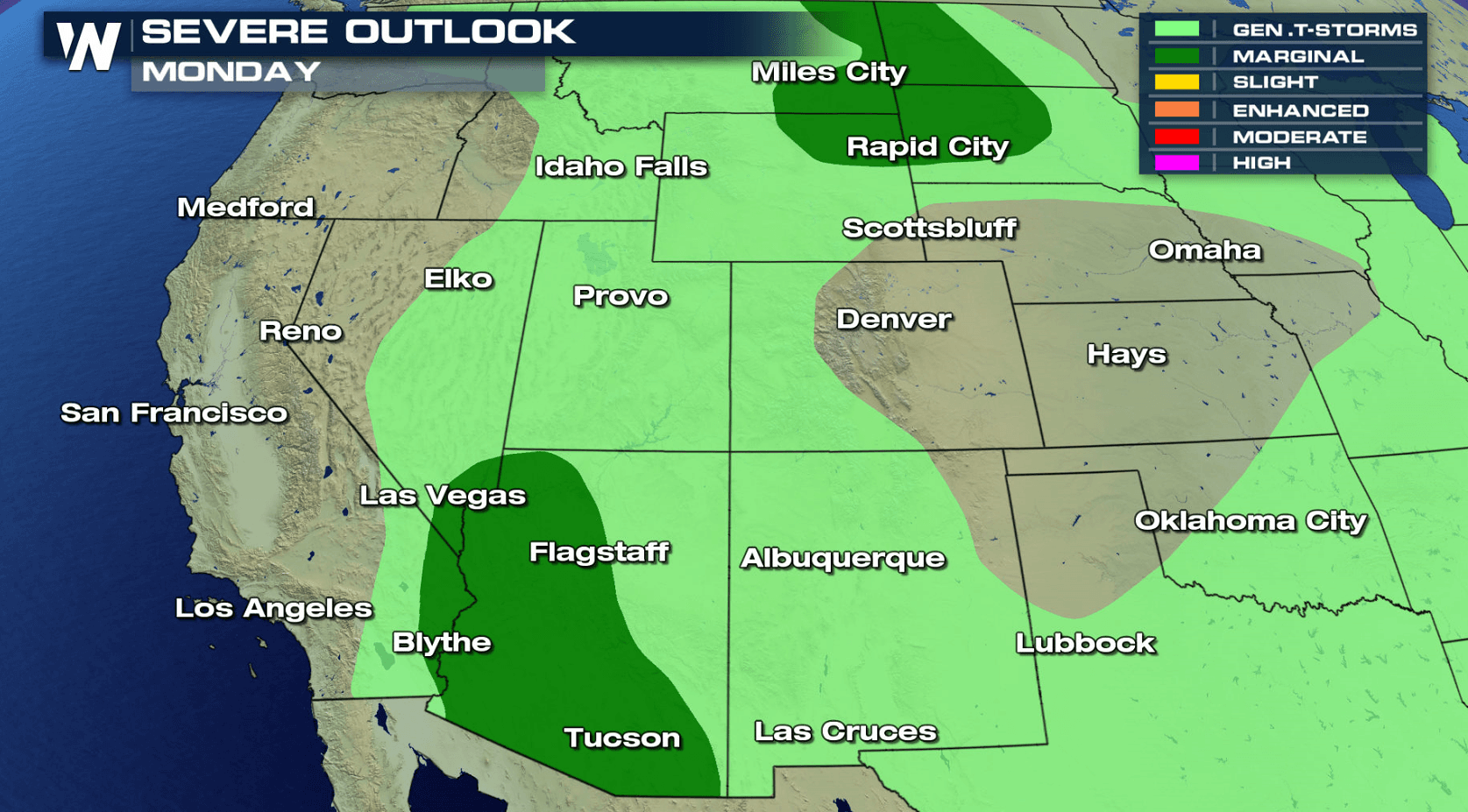
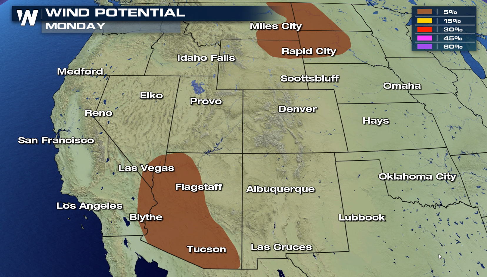
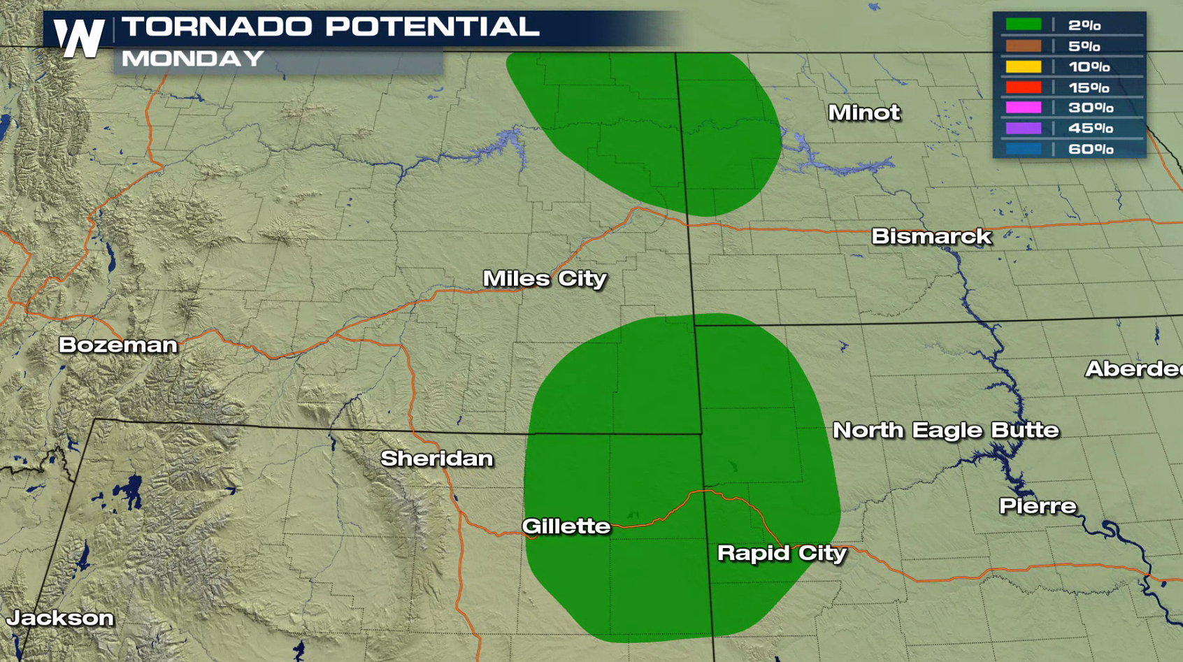
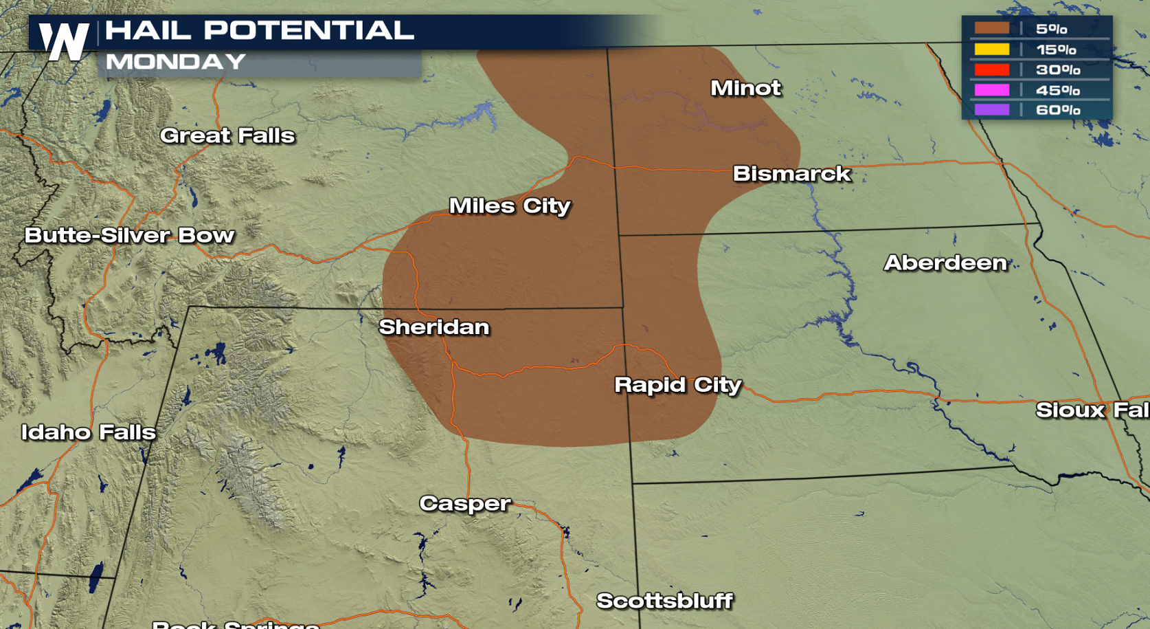
An active Jet Stream pattern across the northern tier of the nation will be the focus for severe weather this week, similar to last week. There is a marginal risk for severe thunderstorms in parts of Montana, Wyoming, North Dakota and South Dakota today (Monday), centered near a warm front and low pressure center. Monsoonal storms may also produce a few severe storms later this afternoon and evening.
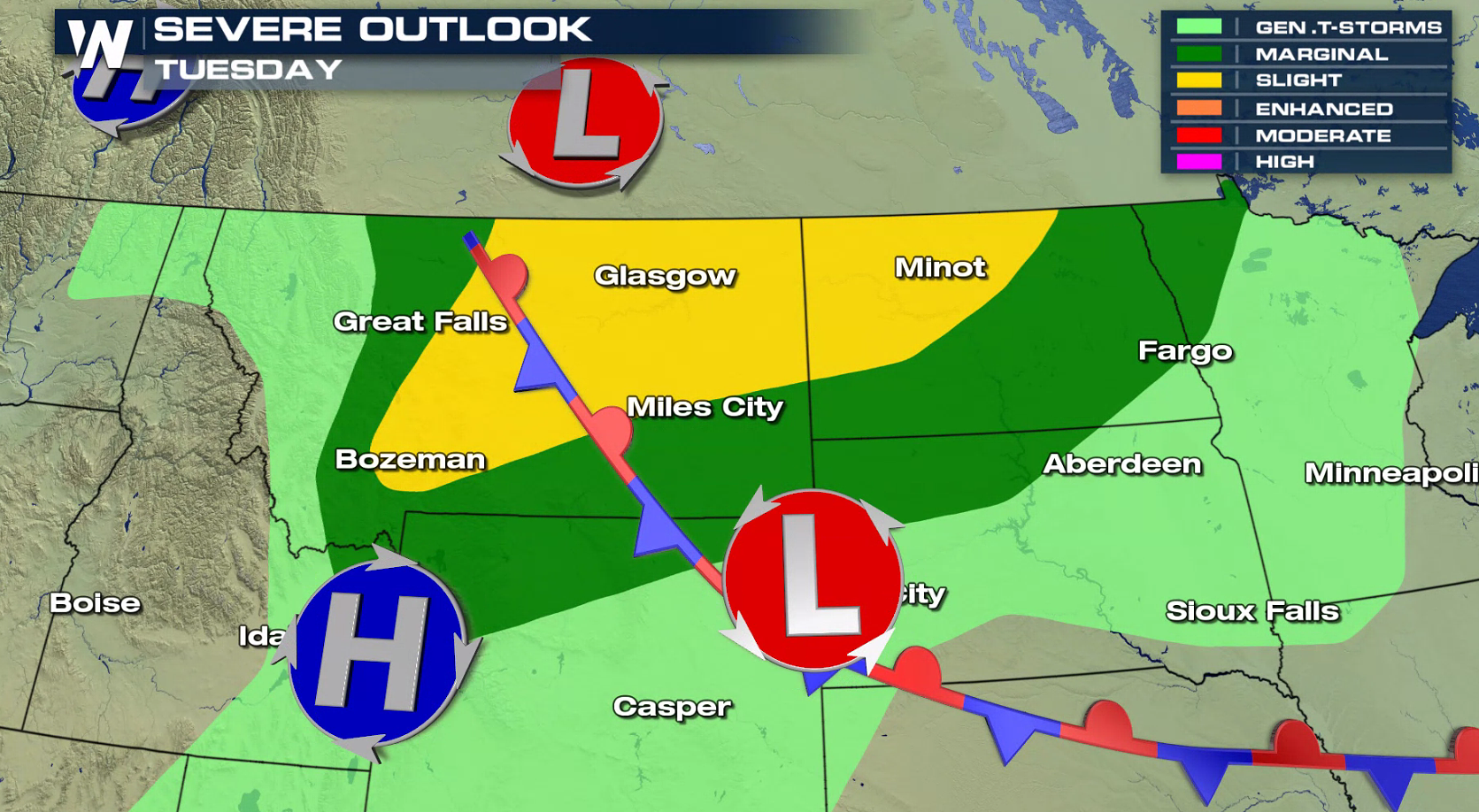
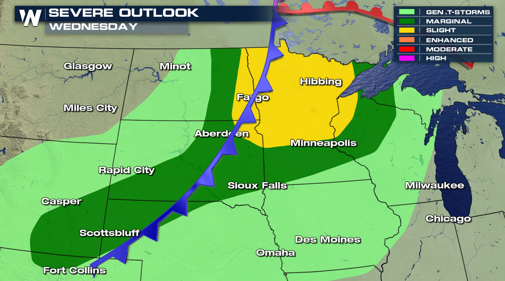
 As a stronger low develops in Canada near the front, a more organized area of severe thunderstorms is expected to develop and move through the region into the middle of the week. There is a slight risk for severe thunderstorms in Montana and North Dakota Tuesday, shifting eastward to include Minnesota and Wisconsin Wednesday.
 For WeatherNation: Meteorologist Mace Michaels
As a stronger low develops in Canada near the front, a more organized area of severe thunderstorms is expected to develop and move through the region into the middle of the week. There is a slight risk for severe thunderstorms in Montana and North Dakota Tuesday, shifting eastward to include Minnesota and Wisconsin Wednesday.
For WeatherNation: Meteorologist Mace MichaelsAll Weather News
More
Fronts Continue To Spark Severe Weather Across the Plains
A cold front that brought record lows to the
18 Jul 2025 10:40 PM

Extreme Heat Impacts for the East Coast & South
Extreme heat continues to impact several area
18 Jul 2025 10:05 PM

Flooding Threat Remains Elevated in the East
A cold front pushing through the Eastern Seab
18 Jul 2025 9:10 PM

EF-2 Firenado from the Deer Creek Fire in Utah
A fire tornado was spotted near La Sal, Utah
18 Jul 2025 7:30 AM

Tropical System Brings Flood Risk to the Central Gulf
Time has run out for notable tropical develop
18 Jul 2025 3:05 AM

Heavy Rain, Flooding Threat Returns to Florida
Keep the rain boots handy in Florida - heavy
13 Jul 2025 12:50 PM

Severe Storm Risk Pushes into the Great Lakes, Ohio Valley
Friday was another busy day with severe weath
12 Jul 2025 8:00 PM