Severe Weather Possible in the Plains into the Weekend
Special Stories
29 Mar 2019 8:10 AM
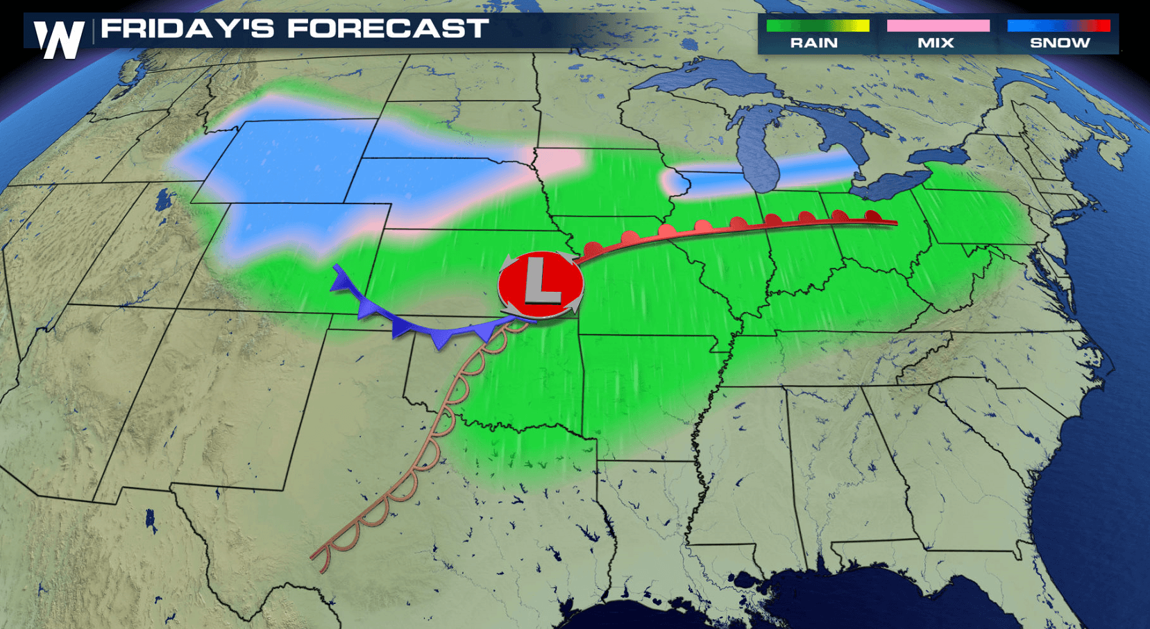
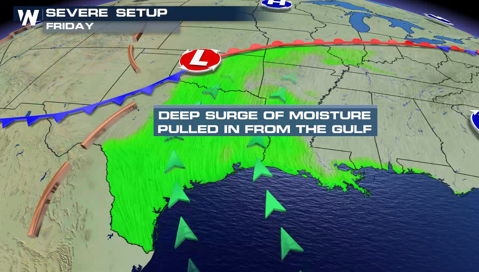
A low pressure center moving across the Plains will bring the risk for severe thunderstorms today (Friday). Humidity will be climbing with a rich, southerly flow of moisture from the Gulf of Mexico. Ahead of the system, temperatures will be warming. This will create instability to support severe storms.
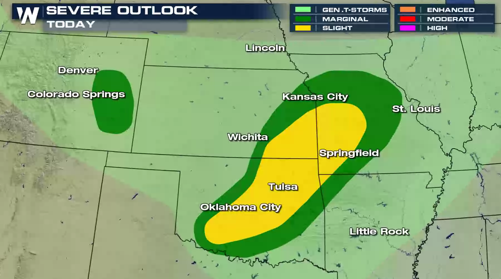
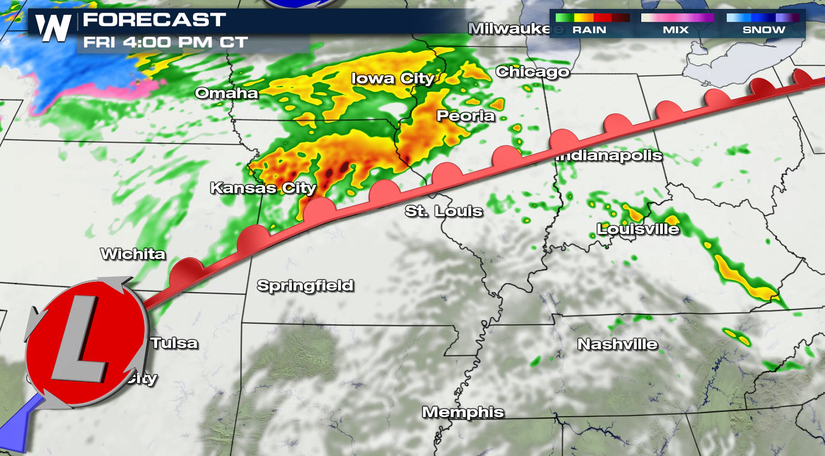
 A slight risk for severe weather has been mapped out by the Storm Prediction Center for central Oklahoma into western Missouri. Large hail and strong wind gusts will be the primary risks, with an isolated tornado possible.
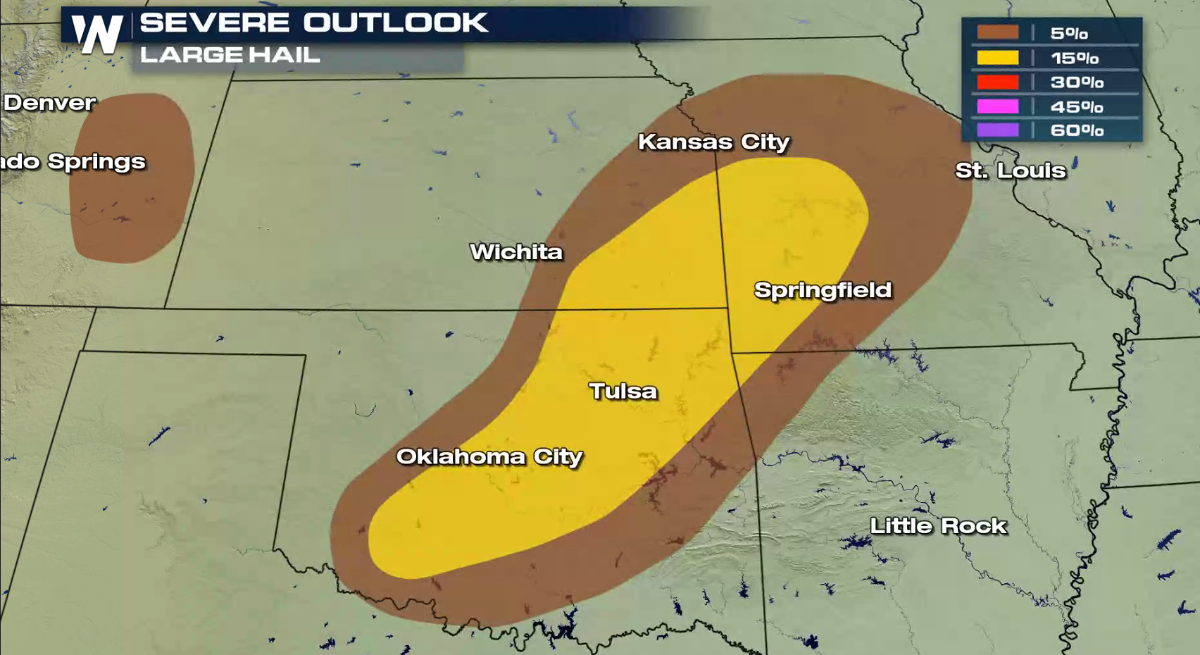
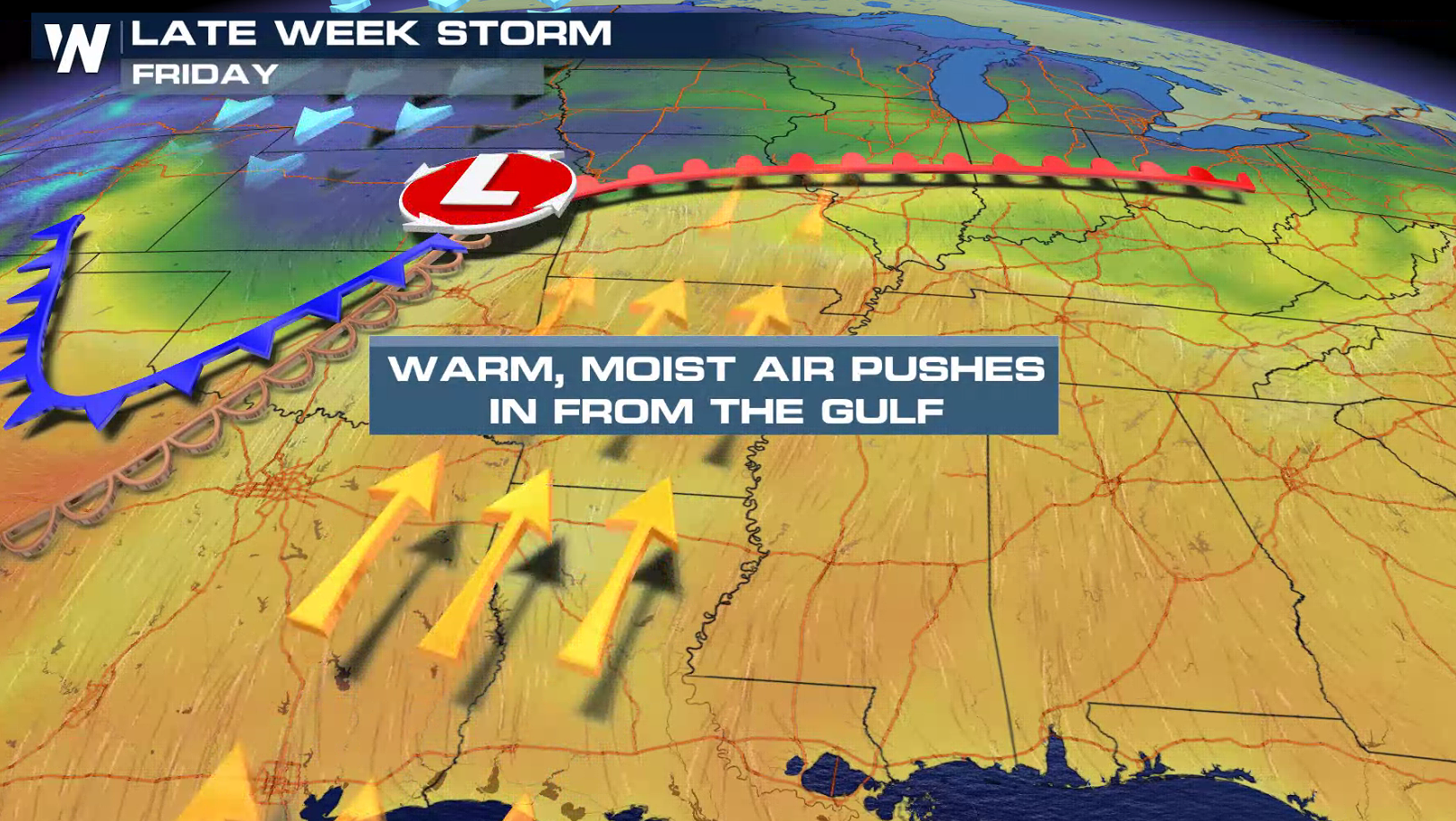
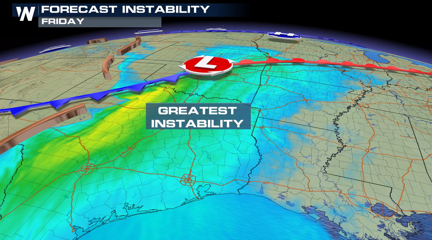
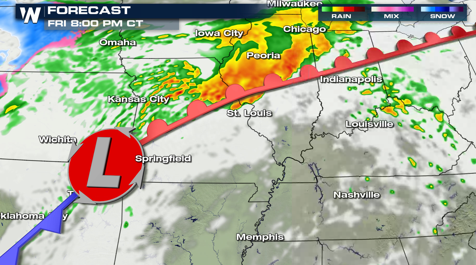
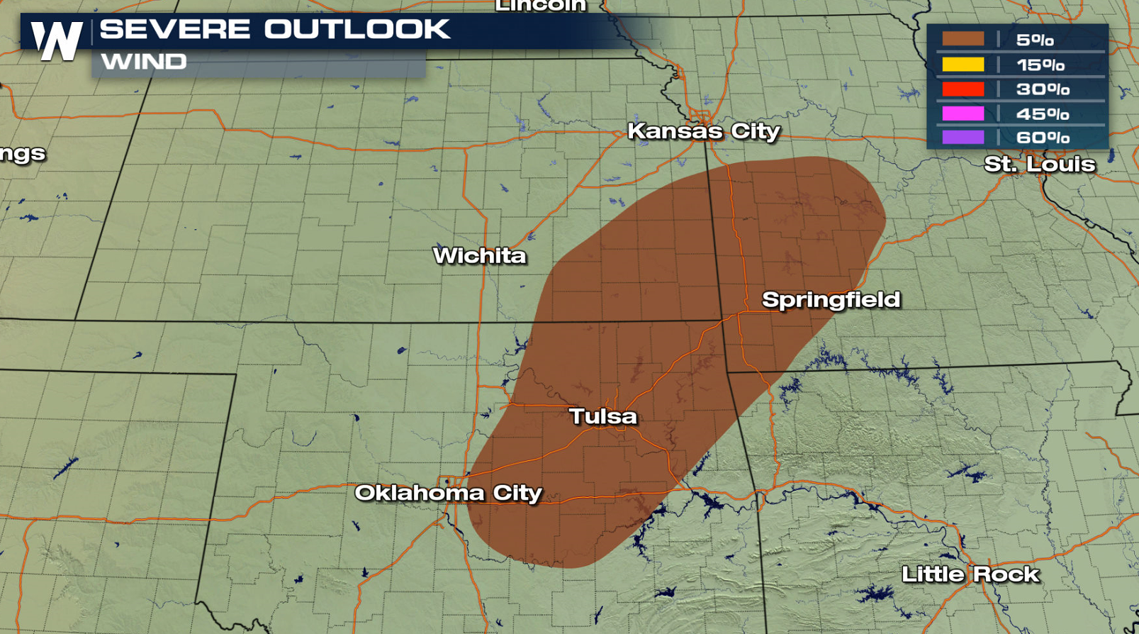 As temperatures surge well into the 70s, a weak upper level disturbance will move across the area along with a surface low pressure center and trough. With very cold temperatures aloft, hail is possible with any storms that develop. Storm coverage will continue to increase along the warm front and ahead of the low pressure center into this evening.
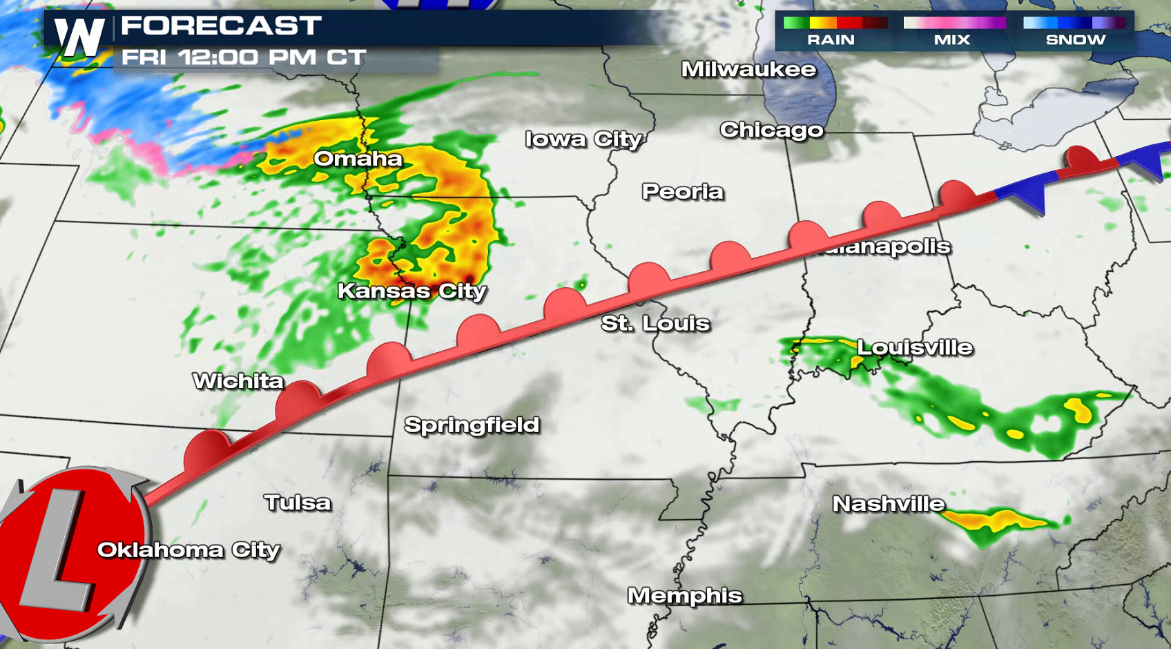
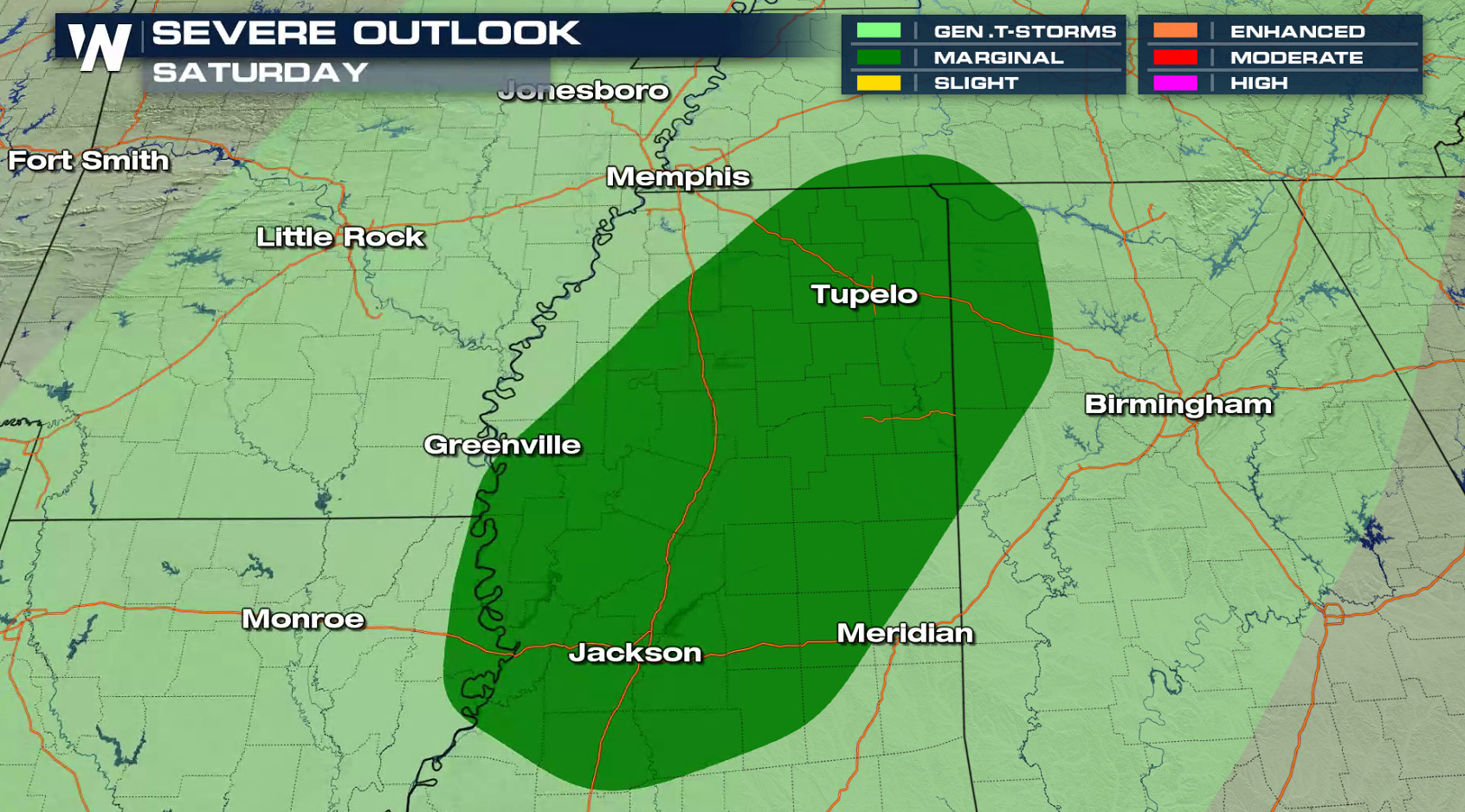
 A marginal severe weather risk is posted for Saturday. Areas from the Tennessee Valley to the Mississippi Delta may see strong wind gusts as the storm system moves into the region.
 For WeatherNation: Meteorologist Mace Michaels
A slight risk for severe weather has been mapped out by the Storm Prediction Center for central Oklahoma into western Missouri. Large hail and strong wind gusts will be the primary risks, with an isolated tornado possible.
As temperatures surge well into the 70s, a weak upper level disturbance will move across the area along with a surface low pressure center and trough. With very cold temperatures aloft, hail is possible with any storms that develop. Storm coverage will continue to increase along the warm front and ahead of the low pressure center into this evening.
A marginal severe weather risk is posted for Saturday. Areas from the Tennessee Valley to the Mississippi Delta may see strong wind gusts as the storm system moves into the region.
For WeatherNation: Meteorologist Mace MichaelsAll Weather News
More
Fronts Continue To Spark Severe Weather Across the Plains
A cold front that brought record lows to the
18 Jul 2025 10:40 PM

Extreme Heat Impacts for the East Coast & South
Extreme heat continues to impact several area
18 Jul 2025 10:05 PM

Flooding Threat Remains Elevated in the East
A cold front pushing through the Eastern Seab
18 Jul 2025 9:10 PM

EF-2 Firenado from the Deer Creek Fire in Utah
A fire tornado was spotted near La Sal, Utah
18 Jul 2025 7:30 AM

Tropical System Brings Flood Risk to the Central Gulf
Time has run out for notable tropical develop
18 Jul 2025 3:05 AM

Heavy Rain, Flooding Threat Returns to Florida
Keep the rain boots handy in Florida - heavy
13 Jul 2025 12:50 PM

Severe Storm Risk Pushes into the Great Lakes, Ohio Valley
Friday was another busy day with severe weath
12 Jul 2025 8:00 PM