Severe Weather Possible in the Upper Midwest
Special Stories
15 May 2019 5:21 AM
SEVERE OUTLOOK
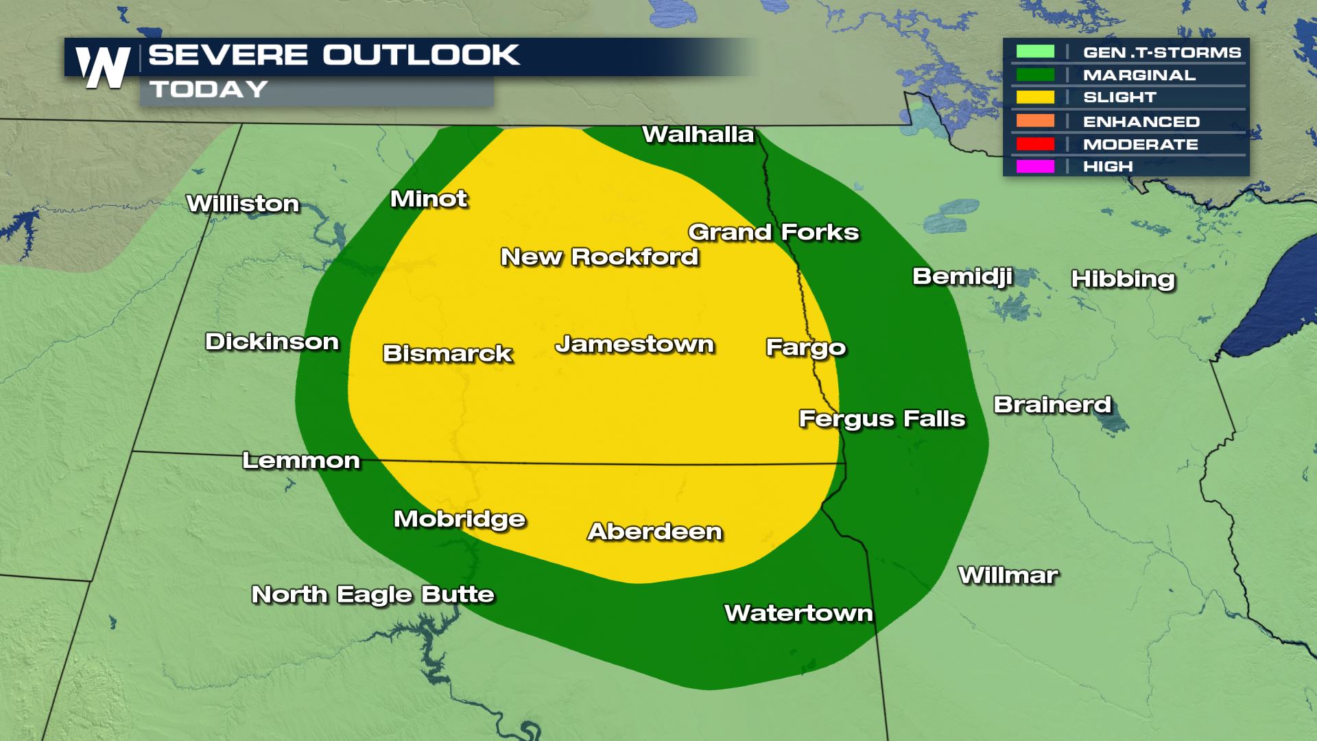
 There is a severe weather chance for the Dakotas and Minnesota, today.
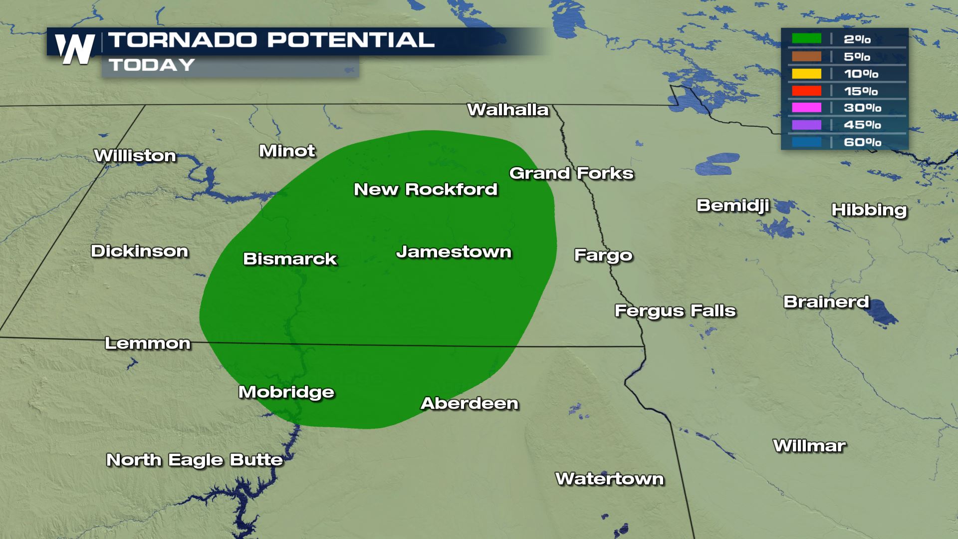
Rotation could occur within some of these storms.
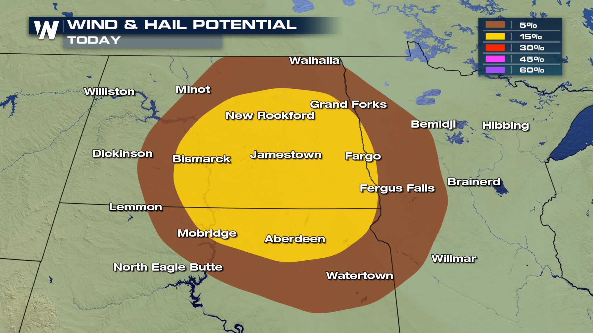
Hail from 1 to 2 inches will be possible as well as winds from 58 to 70 mph.
FORECAST
There is a severe weather chance for the Dakotas and Minnesota, today.
Rotation could occur within some of these storms.
Hail from 1 to 2 inches will be possible as well as winds from 58 to 70 mph.
FORECAST
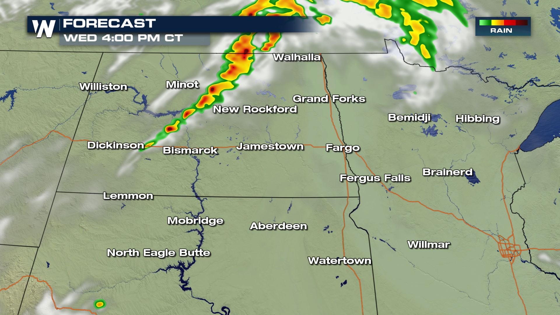
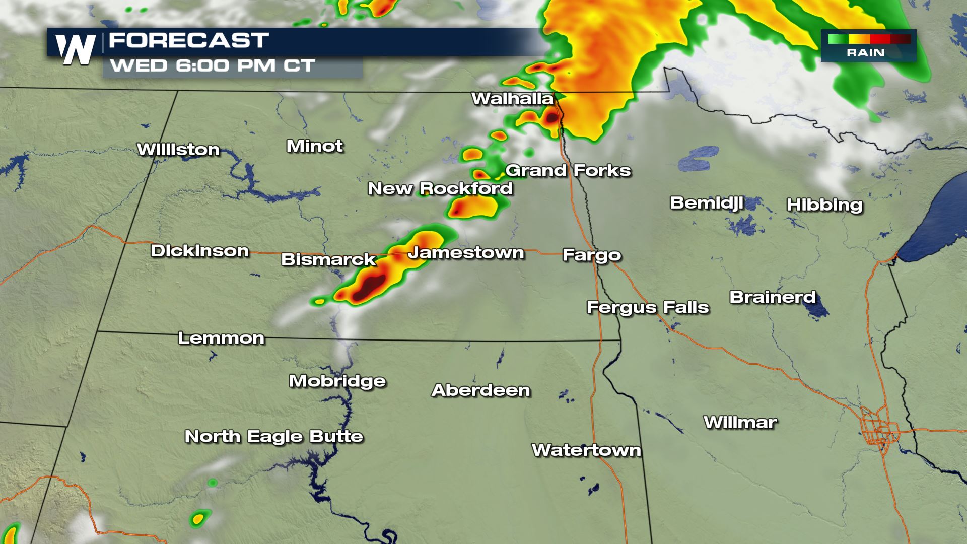
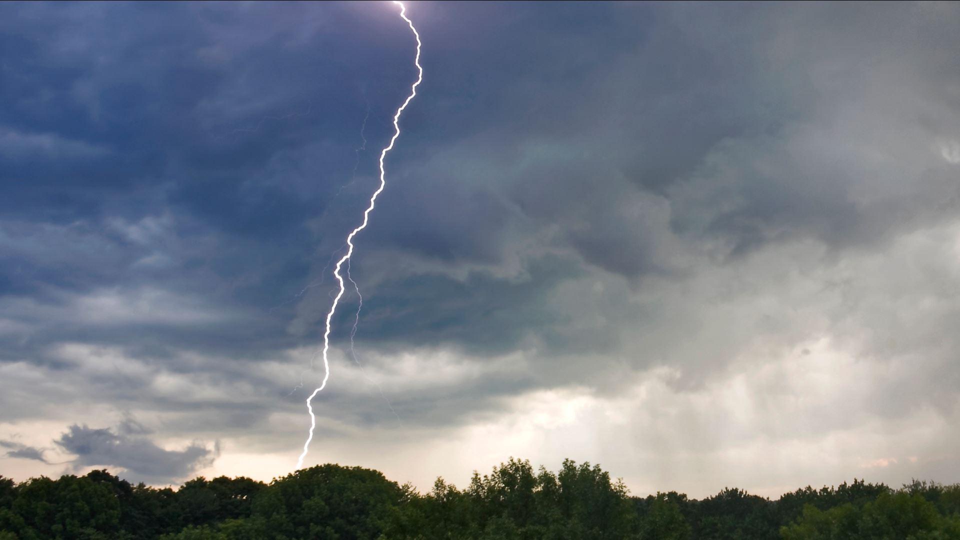
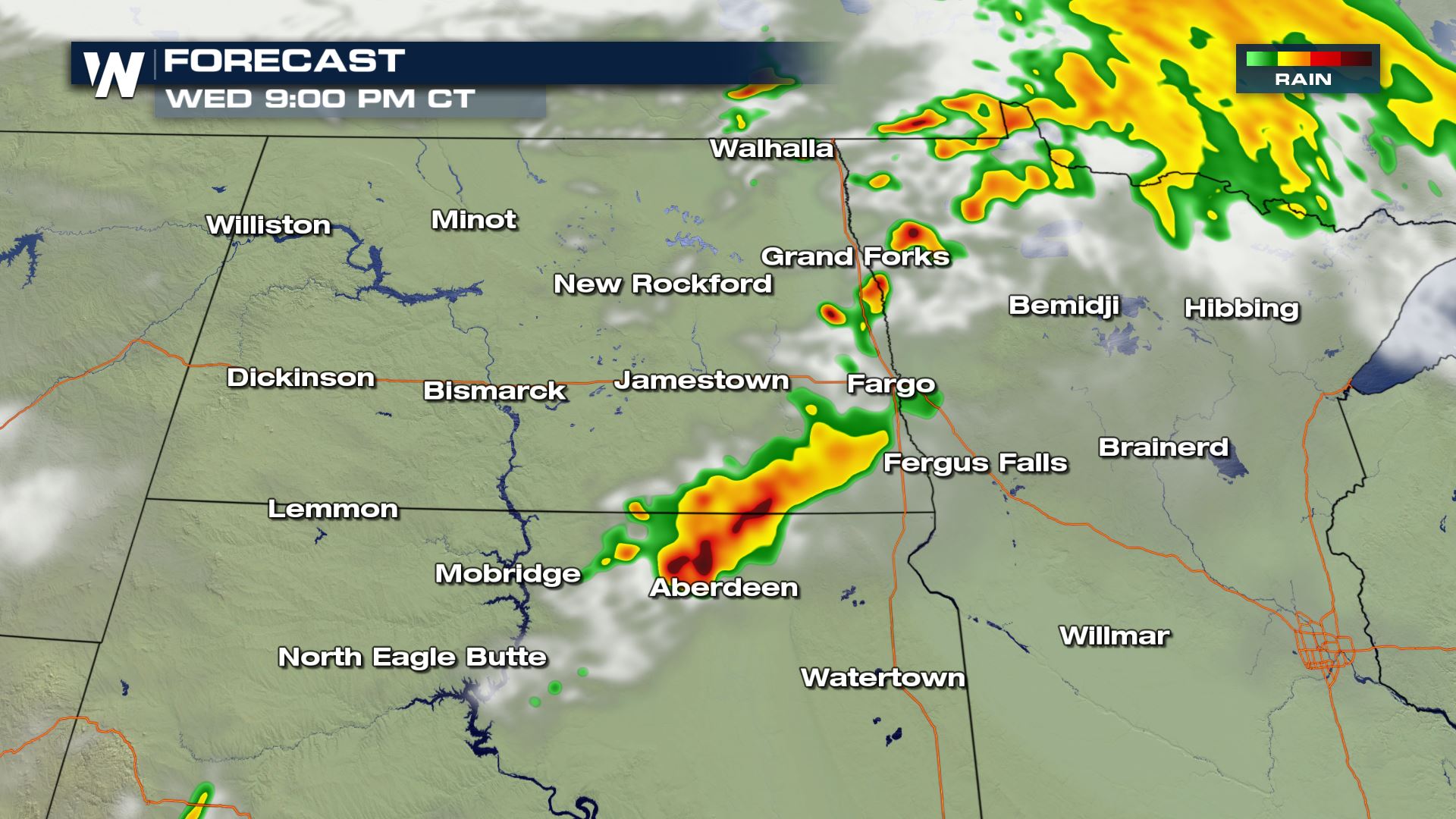 Storms start to kick off around 4 PM today and will continue throughout the evening. Some of these storms will be very strong and possess an abundant amount of lightning. Make sure to stay safe.
These storms will become less severe early Thursday morning, bringing only heavy rain to areas of Minnesota.
Storms start to kick off around 4 PM today and will continue throughout the evening. Some of these storms will be very strong and possess an abundant amount of lightning. Make sure to stay safe.
These storms will become less severe early Thursday morning, bringing only heavy rain to areas of Minnesota.
There is a severe weather chance for the Dakotas and Minnesota, today.
Rotation could occur within some of these storms.
Hail from 1 to 2 inches will be possible as well as winds from 58 to 70 mph.
FORECAST
Storms start to kick off around 4 PM today and will continue throughout the evening. Some of these storms will be very strong and possess an abundant amount of lightning. Make sure to stay safe.
These storms will become less severe early Thursday morning, bringing only heavy rain to areas of Minnesota.All Weather News
More
Wildfire Outbreak in the Pacific Northwest
SPOKANE, WA - On Saturday, August 1st, the Ol
3 Aug 2026 1:55 AM

More Storms for the East Through Monday
A low-pressure system that moved through the
3 Aug 2026 1:50 AM


After Reaching Category 5, Genevieve Weakens in the Pacific
PacificGenevieve formed last Friday south of
3 Aug 2026 12:30 AM

Flooding, Severe Storms Target the Midwest Again
After an active week of storms across the nor
1 Aug 2026 1:40 AM

Flooding Risk Increases as Heavy Rain Targets the Tri-State Area
Tuesday, heavy rainfall moved across the Nort
30 Jul 2026 12:25 AM

Severe Weather: Energy From the Midwest Now in the Southeast
UPPER MIDWEST - Through Monday, dangerous tor
29 Jul 2026 10:30 PM