Severe Weather Possible in the Upper Midwest into July 4th
Special Stories
3 Jul 2018 2:55 PM
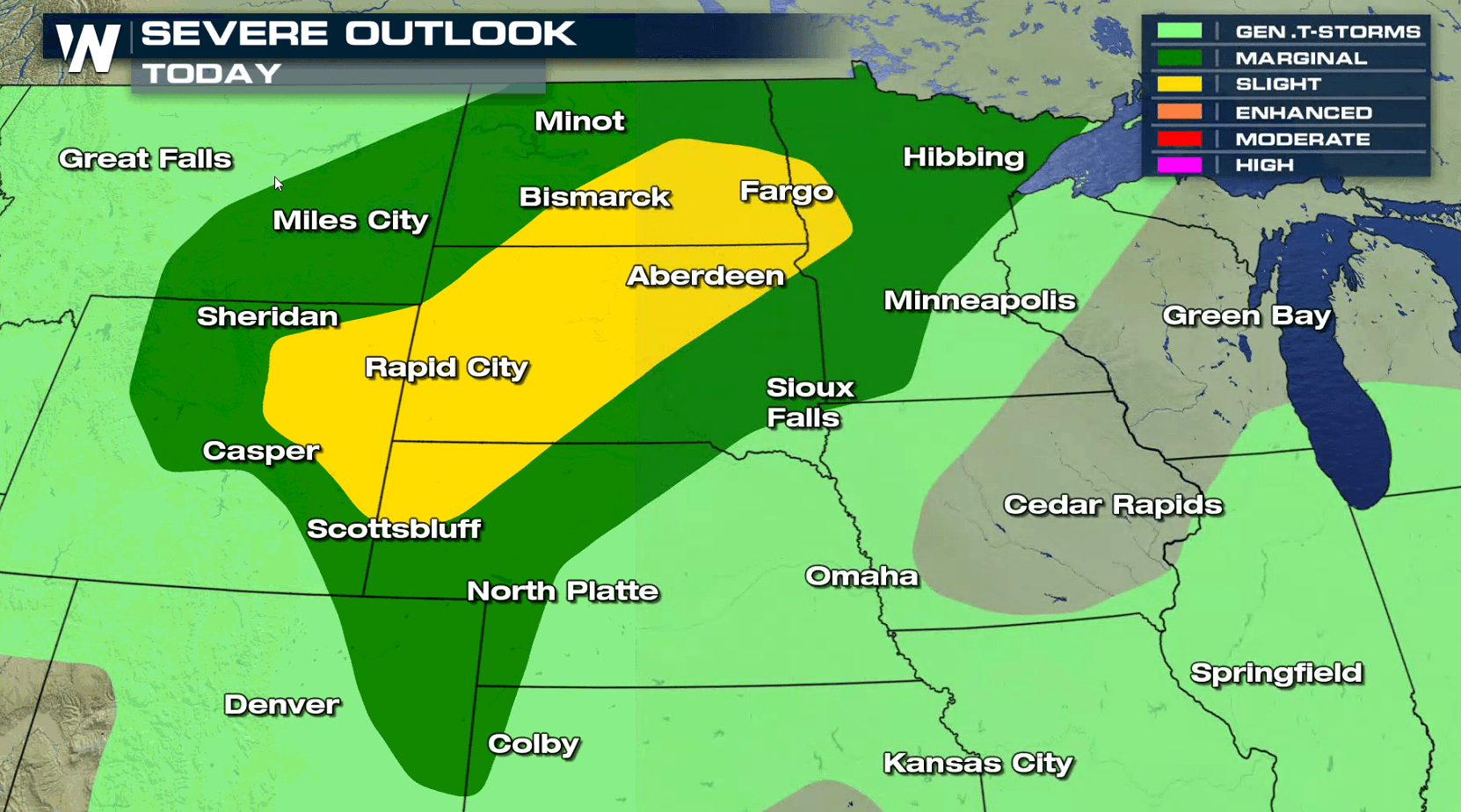
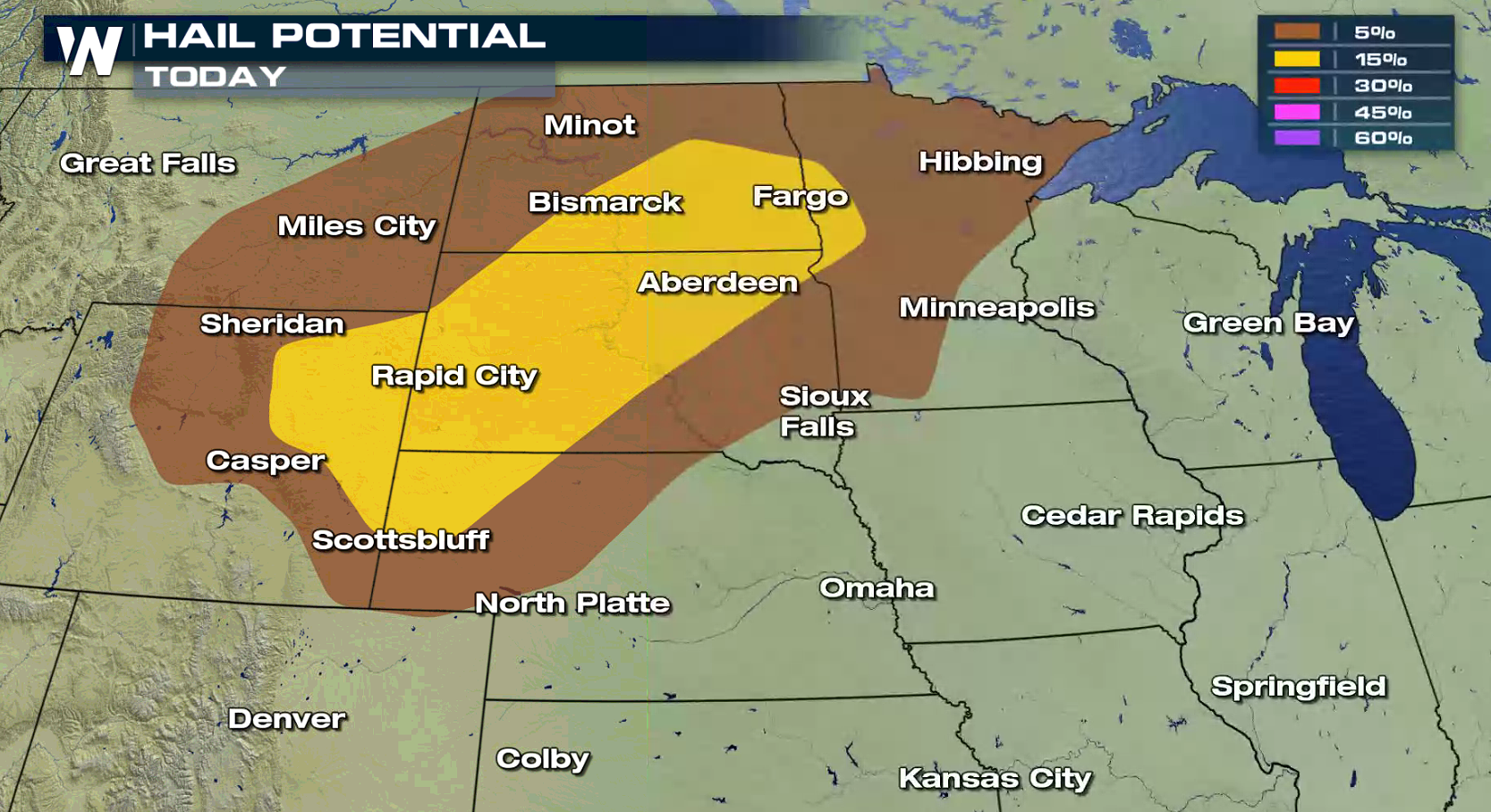
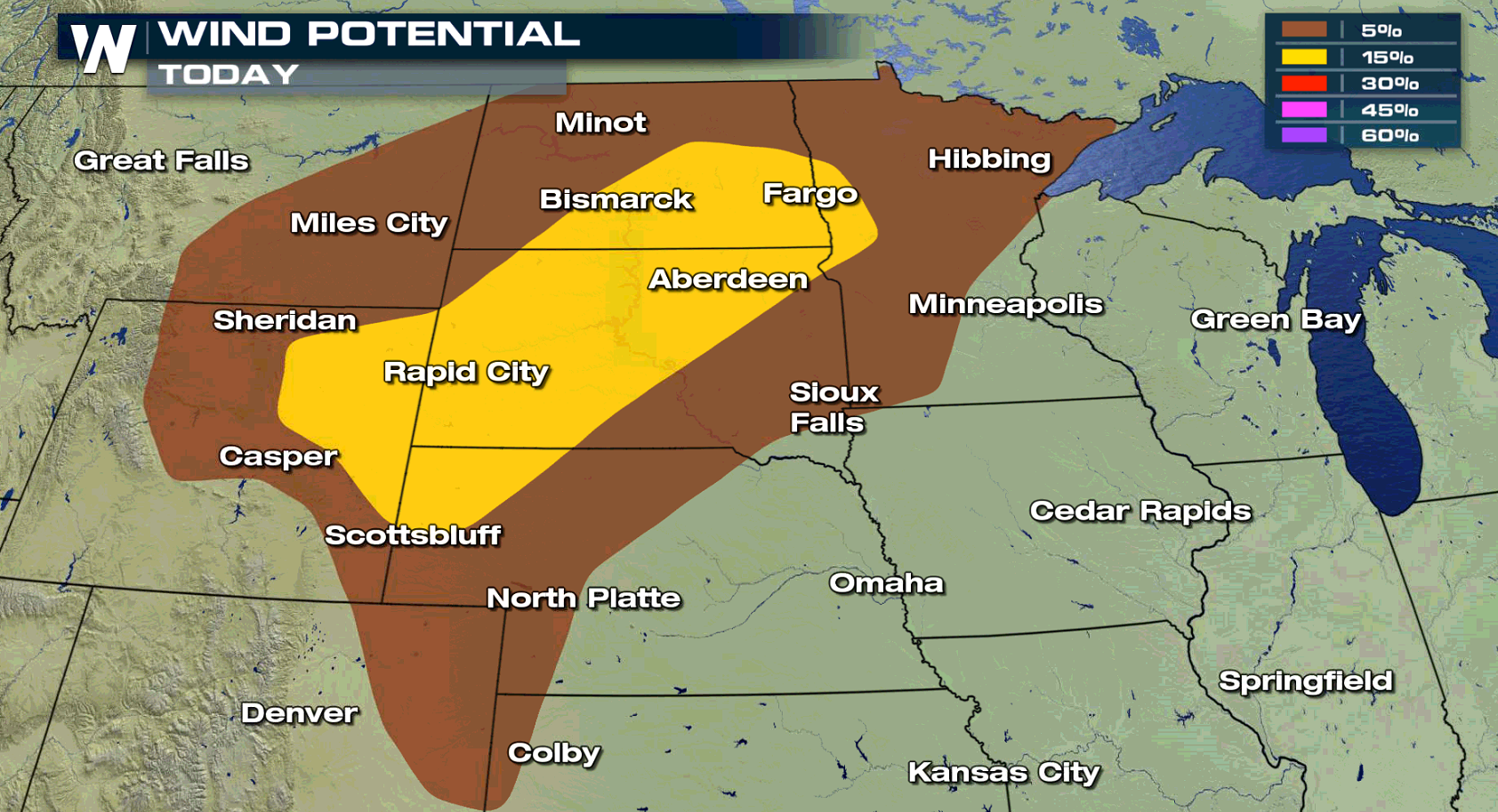
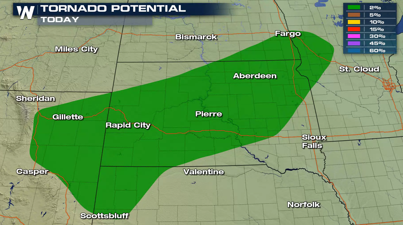
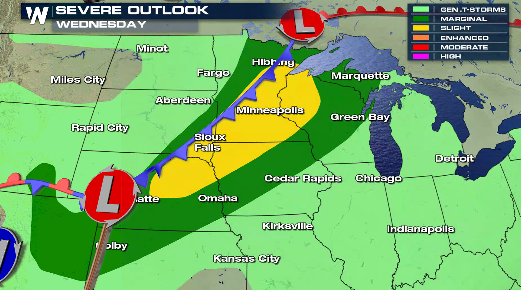
A slow moving storm system will bring the potential for severe thunderstorms later today (Tuesday) into tomorrow (Wednesday, July 4th) across the Upper Midwest. There is a slight risk for severe weather extending from near Fargo to the Black Hills. Large hail and strong wind gusts are the main threats today, along with a low risk for a tornado.
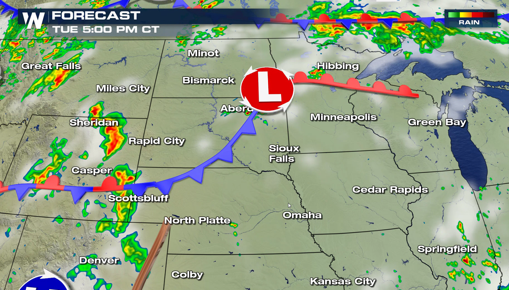
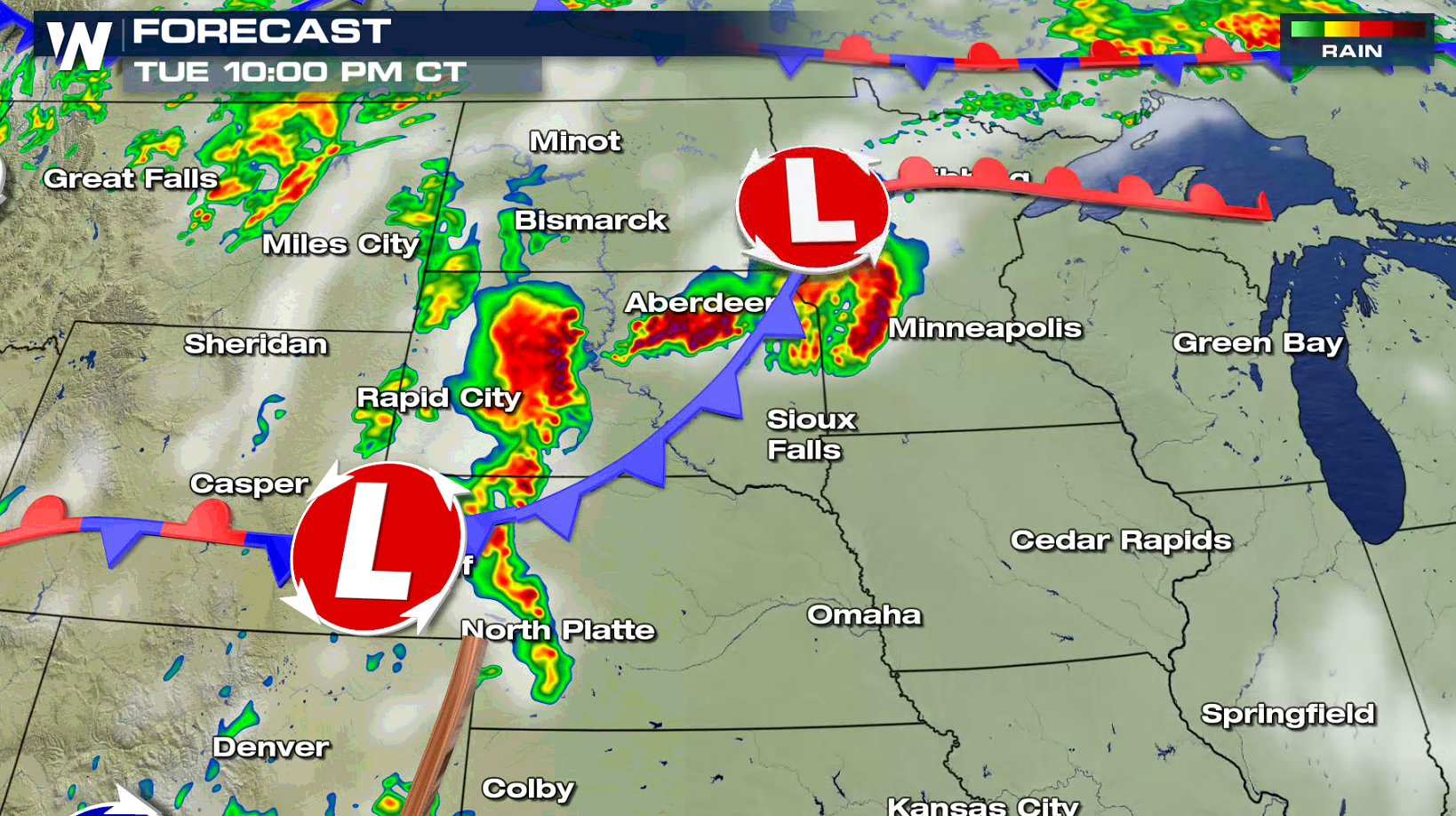
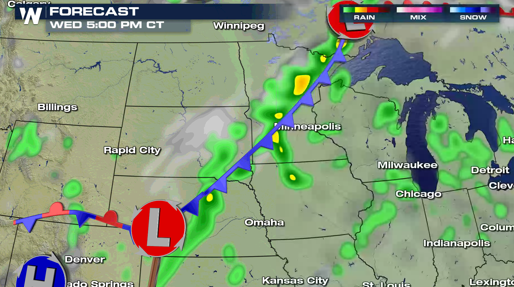
 A low pressure center will drag a warm front into Minnesota, and cold front from South Dakota into Wyoming. Isolated supercells are possible in the evening, which will likely produce all modes of severe weather (tornadoes, large hail, damaging winds). A series of thunderstorm complexes, capable of strong winds and heavy rain, will form later tonight into the overnight.
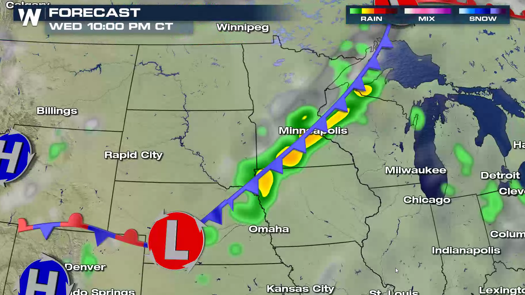
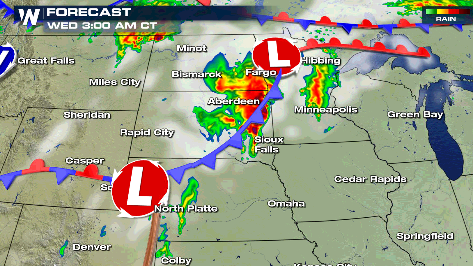 The low pressure center will push into Canada for Independence Day, dragging the cold front eastward from Minnesota to Nebraska. A line of thunderstorms, some severe, will form along and ahead of the front in the late afternoon into the evening.
 For WeatherNation: Meteorologist Mace Michaels
A low pressure center will drag a warm front into Minnesota, and cold front from South Dakota into Wyoming. Isolated supercells are possible in the evening, which will likely produce all modes of severe weather (tornadoes, large hail, damaging winds). A series of thunderstorm complexes, capable of strong winds and heavy rain, will form later tonight into the overnight.
The low pressure center will push into Canada for Independence Day, dragging the cold front eastward from Minnesota to Nebraska. A line of thunderstorms, some severe, will form along and ahead of the front in the late afternoon into the evening.
For WeatherNation: Meteorologist Mace MichaelsAll Weather News
More


After Reaching Category 5, Genevieve Weakens in the Pacific
PacificFausto is now a post-tropical cyclone.
30 Jul 2026 12:00 PM

Flooding Risk Increases as Heavy Rain Targets the Tri-State Area
Tuesday, heavy rainfall moved across the Nort
30 Jul 2026 12:25 AM

Severe Weather: Energy From the Midwest Now in the Southeast
UPPER MIDWEST - Through Monday, dangerous tor
29 Jul 2026 10:30 PM

Southeast Flood Risk Lingers Near Stalled Front
A stalled boundary over the Southeast will ke
25 Jul 2026 10:55 AM

Another Round of Storms Targets the Northeast
Tuesday brought severe weather again across p
23 Jul 2026 1:15 AM