Severe Weather Possible Wednesday from the Gulf Coast to the Tennessee Valley
Top Stories
12 Feb 2020 4:14 AM
An active weather pattern in the Southeast will bring the threat for severe thunderstorms through the middle of the week. A low pressure system moving out of Texas and heading into the Tennessee Valley will be the focus for severe storms today.
 Strong southerly flow will lead to abundant moisture across the region and this will be the fuel for heavy and severe storms.
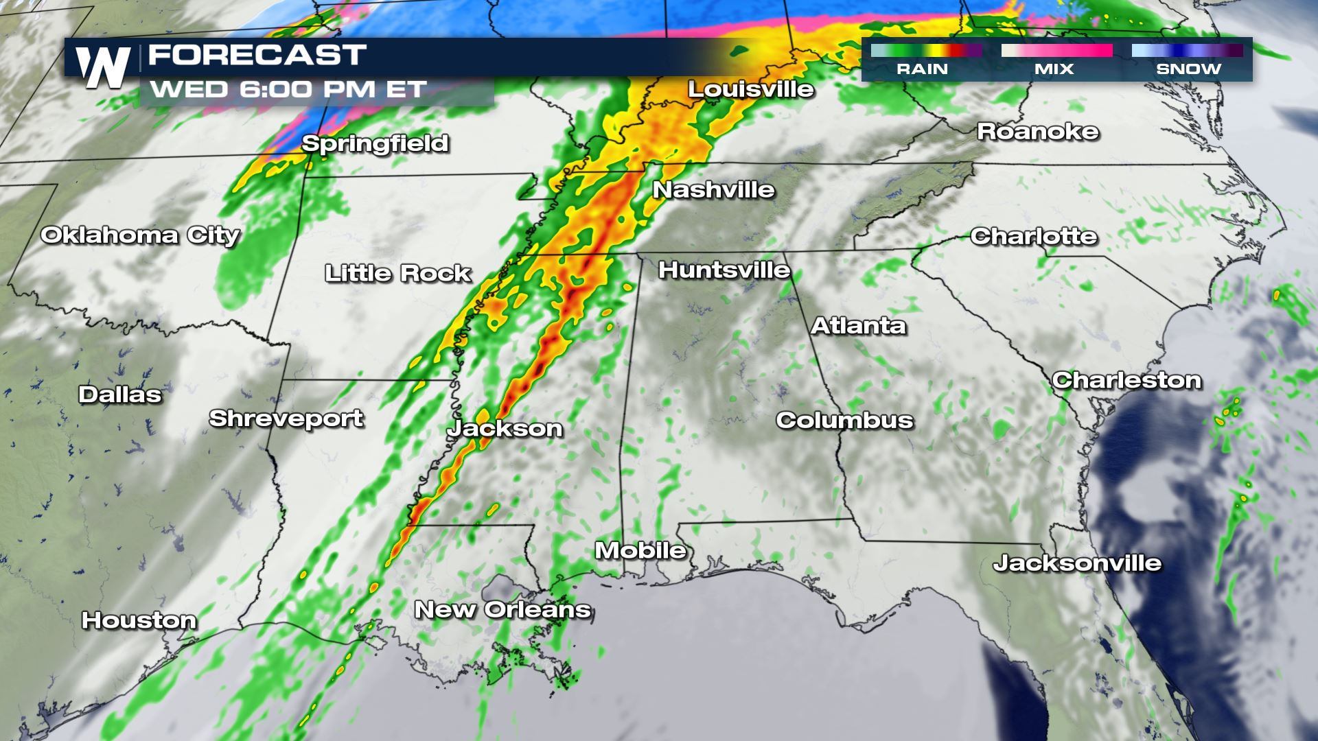
 Isolated to scattered severe storms will be in the forecast today from Lake Charles to Chattanooga. This could be a set-up where we do see overnight severe storms for some areas, so you will want a plan in place in case severe strikes while you're sleeping.
 The primary weather threats for Wednesday's severe forecast will be damaging winds and tornadoes. The large hail risk will be more isolated with this particular set-up, but heavy rain is another severe risk to monitor. Flash flooding and low visibility will also be very likely in a lot of the same areas under the risk for damaging winds and tornadoes.
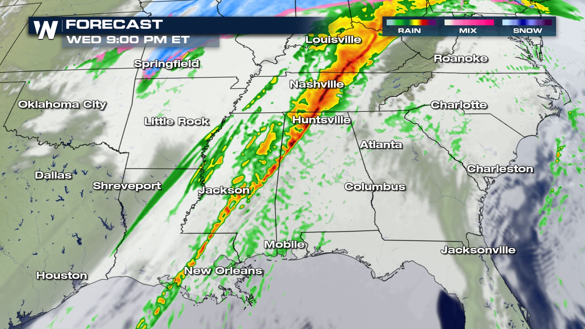
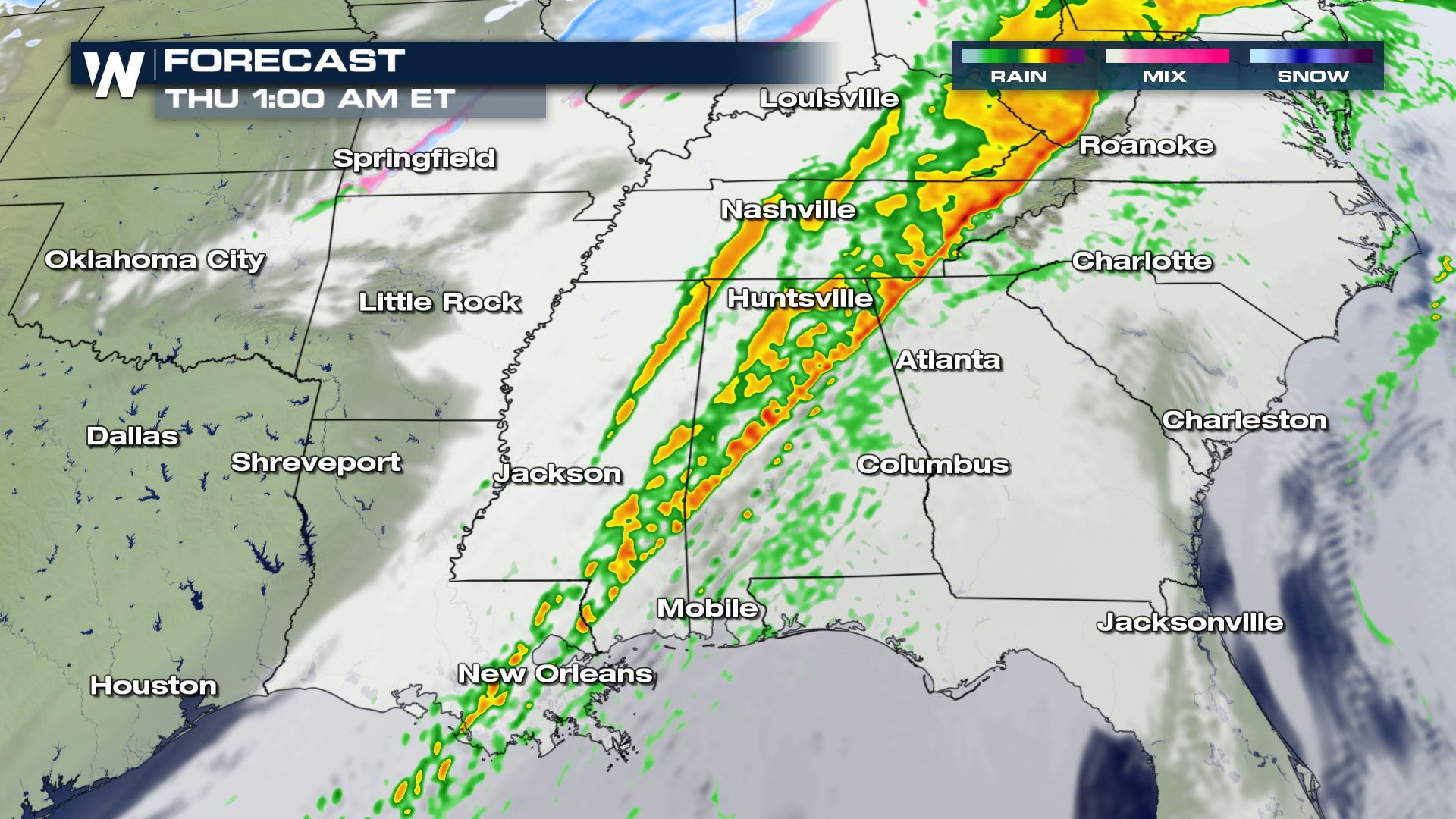 The timing of the severe storms will be during the peak heating of the afternoon and evening hours Wednesday. The mid and upper-level winds will be strong enough to support the risk of severe storms into early Thursday morning as well. This is a situation where you will want to have a way to get alerts while you are sleeping.
WeatherNation will be getting you prepared and ready for this storm so keep checking back for more updates!
The timing of the severe storms will be during the peak heating of the afternoon and evening hours Wednesday. The mid and upper-level winds will be strong enough to support the risk of severe storms into early Thursday morning as well. This is a situation where you will want to have a way to get alerts while you are sleeping.
WeatherNation will be getting you prepared and ready for this storm so keep checking back for more updates!
Severe Ingredients
Strong southerly flow will lead to abundant moisture across the region and this will be the fuel for heavy and severe storms.
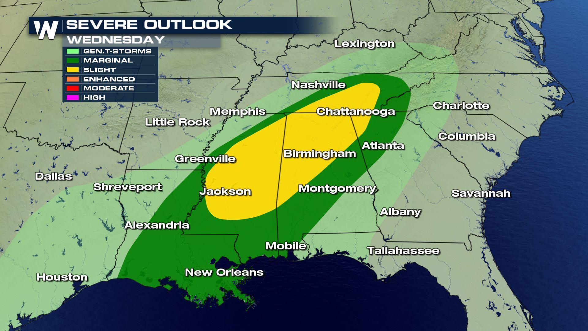
Severe Outlook
Isolated to scattered severe storms will be in the forecast today from Lake Charles to Chattanooga. This could be a set-up where we do see overnight severe storms for some areas, so you will want a plan in place in case severe strikes while you're sleeping.
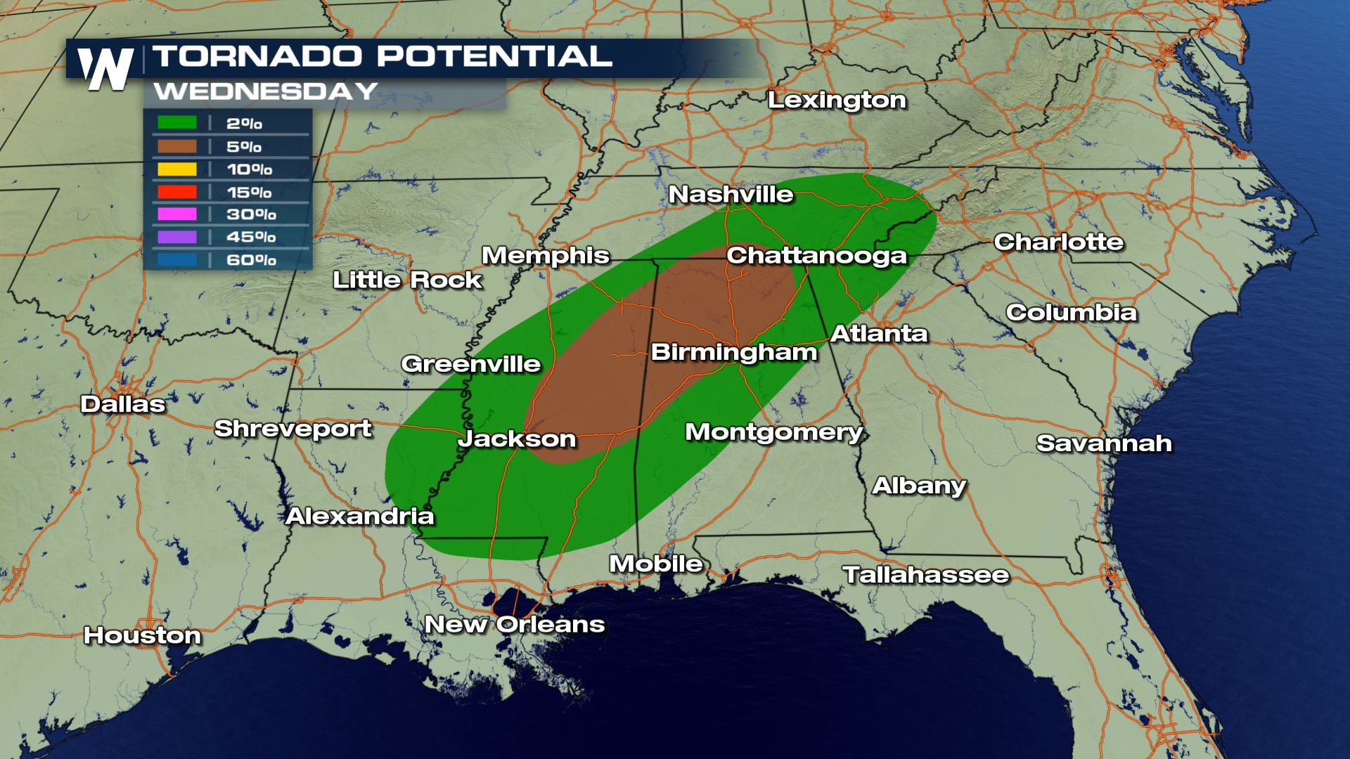
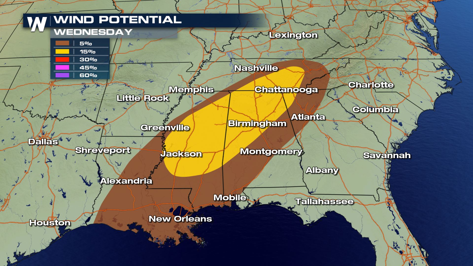
Severe Risks
The primary weather threats for Wednesday's severe forecast will be damaging winds and tornadoes. The large hail risk will be more isolated with this particular set-up, but heavy rain is another severe risk to monitor. Flash flooding and low visibility will also be very likely in a lot of the same areas under the risk for damaging winds and tornadoes.
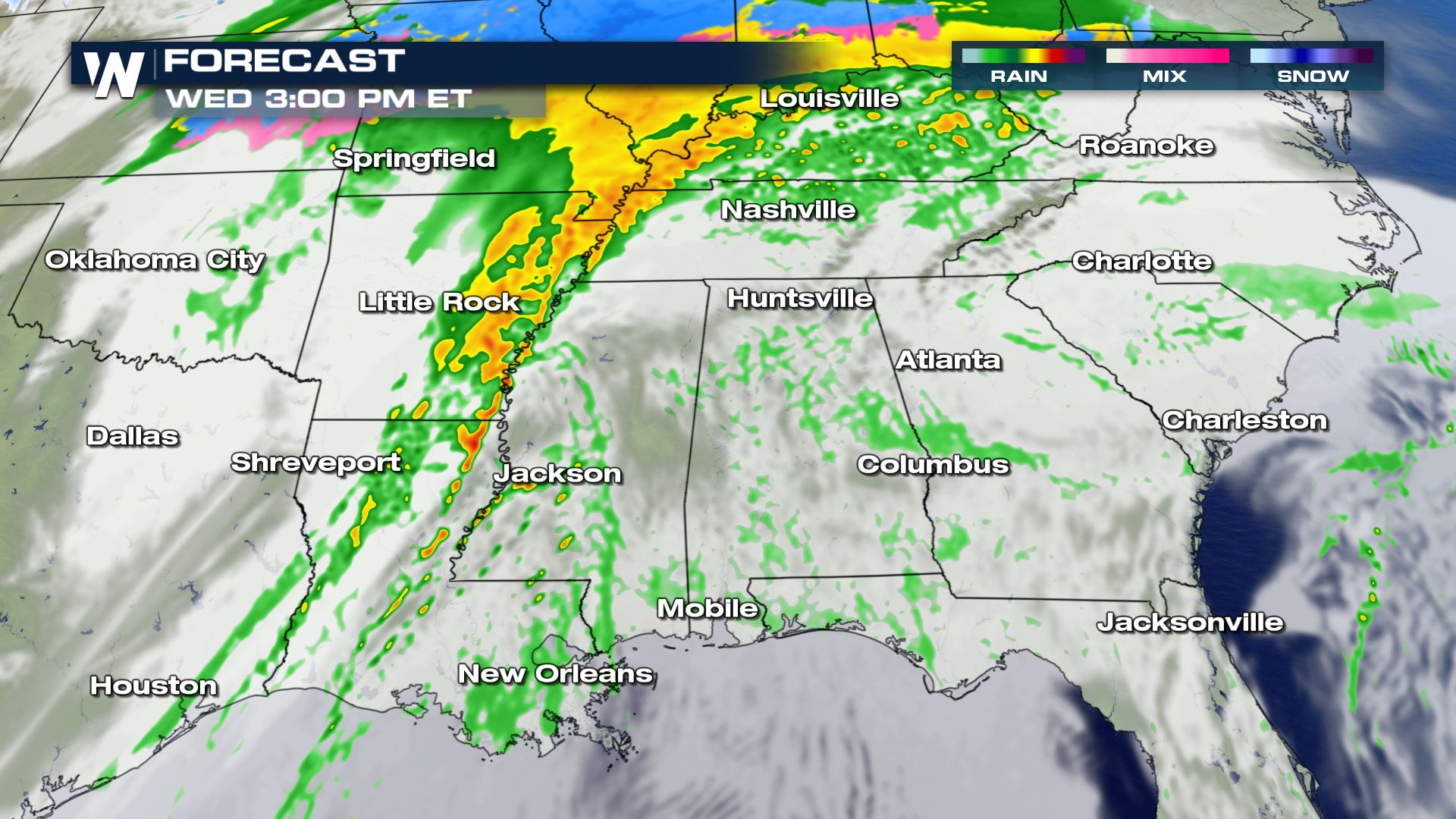
Forecast
The timing of the severe storms will be during the peak heating of the afternoon and evening hours Wednesday. The mid and upper-level winds will be strong enough to support the risk of severe storms into early Thursday morning as well. This is a situation where you will want to have a way to get alerts while you are sleeping.
WeatherNation will be getting you prepared and ready for this storm so keep checking back for more updates!All Weather News
More
Texas Facing Major Flood Threat This week
A moisture-rich weather pattern is expected t
15 Jul 2026 7:05 PM

Historic Heatwave Hits the Northern Rockies, California Heat Expands
Dangerous heat and record high temperatures c
15 Jul 2026 7:00 PM

A New Area to Monitor in the Atlantic
One area of SIX that we're monitoring in the
15 Jul 2026 4:05 PM

Canadian Wildfires to Send Thick Dense Smoke Across The Northern U.S.
As temperatures have soared across the Northe
15 Jul 2026 9:40 AM

Monsoon Moisture Returns to the Southwest, Increasing Storm and Flash Flood Potential
After weeks of hot and mostly dry weather, th
15 Jul 2026 9:15 AM

Rare Enhanced Severe Threat For New England
WHAT TO EXPECT The SPC has issued a severe ou
15 Jul 2026 1:35 AM

Saharan Dust and Excessive Heat Impact the Southeast
Hazy skies will be hovering over portions of
14 Jul 2026 10:05 AM