Severe Weather Potential for the South on Friday
Special Stories
28 Nov 2018 5:10 AM
FORECAST
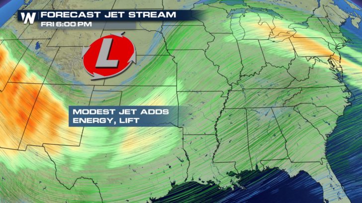
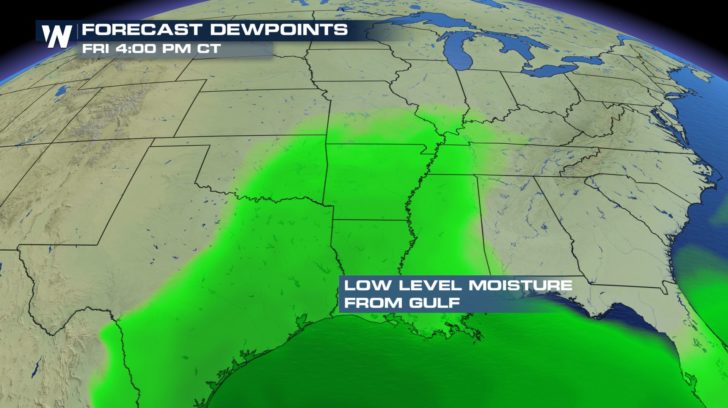
 A low pressure system pushing towards the east coast is going to bring in a chance of storms for the south. The counterclockwise flow from this system will help to pull an abundant amount of moisture in from the Gulf helping to fuel the storms.
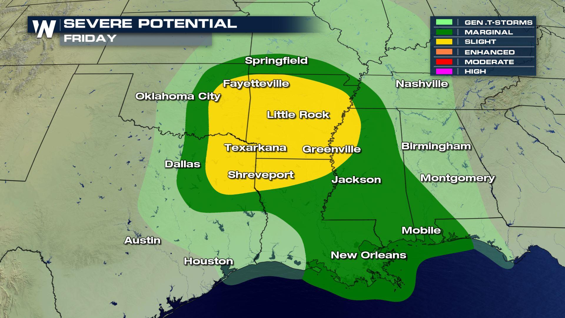
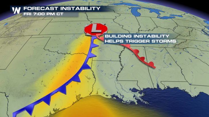
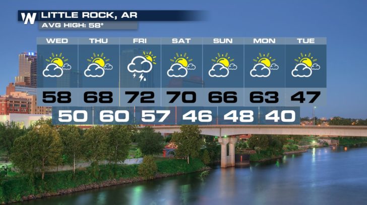
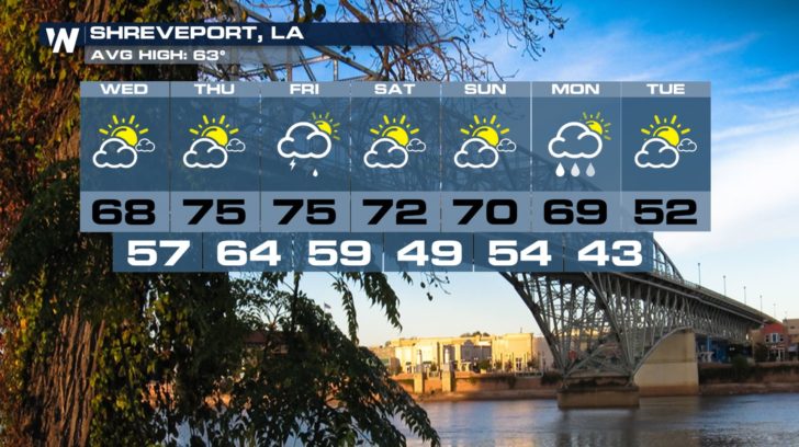
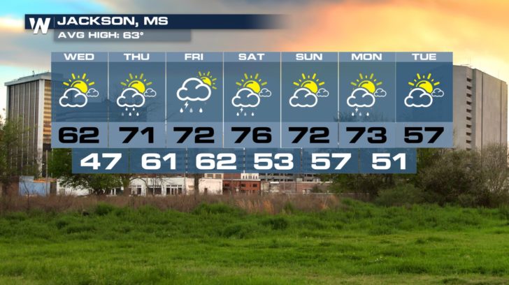
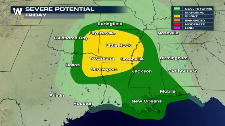 There is a marginal to slight risk of severe weather for Friday. In the slight area, scattered severe thunderstorms will be possible. In the marginal area, isolated severe thunderstorms will be possible. Hail, damaging winds, and rotation within some of these storms could be possible. For the first half of the day, showers and thunderstorms will spark up. It won't be until the evening hours where the stronger storms will start to move in.
A LOOK AHEAD
There is a marginal to slight risk of severe weather for Friday. In the slight area, scattered severe thunderstorms will be possible. In the marginal area, isolated severe thunderstorms will be possible. Hail, damaging winds, and rotation within some of these storms could be possible. For the first half of the day, showers and thunderstorms will spark up. It won't be until the evening hours where the stronger storms will start to move in.
A LOOK AHEAD
A low pressure system pushing towards the east coast is going to bring in a chance of storms for the south. The counterclockwise flow from this system will help to pull an abundant amount of moisture in from the Gulf helping to fuel the storms.
There is a marginal to slight risk of severe weather for Friday. In the slight area, scattered severe thunderstorms will be possible. In the marginal area, isolated severe thunderstorms will be possible. Hail, damaging winds, and rotation within some of these storms could be possible. For the first half of the day, showers and thunderstorms will spark up. It won't be until the evening hours where the stronger storms will start to move in.
A LOOK AHEAD
All Weather News
More
Wildfire Outbreak in the Pacific Northwest
SPOKANE, WA - On Saturday, August 1st, the Ol
3 Aug 2026 1:55 AM

More Storms for the East Through Monday
A low-pressure system that moved through the
3 Aug 2026 1:50 AM


After Reaching Category 5, Genevieve Weakens in the Pacific
PacificGenevieve formed last Friday south of
3 Aug 2026 12:30 AM

Flooding, Severe Storms Target the Midwest Again
After an active week of storms across the nor
1 Aug 2026 1:40 AM

Flooding Risk Increases as Heavy Rain Targets the Tri-State Area
Tuesday, heavy rainfall moved across the Nort
30 Jul 2026 12:25 AM

Severe Weather: Energy From the Midwest Now in the Southeast
UPPER MIDWEST - Through Monday, dangerous tor
29 Jul 2026 10:30 PM