Severe Weather Potential from the Great Lakes to the Rio Grande
Special Stories
24 May 2019 8:55 AM
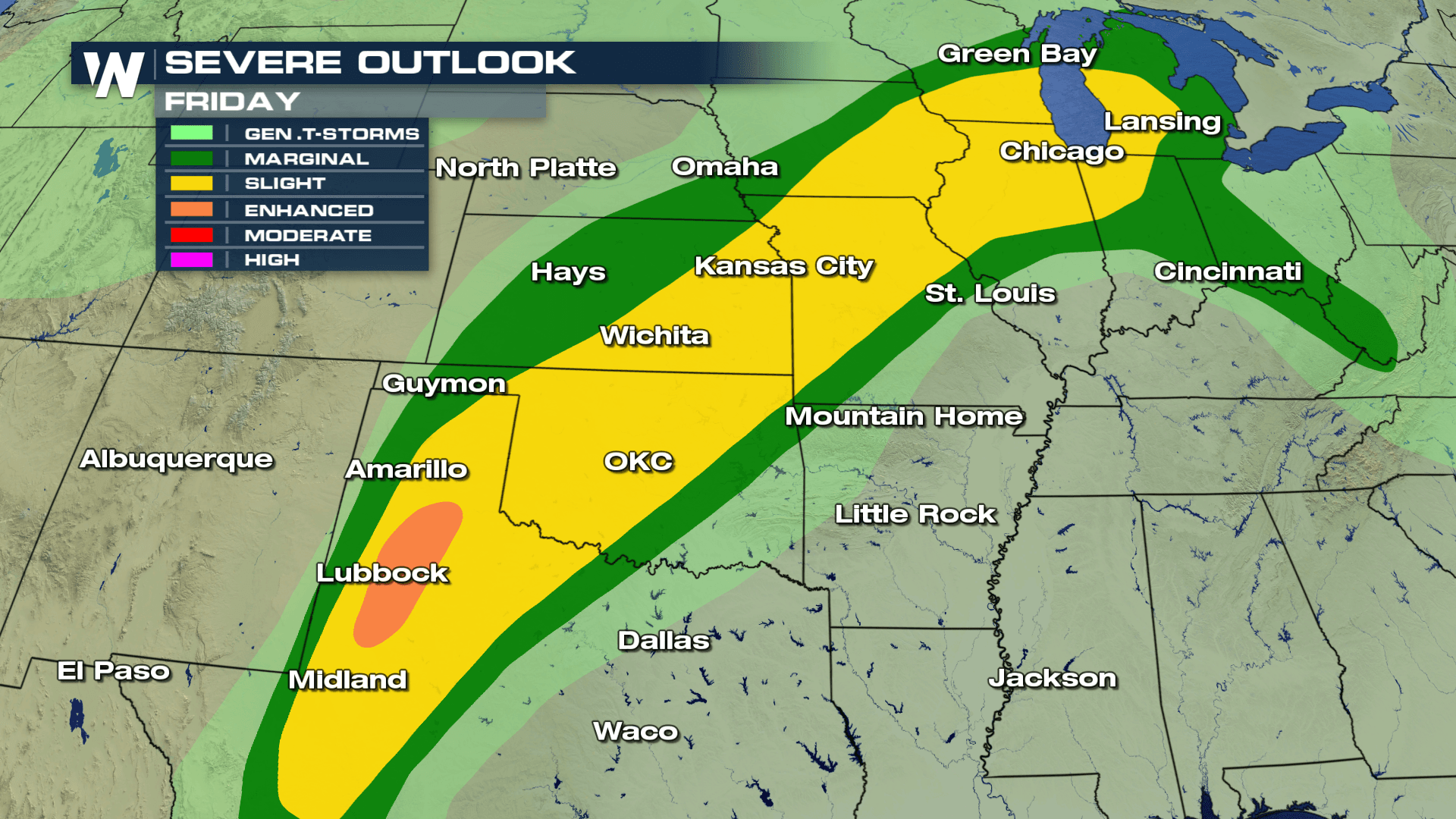
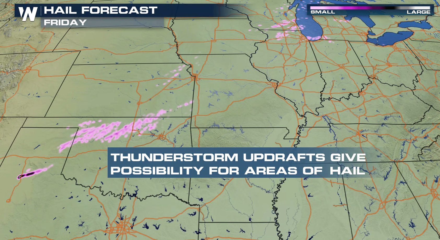
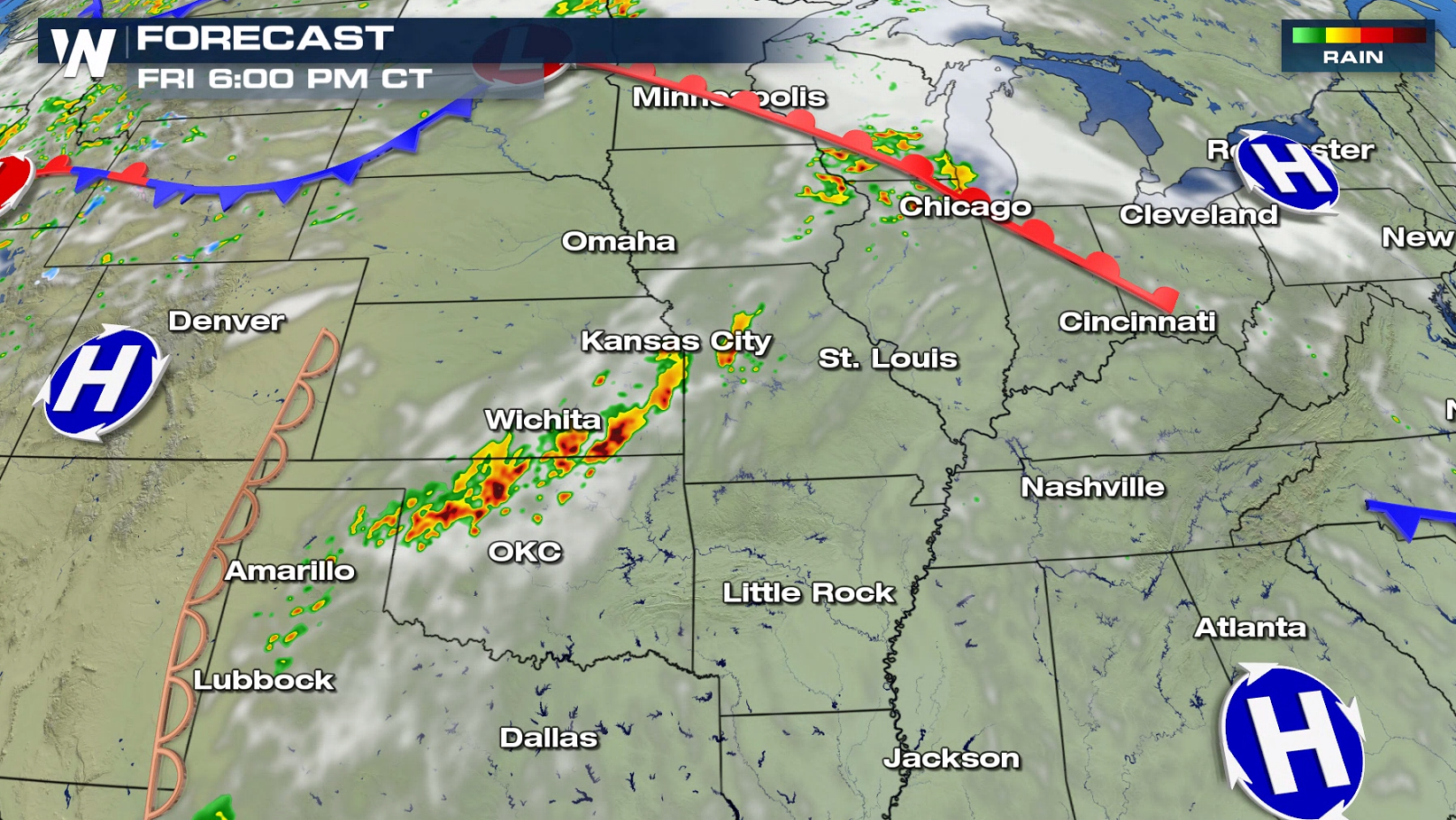
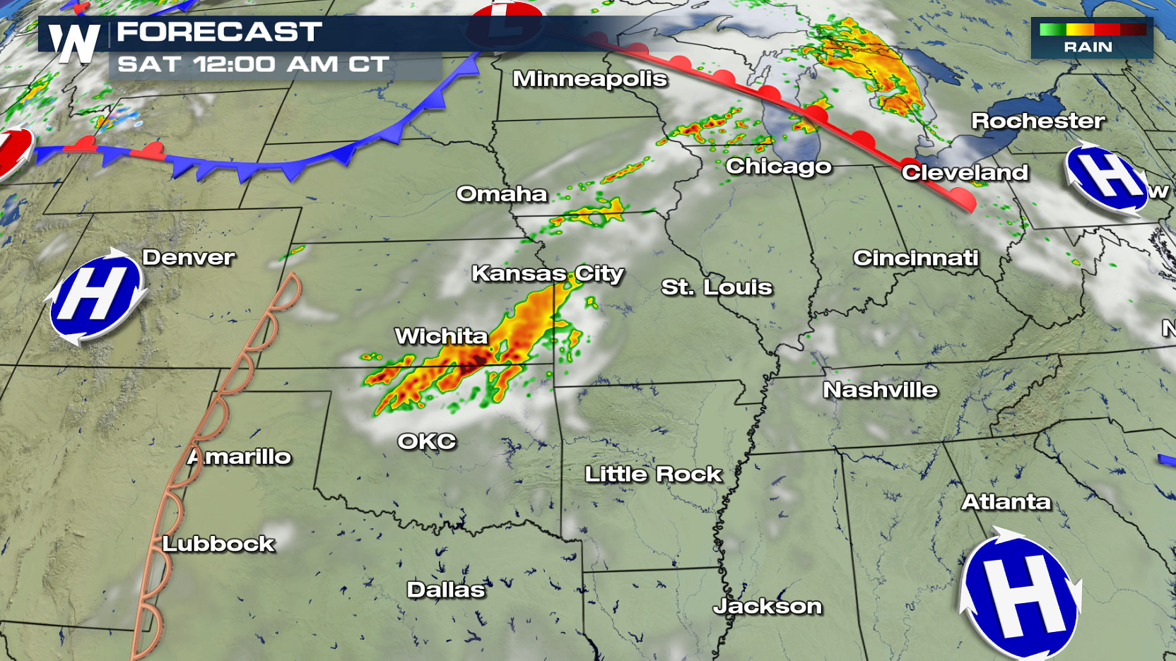
Severe weather continues to be a threat across the Plains today (Friday). A slight risk for severe thunderstorms extends from near Lake Michigan to the Rio Grand River in Texas. Damaging wind gusts and large hail are the biggest concerns. There is a threat for isolated tornadoes, stretching from areas in West Texas through the Great Lakes.
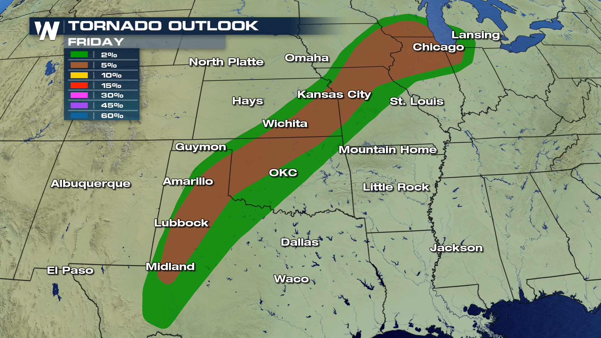
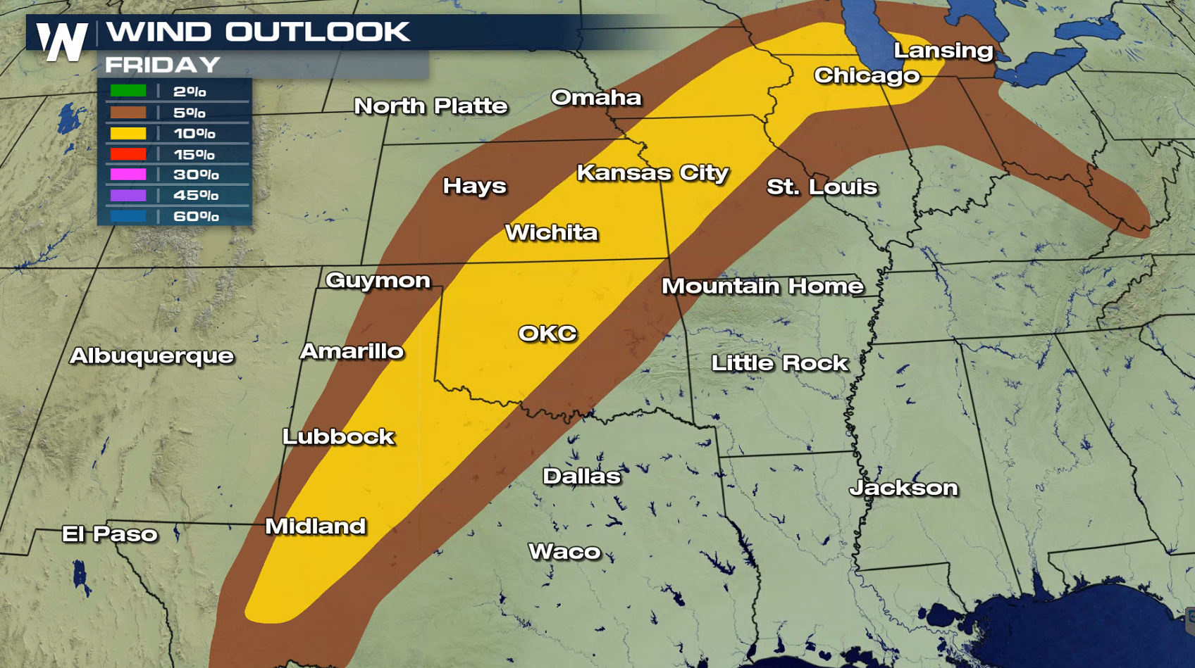
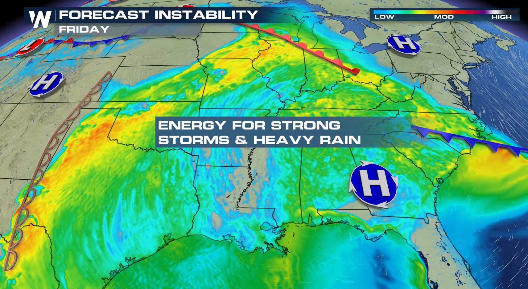
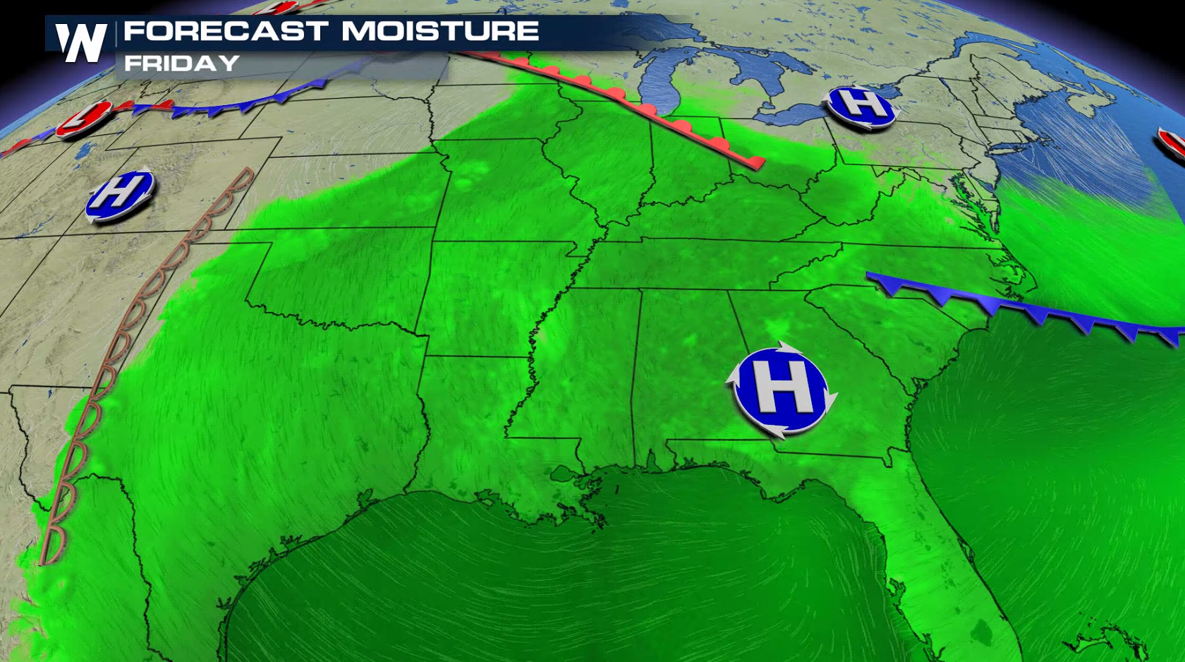
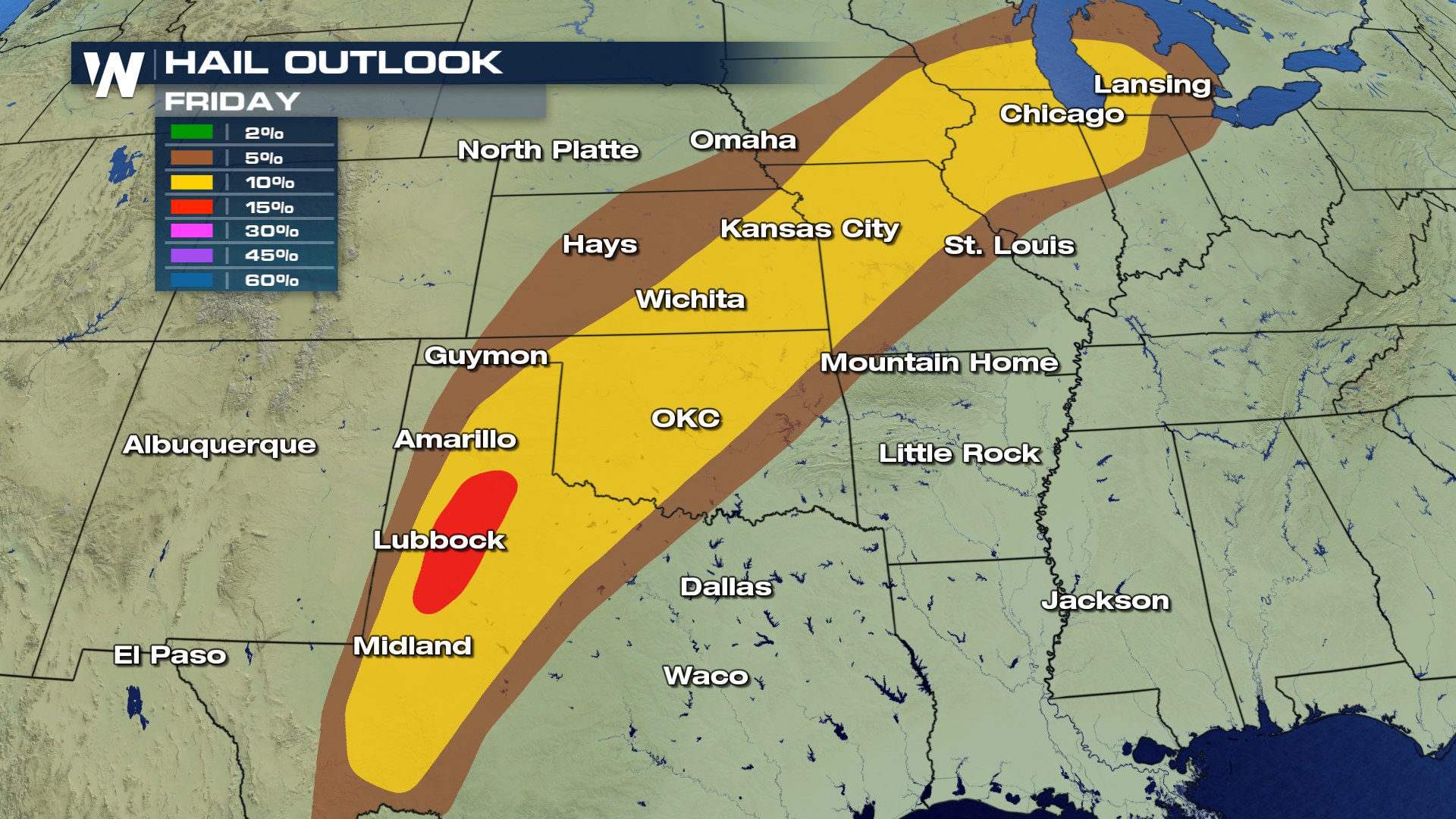 Strong instability will build ahead of a cold front, providing robust updraft to support severe storms. High humidity and warm temperatures will provide fuel to keep storms firing.
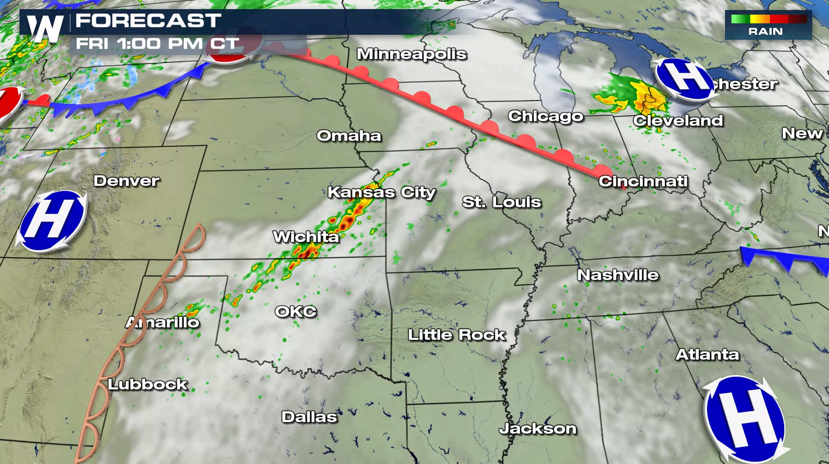
 Showers and thunderstorms will develop along a warm front and ahead of a cold front in the afternoon. Storms will become more numerous in the early evening and continue through the night. Coverage is not expected to be as widespread or strong as earlier this week, but a few storms may become rather intense.
 For WeatherNation: Meteorologist Mace Michaels
Strong instability will build ahead of a cold front, providing robust updraft to support severe storms. High humidity and warm temperatures will provide fuel to keep storms firing.
Showers and thunderstorms will develop along a warm front and ahead of a cold front in the afternoon. Storms will become more numerous in the early evening and continue through the night. Coverage is not expected to be as widespread or strong as earlier this week, but a few storms may become rather intense.
For WeatherNation: Meteorologist Mace MichaelsAll Weather News
More
East Gears Up for Stormy, Wet Weekend
A low pressure system crashing through the Mi
1 Aug 2026 6:15 PM


Flooding, Severe Storms Target the Midwest Again
After an active week of storms across the nor
1 Aug 2026 1:40 AM

After Reaching Category 5, Genevieve Weakens in the Pacific
PacificFausto is now a post-tropical cyclone.
31 Jul 2026 1:30 AM

Flooding Risk Increases as Heavy Rain Targets the Tri-State Area
Tuesday, heavy rainfall moved across the Nort
30 Jul 2026 12:25 AM

Severe Weather: Energy From the Midwest Now in the Southeast
UPPER MIDWEST - Through Monday, dangerous tor
29 Jul 2026 10:30 PM