Severe Weather Potential in the Northeast

Special Stories
26 May 2019 11:26 AM
SEVERE OUTLOOK
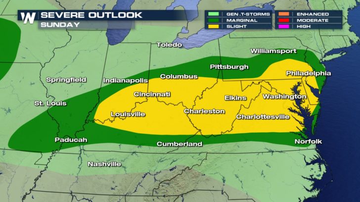
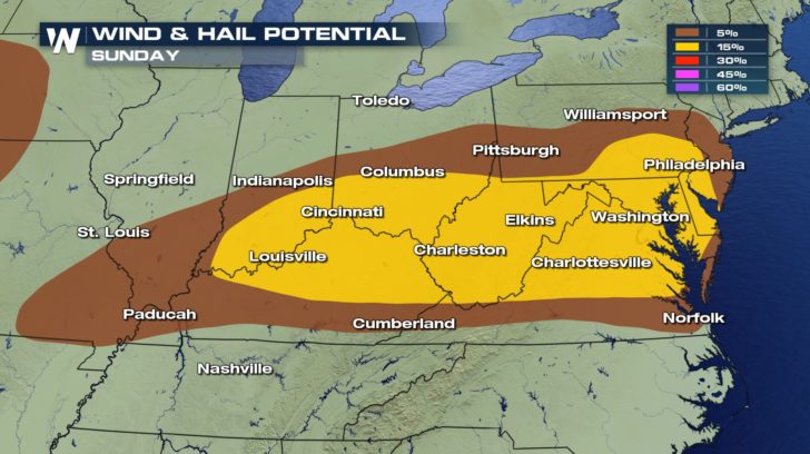 A chance of severe weather threatens the northeast and central U.S. for today.
The good news is that there is no tornado potential, but there still is a risk of gusty winds and damaging hail.
Winds could range anywhere from 58 mph to 70 mph within some of these storms.
Hail could reach up to 2 inches.
A chance of severe weather threatens the northeast and central U.S. for today.
The good news is that there is no tornado potential, but there still is a risk of gusty winds and damaging hail.
Winds could range anywhere from 58 mph to 70 mph within some of these storms.
Hail could reach up to 2 inches.
FORECAST
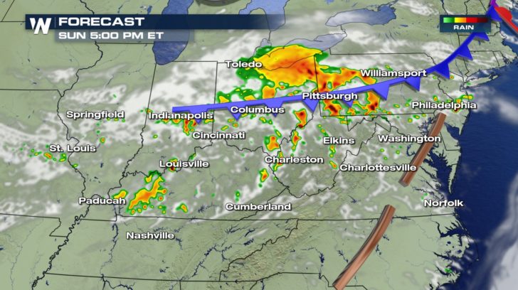
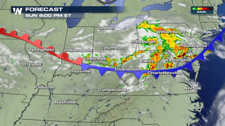 Storms will start to fire off during the late afternoon and will last into the evening hours.
By early Monday morning, the storms will have moved out and we'll be back to dry conditions.
Storms will start to fire off during the late afternoon and will last into the evening hours.
By early Monday morning, the storms will have moved out and we'll be back to dry conditions.All Weather News
More
Flooding Risk Increases as Heavy Rain Targets the Tri-State Area
Tuesday, heavy rainfall moved across the Nort
30 Jul 2026 12:25 AM


Genevieve Down to a Category 2 Hurricane
PacificFausto is now a post-tropical cyclone.
30 Jul 2026 12:00 AM

Severe Weather: Energy From the Midwest Now in the Southeast
UPPER MIDWEST - Through Monday, dangerous tor
29 Jul 2026 10:30 PM


Southeast Flood Risk Lingers Near Stalled Front
A stalled boundary over the Southeast will ke
25 Jul 2026 10:55 AM

Another Round of Storms Targets the Northeast
Tuesday brought severe weather again across p
23 Jul 2026 1:15 AM