Severe Weather Risk from the Mississippi Valley to the Gulf Coast Monday
Special Stories
21 Oct 2019 4:44 AM
The cold front that brought the numerous severe storms to the Southern Plains will bring more severe weather chances to areas of the Mississippi and Tennessee Valleys today. Areas along the Gulf Coast could also see severe storms throughout the day. Here is the very latest.
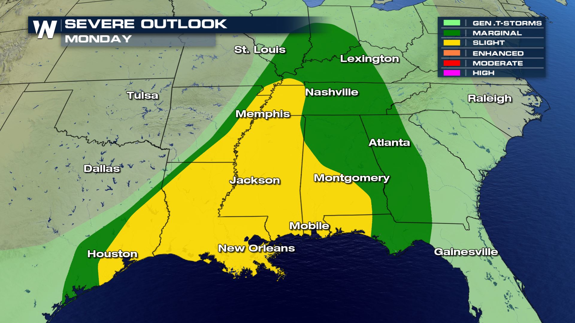 Areas from east Texas towards the Ohio Valley could all see severe storms today with the highest risk for the Gulf Coast and Mississippi Valley. These severe storms will be scattered and could produce more tornadoes, damaging winds and large hail.
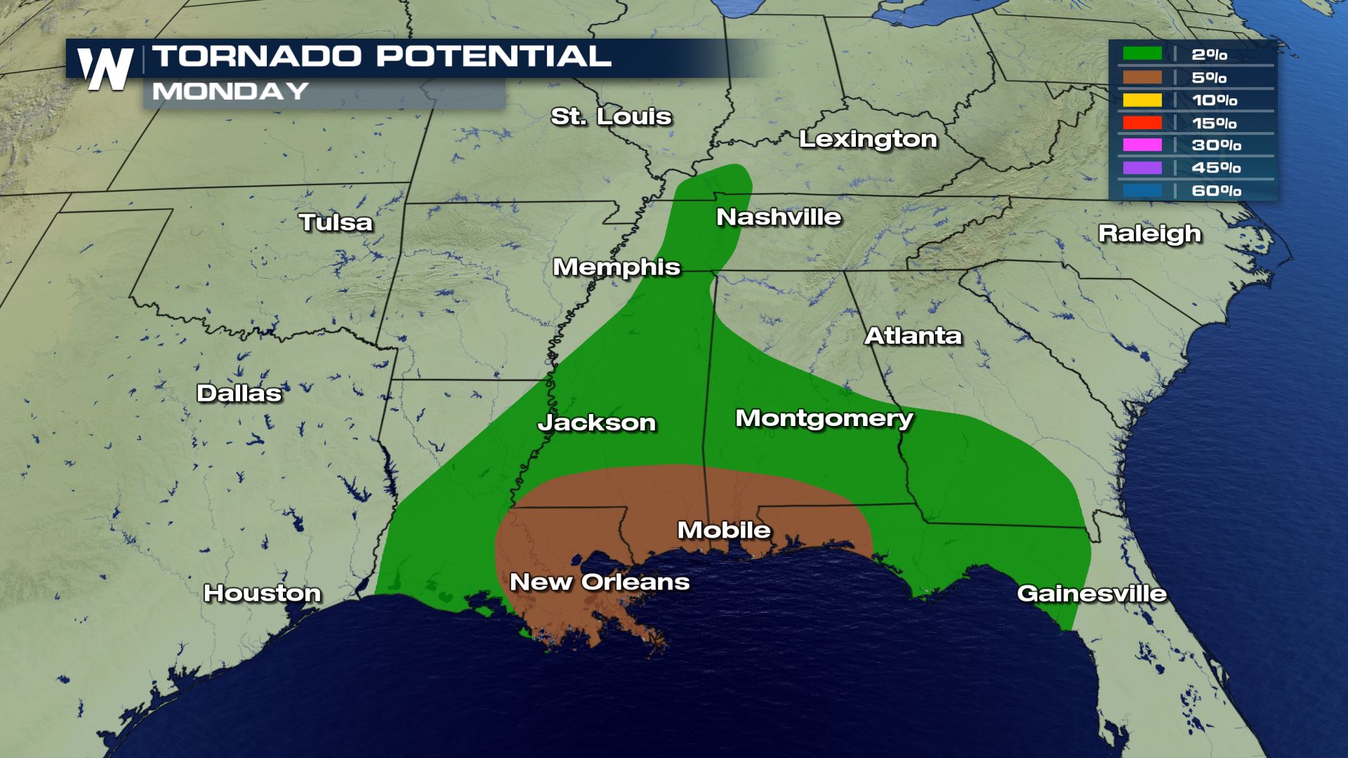
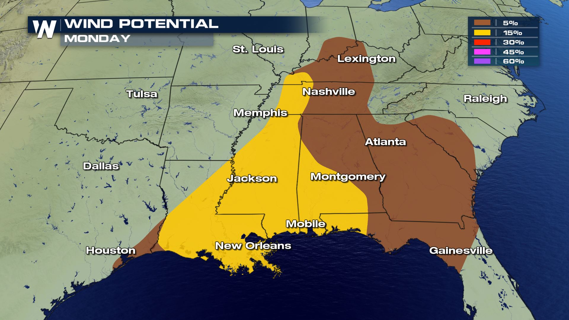 The wind and tornado risks will be the higher threats with only an isolated chance for hail that will be below severe criteria.
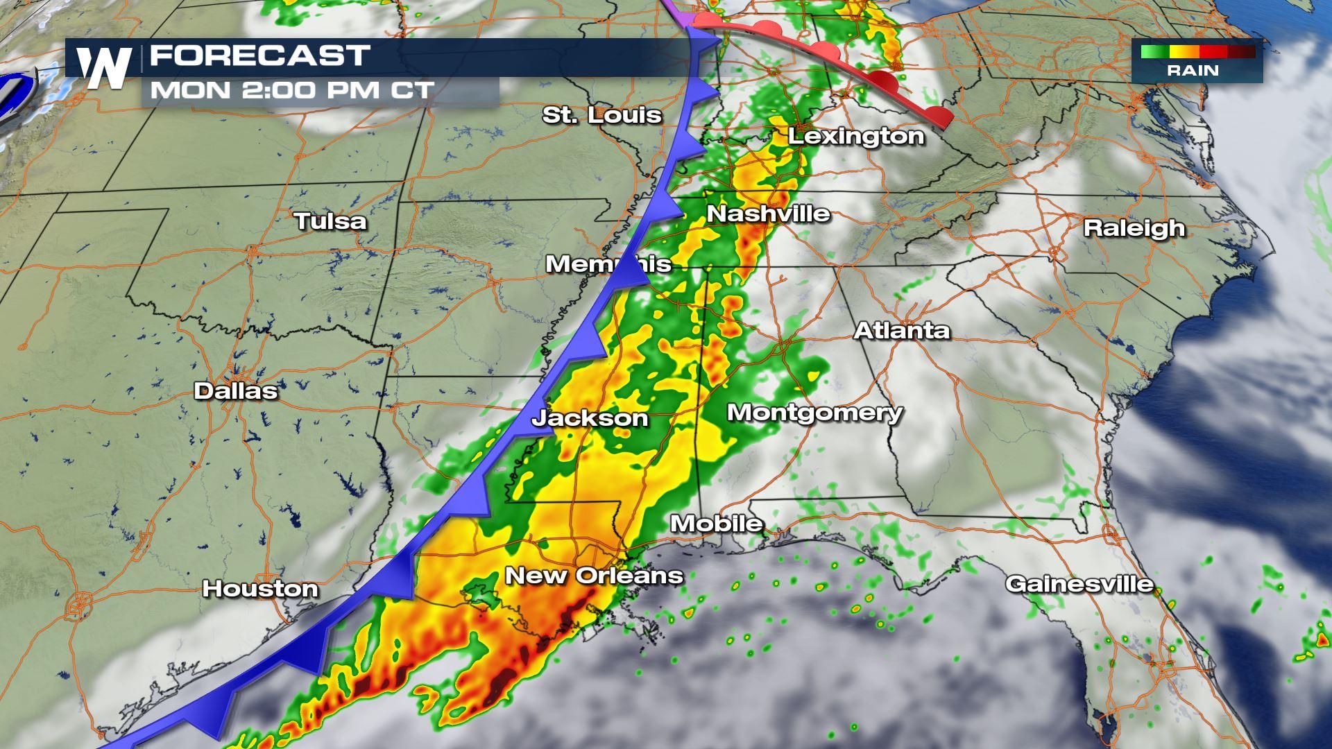
 The intensity of the storms will start to weaken by this afternoon and evening along the front, with the exception down along the Gulf Coast. Cities like Gulfport and Mobile could have severe storms for the evening commute home. Keep checking with WeatherNation for more severe weather updates!
Severe Outlook
Areas from east Texas towards the Ohio Valley could all see severe storms today with the highest risk for the Gulf Coast and Mississippi Valley. These severe storms will be scattered and could produce more tornadoes, damaging winds and large hail.
Severe Risks
The wind and tornado risks will be the higher threats with only an isolated chance for hail that will be below severe criteria.
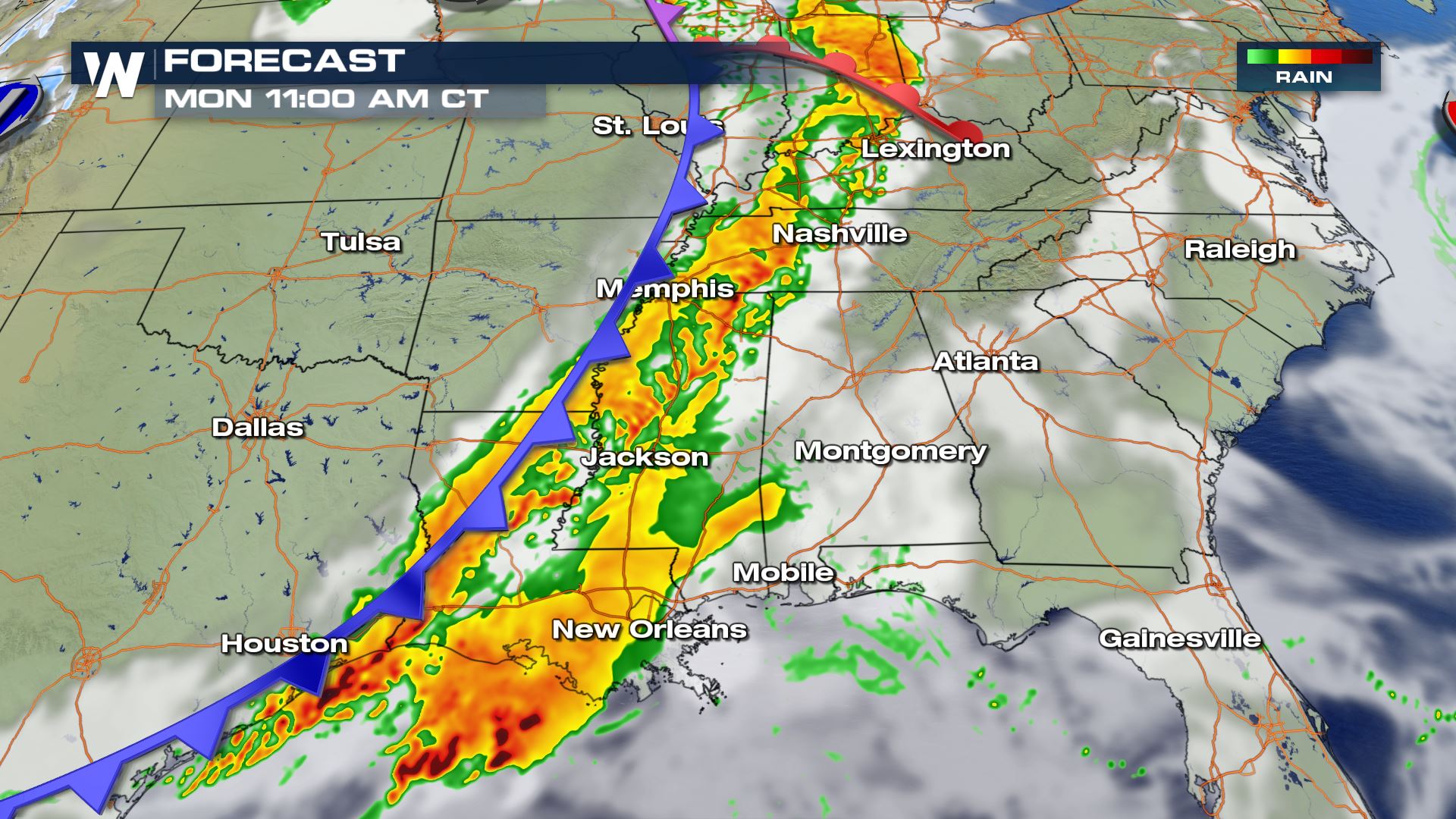
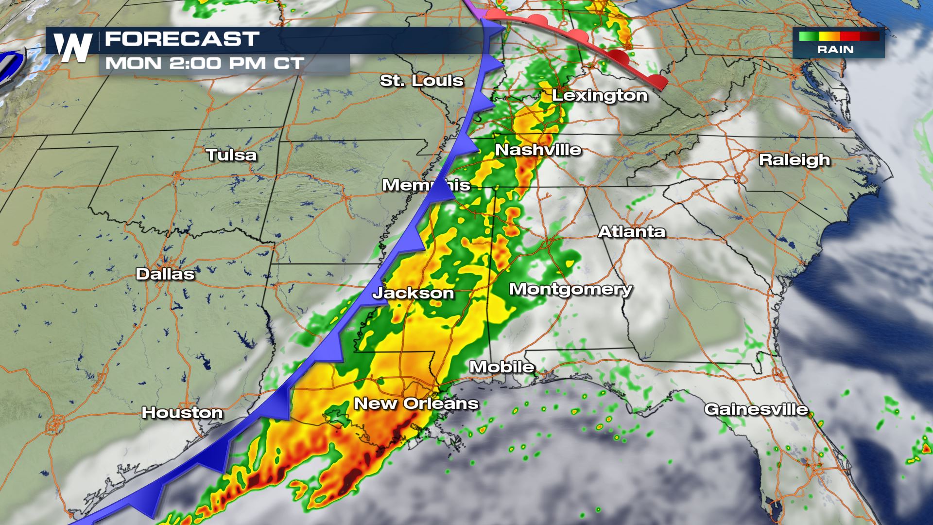
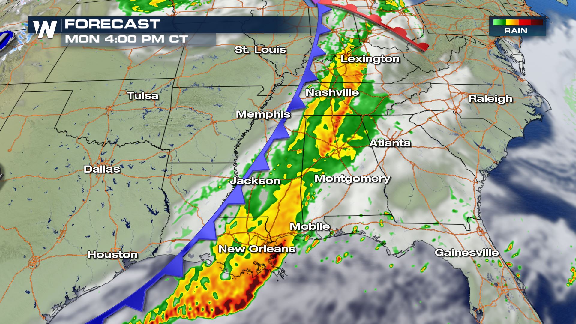
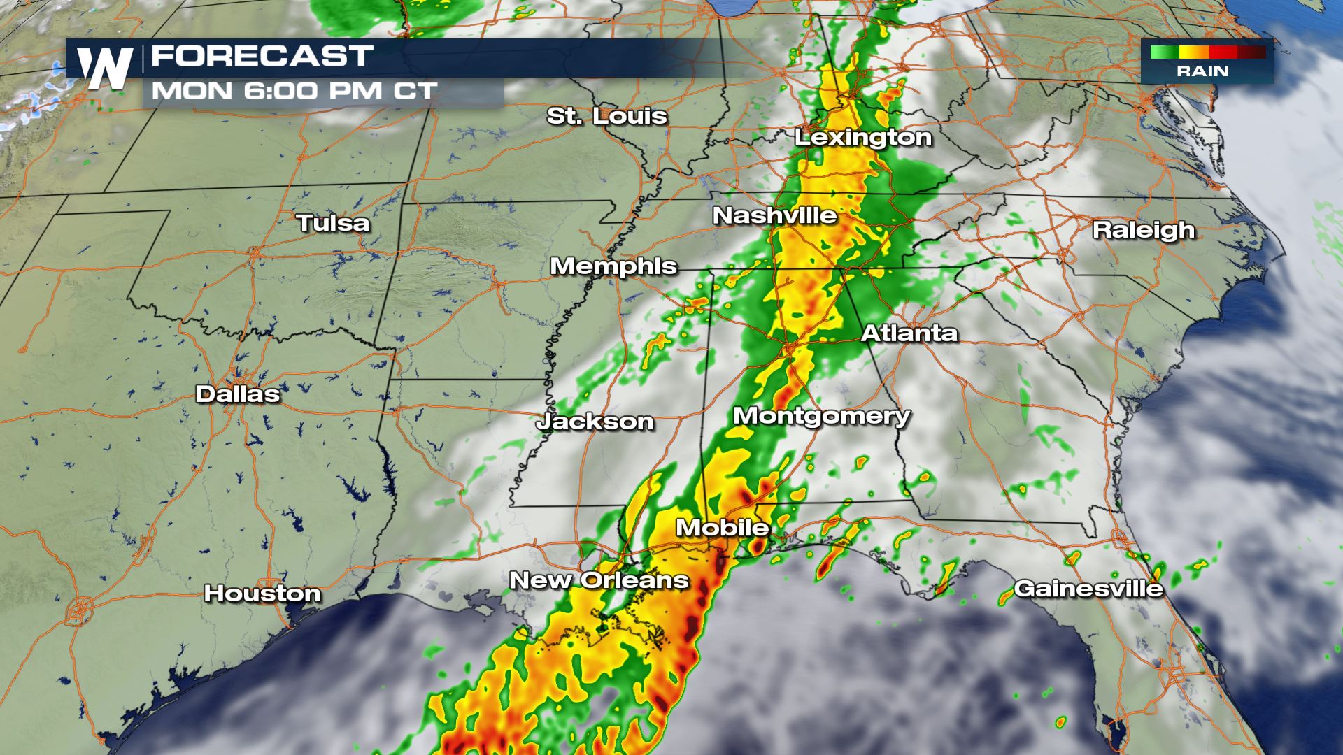
Forecast
The intensity of the storms will start to weaken by this afternoon and evening along the front, with the exception down along the Gulf Coast. Cities like Gulfport and Mobile could have severe storms for the evening commute home. Keep checking with WeatherNation for more severe weather updates!
All Weather News
More

More Storms for the East Through Monday
A low-pressure system that moved through the
3 Aug 2026 12:20 PM


After Reaching Category 5, Genevieve Weakens in the Pacific
PacificGenevieve formed last Friday south of
3 Aug 2026 12:30 AM

Flooding, Severe Storms Target the Midwest Again
After an active week of storms across the nor
1 Aug 2026 1:40 AM

Flooding Risk Increases as Heavy Rain Targets the Tri-State Area
Tuesday, heavy rainfall moved across the Nort
30 Jul 2026 12:25 AM