Severe Weather Risk From the Middle Atlantic to Tennessee Valley
Special Stories
27 Jun 2018 11:13 AM
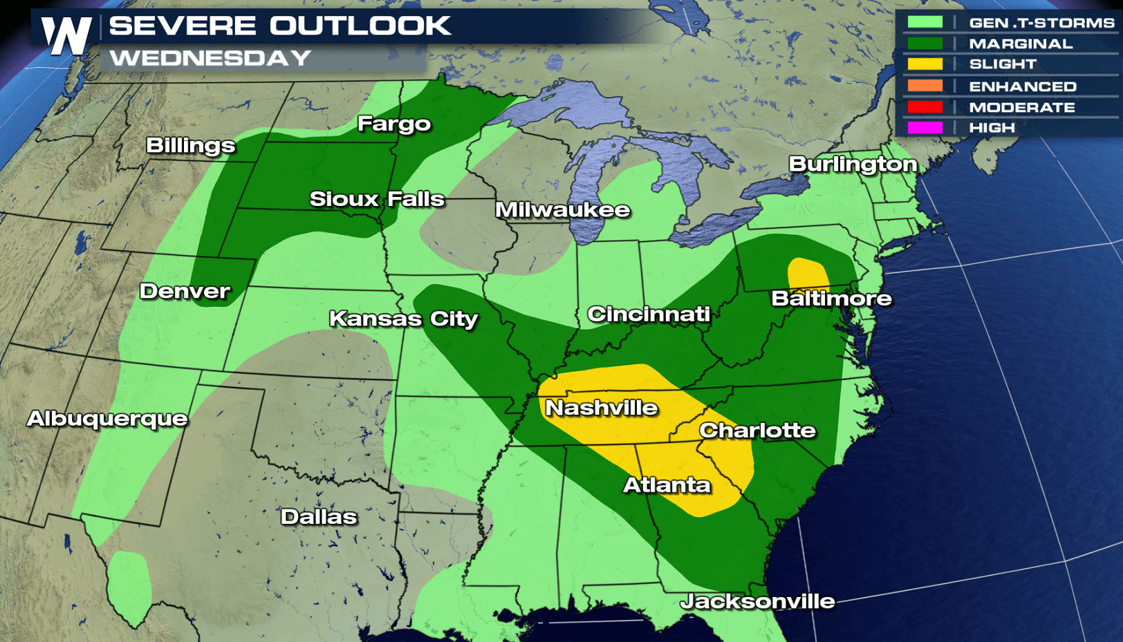
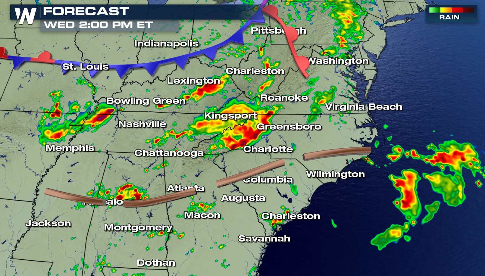
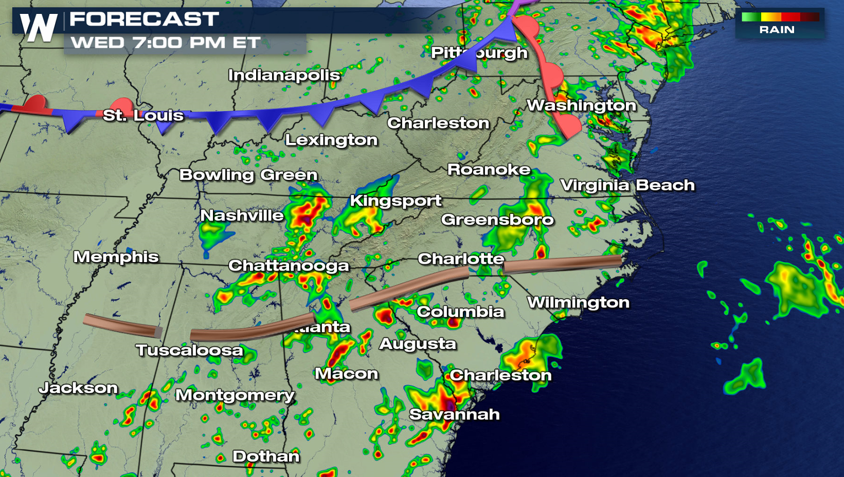
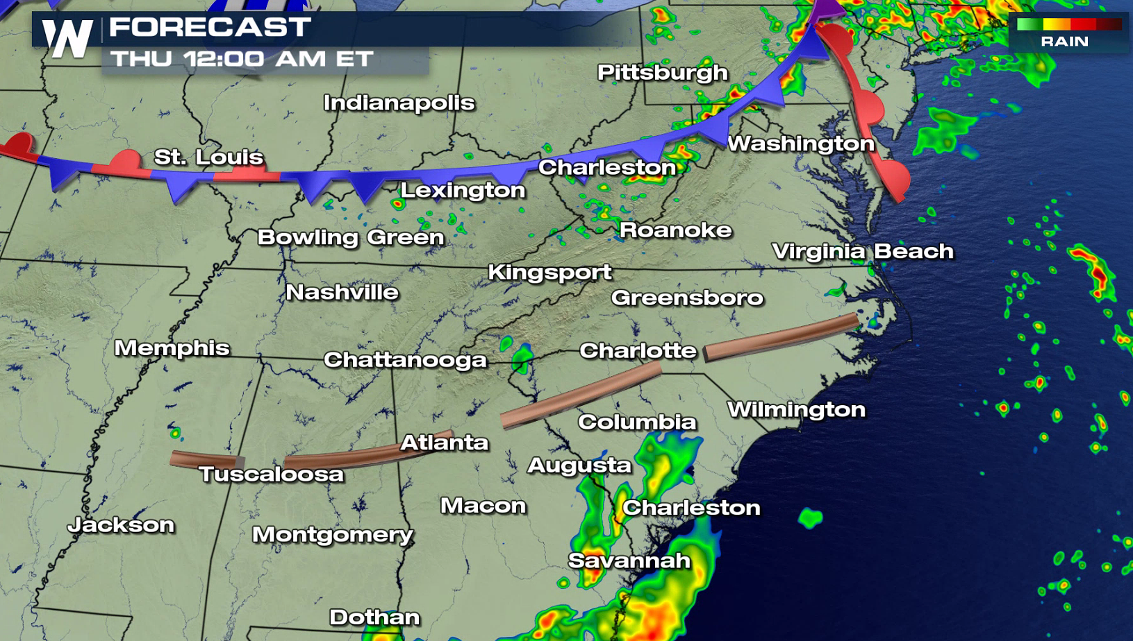
The risk for severe thunderstorms today (Wednesday) has pushed eastward into the Middle Atlantic and Ohio Valley. A slight risk for severe weather has been posted from the Storm Prediction Center from Kentucky to Alabama, where strong wind gusts are the biggest concern. Isolated tornadoes may occur in Pennsylvania and Maryland, another slight risk area for today (Wednesday).
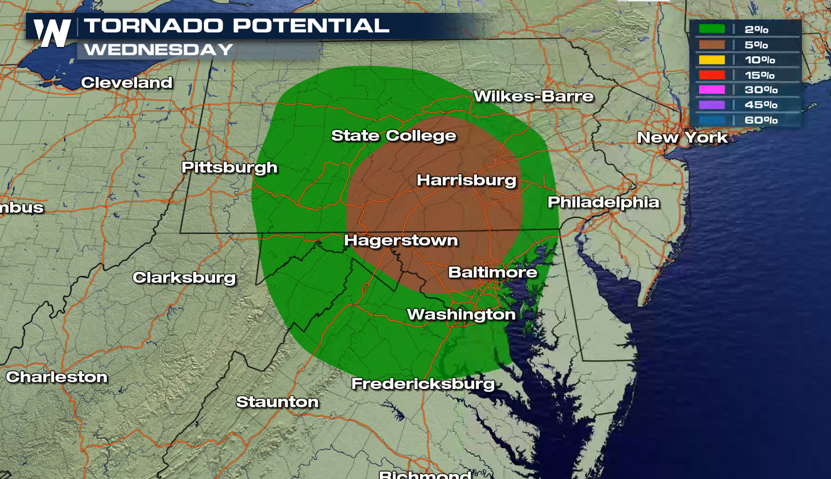
 A warm front pushing along the Mason-Dixon line will provide enough wind shear for severe thunderstorms and possible tornado development. Areas ahead of a cold front may see severe weather as well, with large hail and damaging winds.
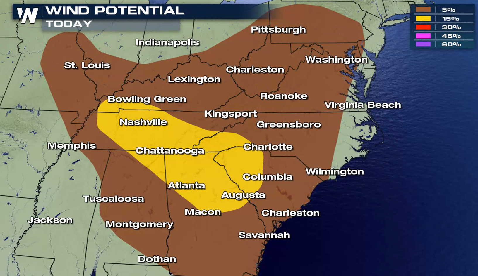
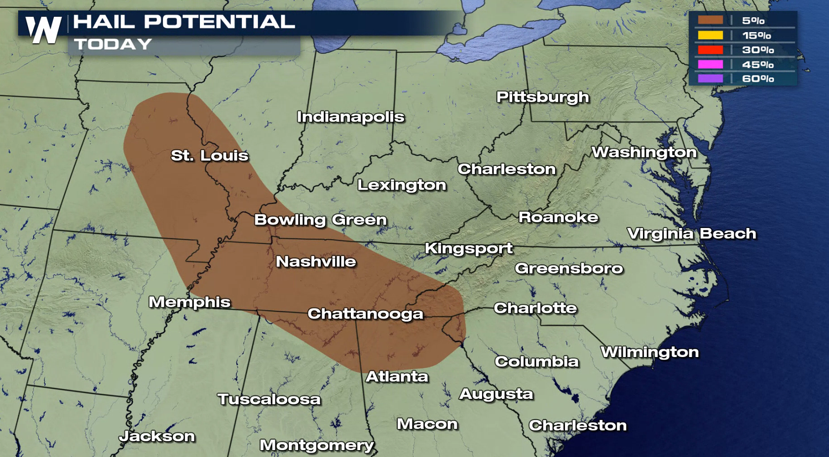
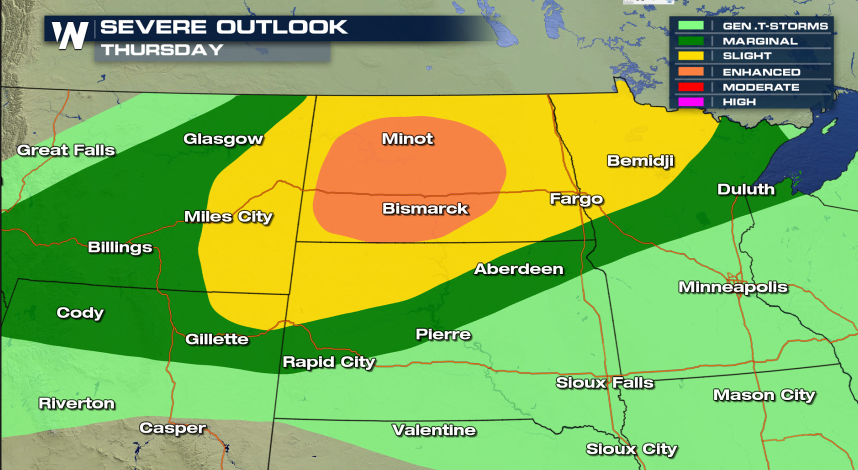
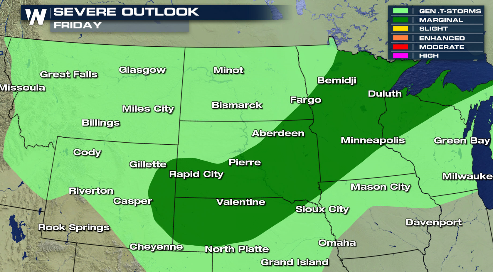
 There is an enhanced risk for severe weather tomorrow in North Dakota. Supercells are possible, with tornadoes, large hail, and strong winds. The severe weather threat is lower for Friday.
 For WeatherNation: Meteorologist Mace Michaels
A warm front pushing along the Mason-Dixon line will provide enough wind shear for severe thunderstorms and possible tornado development. Areas ahead of a cold front may see severe weather as well, with large hail and damaging winds.
There is an enhanced risk for severe weather tomorrow in North Dakota. Supercells are possible, with tornadoes, large hail, and strong winds. The severe weather threat is lower for Friday.
For WeatherNation: Meteorologist Mace MichaelsAll Weather News
More


More Storms for the East Through Monday
A low-pressure system that moved through the
3 Aug 2026 1:50 AM

After Reaching Category 5, Genevieve Weakens in the Pacific
PacificGenevieve formed last Friday south of
3 Aug 2026 12:30 AM

Flooding, Severe Storms Target the Midwest Again
After an active week of storms across the nor
1 Aug 2026 1:40 AM

Flooding Risk Increases as Heavy Rain Targets the Tri-State Area
Tuesday, heavy rainfall moved across the Nort
30 Jul 2026 12:25 AM

Severe Weather: Energy From the Midwest Now in the Southeast
UPPER MIDWEST - Through Monday, dangerous tor
29 Jul 2026 10:30 PM