Severe Weather Risks for Monday
Special Stories
12 Aug 2019 10:02 AM
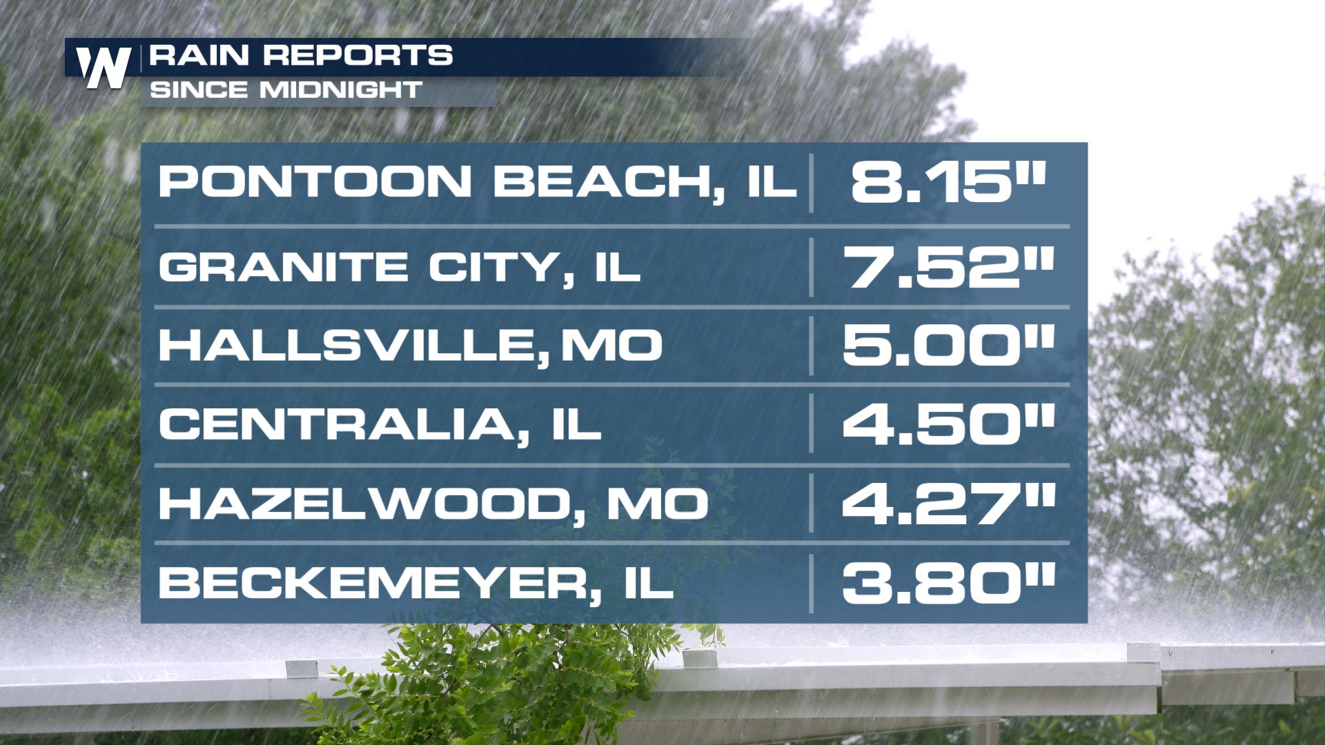
The work week got off to a very wet start in Missouri and Illinois. Granite City was hit hard and it led to major street flooding. Rainfall totals exceeded half a foot in several spots.
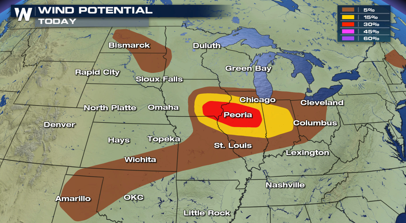
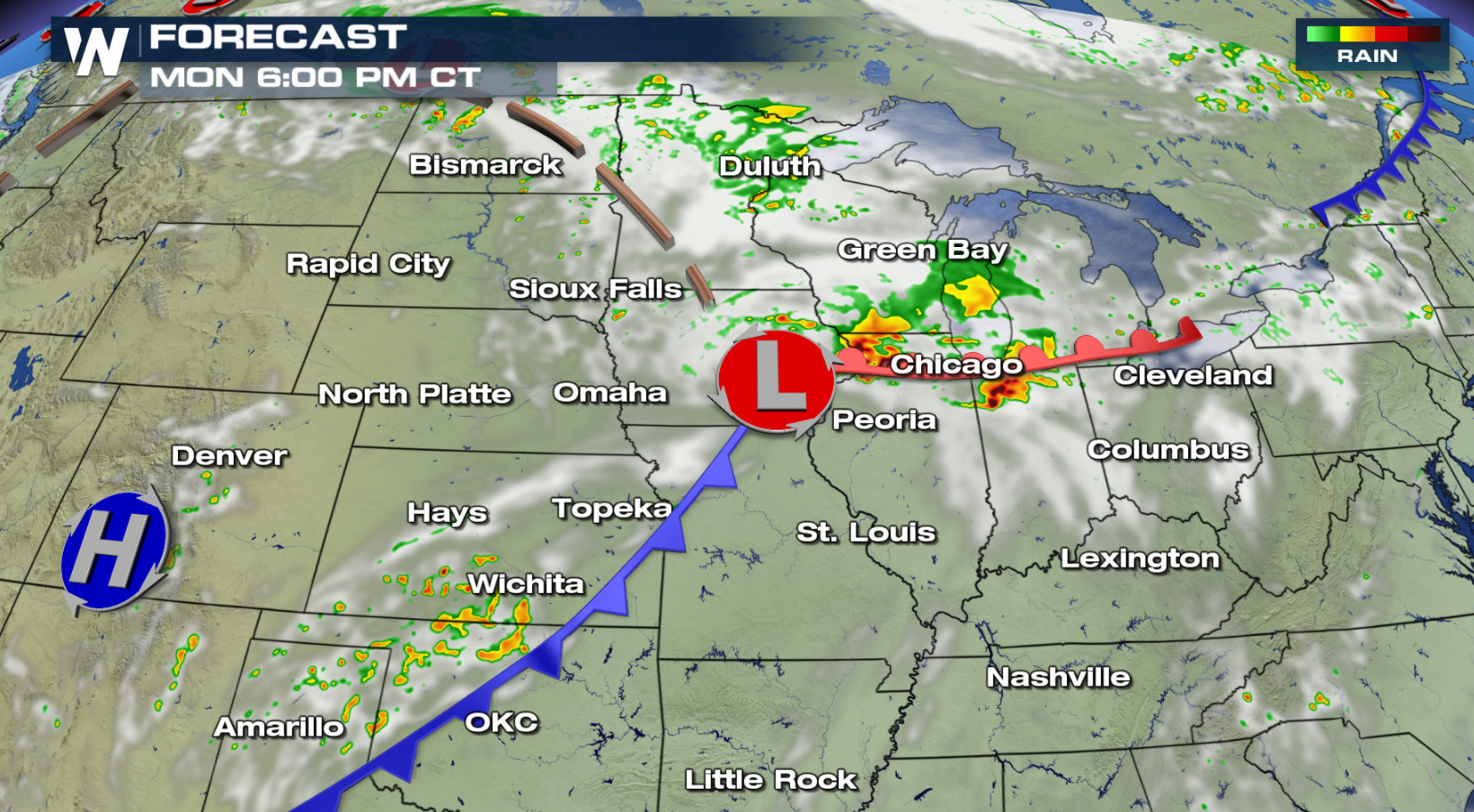
 Severe thunderstorms will be the focus for the rest of the evening. There is an enhanced risk for severe thunderstorms in Iowa and Illinois, with a slight risk into surrounding Indiana and Missouri. Marginal risks extended eastward into Ohio and southward to the Texas Panhandle. Parts of the Dakotas and Maine are also under marginal severe weather threats. Damaging wind gusts are a primary concern this evening. Gusts could exceed 80 mph in areas highlighted in red. Some large hail is also possible.
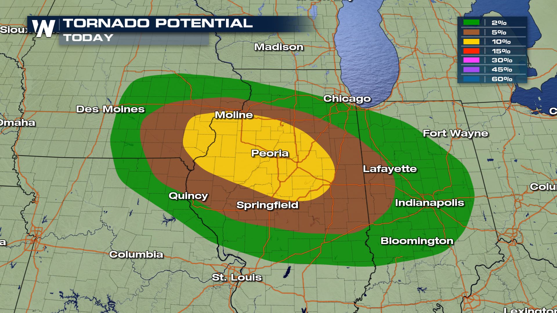
 The tornado potential is highest over central Illinois. Some strong tornadoes are possible across the yellow shaded region.
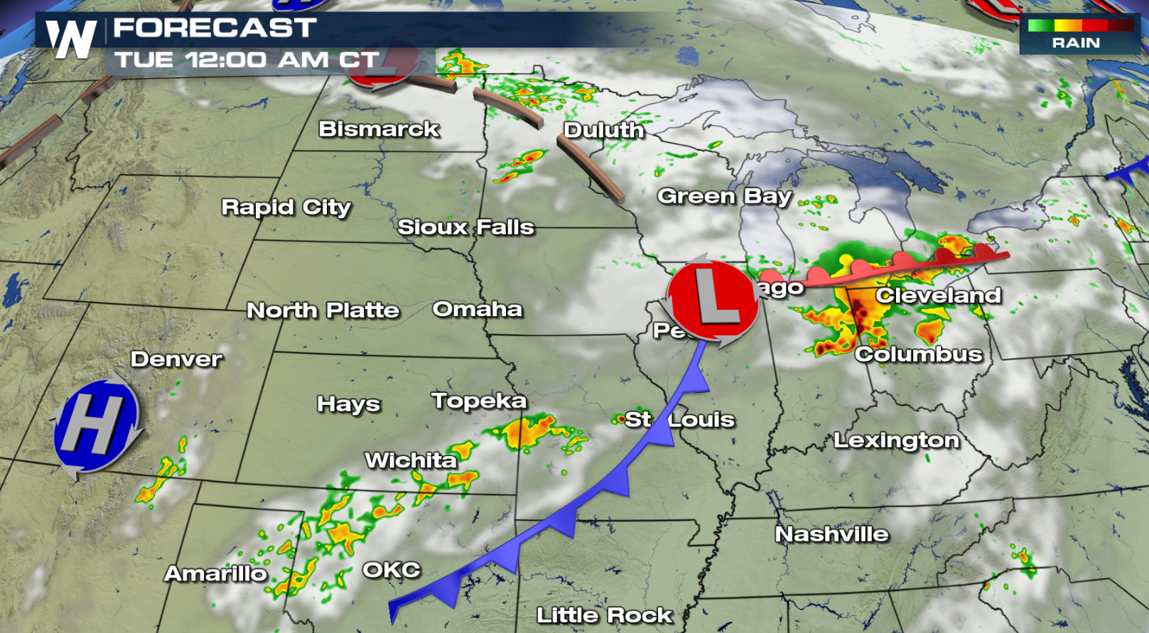
 The strongest storms will move through Peoria late this evening. The complex of storms will then move into Indiana by late tonight.
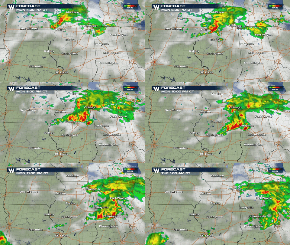 While the strong storms will be centered for Illinois, isolated severe weather is possible anywhere along the cold strong. The front will slip through states like Oklahoma and Missouri this evening as well. Storms push into the Ohio Valley overnight and will continue into Tuesday.
 If you are in the risk areas, be sure to check back with WeatherNation on-air and online for updates and weather alerts.
For WeatherNation: Meteorologist Mace Michaels
If you are in the risk areas, be sure to check back with WeatherNation on-air and online for updates and weather alerts.
For WeatherNation: Meteorologist Mace Michaels
Severe thunderstorms will be the focus for the rest of the evening. There is an enhanced risk for severe thunderstorms in Iowa and Illinois, with a slight risk into surrounding Indiana and Missouri. Marginal risks extended eastward into Ohio and southward to the Texas Panhandle. Parts of the Dakotas and Maine are also under marginal severe weather threats. Damaging wind gusts are a primary concern this evening. Gusts could exceed 80 mph in areas highlighted in red. Some large hail is also possible.
The tornado potential is highest over central Illinois. Some strong tornadoes are possible across the yellow shaded region.
The strongest storms will move through Peoria late this evening. The complex of storms will then move into Indiana by late tonight.
While the strong storms will be centered for Illinois, isolated severe weather is possible anywhere along the cold strong. The front will slip through states like Oklahoma and Missouri this evening as well. Storms push into the Ohio Valley overnight and will continue into Tuesday.
If you are in the risk areas, be sure to check back with WeatherNation on-air and online for updates and weather alerts.
For WeatherNation: Meteorologist Mace MichaelsAll Weather News
More
SW Low Moves East, Brings Flood Threat to the Plains
A powerful low pressure system has been movin
23 Oct 2026 8:40 PM

Hurricane Vance Strengthens In The Pacific
After becoming a hurricane Friday, Vance quic
23 Oct 2026 8:30 PM

Warmer Than Average: Above-Normal Temperatures Across the Central U.S. This Week
WHAT TO EXPECTA ridge of high pressure linger
23 Oct 2026 1:00 PM


Several Fires Break Out in SoCal Last Week Amid Santa Ana Wind Event
Santa Ana winds helped several fires grow qui
19 Oct 2026 1:25 PM

Another Cold Morning Before Things Warm Back Up
Across portions of the Ohio Valley through th
19 Oct 2026 10:15 AM

Severe Risk Diminishing Saturday Morning for the Northeast
Severe Storm PotentialSevere risk is decreasi
16 Oct 2026 10:20 AM