Severe Weather Threat Across Southern Lake Michigan Overnight
Top Stories
25 Sep 2022 8:15 PM
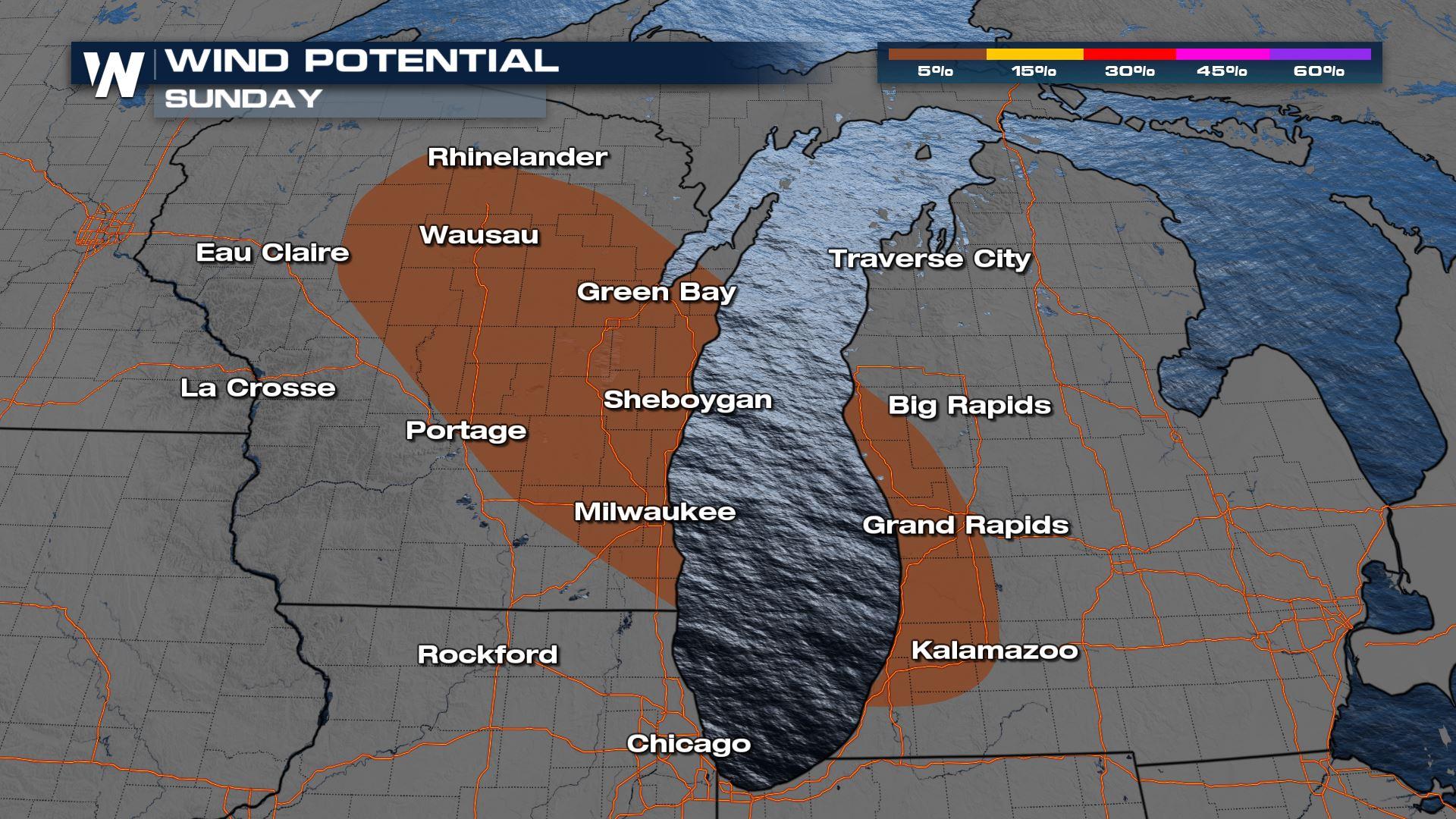
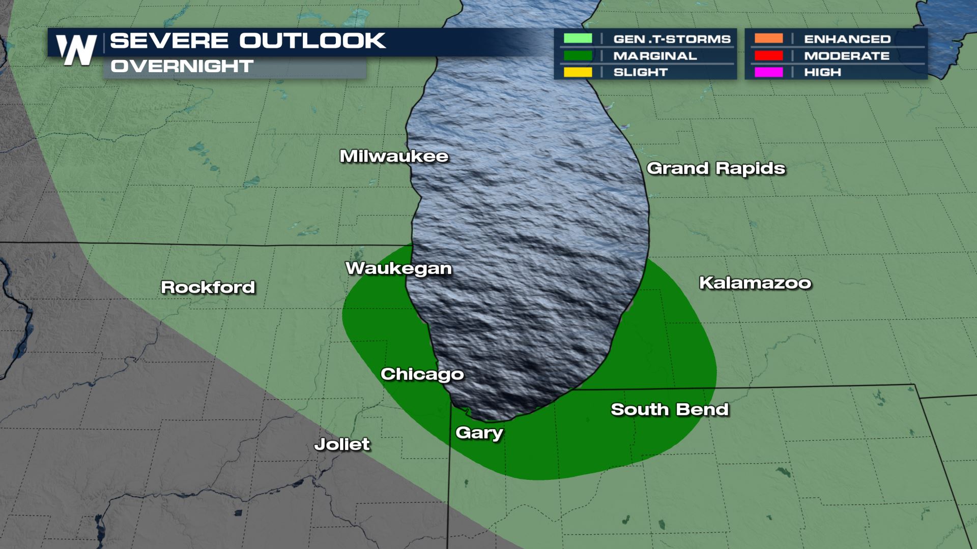
The severe weather risk has shifted across portions of south Lake Michigan tonight, with Chicago in the risk area. Behind the upper-level low, there will be enough instability and energy in the atmosphere to spark up isolated severe storms with wind being the primary threat.
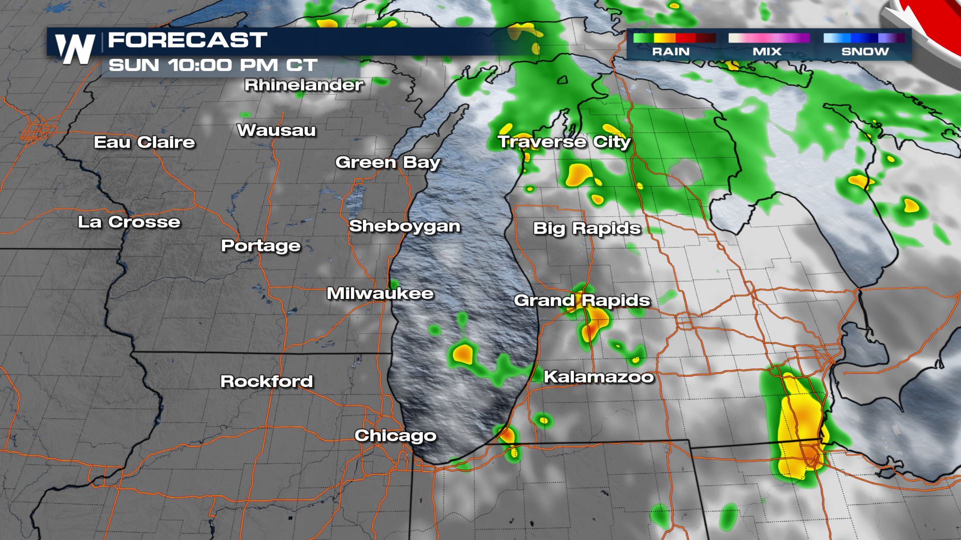
 A few showers and storms will continue overnight, mainly across southwest Michigan.
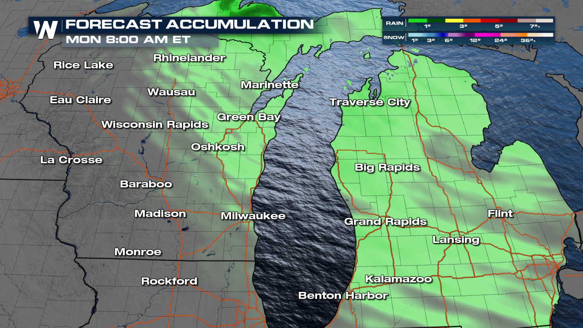
 Rainfall totals won't be all that impressive, but we could pick up on an inch or so in the heaviest of downpours.
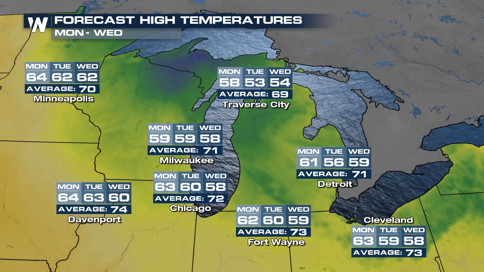
 Temperatures will drop behind this front as well, back down into the 50s for the day on Monday! Feeling certainly like fall.
 Stay with WeatherNation for the latest on this top weather headline, as well as the rest of our national weather headlines!
A few showers and storms will continue overnight, mainly across southwest Michigan.
Rainfall totals won't be all that impressive, but we could pick up on an inch or so in the heaviest of downpours.
Temperatures will drop behind this front as well, back down into the 50s for the day on Monday! Feeling certainly like fall.
Stay with WeatherNation for the latest on this top weather headline, as well as the rest of our national weather headlines!All Weather News
More

More Storms for the East Through Monday
A low-pressure system that moved through the
3 Aug 2026 12:20 PM


After Reaching Category 5, Genevieve Weakens in the Pacific
PacificGenevieve formed last Friday south of
3 Aug 2026 12:30 AM

Flooding, Severe Storms Target the Midwest Again
After an active week of storms across the nor
1 Aug 2026 1:40 AM

Flooding Risk Increases as Heavy Rain Targets the Tri-State Area
Tuesday, heavy rainfall moved across the Nort
30 Jul 2026 12:25 AM