Severe Weather Threat Continues Across the Plains and Midwest

Special Stories
11 Jul 2020 4:15 PM
Massive hail-producing thunderstorms quickly evolved Saturday across multiple states. Some of the biggest hail reports were up to softball-sized stones! That diameter equals about 4 inches thick! Take a listen to some of the hail hitting in this video from Minnesota on Saturday:
https://twitter.com/WeatherNation/status/1282072174270902272
Some of the top hail reports from Minnesota Saturday were as follows (diameter):
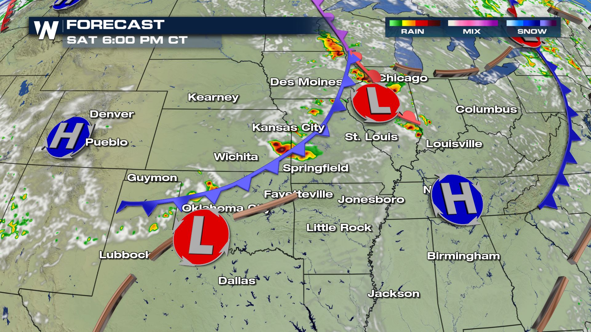 The weather set-up tonight features a cold front moving to the southeast. This cold front is expected to trigger thunderstorms, while winds in the mid-levels of the atmosphere are strong enough to keep these storms going. These mid-level winds will be around 50 knots, or 65 miles per hour, and will help create thunderstorms containing very large hail and damaging winds.
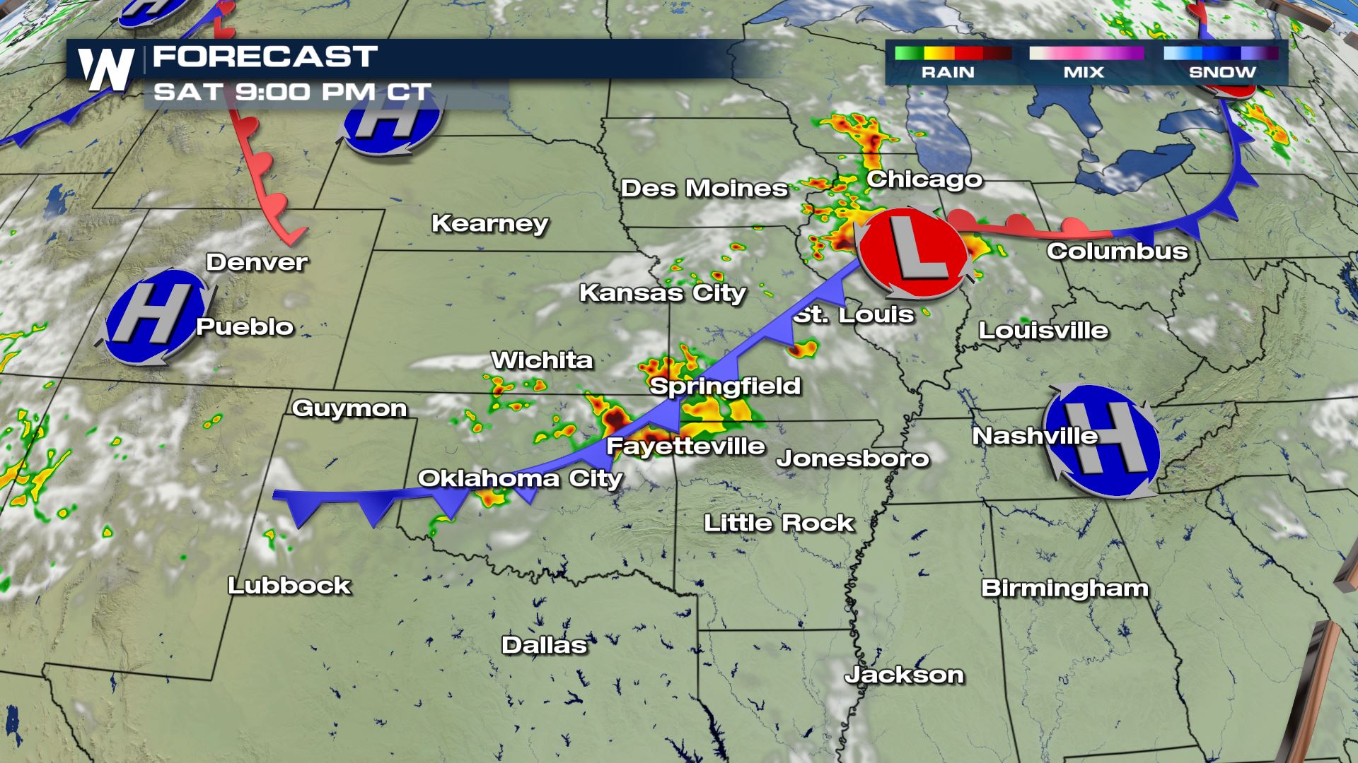 Lastly, it will be a hot and humid night. The combination of a steamy summer day, unstable atmosphere, strong supporting wind, and a cold front will help create these storms overnight.
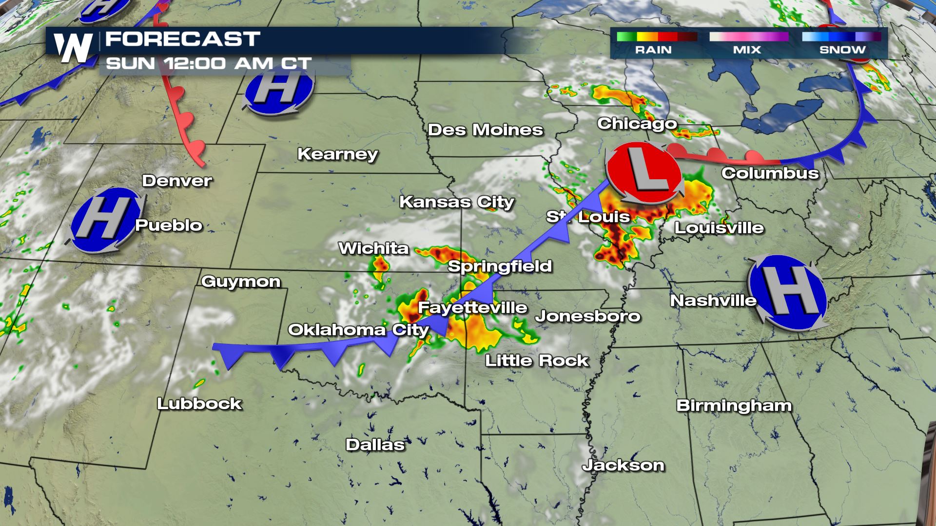
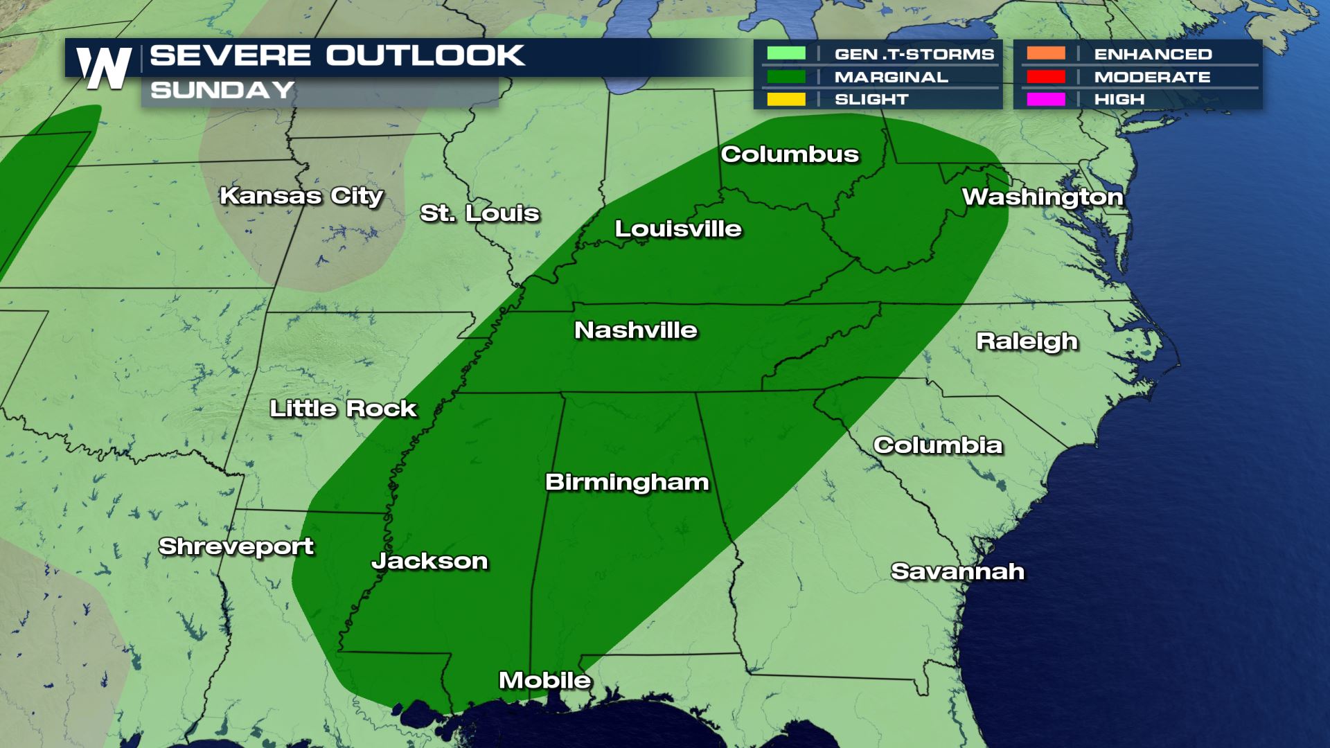 On Sunday, the severe weather potential shifts to the Ohio and Tennessee Valleys, the southern Appalachians, as well as the northern Gulf Coast. Once again, hail and strong wind will be possible. Please stay weather aware!
Stay with WeatherNation for the latest forecast and warnings.
On Sunday, the severe weather potential shifts to the Ohio and Tennessee Valleys, the southern Appalachians, as well as the northern Gulf Coast. Once again, hail and strong wind will be possible. Please stay weather aware!
Stay with WeatherNation for the latest forecast and warnings.
- Stewart: 2.50"
- Lakefield: 2.50"
- Hector: 2.00"
- Okabena: 1.75"
- Lake Lillian: 1.25"
The weather set-up tonight features a cold front moving to the southeast. This cold front is expected to trigger thunderstorms, while winds in the mid-levels of the atmosphere are strong enough to keep these storms going. These mid-level winds will be around 50 knots, or 65 miles per hour, and will help create thunderstorms containing very large hail and damaging winds.
Lastly, it will be a hot and humid night. The combination of a steamy summer day, unstable atmosphere, strong supporting wind, and a cold front will help create these storms overnight.
Kansas Hail Reports (Diameter)
- Waverly: 4"
- Dover: 3"
- Westmoreland: 2.75"
- Paxico: 1.75"
- Auburn: 1.75"
On Sunday, the severe weather potential shifts to the Ohio and Tennessee Valleys, the southern Appalachians, as well as the northern Gulf Coast. Once again, hail and strong wind will be possible. Please stay weather aware!
Stay with WeatherNation for the latest forecast and warnings.All Weather News
More
Fronts Continue To Spark Severe Weather Across the Plains
A cold front that brought record lows to the
18 Jul 2025 10:40 PM

Extreme Heat Impacts for the East Coast & South
Extreme heat continues to impact several area
18 Jul 2025 10:05 PM

Flooding Threat Remains Elevated in the East
A cold front pushing through the Eastern Seab
18 Jul 2025 9:10 PM

EF-2 Firenado from the Deer Creek Fire in Utah
A fire tornado was spotted near La Sal, Utah
18 Jul 2025 7:30 AM

Tropical System Brings Flood Risk to the Central Gulf
Time has run out for notable tropical develop
18 Jul 2025 3:05 AM

Heavy Rain, Flooding Threat Returns to Florida
Keep the rain boots handy in Florida - heavy
13 Jul 2025 12:50 PM

Severe Storm Risk Pushes into the Great Lakes, Ohio Valley
Friday was another busy day with severe weath
12 Jul 2025 8:00 PM