Severe Weather Threat for Friday and Into the Weekend
Special Stories
20 Sep 2019 7:00 AM
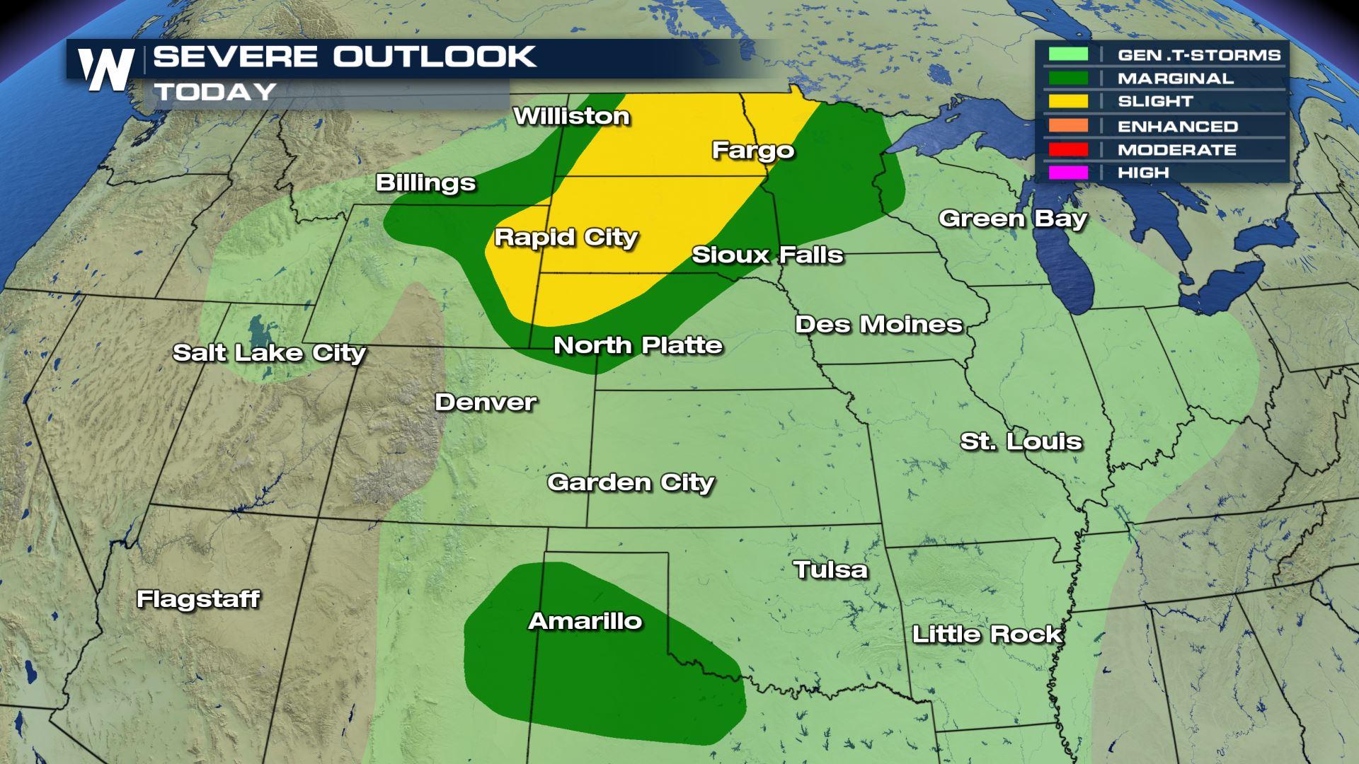
The chance of severe weather remains in the forecast to end the week and through the weekend as a strong line of thunderstorms move across the region. The Storm Prediction Center, or SPC, has issued a Slight chance of severe storms on Friday across areas in the High Plains. Moisture will continue to stream in from the south, enhancing the storm activity into the evening hours.
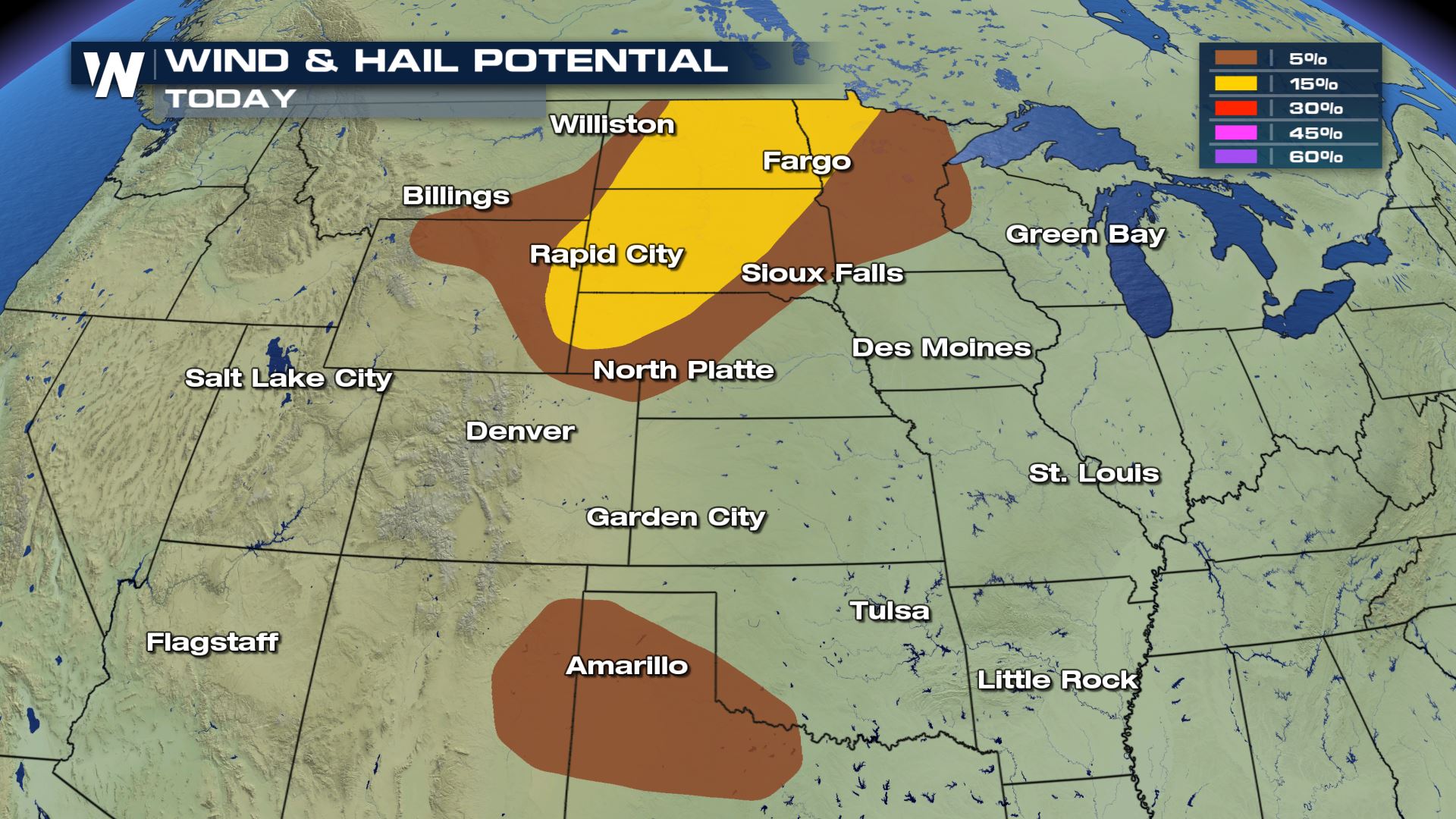
 There will likely be multiple threats this afternoon and evening. Gusty outflow winds may exceed 50 MPH accompanied with large damaging hail. Some hail may grow as large as 2" in diameter, so make sure to have those cars in the garage!
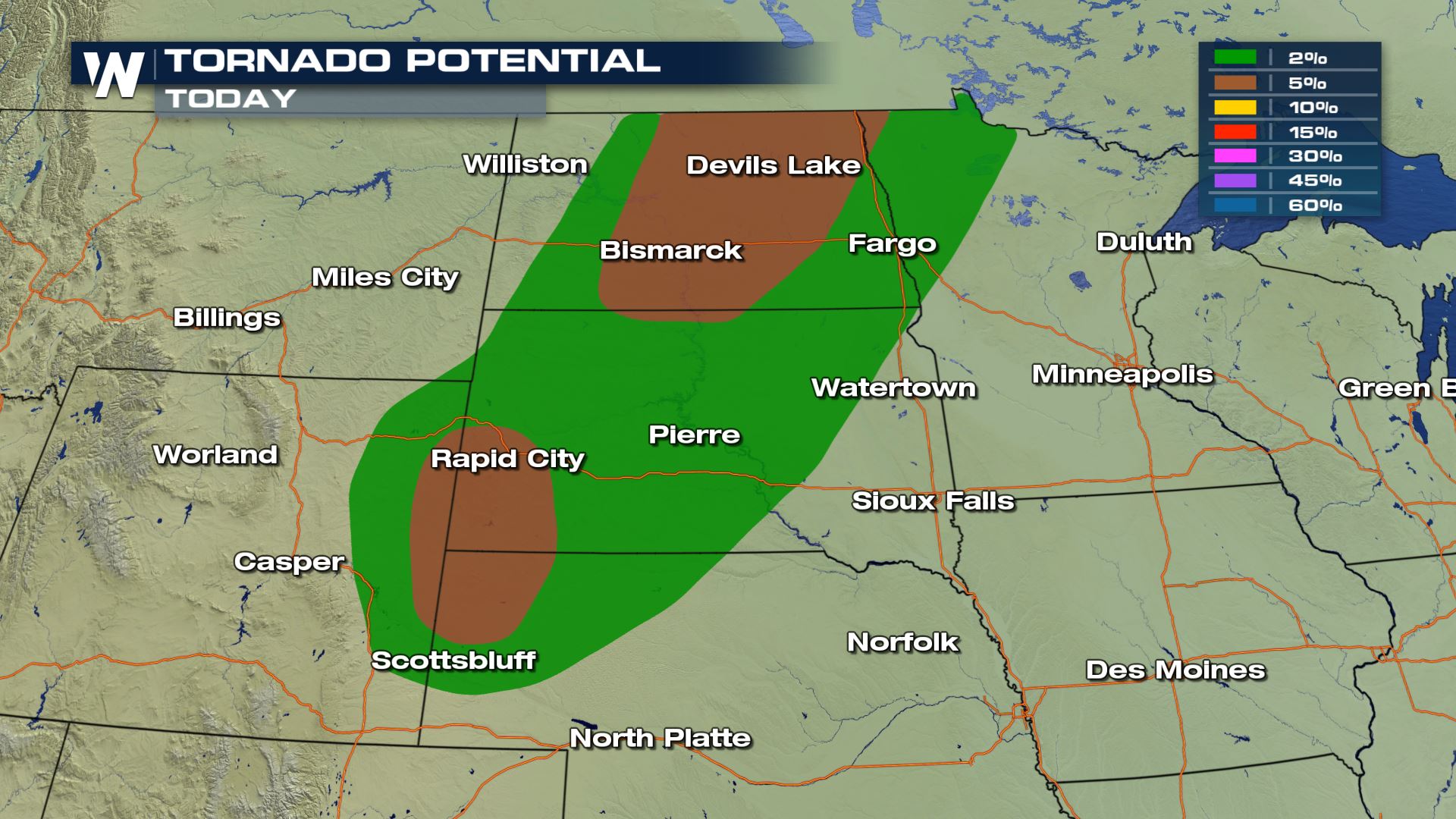
 There is also the threat for a few isolated areas of tornadoes. Locations include both North and South Dakota, Nebraska and Wyoming. These areas will have the best chance for rotation throughout the afternoon and evening hours.
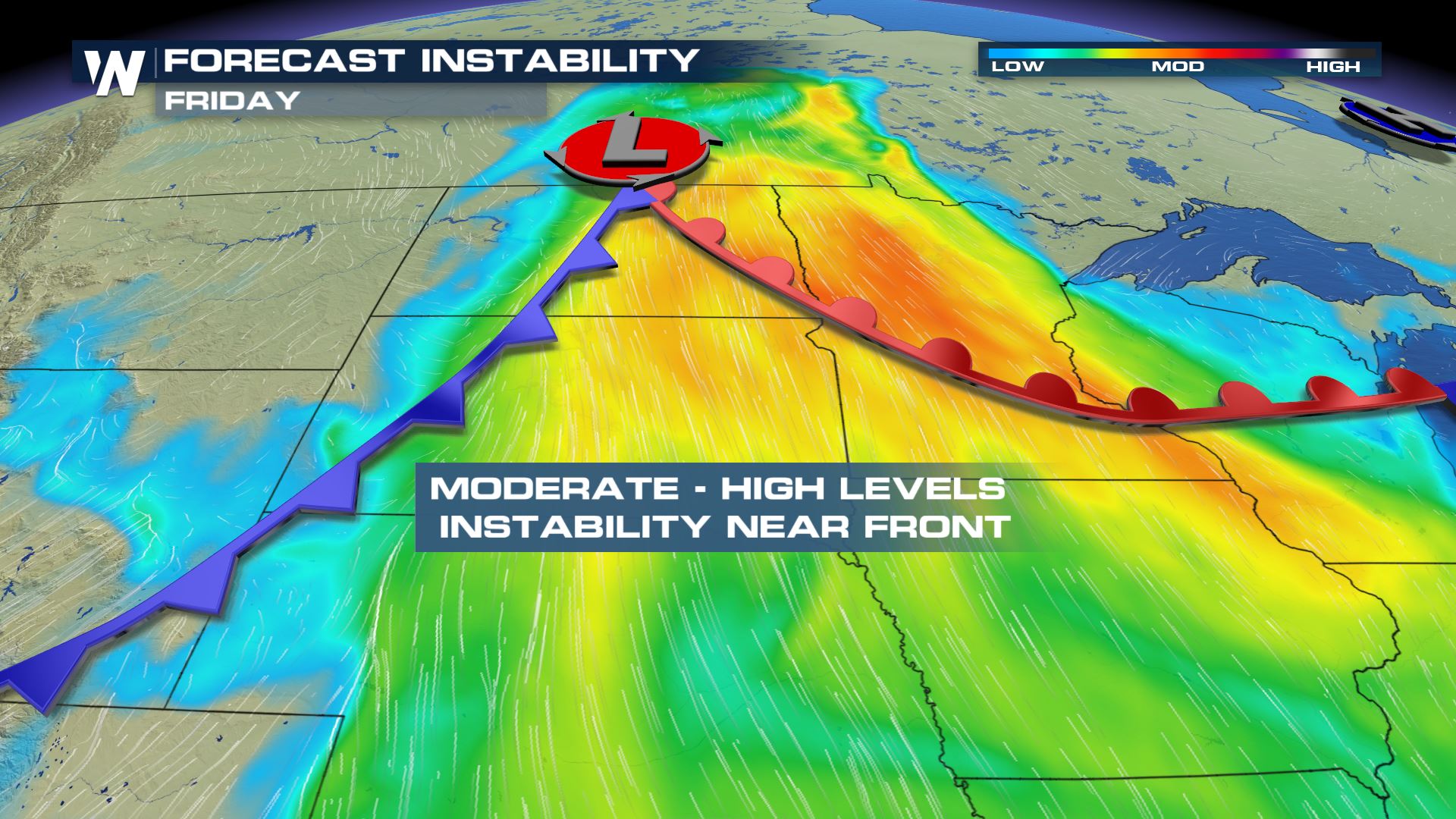
 Conditions will be favorable for severe weather due to the large amount of instability expected within the atmosphere. The main areas will be near and ahead of the frontal boundary.
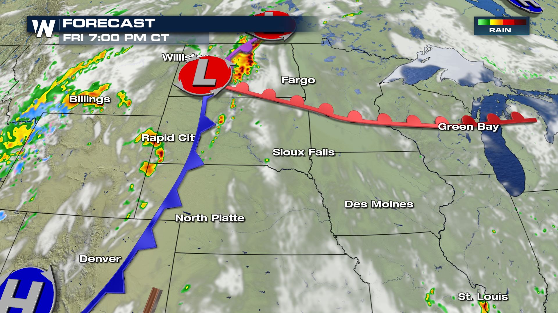
 Below is the expected timing of the event on Friday evening. Storms are forecast to develop after 3 or 4 PM and continue to expand in coverage through the evening and potentially into the overnight hours as well.
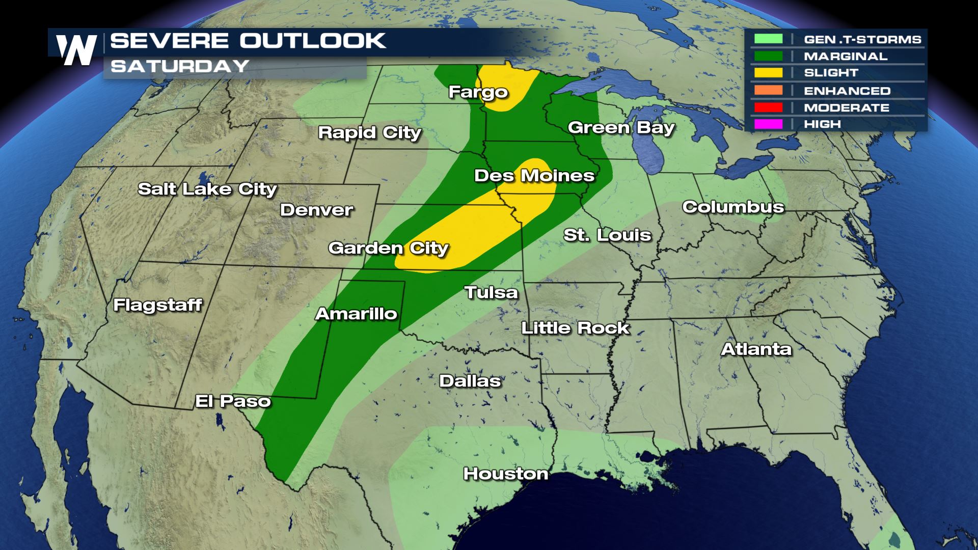
 As the line of storms slowly moves east overnight, the threat of severe weather continues into the upcoming weekend. Areas shaded in yellow will see the highest probability of severe weather extending from Kansas into Missouri and Iowa. A pocket in north central Minnesota will also have the chance for severe weather development. However, the risk extends from West Texas through Upper Mid-West throughout Saturday afternoon.
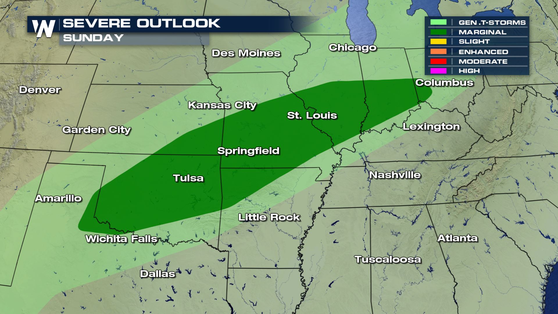
 On Sunday, the threat decreases, but continues to see a Marginal risk. The largest threat will likely be windy conditions and small hail.
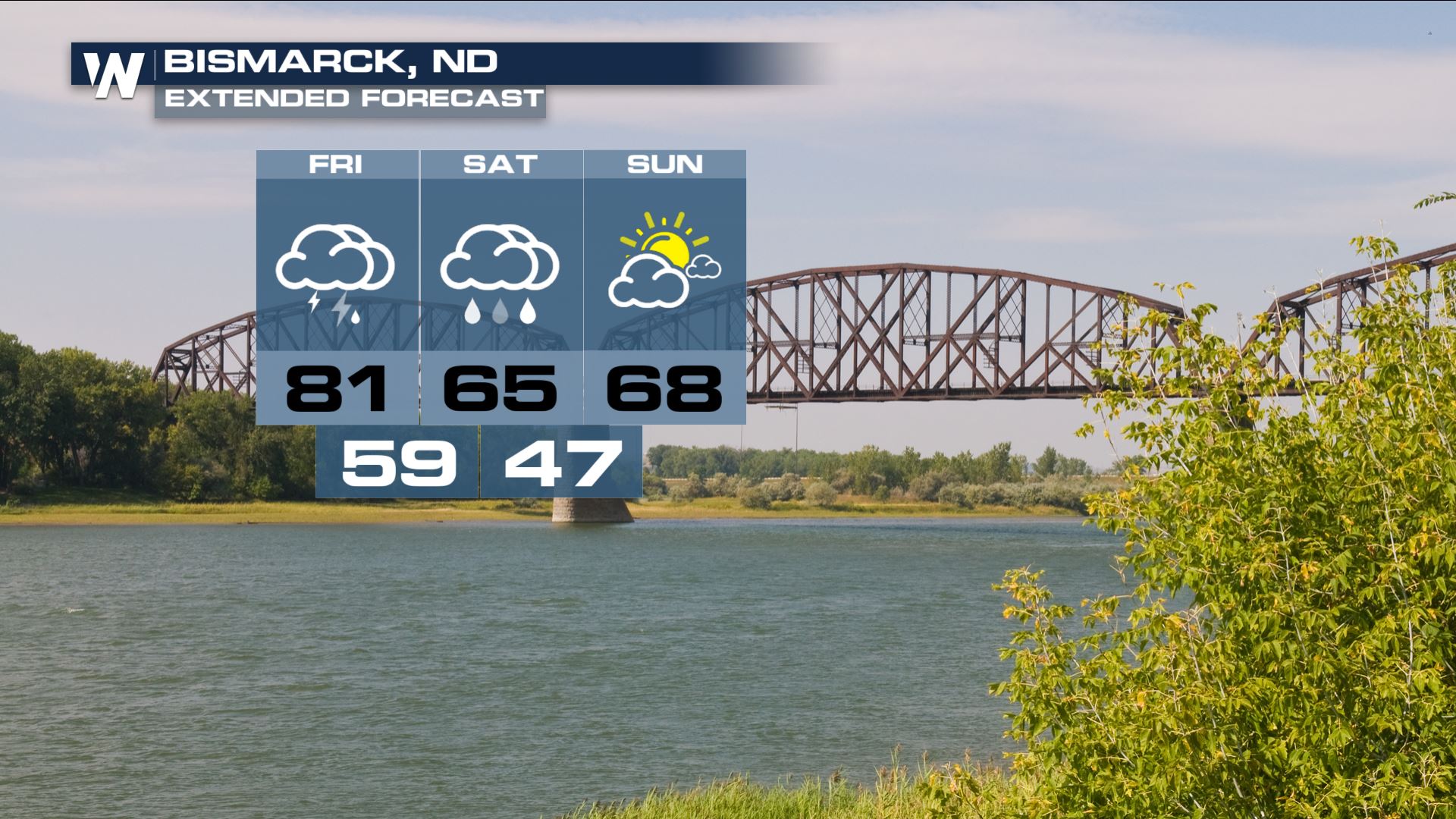
 Bismarck, ND has thunderstorms in the forecast through Saturday evening, with partly cloudy skies and cooler condtions on Sunday.
 Forecasts are always subject to change, so make sure to stay with WeatherNation!
There will likely be multiple threats this afternoon and evening. Gusty outflow winds may exceed 50 MPH accompanied with large damaging hail. Some hail may grow as large as 2" in diameter, so make sure to have those cars in the garage!
There is also the threat for a few isolated areas of tornadoes. Locations include both North and South Dakota, Nebraska and Wyoming. These areas will have the best chance for rotation throughout the afternoon and evening hours.
Conditions will be favorable for severe weather due to the large amount of instability expected within the atmosphere. The main areas will be near and ahead of the frontal boundary.
Below is the expected timing of the event on Friday evening. Storms are forecast to develop after 3 or 4 PM and continue to expand in coverage through the evening and potentially into the overnight hours as well.
As the line of storms slowly moves east overnight, the threat of severe weather continues into the upcoming weekend. Areas shaded in yellow will see the highest probability of severe weather extending from Kansas into Missouri and Iowa. A pocket in north central Minnesota will also have the chance for severe weather development. However, the risk extends from West Texas through Upper Mid-West throughout Saturday afternoon.
On Sunday, the threat decreases, but continues to see a Marginal risk. The largest threat will likely be windy conditions and small hail.
Bismarck, ND has thunderstorms in the forecast through Saturday evening, with partly cloudy skies and cooler condtions on Sunday.
Forecasts are always subject to change, so make sure to stay with WeatherNation!All Weather News
More
Wildfire Outbreak in the Pacific Northwest
SPOKANE, WA - On Saturday, August 1st, the Ol
2 Aug 2026 7:20 PM

More Storms for the East Through Monday
A low-pressure system that moved through the
2 Aug 2026 7:20 PM


After Reaching Category 5, Genevieve Weakens in the Pacific
PacificGenevieve formed on last Friday south
2 Aug 2026 6:25 PM

Flooding, Severe Storms Target the Midwest Again
After an active week of storms across the nor
1 Aug 2026 1:40 AM

Flooding Risk Increases as Heavy Rain Targets the Tri-State Area
Tuesday, heavy rainfall moved across the Nort
30 Jul 2026 12:25 AM

Severe Weather: Energy From the Midwest Now in the Southeast
UPPER MIDWEST - Through Monday, dangerous tor
29 Jul 2026 10:30 PM