Severe Weather Threat in the Middle Atlantic and Plains
Special Stories
20 Jun 2018 9:09 AM
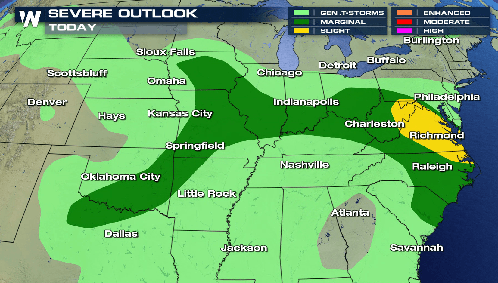
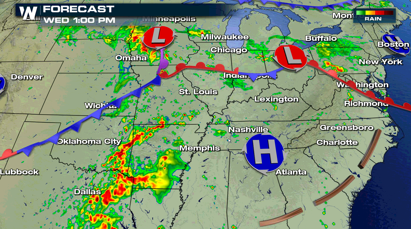
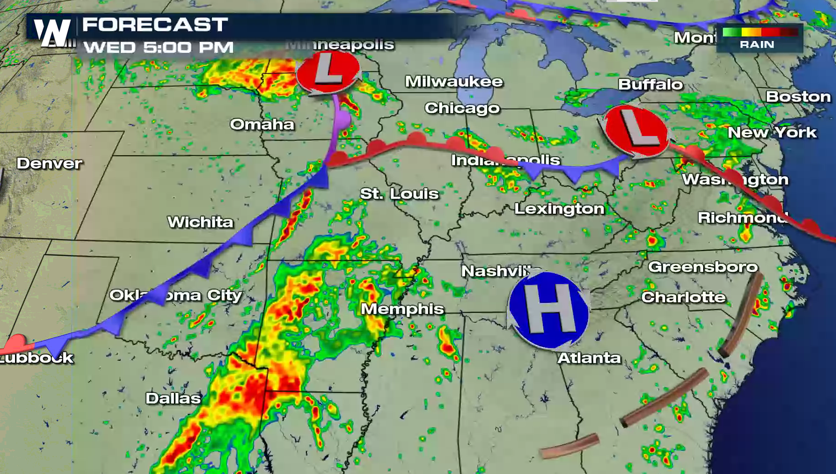
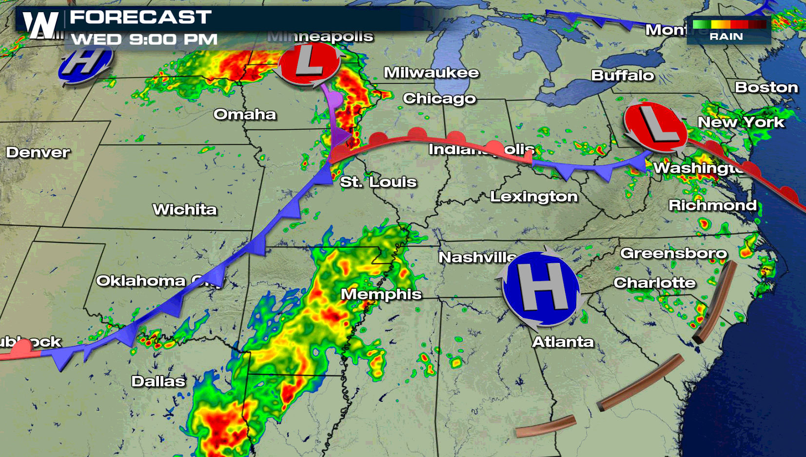
A system swinging into the Middle Atlantic states will likely produce a few severe thunderstorms later this afternoon and evening (Wednesday). Strong wind gusts are the biggest concern, with a more limited hail and tornado threat in the Plains.
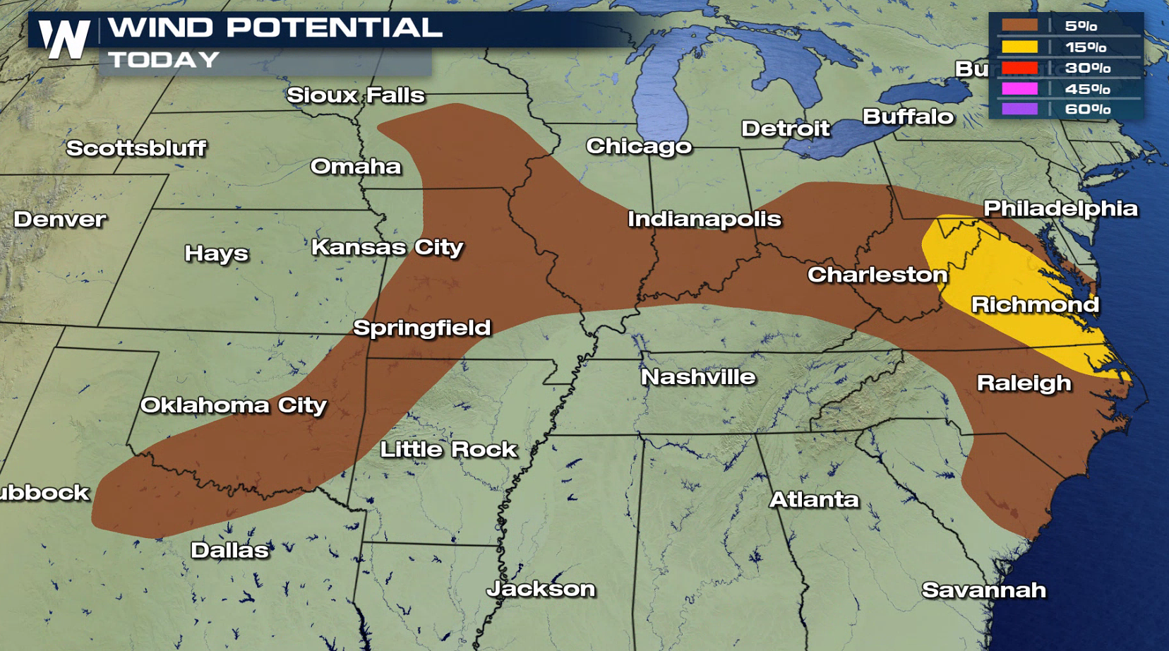
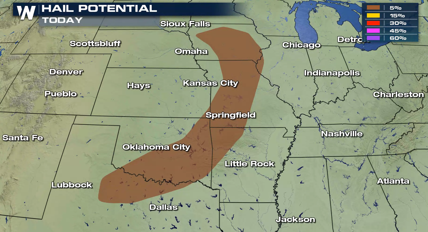
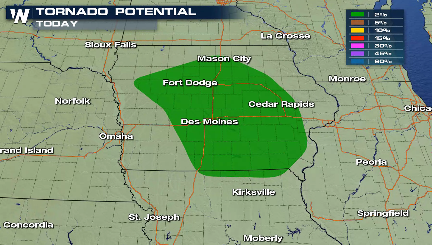 A low pressure center and warm front swinging through the Mid Atlantic will create a few showers and thunderstorms this afternoon. With strong instability due to high humidity and temperatures in the 90s, severe thunderstorms will likely develop as upper level energy rolls into the region. Further west, isolated severe thunderstorms are possible along a cold front and low pressure center.
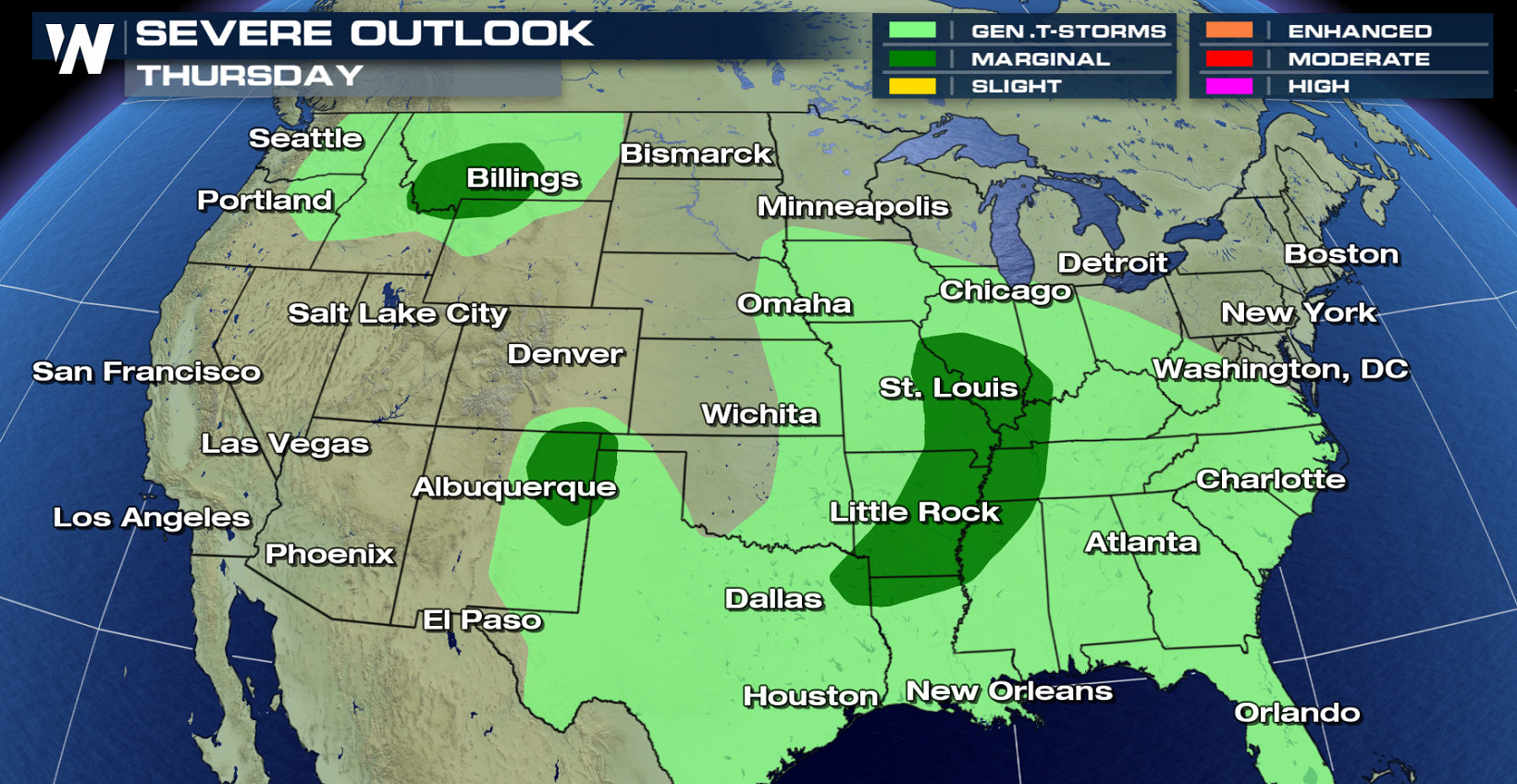
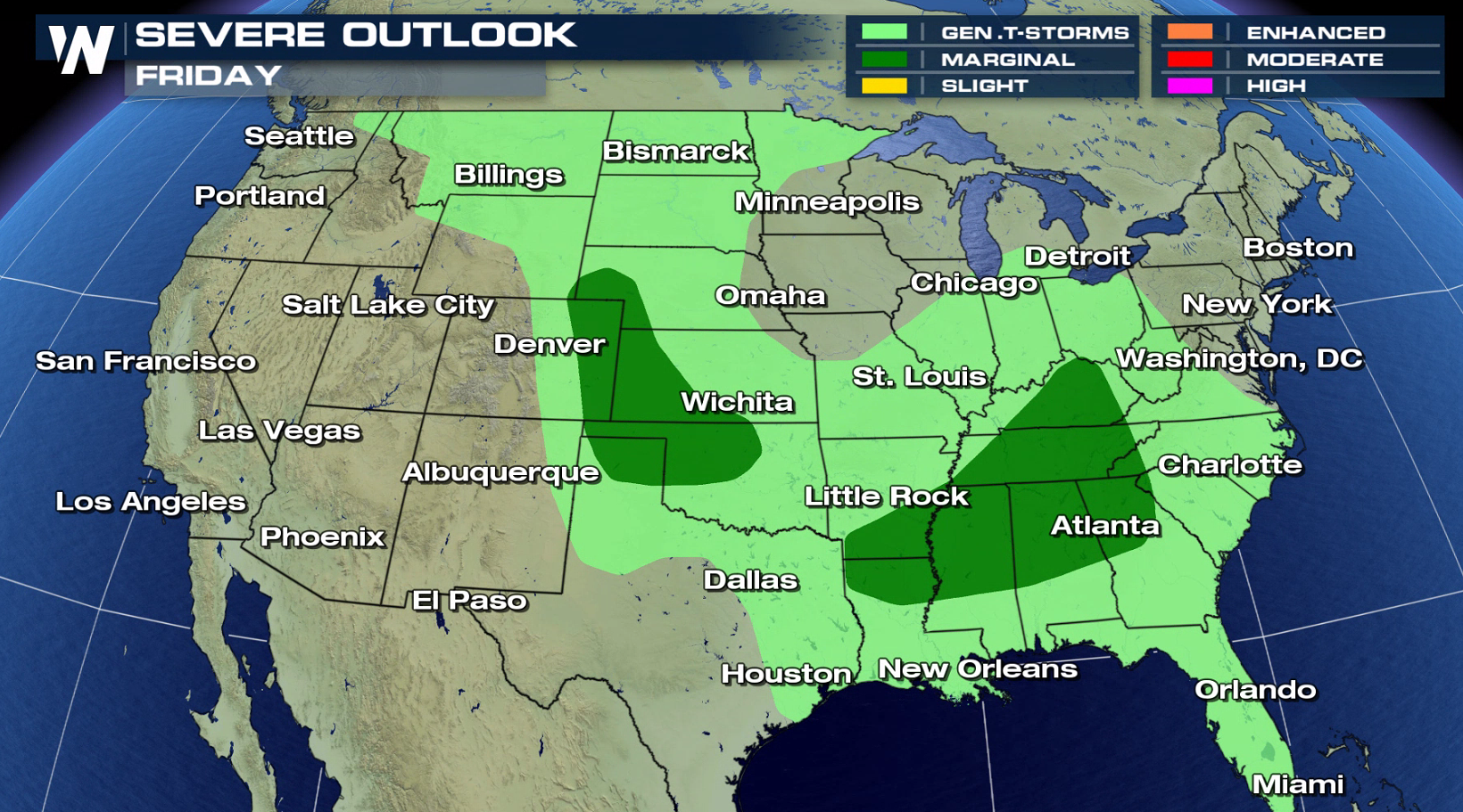
 On Thursday and Friday, there is a marginal severe weather risk from the Southeast to the High Plains.
 For WeatherNation: Meteorologist Mace Michaels
A low pressure center and warm front swinging through the Mid Atlantic will create a few showers and thunderstorms this afternoon. With strong instability due to high humidity and temperatures in the 90s, severe thunderstorms will likely develop as upper level energy rolls into the region. Further west, isolated severe thunderstorms are possible along a cold front and low pressure center.
On Thursday and Friday, there is a marginal severe weather risk from the Southeast to the High Plains.
For WeatherNation: Meteorologist Mace MichaelsAll Weather News
More
Fronts Continue To Spark Severe Weather Across the Plains
A cold front that brought record lows to the
18 Jul 2025 10:40 PM

Extreme Heat Impacts for the East Coast & South
Extreme heat continues to impact several area
18 Jul 2025 10:05 PM

Flooding Threat Remains Elevated in the East
A cold front pushing through the Eastern Seab
18 Jul 2025 9:10 PM

EF-2 Firenado from the Deer Creek Fire in Utah
A fire tornado was spotted near La Sal, Utah
18 Jul 2025 7:30 AM

Tropical System Brings Flood Risk to the Central Gulf
Time has run out for notable tropical develop
18 Jul 2025 3:05 AM

Heavy Rain, Flooding Threat Returns to Florida
Keep the rain boots handy in Florida - heavy
13 Jul 2025 12:50 PM

Severe Storm Risk Pushes into the Great Lakes, Ohio Valley
Friday was another busy day with severe weath
12 Jul 2025 8:00 PM