Severe Weather Threat in the Plains and Upper Midwest the Next Few Days
Special Stories
23 May 2018 7:59 AM
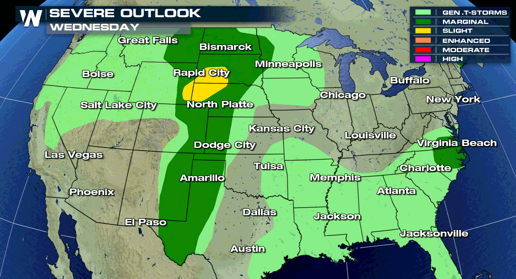
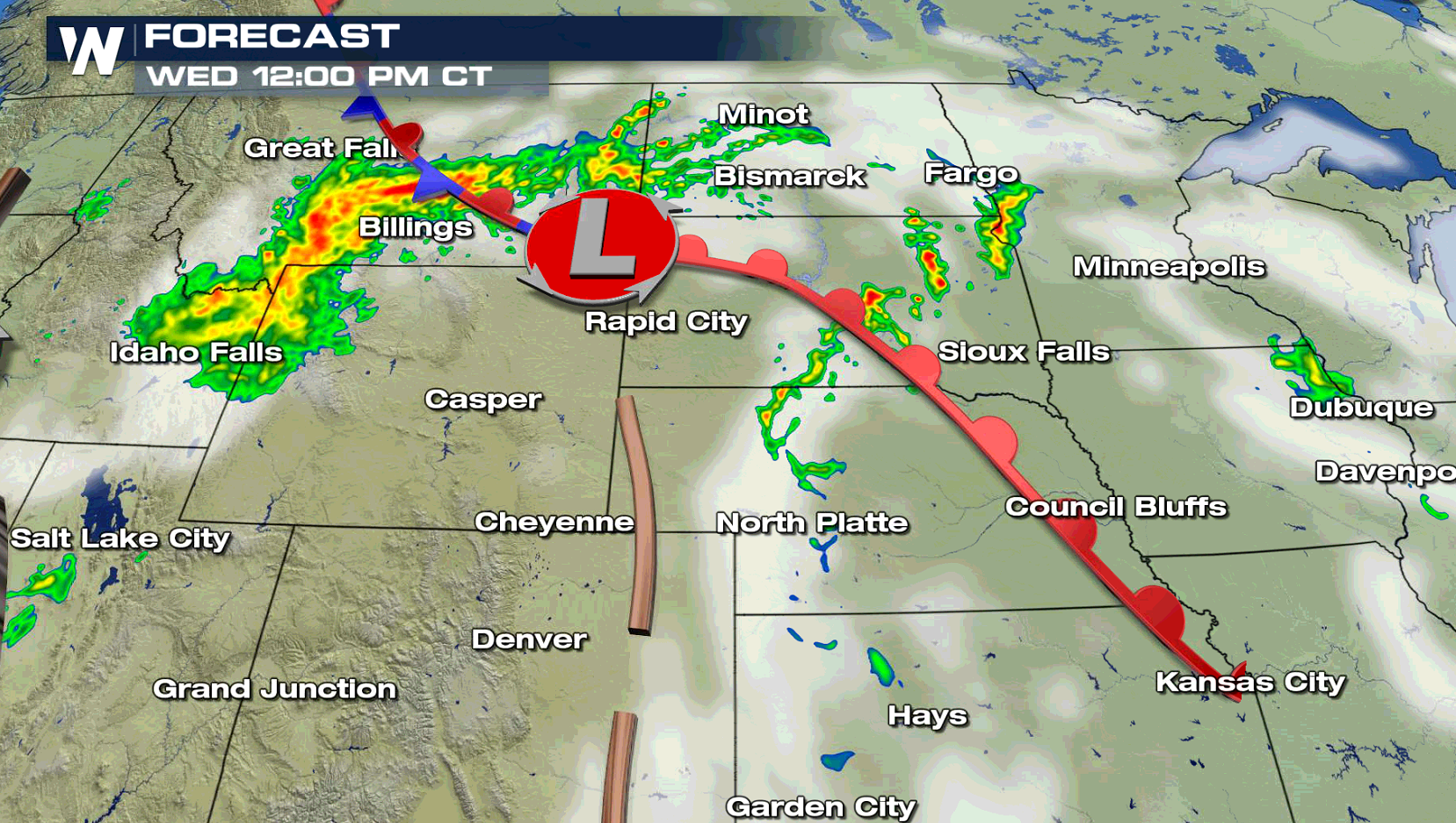
A slow moving low pressure center will bring the potential for severe thunderstorms to the Plains and Upper Midwest the next few days. For today, the slight risk area is focused from the Black Hills to near Cheyenne, Wyoming. A marginal risk extends through the Plains from the Canadian Border to the Mexican Border.
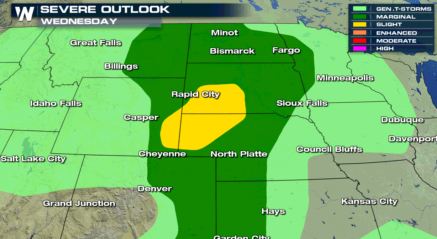
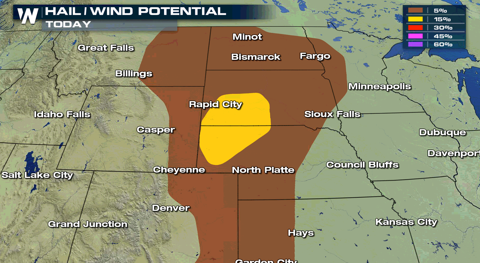
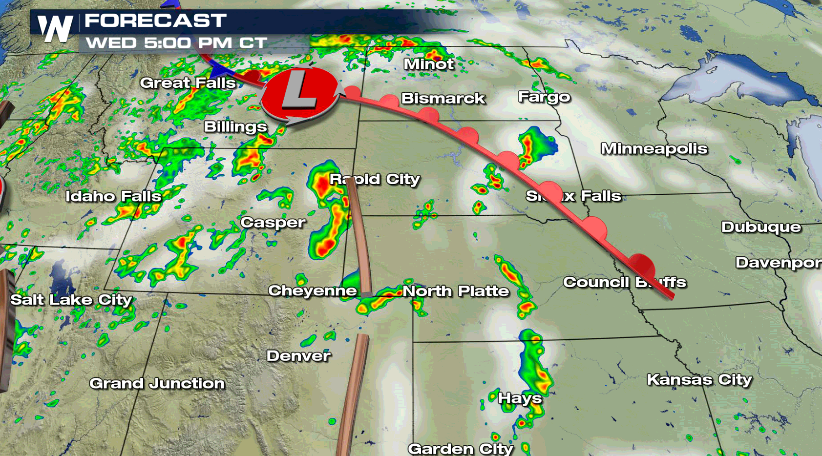
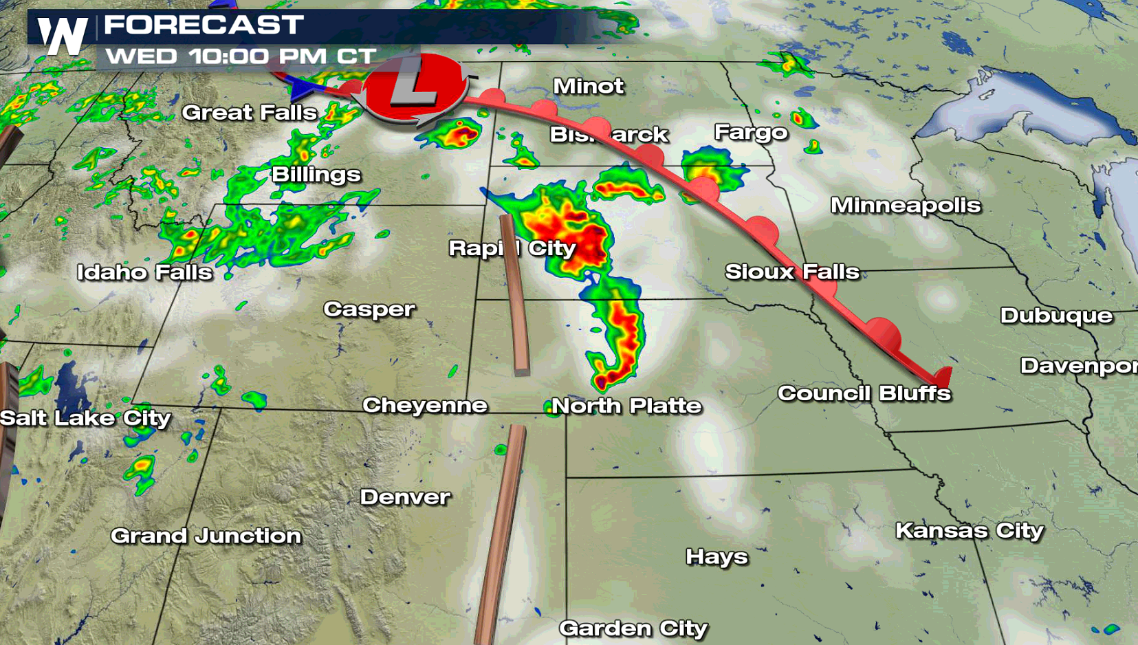
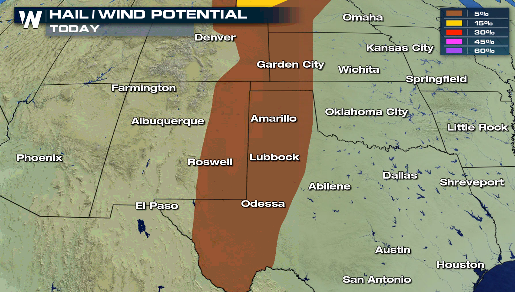 Isolated thunderstorms will be ongoing from midday into the afternoon across the High Plains. As a trough / dry line develops in the late afternoon, severe thunderstorms will likely form along and ahead of it. The storms will move east into the evening across South Dakota and Nebraska, diminishing in intensity during the overnight.
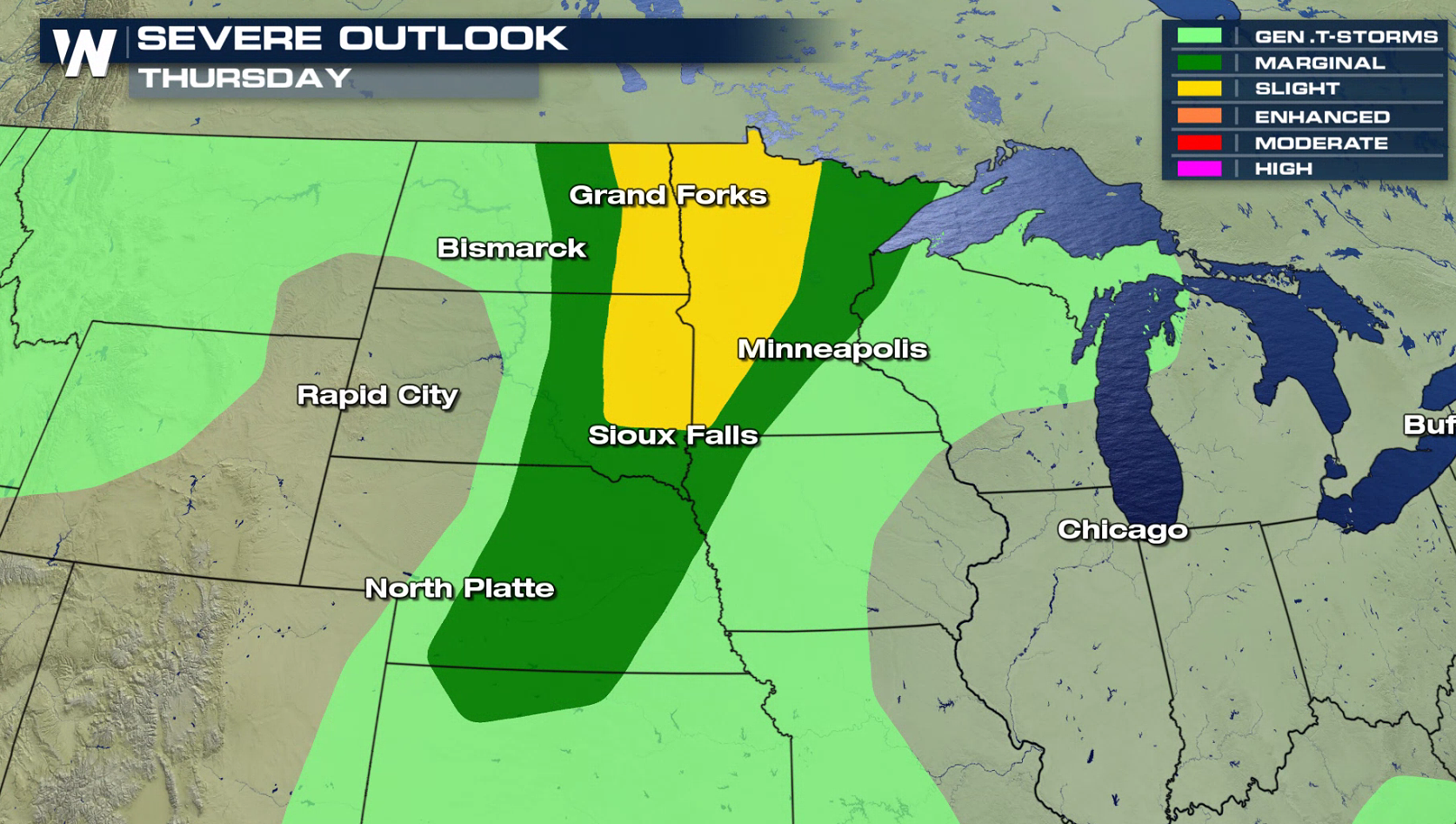
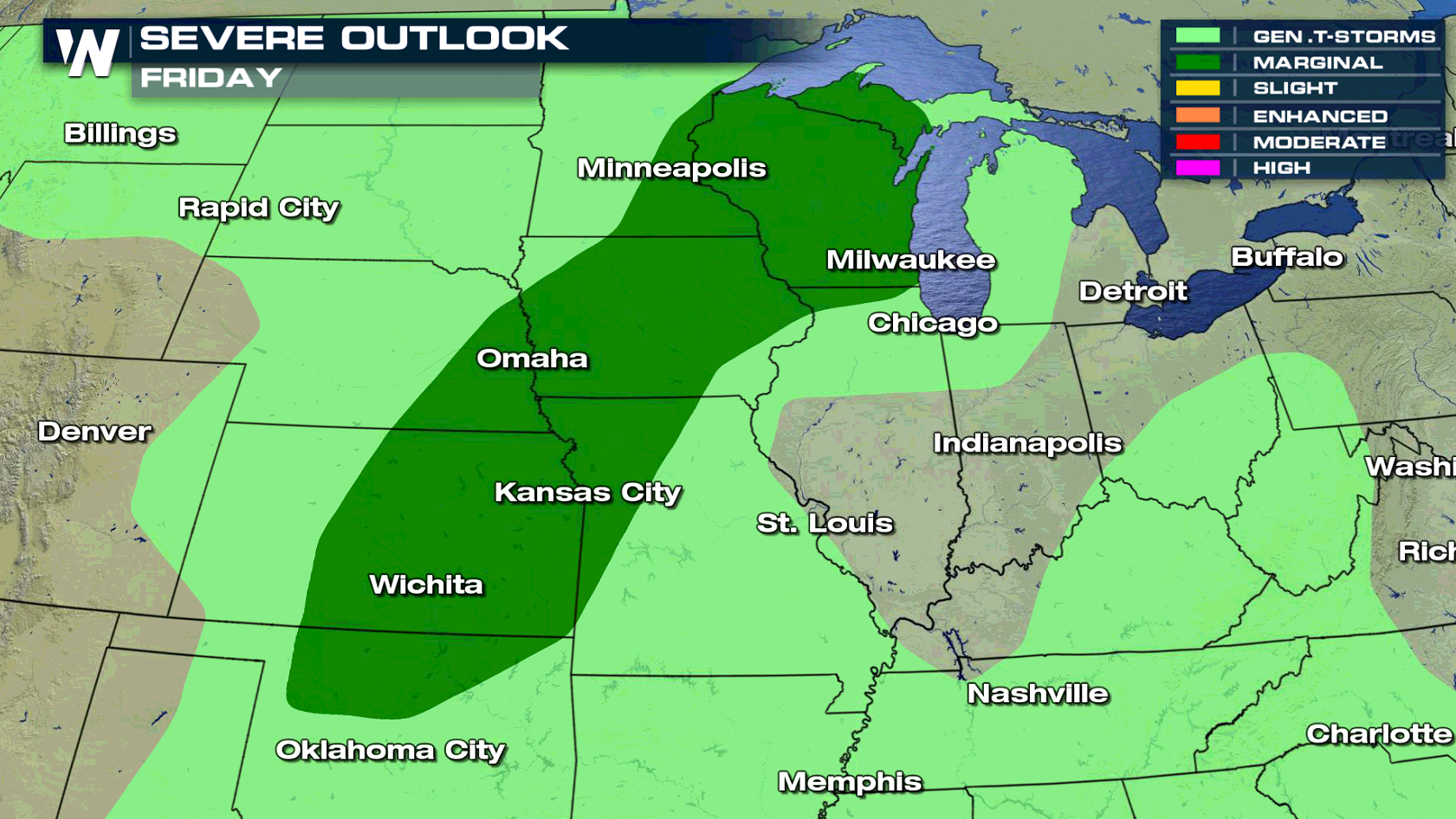
 For Thursday and Friday, south and southwesterly winds will push heat and humidity northward into the Upper Midwest. This will help to fuel severe thunderstorms as the low pressure center and cold front moves eastward.
 For WeatherNation: Meteorologist Mace Michaels
Isolated thunderstorms will be ongoing from midday into the afternoon across the High Plains. As a trough / dry line develops in the late afternoon, severe thunderstorms will likely form along and ahead of it. The storms will move east into the evening across South Dakota and Nebraska, diminishing in intensity during the overnight.
For Thursday and Friday, south and southwesterly winds will push heat and humidity northward into the Upper Midwest. This will help to fuel severe thunderstorms as the low pressure center and cold front moves eastward.
For WeatherNation: Meteorologist Mace MichaelsAll Weather News
More


More Storms for the East Through Monday
A low-pressure system that moved through the
3 Aug 2026 1:50 AM

After Reaching Category 5, Genevieve Weakens in the Pacific
PacificGenevieve formed last Friday south of
3 Aug 2026 12:30 AM

Flooding, Severe Storms Target the Midwest Again
After an active week of storms across the nor
1 Aug 2026 1:40 AM

Flooding Risk Increases as Heavy Rain Targets the Tri-State Area
Tuesday, heavy rainfall moved across the Nort
30 Jul 2026 12:25 AM

Severe Weather: Energy From the Midwest Now in the Southeast
UPPER MIDWEST - Through Monday, dangerous tor
29 Jul 2026 10:30 PM