Severe Weather Threat Returns Tuesday
Top Stories
2 Apr 2018 5:06 PM
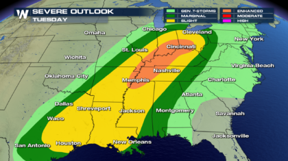
After a quiet start to the week, strong storms are set to erupt from the Gulf Coast to the Lake Erie on Tuesday.
 Enhanced
The greatest possibility for strong storms will be under the enhanced risk. Stretching from the mid-Mississippi valley to the mid-Ohio valley these storms will be persistent throughout the day. First along the warm from in the morning then leading the cold front in the later day following a period of destabilization of the atmosphere.
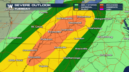 The tornado possibility will be greatest in the morning along the warm front.
Later in the day the threat will shift more to damaging wind in advance of the cold front.
Timing
The event will start early in the day along the advancing warm front.
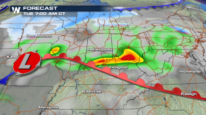 In the afternoon the cold front pushing through almost the same area will bring a round of powerful storms to the same region. The main threat in the afternoon transitioning to damaging wind.
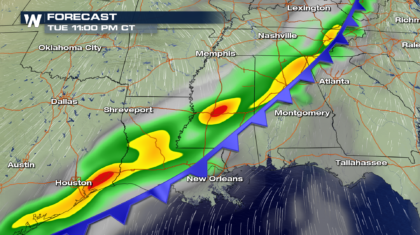
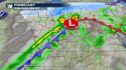 By the evening hours the storms will press farther south. From eastern Texas to northern Louisiana and the Tennessee Valley.
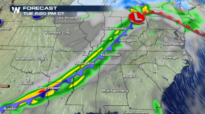 Then wind down overnight.
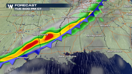
 Wednesday
The entire system will move east during the middle part of the week. Spreading the threat of severe weather from Florida's pan handle to the Mid Atlantic.
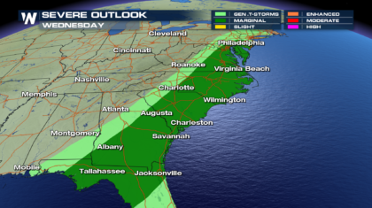
 Enhanced
The greatest possibility for strong storms will be under the enhanced risk. Stretching from the mid-Mississippi valley to the mid-Ohio valley these storms will be persistent throughout the day. First along the warm from in the morning then leading the cold front in the later day following a period of destabilization of the atmosphere.
 The tornado possibility will be greatest in the morning along the warm front.
Later in the day the threat will shift more to damaging wind in advance of the cold front.
Timing
The event will start early in the day along the advancing warm front.
 In the afternoon the cold front pushing through almost the same area will bring a round of powerful storms to the same region. The main threat in the afternoon transitioning to damaging wind.
 By the evening hours the storms will press farther south. From eastern Texas to northern Louisiana and the Tennessee Valley.
 Then wind down overnight.

 Wednesday
The entire system will move east during the middle part of the week. Spreading the threat of severe weather from Florida's pan handle to the Mid Atlantic.

All Weather News
More