Severe Weather Threats Return This Weekend for the South
Special Stories
8 Mar 2019 6:17 PM
The threat for severe weather increases once again for residents in the South beginning early Saturday morning and lasting through the weekend, as another strong storm rolls through the area.
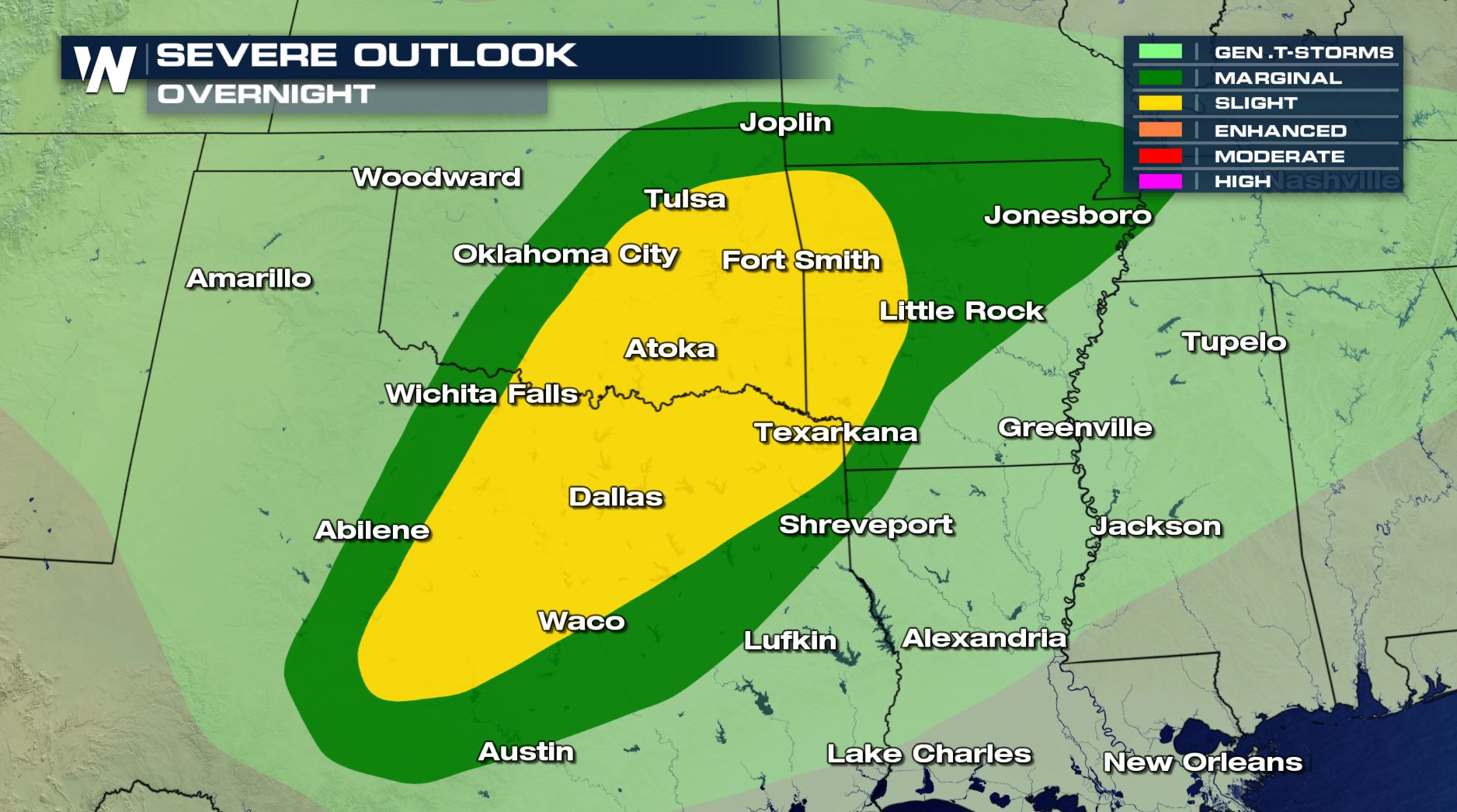
The Storm Prediction Center, or SPC, has issued a slight risk for severe weather to develop on Friday night. Below is the expected timing of strong storms by late Friday night and into the overnight hours.
 The slight risk includes cities from Dallas, Tulsa and south through the Texarkana areas late Friday night.
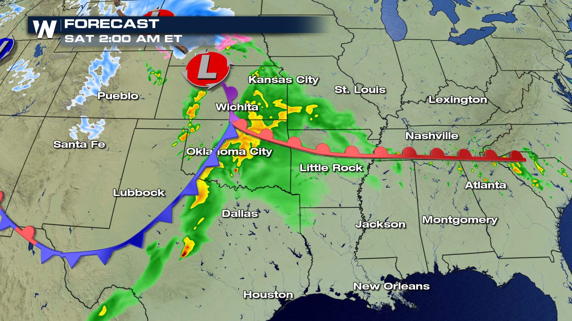
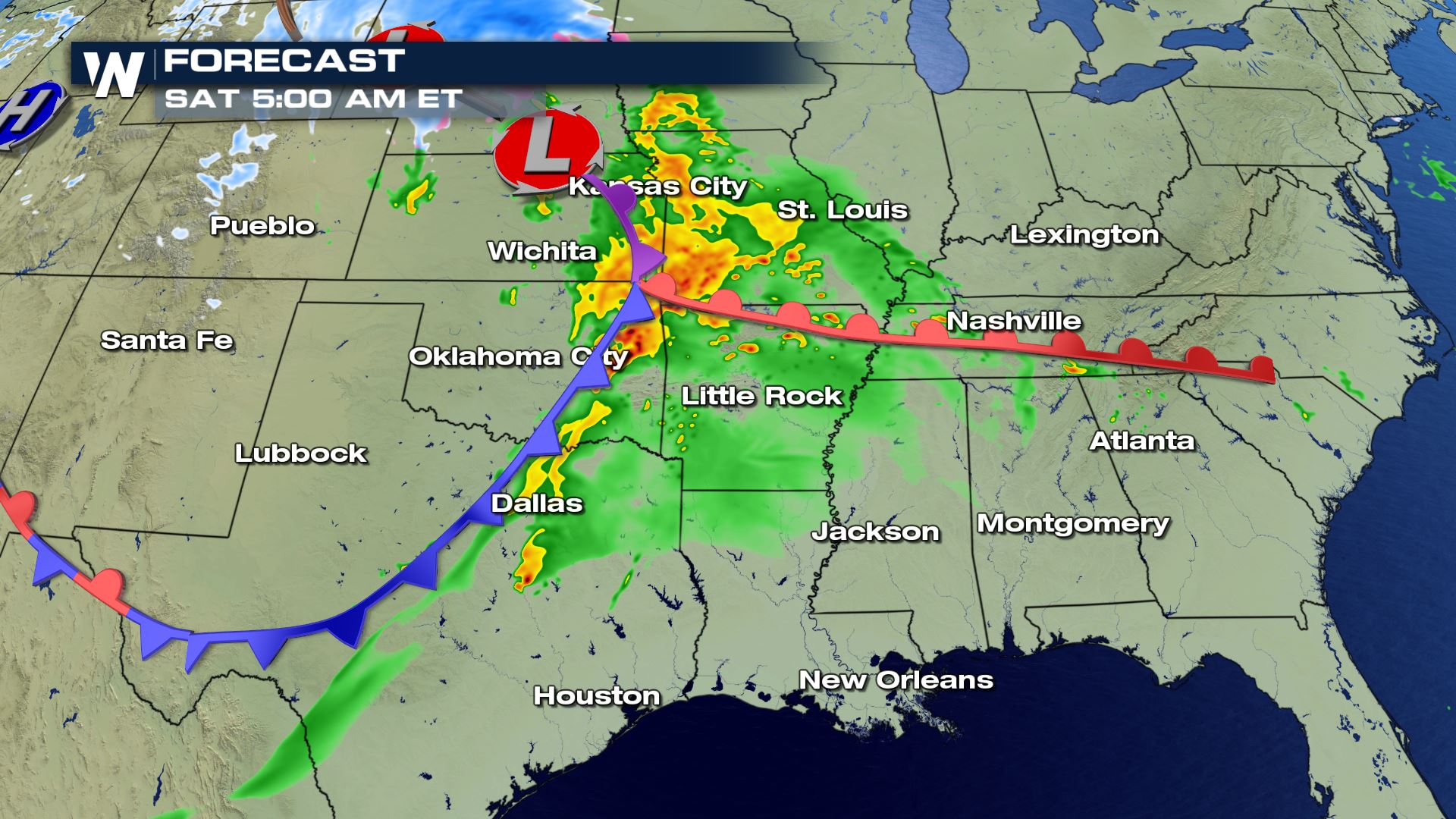
 By early Saturday afternoon, strong storms will have moved east, alongside the frontal boundary, where severe weather with the chance for isolated tornadoes, large hail and heavy rain will remain in the forecast.
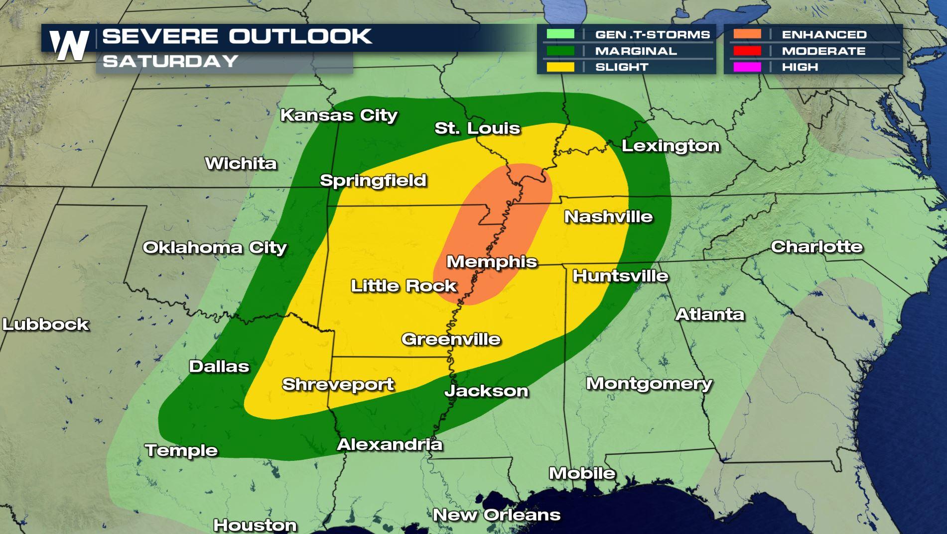
 The SPC increased the chances for severe from Friday into Saturday with a enhanced risk. All the areas shaded in orange will have the highest likelihood of severe storms developing throughout the day and into the evening.
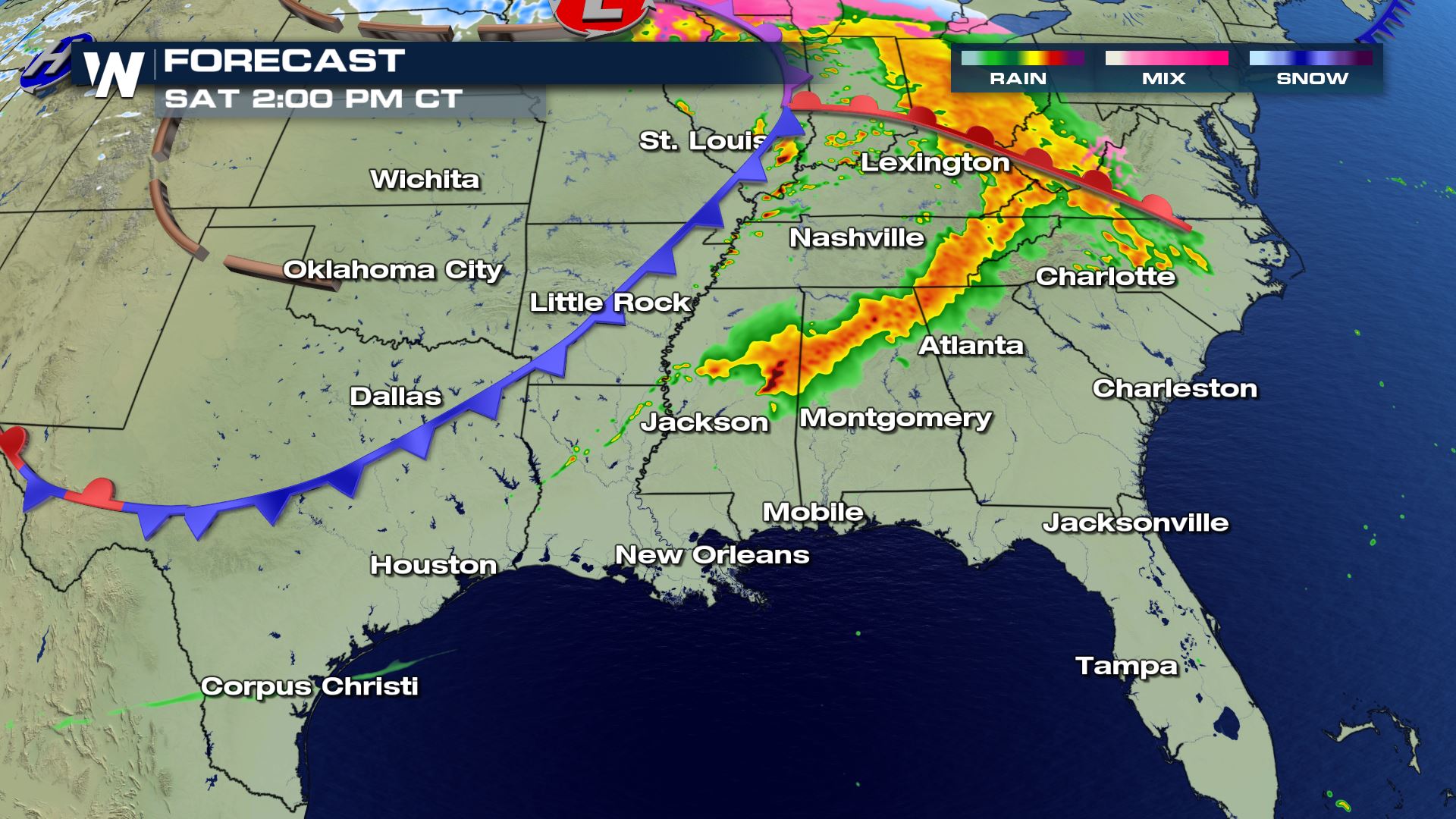 The best potential for scattered damaging winds and a few strong tornadoes appears to be across parts of the ArkLaMiss into northern Mississippi and southwestern Tennessee.
[Related Articles:]
RECAP OF SUNDAY, MARCH 3 SEVERE STORMS
WHAT'S THE "RISK" MEAN?
The best potential for scattered damaging winds and a few strong tornadoes appears to be across parts of the ArkLaMiss into northern Mississippi and southwestern Tennessee.
[Related Articles:]
RECAP OF SUNDAY, MARCH 3 SEVERE STORMS
WHAT'S THE "RISK" MEAN?
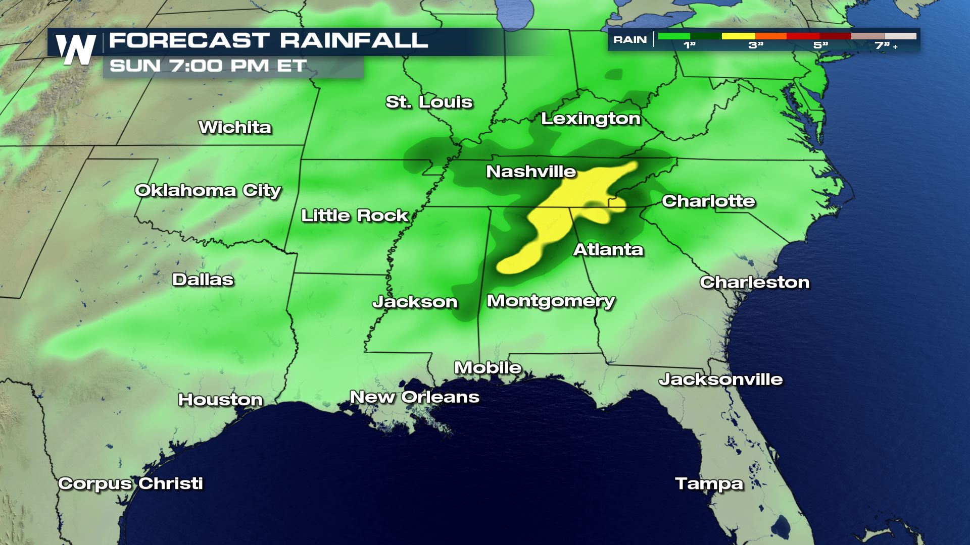
 Alongside the chance for severe weather will be the heavy rainfall through the weekend. Areas in central Alabama, southern Tennessee and northern Georgia may see up to 3"+! Low-lying areas will be prone to flooding, so remember the phrase "Turn Around, Don't Drown"
 For WeatherNation, I'm Meteorologist Greg Rule
The slight risk includes cities from Dallas, Tulsa and south through the Texarkana areas late Friday night.
By early Saturday afternoon, strong storms will have moved east, alongside the frontal boundary, where severe weather with the chance for isolated tornadoes, large hail and heavy rain will remain in the forecast.
The SPC increased the chances for severe from Friday into Saturday with a enhanced risk. All the areas shaded in orange will have the highest likelihood of severe storms developing throughout the day and into the evening.
The best potential for scattered damaging winds and a few strong tornadoes appears to be across parts of the ArkLaMiss into northern Mississippi and southwestern Tennessee.
[Related Articles:]
RECAP OF SUNDAY, MARCH 3 SEVERE STORMS
WHAT'S THE "RISK" MEAN?
Alongside the chance for severe weather will be the heavy rainfall through the weekend. Areas in central Alabama, southern Tennessee and northern Georgia may see up to 3"+! Low-lying areas will be prone to flooding, so remember the phrase "Turn Around, Don't Drown"
For WeatherNation, I'm Meteorologist Greg Rule
All Weather News
More
Severe Storms Target the Midwest to the Northeast This Week
Extreme heat will be a big story this week ac
26 Jul 2026 2:30 PM

Tropics: Fausto Heads to Hawaii; Genevieve Rapidly Intensifying
Atlantic BasinBertha has dissipated after mov
26 Jul 2026 2:30 PM

Fire Weather Continues This Weekend
Conditions have been really dry out west. We'
26 Jul 2026 10:40 AM

Heat Wave Grips Central, Western U.S.
Are you over the summer heat yet? The heat al
26 Jul 2026 10:35 AM

Southeast Flood Risk Lingers Near Stalled Front
A stalled boundary over the Southeast will ke
25 Jul 2026 10:55 AM

Another Round of Storms Targets the Northeast
Tuesday brought severe weather again across p
23 Jul 2026 1:15 AM

Another Round of Severe Weather for the Upper Midwest and Great Lakes
The upper-level low train continues to keep t
21 Jul 2026 1:45 AM