Sharp Front Sparks More Severe Chances Late Week

It's the season of swings! Baseball counts but that's not what we're talking about right now. Temperature swings! Temperatures will climb this week ahead of our approaching front, soaring into the 70's and 80's through Thursday. The front is going to drop through the Midwest, igniting another round of severe chances. As the front moves into warmer temperatures, more energy and instability will build ahead and along the front.
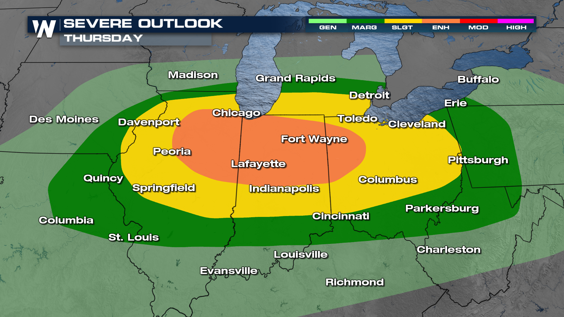
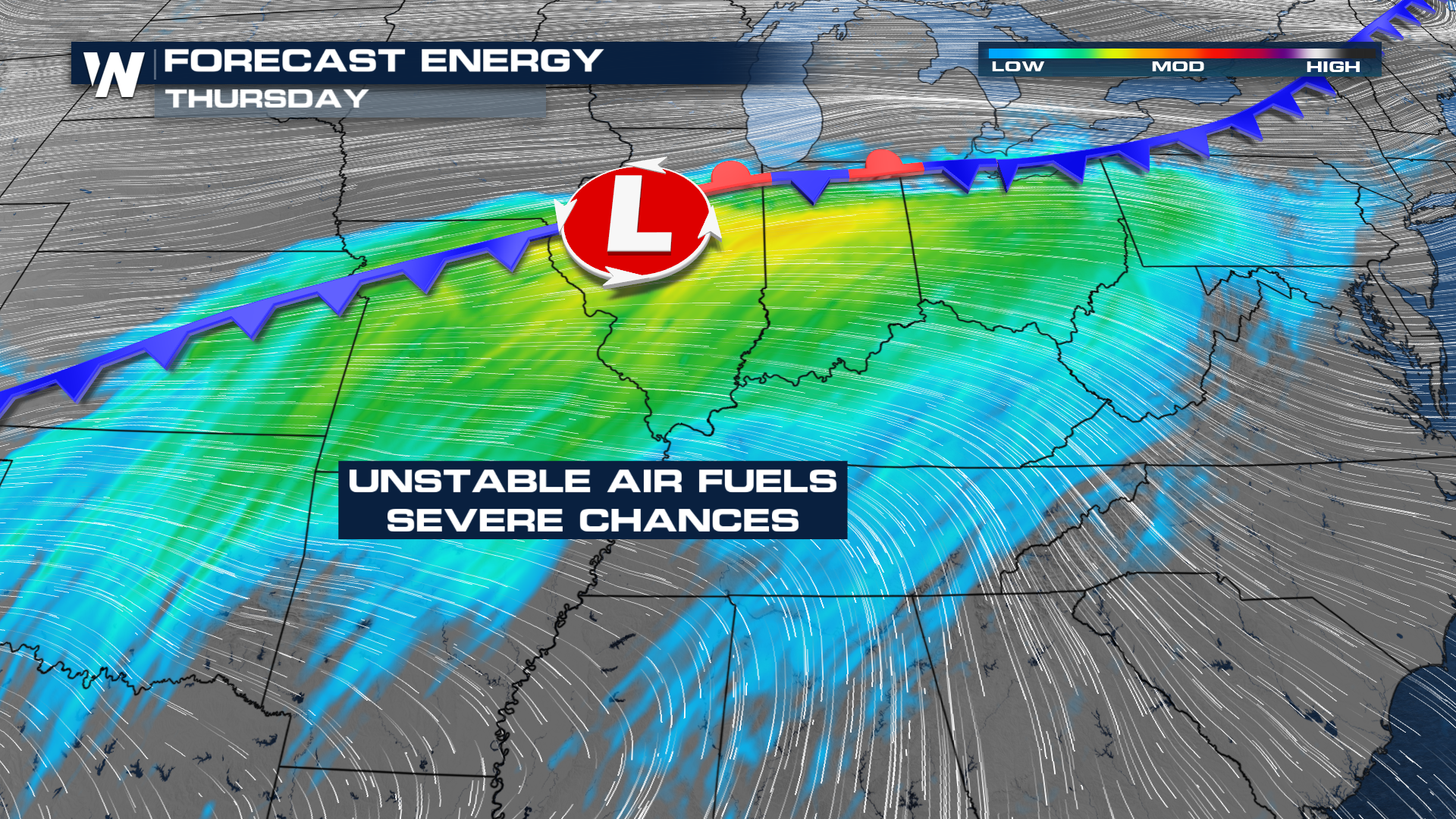 That should provide enough fuel for storms by the end of the week. Right now, the Storm Prediction Center is highlighting areas in the mid-Mississippi River and Ohio River Valleys with the highest chance on Thursday. The current outlook has been upgraded to an ENHANCED risk, level 3 out of 5.
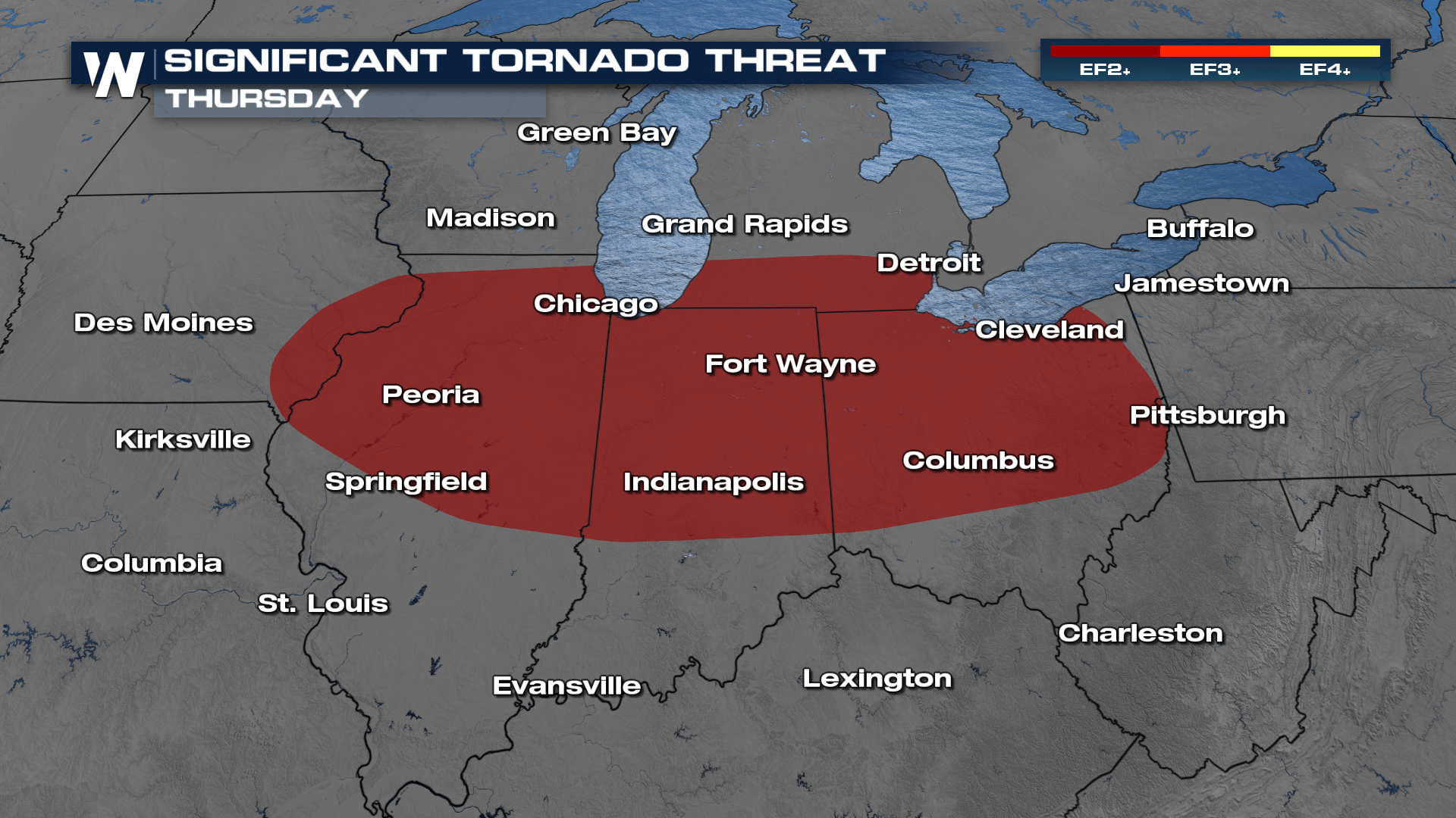
 There are a couple significant threats with these storms to watch out for. One of those is the significant tornado threat. Meaning, if there is a tornado, there is the potential for it to be a stronger tornado. Right now, the outlook has the threat of an EF2 or stronger possible in the red highlighted areas.
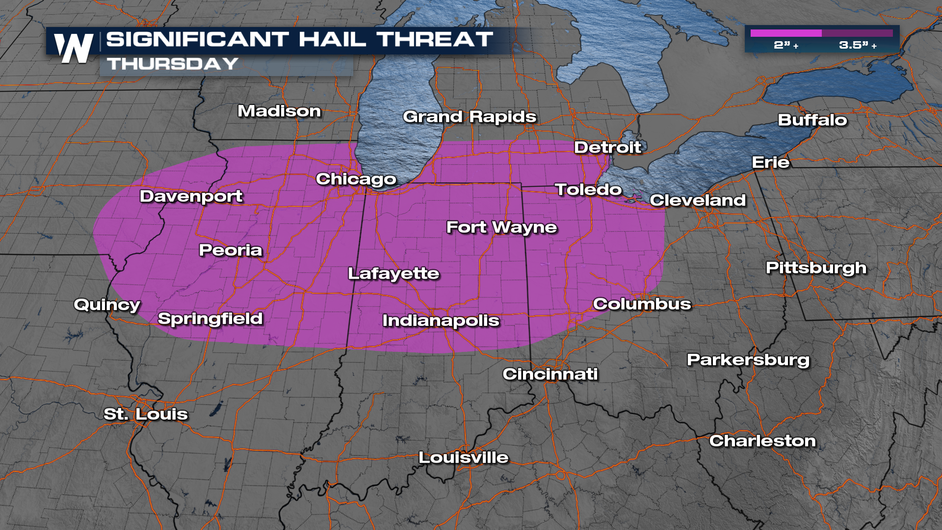
 Another significant threat is for hail. Cities like Chicago, St. Louis, and Indianapolis have the threat of 2"+ hailstones. Severe hail potential begins at 1".
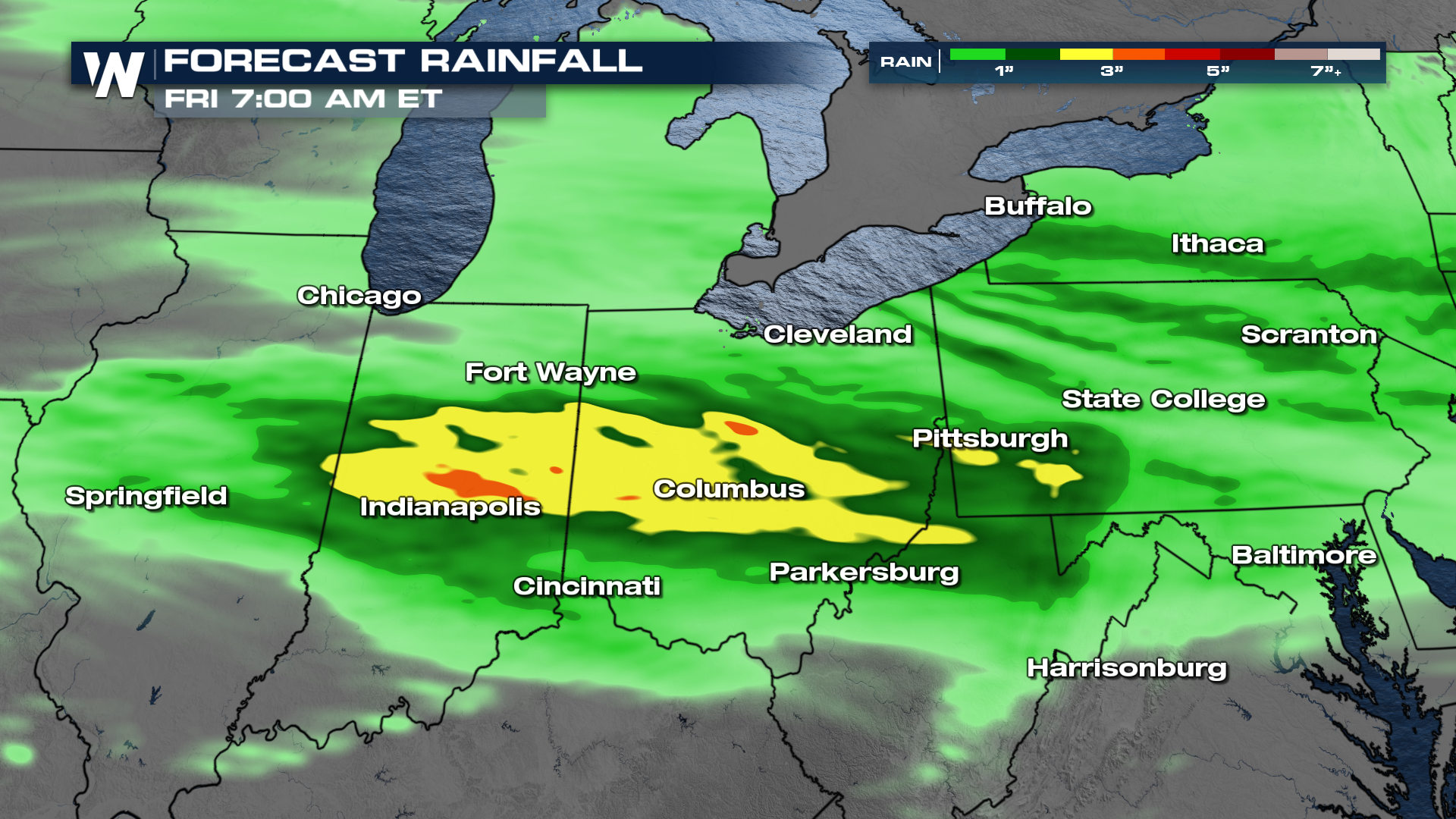
 The heaviest of the rainfall will span across Indiana and Ohio. There is an isolated threat for flooding to watch for.
 Some rain will likely be ongoing Thursday morning. Watch as they drop south into better ingredients by the afternoon


