Powerful Kona Low Devastates Hawaii Over the Weekend

After record shattering rain and hurricane force winds last weekend, Hawaii is already dealing with another strong low pressure system moving in from the west, known locally as a Kona Low.
FRIDAY
Catastrophic flash flooding unfolded overnight Thursday into Friday morning on the northern side of O'ahu, after 5-9 inches of rain fell from slow moving thunderstorms. As a result, a dam failure was possible but officials say that the dam is in good condition so far. More heavy rain is possible to change the status. Evacuation orders have been issued for Haleiwa and Waialua as intense flooding cut off roads and inundated low lying areas. 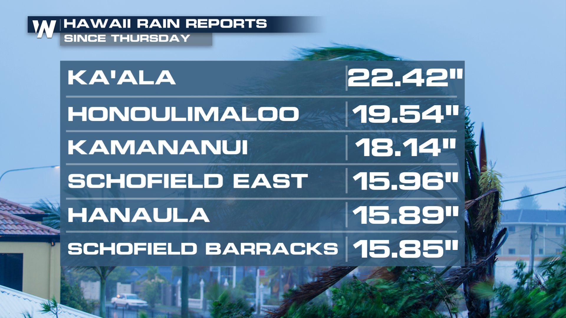 The heavy rain was created by an approaching Kona Low, which will keep the weather pattern rainy through the weekend.
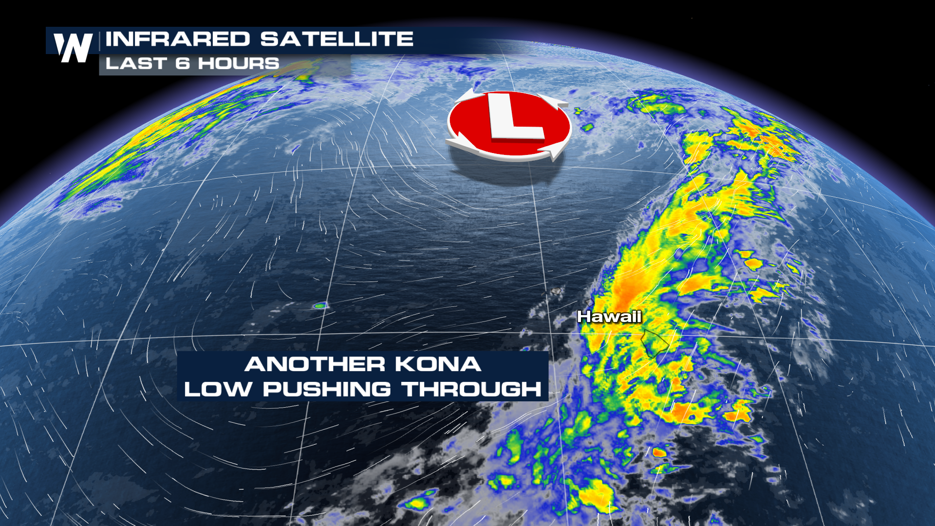
The low is shifting east into this week, leading to sunnier conditions and a much-needed break from the rain.
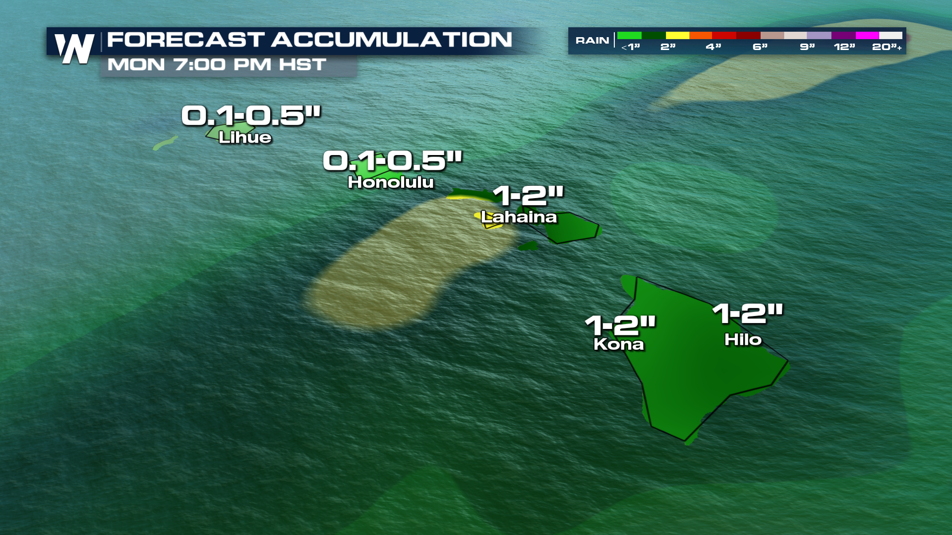
Rainfall totals could easily surpass 1-4 inches where thunderstorms train, or move over the same locations multiple times. Flooding will happen fast as the grounds are very saturated from the previous storms.
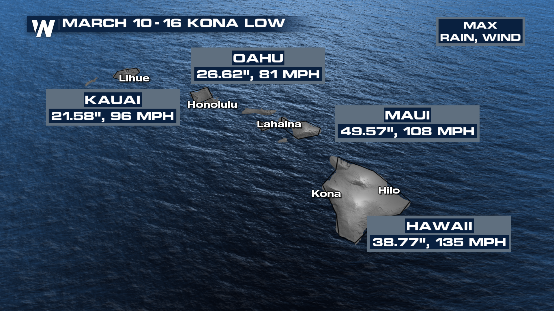
Previous System Record Rain & Wind
Rainfall totals from the previous system are almost unfathomable. Each island had at least one weather station record over 20 inches of rain with hurricane-force winds recorded as well. These intense conditions left the islands more prone for impacts from following storms.