Showers and Storms Sunday for the Southern Plains and Southeast
Special Stories
30 Dec 2019 3:10 AM
A stationary front sitting over the northern Gulf of Mexico will allow for shower and thunderstorm development today and tonight. The risk of severe weather will be low, but some strong storms can't be ruled out. Here is the very latest.
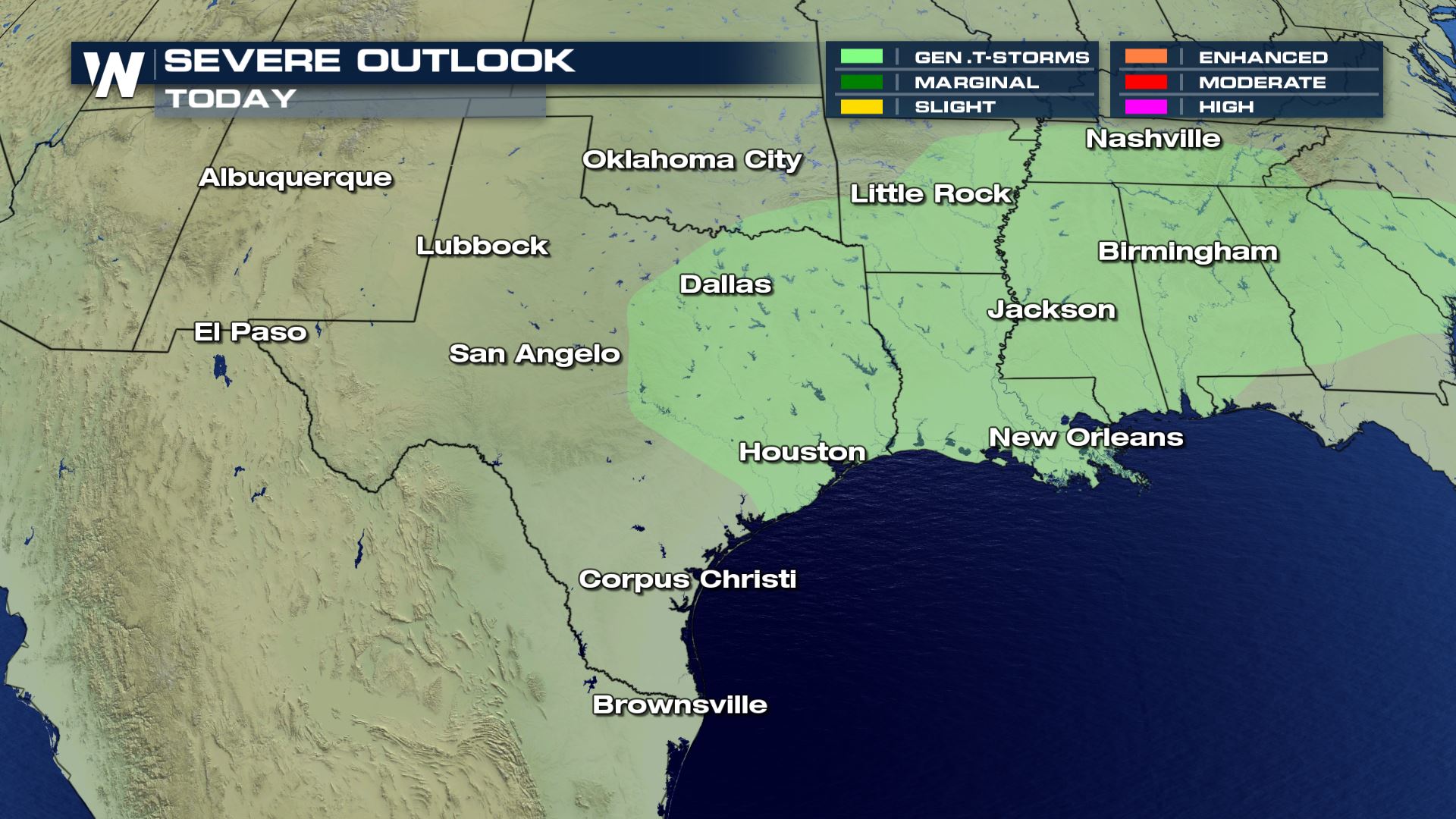 General thunderstorm chances are in the forecast from East Texas to South Carolina. Today's storms will likely be below severe limits, but some storms with gusty winds and heavy rain will be possible.
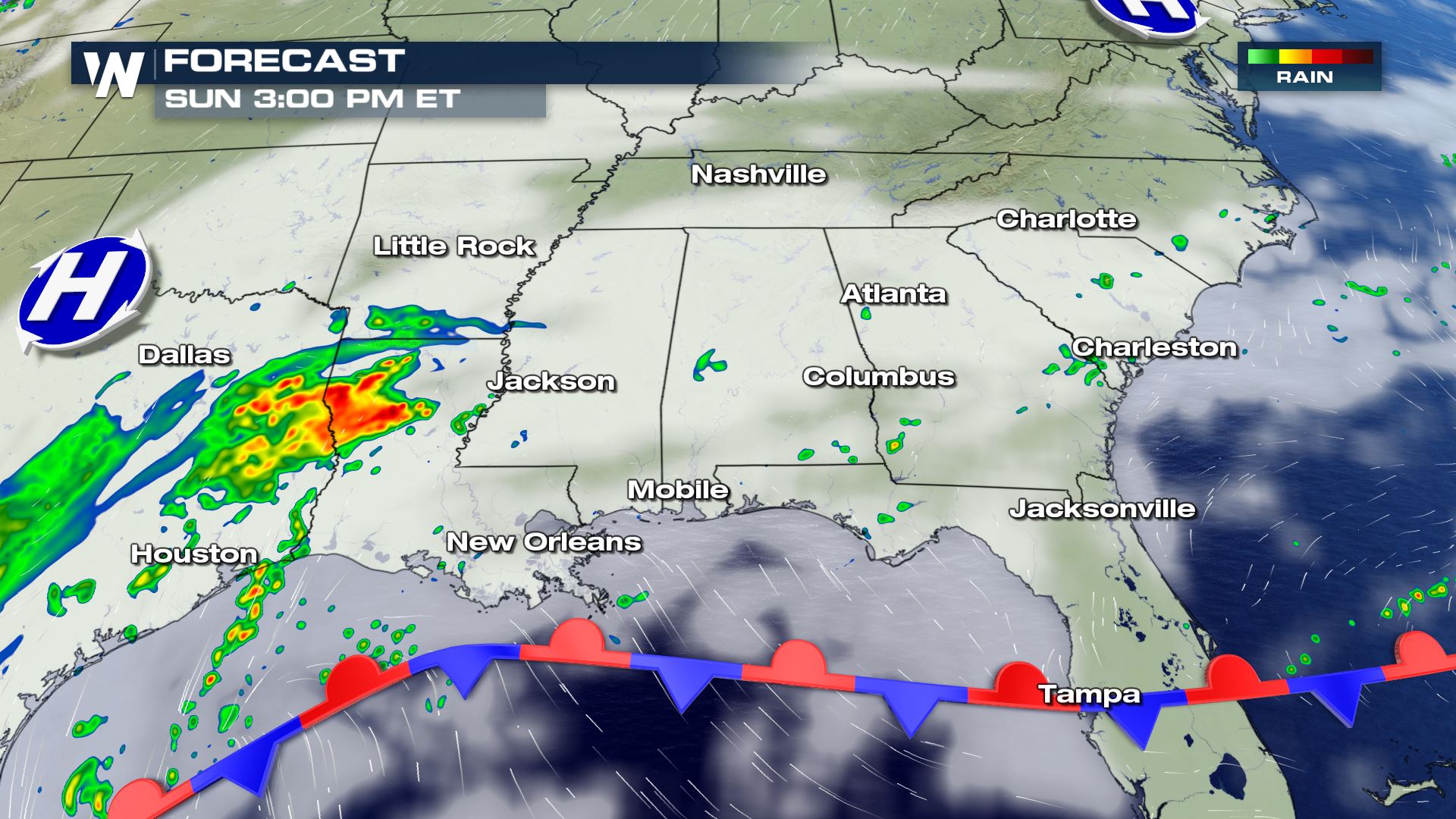
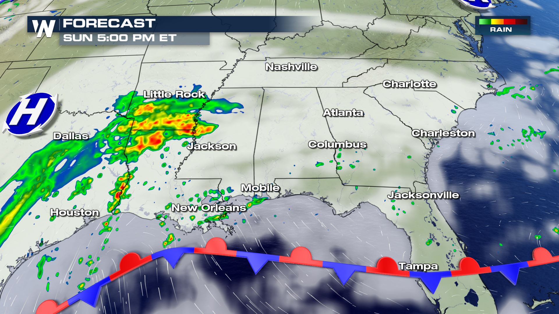
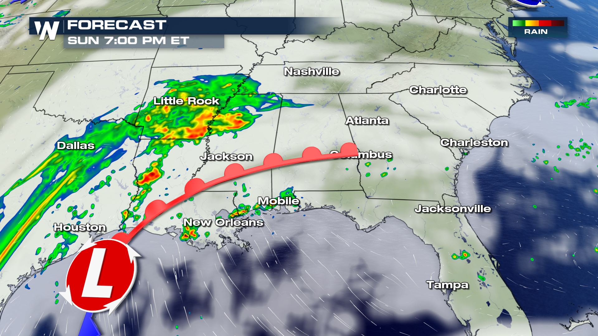 Showers and storms will be likely this afternoon for East Texas and up into the Arklatex. This activity will continue to move east tonight and tomorrow. Tomorrow's ingredients will be more favorable for severe storms.
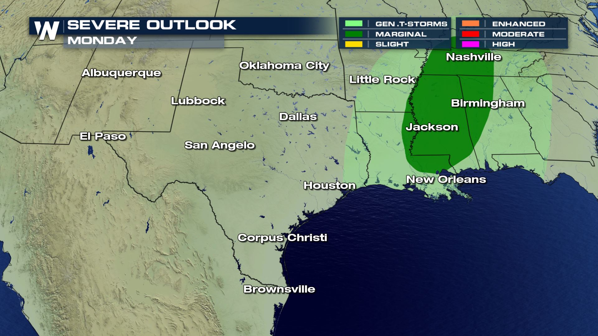 A marginal risk has already been issued for parts of Louisiana, Mississippi and Tennessee on Monday. This means isolated severe storms will be possible.
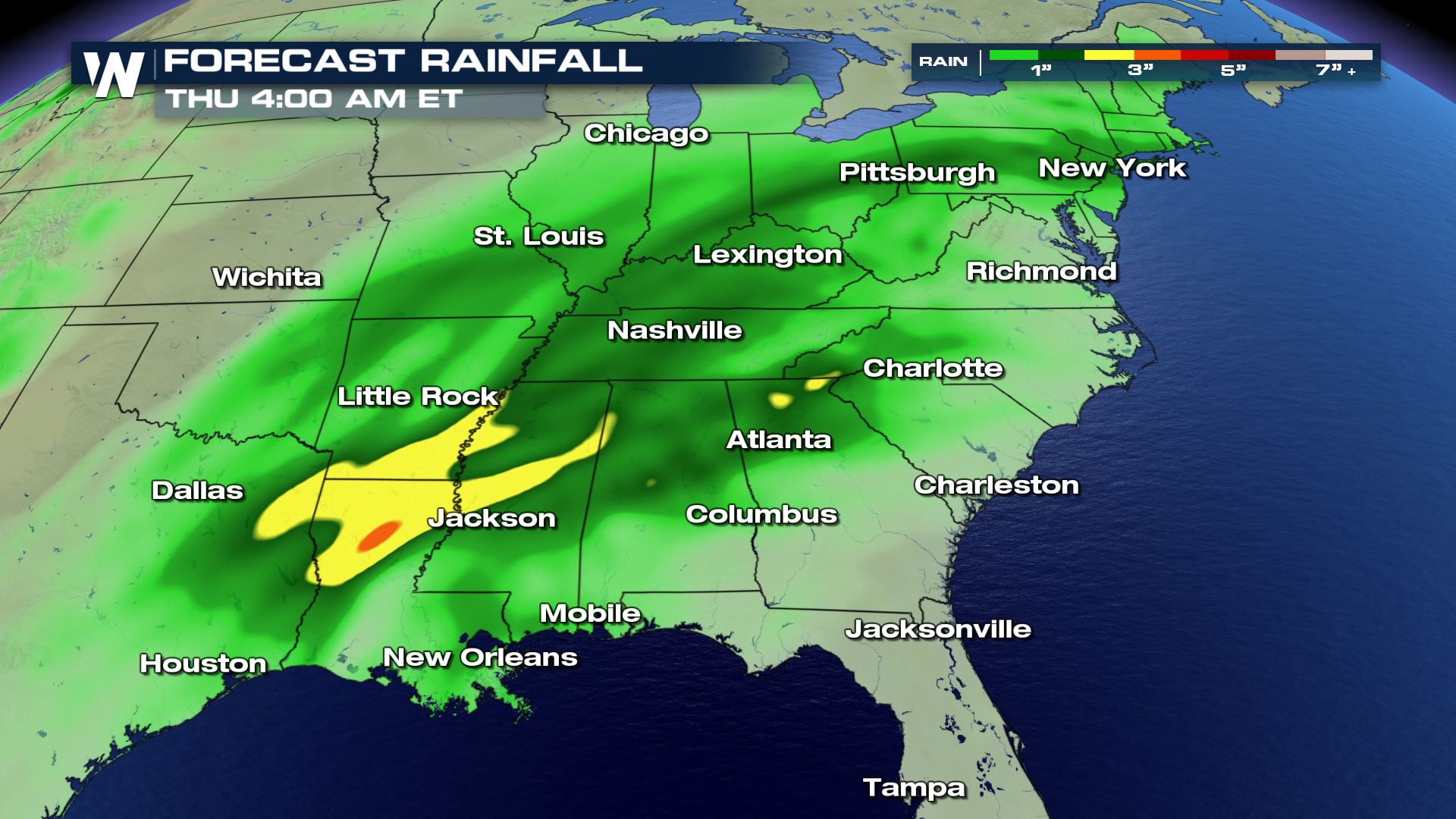 Heavy rain will be a risk for the Mississippi Valley through the week with some areas of Louisiana and Arkansas seeing over 3 inches of rainfall.
Keep checking back with WeatherNation for more updates.
Severe Outlook
 General thunderstorm chances are in the forecast from East Texas to South Carolina. Today's storms will likely be below severe limits, but some storms with gusty winds and heavy rain will be possible.
Forecast


 Showers and storms will be likely this afternoon for East Texas and up into the Arklatex. This activity will continue to move east tonight and tomorrow. Tomorrow's ingredients will be more favorable for severe storms.
Monday Severe Outlook
 A marginal risk has already been issued for parts of Louisiana, Mississippi and Tennessee on Monday. This means isolated severe storms will be possible.
Rainfall Potential
 Heavy rain will be a risk for the Mississippi Valley through the week with some areas of Louisiana and Arkansas seeing over 3 inches of rainfall.
Keep checking back with WeatherNation for more updates.
All Weather News
More