Sierra Nevada Snowpack Below Average
Special Stories
4 Jan 2019 12:27 PM
https://www.youtube.com/watch?time_continue=1&v=UIAqpgxOLc4
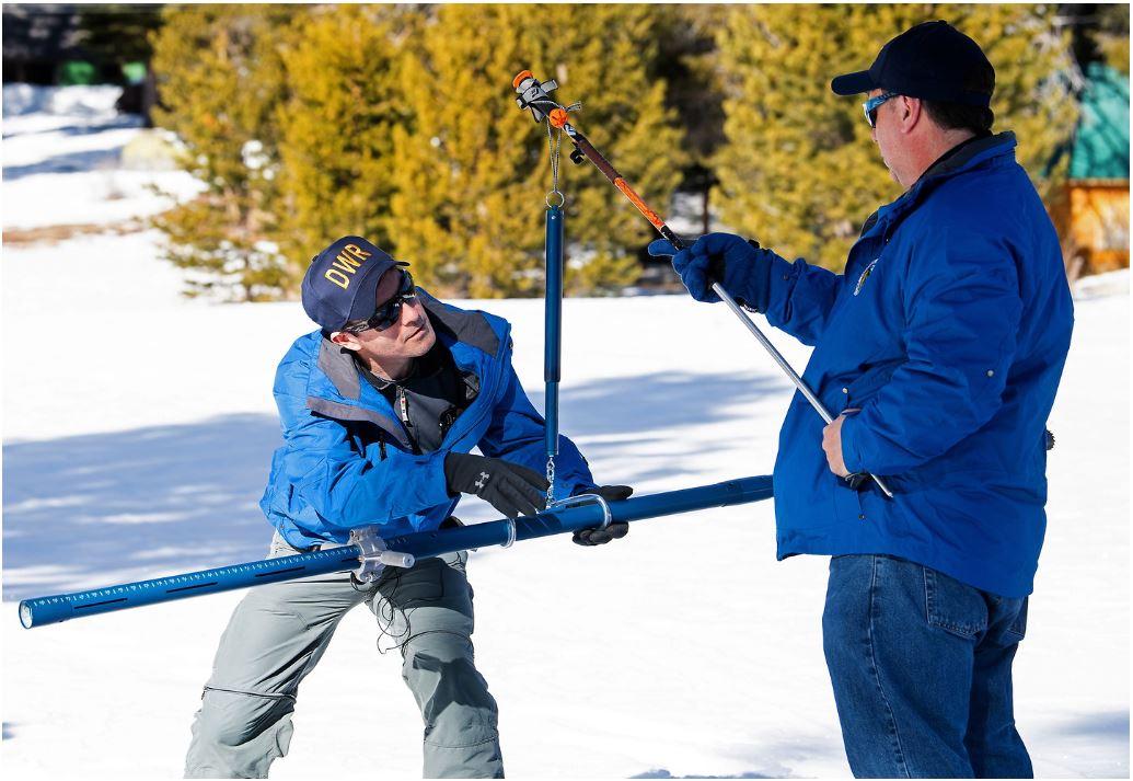
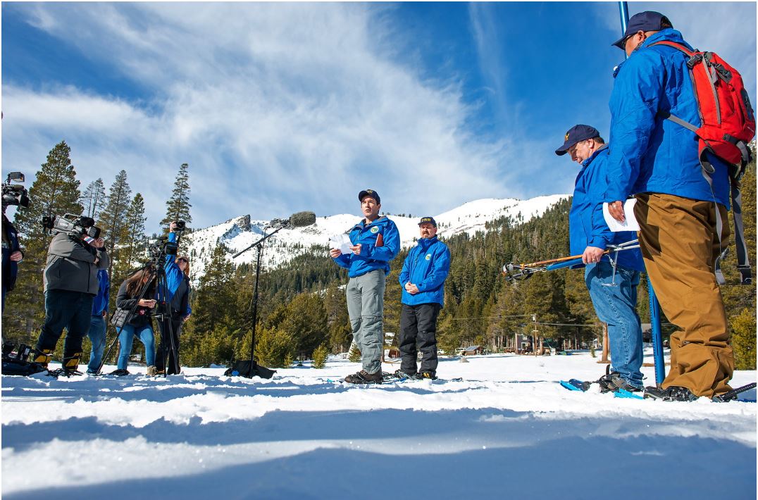
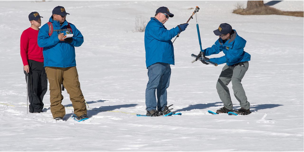
As California braces for multiple rounds of winter weather, state officials are checking in on the current Sierra Nevada snowpack to see how it stacks up. On January 3, the California Department of Water Resources (CA DWR) conducted the first of five monthly snow surveys at Phillips Station. Manual and electronic measurements examine the snow depth and snow water equivalent to get build a snapshot of current conditions. These are crucial for successful runoff forecasts and water resource management.
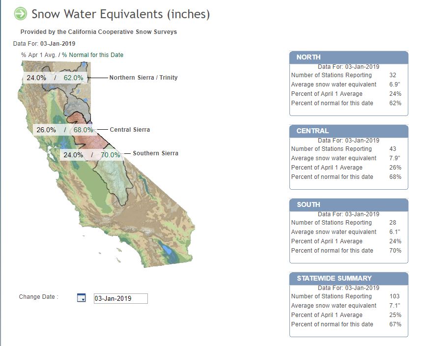
 The survey at Phillips Station measured 25.5 inches of snow depth, with a snow water equivalent of 9 inches. That's about 80 percent of average for this location. That means that despite early season winter storms, Sierra snowpack is still below average. With 103 stations reporting statewide, the snow water equivalent is about 67% of normal through January 3. CA DWR defines snow water equivalent as "the depth of water that theoretically would result if the entire snowpack melted instantaneously."
 “About two-thirds of California’s annual rainfall occurs December through March. Total precipitation so far this water year, which began October 1, has been below average,” said DWR State Climatologist Michael Anderson. “We still have three wet season months ahead of us, so there’s time for the snowpack to build and improve before it begins to melt, which usually starts happening around April 1.”
Snowmelt in California supplies about 30 percent of the state's water needs. Reservoirs rely on snowpack water content to receive enough snowmelt runoff to meet water demands during the summer and fall. Winter Sierra snow is also crucial for drought mitigation. Ninety two percent of the state is experiencing D0-D4 drought conditions.
“About two-thirds of California’s annual rainfall occurs December through March. Total precipitation so far this water year, which began October 1, has been below average,” said DWR State Climatologist Michael Anderson. “We still have three wet season months ahead of us, so there’s time for the snowpack to build and improve before it begins to melt, which usually starts happening around April 1.”
Snowmelt in California supplies about 30 percent of the state's water needs. Reservoirs rely on snowpack water content to receive enough snowmelt runoff to meet water demands during the summer and fall. Winter Sierra snow is also crucial for drought mitigation. Ninety two percent of the state is experiencing D0-D4 drought conditions.
 Content Courtesy of California Department of Water Resources
The survey at Phillips Station measured 25.5 inches of snow depth, with a snow water equivalent of 9 inches. That's about 80 percent of average for this location. That means that despite early season winter storms, Sierra snowpack is still below average. With 103 stations reporting statewide, the snow water equivalent is about 67% of normal through January 3. CA DWR defines snow water equivalent as "the depth of water that theoretically would result if the entire snowpack melted instantaneously."
“About two-thirds of California’s annual rainfall occurs December through March. Total precipitation so far this water year, which began October 1, has been below average,” said DWR State Climatologist Michael Anderson. “We still have three wet season months ahead of us, so there’s time for the snowpack to build and improve before it begins to melt, which usually starts happening around April 1.”
Snowmelt in California supplies about 30 percent of the state's water needs. Reservoirs rely on snowpack water content to receive enough snowmelt runoff to meet water demands during the summer and fall. Winter Sierra snow is also crucial for drought mitigation. Ninety two percent of the state is experiencing D0-D4 drought conditions.
Content Courtesy of California Department of Water ResourcesAll Weather News
More
East Gears Up for Stormy, Wet Weekend
A low pressure system crashing through the Mi
1 Aug 2026 11:35 AM


Flooding, Severe Storms Target the Midwest Again
After an active week of storms across the nor
1 Aug 2026 1:40 AM


After Reaching Category 5, Genevieve Weakens in the Pacific
PacificFausto is now a post-tropical cyclone.
31 Jul 2026 1:30 AM

Flooding Risk Increases as Heavy Rain Targets the Tri-State Area
Tuesday, heavy rainfall moved across the Nort
30 Jul 2026 12:25 AM

Severe Weather: Energy From the Midwest Now in the Southeast
UPPER MIDWEST - Through Monday, dangerous tor
29 Jul 2026 10:30 PM