Ice and Snow Continue in the Deep South this Morning
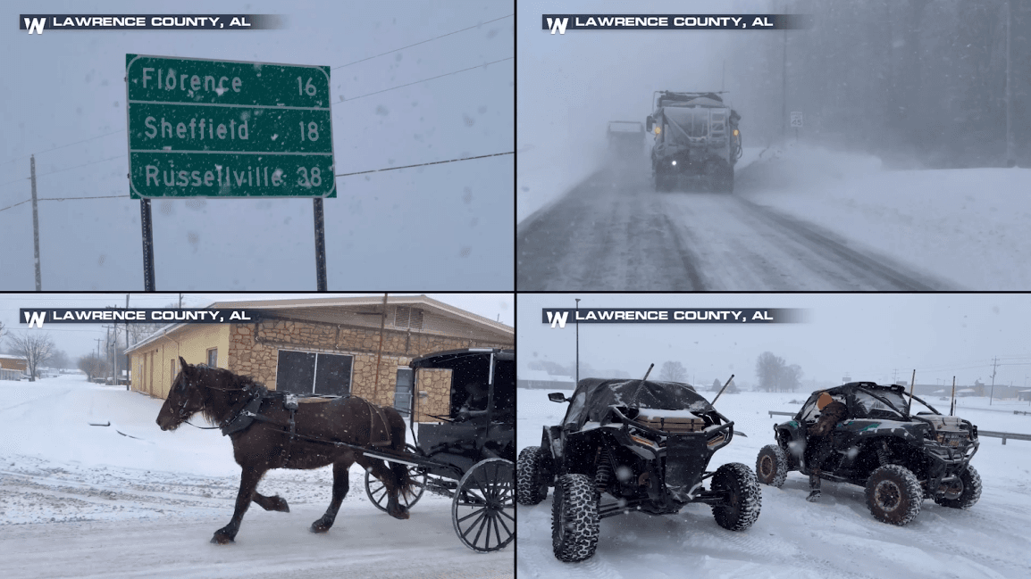
Snow and ice blanketed the Deep South as cold air and moisture met up to produce winter precipitation from Texas to Alabama! The heaviest of the ice and snow is behind us, but there is a chance some pockets of rain and freezing rain persist into the first-half of the day on Tuesday especially through Alabama, Mississippi and Georgia.
Houston authorities are still urging folks stay off the roadways until the remaining slick spots can be addressed. On Tuesday alone there were 580 crashes, 100 of them ice related.
In addition to this cold air, wintry precipitation continues to cause issues in the South with numerous accidents reported on Monday night in states like Louisiana and Mississippi, leading to road closures. Over a tenth of an inch of ice lead to tough travel across the South. Roughly 75k customers are without power in Texas, Louisiana and Alabama this morning.
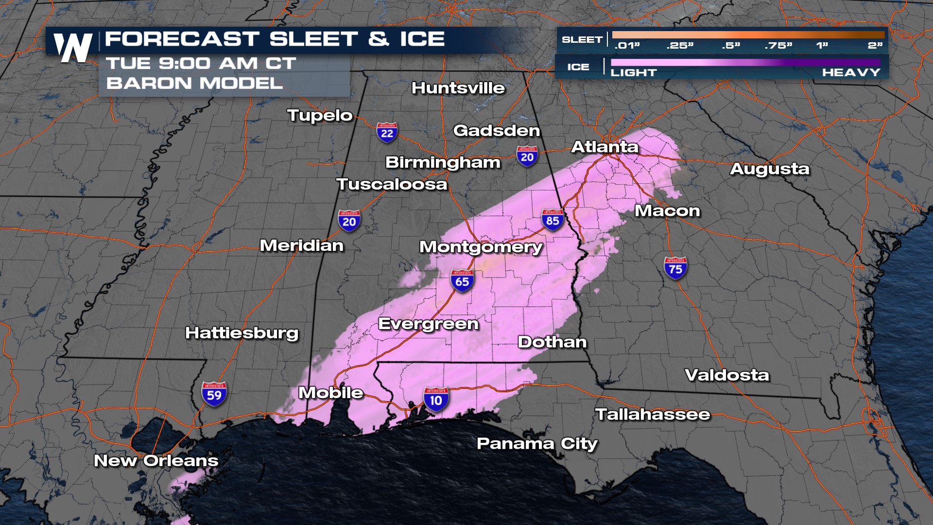
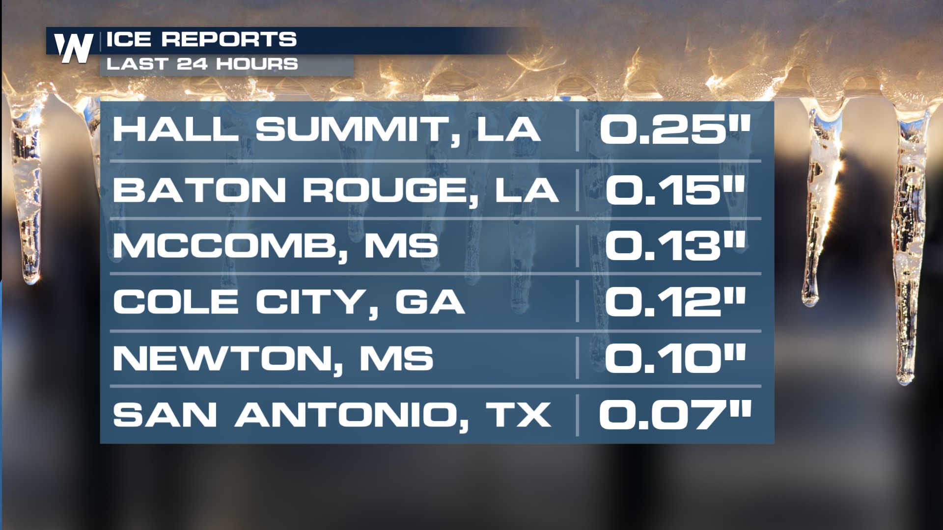 We can expect more ice to follow through Louisiana, and portions of Mississippi and western Alabama through Tuesday afternoon. There is even the chance that we could see some showers and storms in northern Florida through Tuesday. In terms of ice totals, generally a trace to 0.10" is expected but there are some areas that could manage to see up to a quarter of an inch of icing.
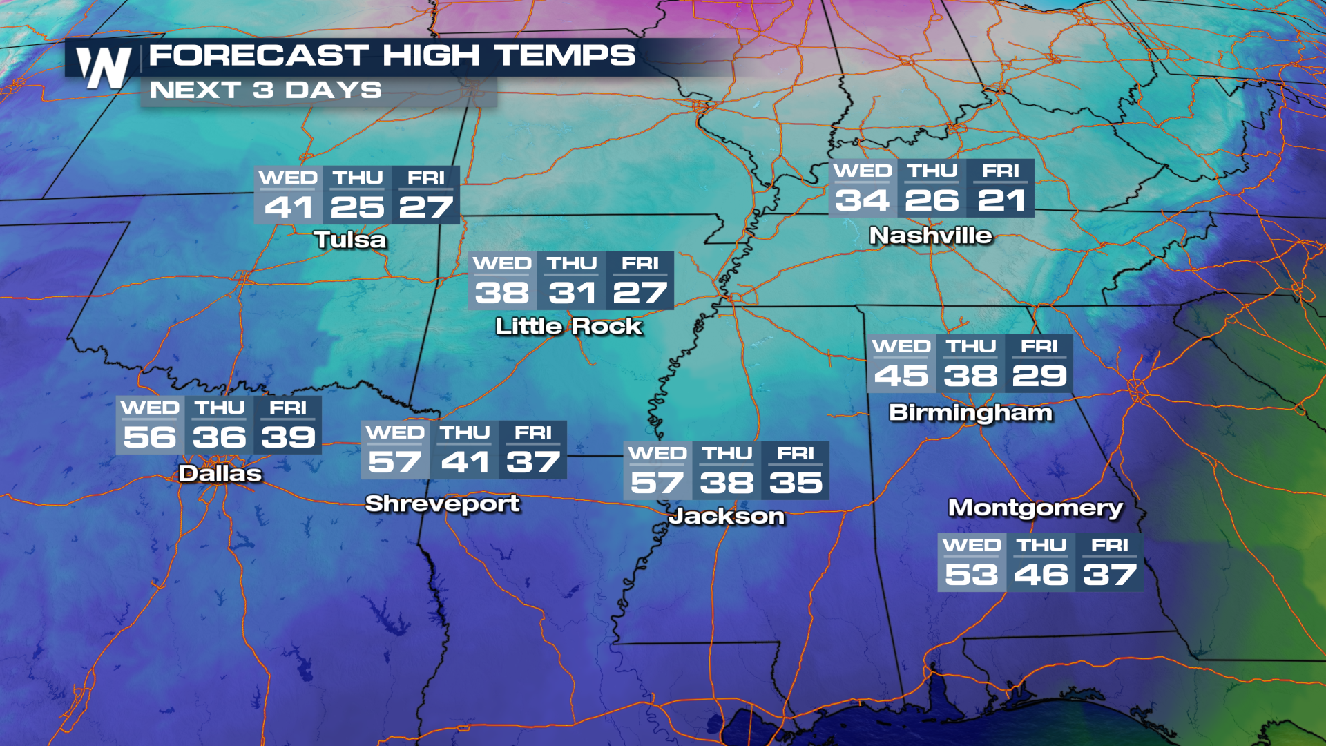
 The coldest air is in the Southeast U.S. into Wednesday, following the front. Meanwhile, temperatures start to rebound in the Plains before they fall again later this week. Dress appropriately in this weather with layers and covering exposed skin. If you must travel, know the conditions before you depart. Remember, "Ice and Snow, Take it Slow!"