Slippery Travel with Wintry Mix from Plains to Northeast
Special Stories
16 Jan 2019 8:19 AM
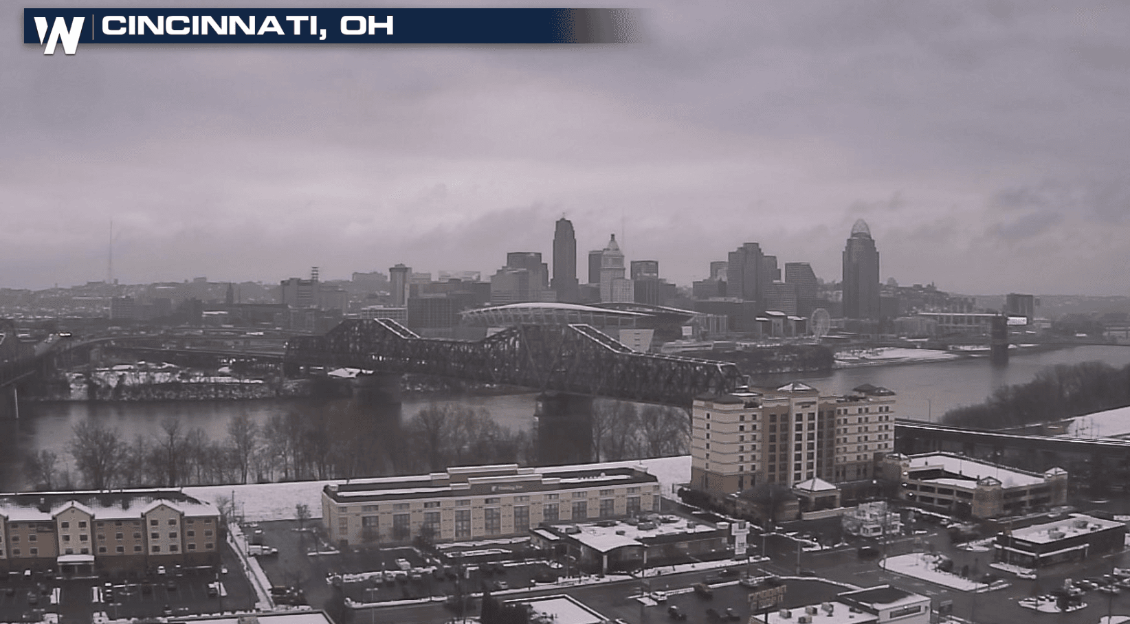
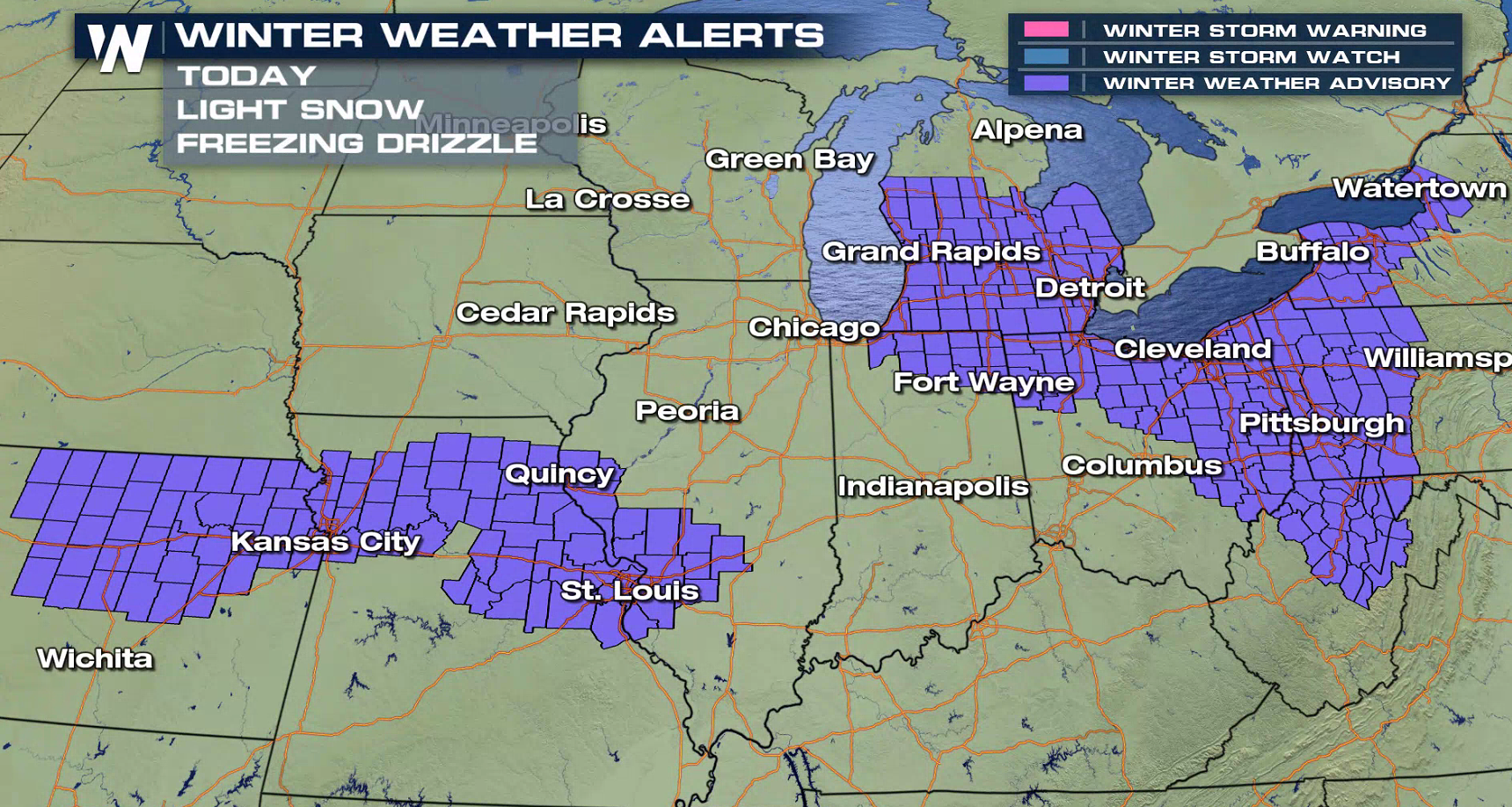
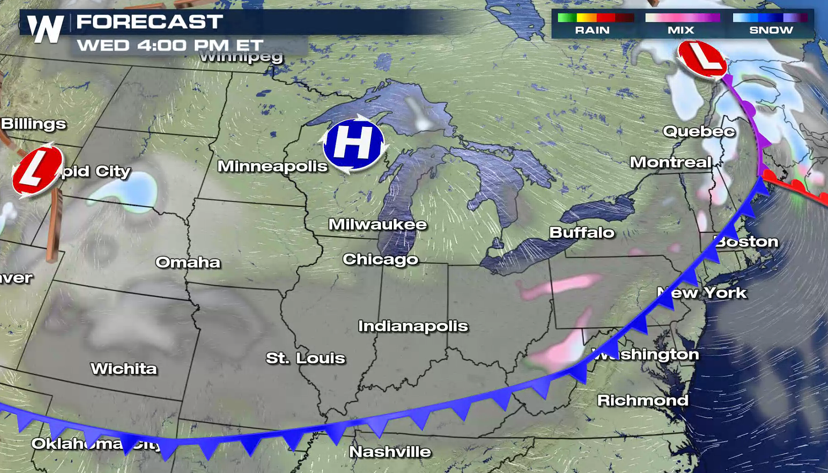
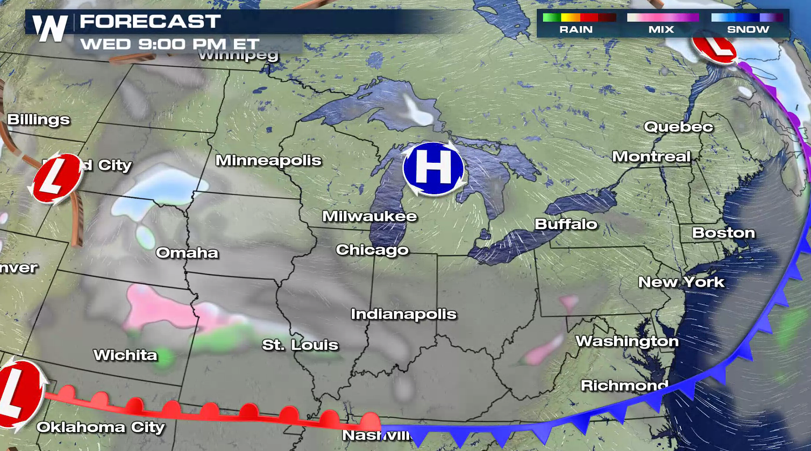
A cold front stretched out from the Northeast to the Plains will produce a wintry mix of snow and freezing rain today (Wednesday) into Thursday. Winter Weather Advisories extend from New York to Kansas. Snowfall amounts of a couple inches are possible, along with a light glaze of ice accumulation.
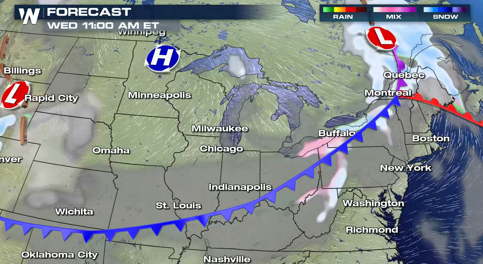
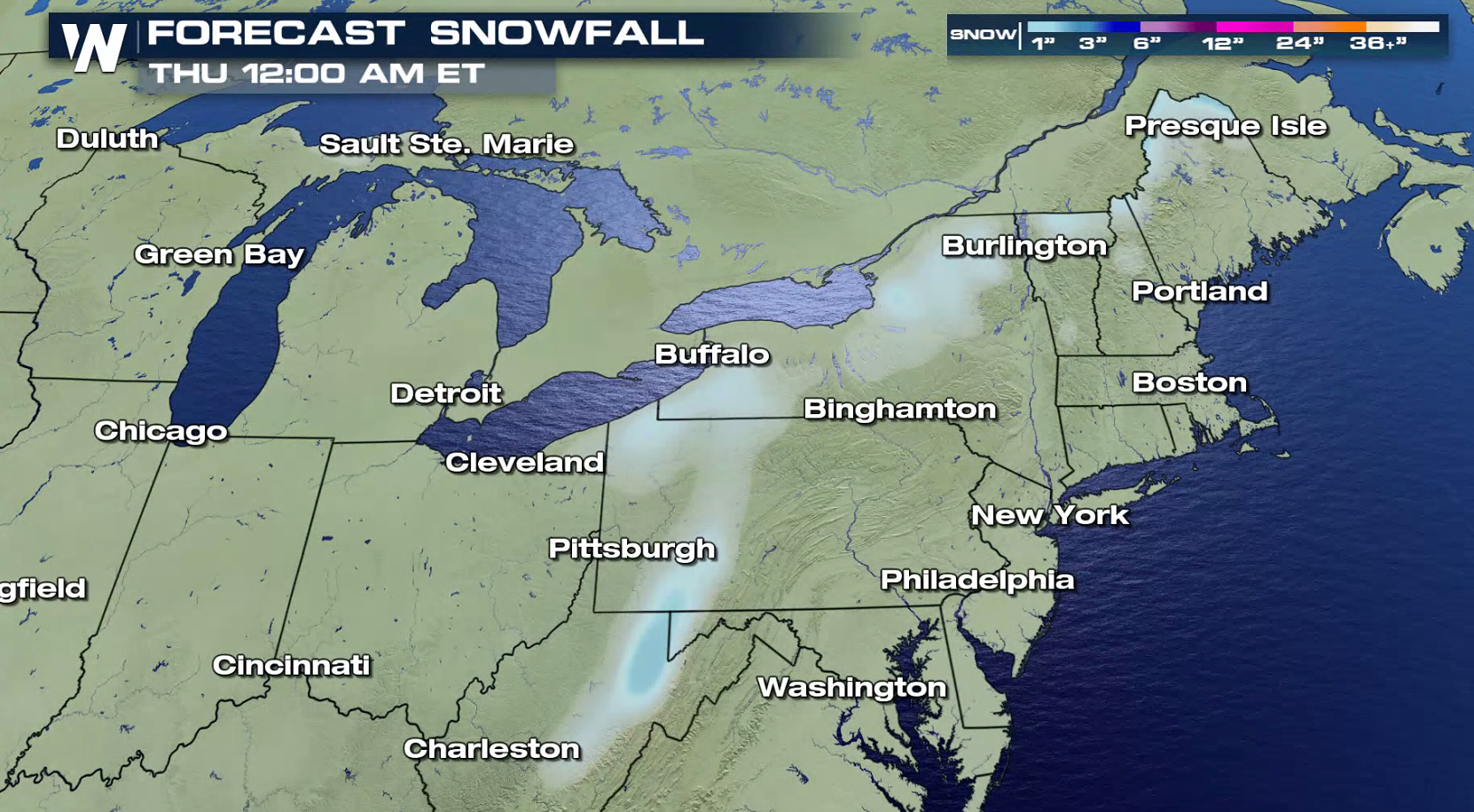 The storm system will sweep to the south and east from New England to the southern Plains. The system has limited humidity along it, so heavy amounts of accumulation are not anticipated. The light glaze on roadways will cause some travel difficulties. Expect ice covered roads and use caution while driving.
 For WeatherNation: Meteorologist Mace Michaels
The storm system will sweep to the south and east from New England to the southern Plains. The system has limited humidity along it, so heavy amounts of accumulation are not anticipated. The light glaze on roadways will cause some travel difficulties. Expect ice covered roads and use caution while driving.
For WeatherNation: Meteorologist Mace MichaelsAll Weather News
More
Wildfire Outbreak in the Pacific Northwest
SPOKANE, WA - On Saturday, August 1st, the Ol
3 Aug 2026 1:55 AM

More Storms for the East Through Monday
A low-pressure system that moved through the
3 Aug 2026 1:50 AM


After Reaching Category 5, Genevieve Weakens in the Pacific
PacificGenevieve formed last Friday south of
3 Aug 2026 12:30 AM

Flooding, Severe Storms Target the Midwest Again
After an active week of storms across the nor
1 Aug 2026 1:40 AM

Flooding Risk Increases as Heavy Rain Targets the Tri-State Area
Tuesday, heavy rainfall moved across the Nort
30 Jul 2026 12:25 AM

Severe Weather: Energy From the Midwest Now in the Southeast
UPPER MIDWEST - Through Monday, dangerous tor
29 Jul 2026 10:30 PM