Severe Threat Closes With a Bang Today

Top Stories
21 Apr 2025 2:10 AM
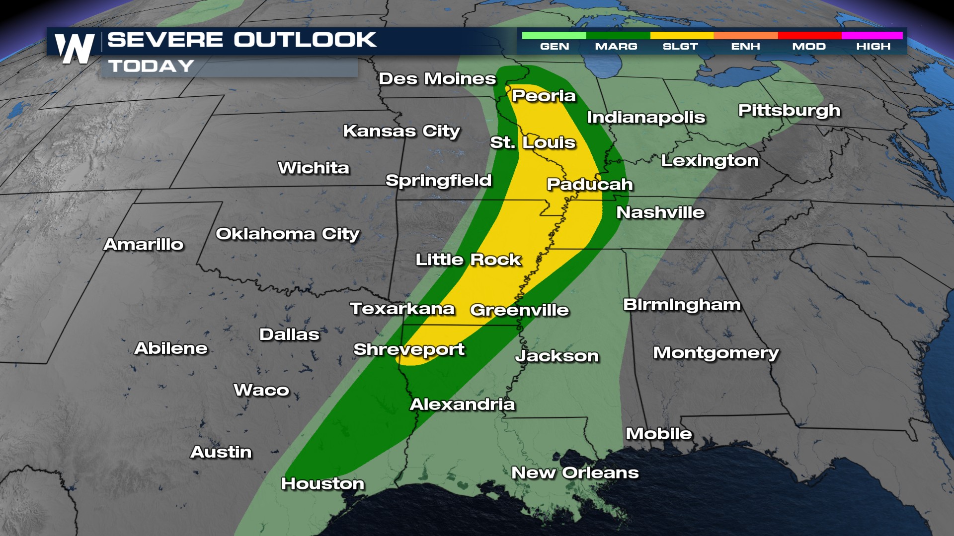
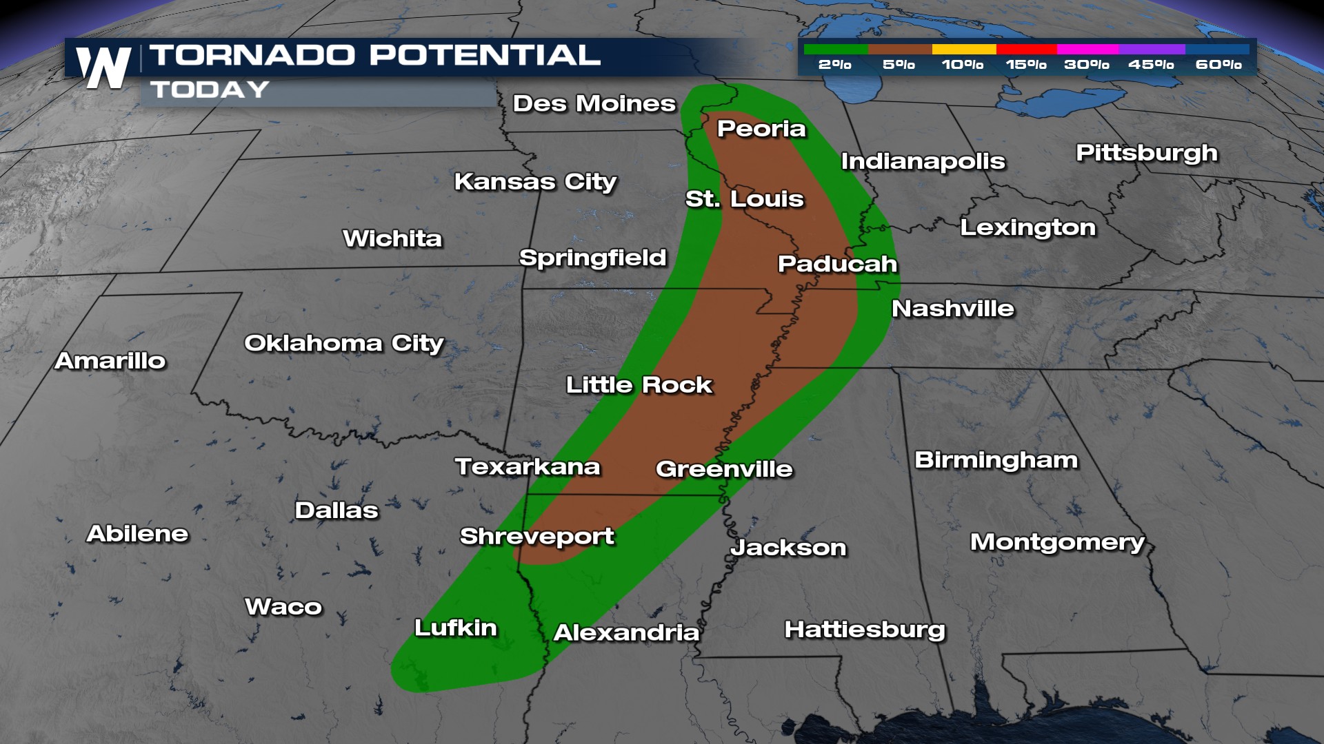
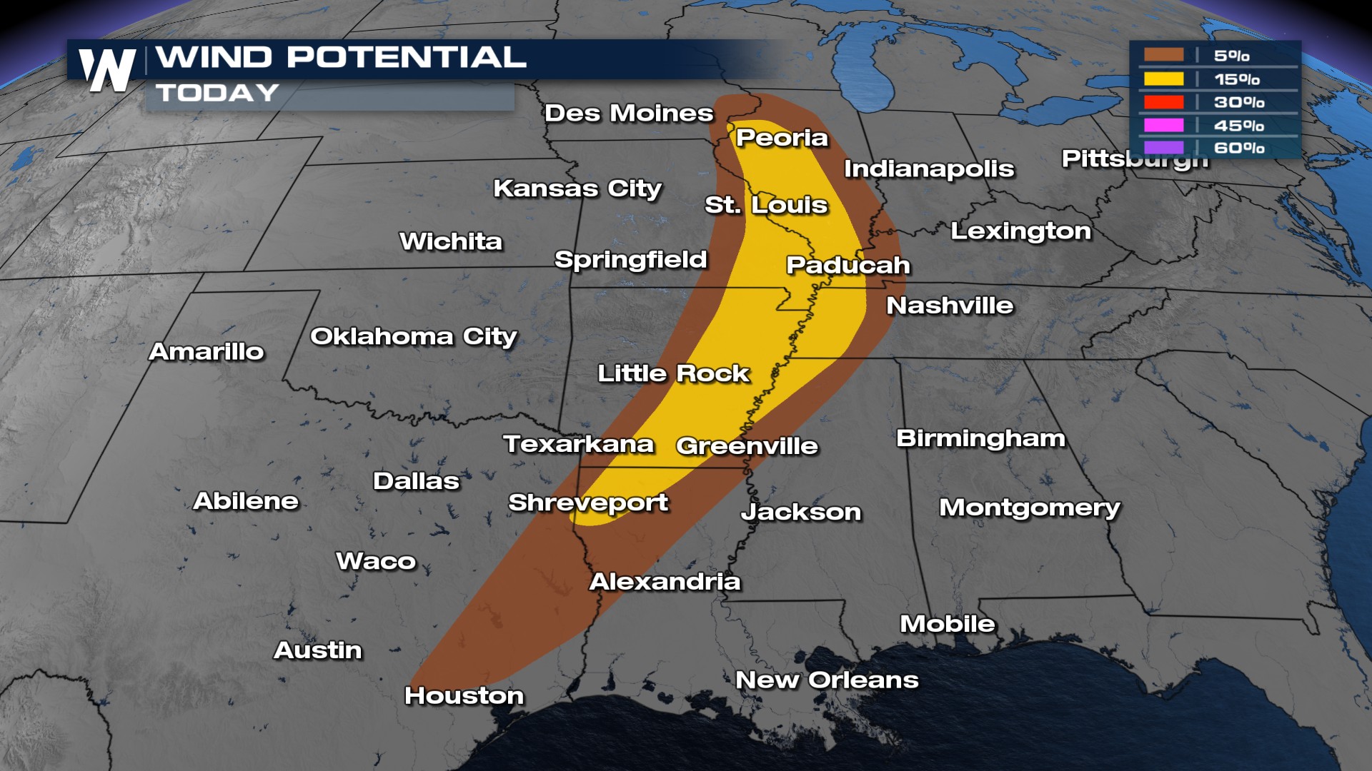
Sunday's severe weather risk includes a Slight risk right over Missouri and Arkansas (orange color). This means severe thunderstorms with damaging wind and tornadoes are possible through early Monday morning.
TIMING
The key time for severe weather is Sunday afternoon through early Monday morning.
Rainfall Next 24 hours
Total rainfall through Monday night could range from 1-4 inches.
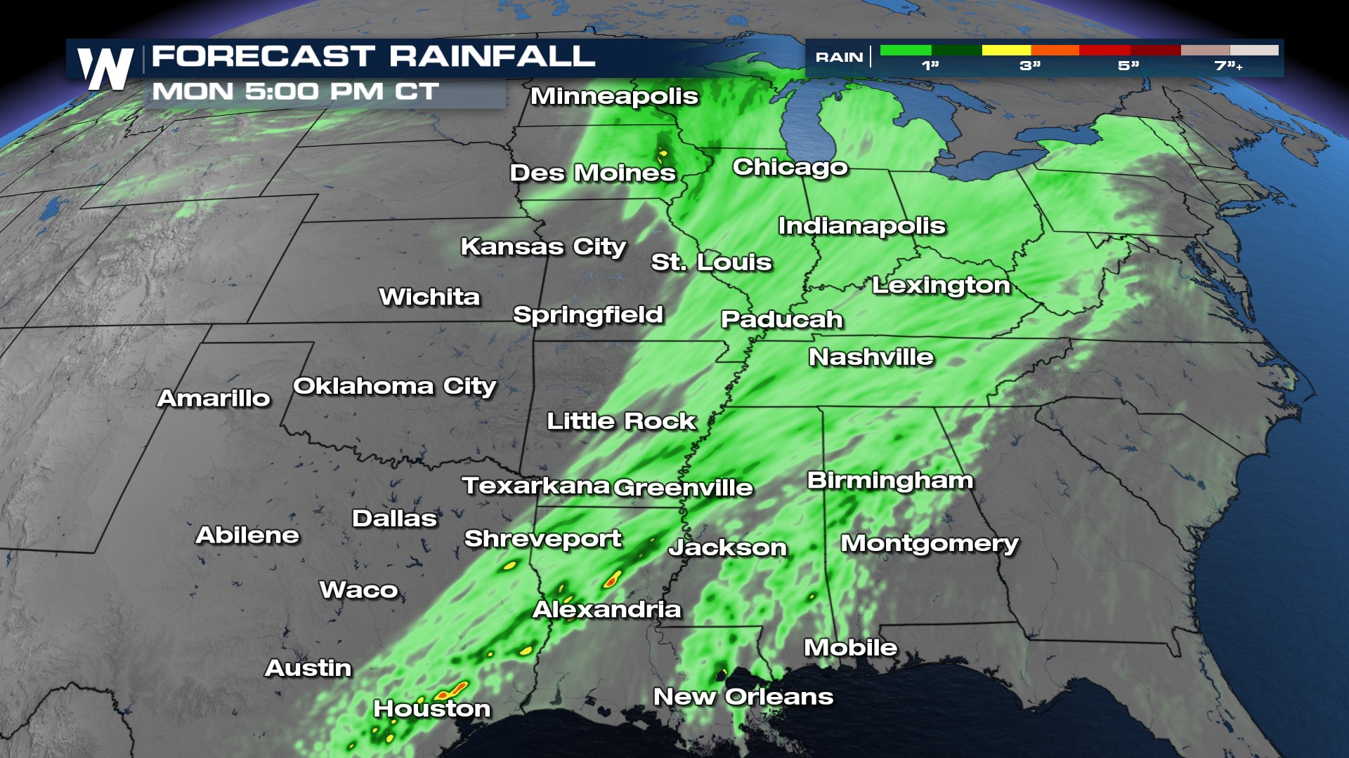
A lot of soils are already saturated and rivers at bankfull. Stay with WeatherNation for the latest.
All Weather News
More

Flooding, Severe Storms Target the Midwest Again
After an active week of storms across the nor
1 Aug 2026 1:40 AM


After Reaching Category 5, Genevieve Weakens in the Pacific
PacificFausto is now a post-tropical cyclone.
31 Jul 2026 1:30 AM

Flooding Risk Increases as Heavy Rain Targets the Tri-State Area
Tuesday, heavy rainfall moved across the Nort
30 Jul 2026 12:25 AM

Severe Weather: Energy From the Midwest Now in the Southeast
UPPER MIDWEST - Through Monday, dangerous tor
29 Jul 2026 10:30 PM