More Snow Ahead in the West
Special Stories
10 Jan 2018 5:19 PM
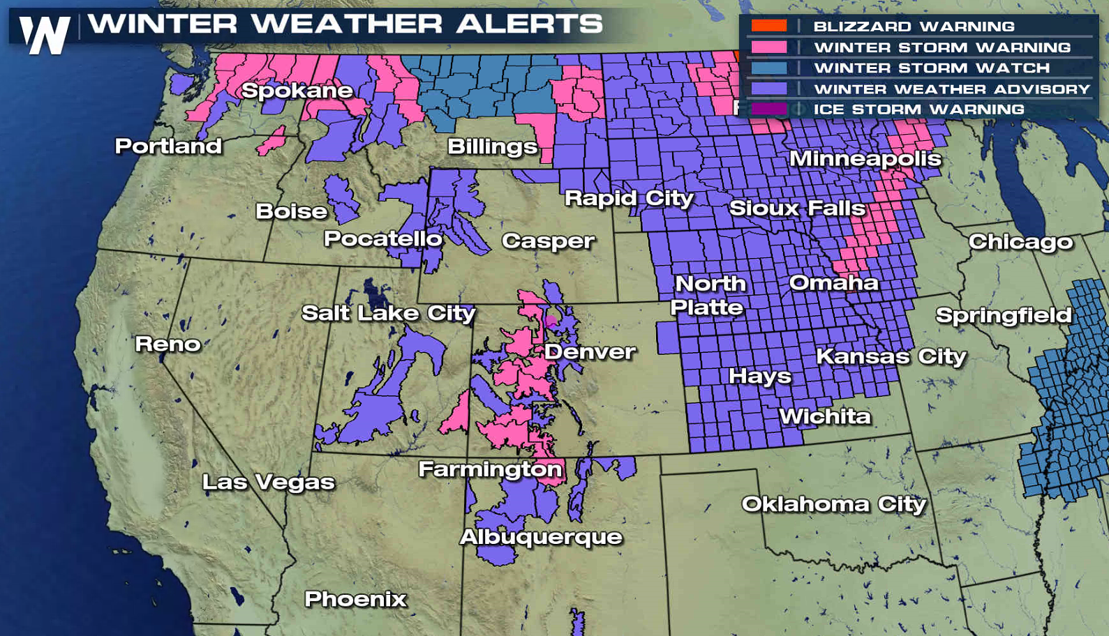
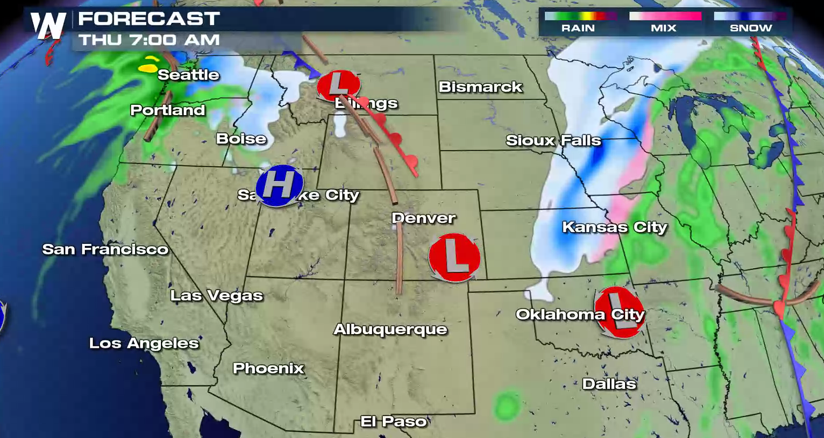
More snow is ahead for the West, as another storm system will follow on the heels of the first low pressure center now moving into the Plains. Winter weather alerts extend from Washington to New Mexico. 1 to 2 feet of new accumulations are possible in the highest elevations, especially near Glacier National Park.
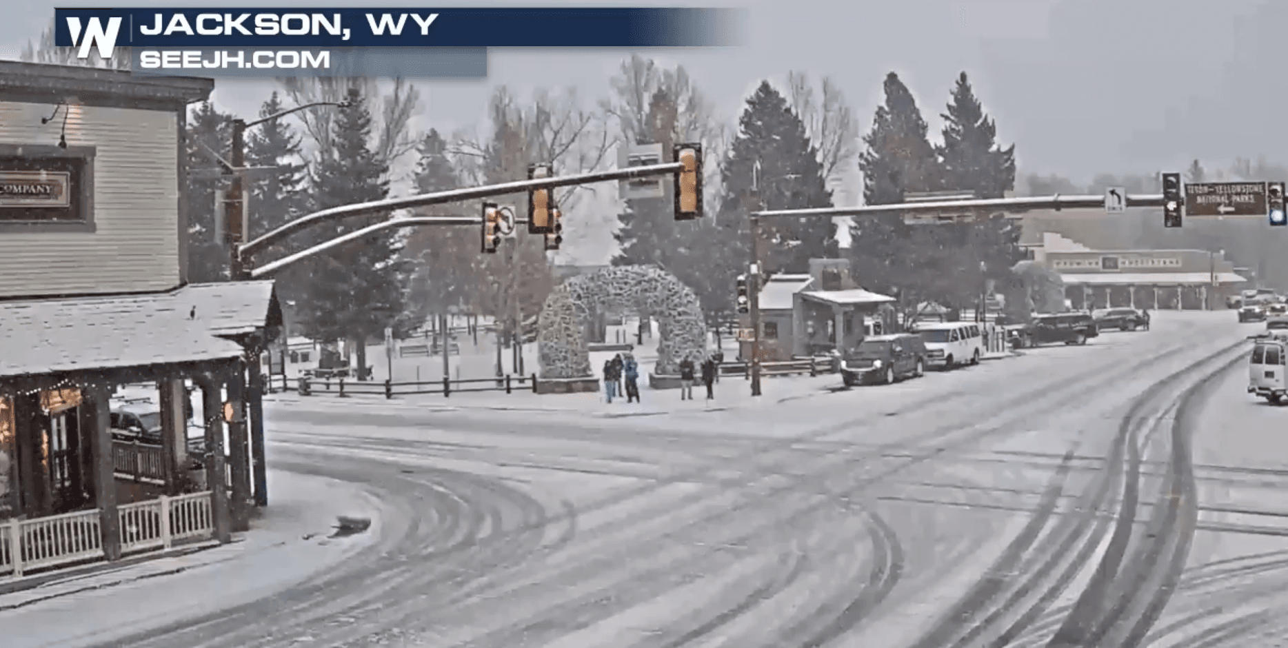
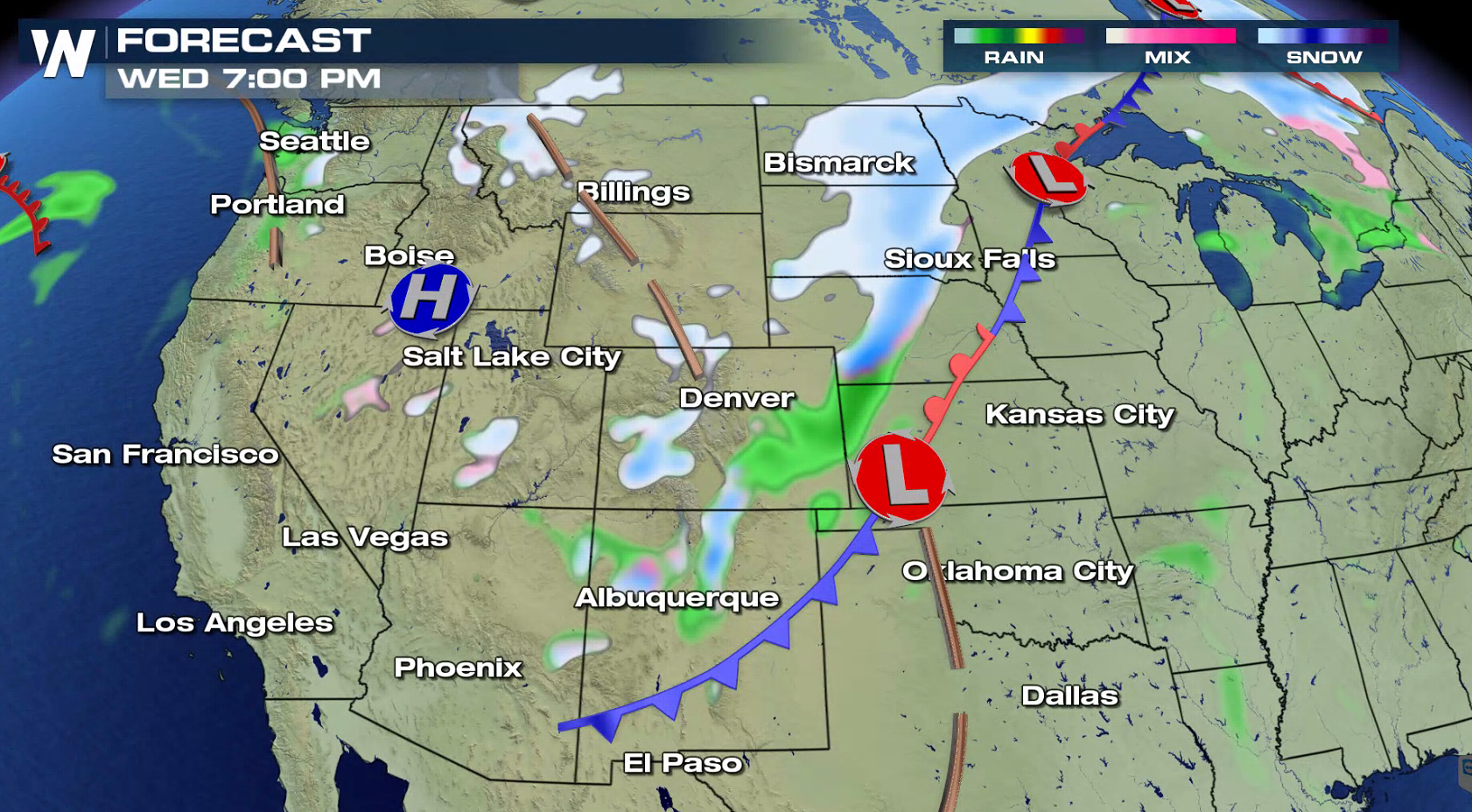
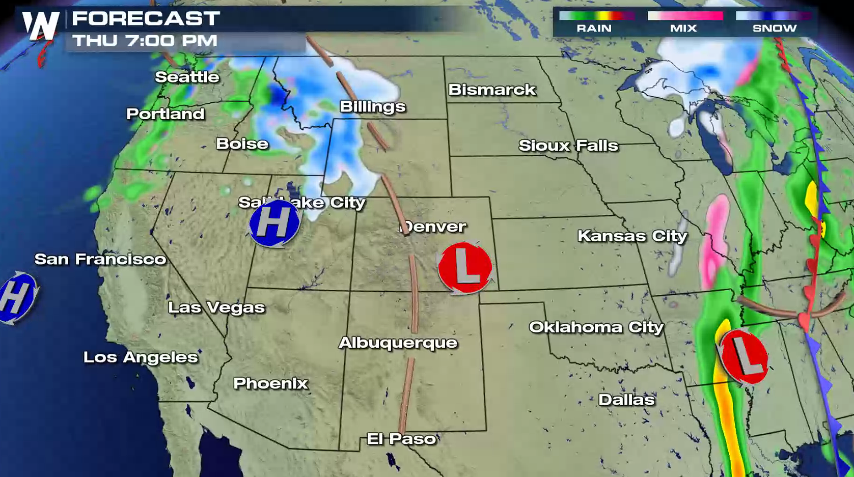
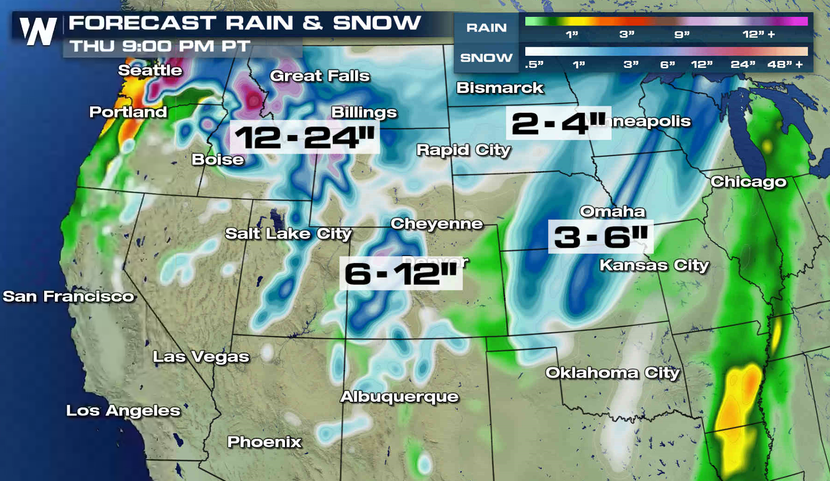 The first low pressure center has moved into the Upper Midwest and snowfall will gradually diminish in the Front Range. The second system will move into the Pacific Northwest Thursday morning, bringing another round of snow into the region. The snow will push from the Cascades eastward to the Tetons throughout Thursday.
 For WeatherNation: Meteorologist Mace Michaels
The first low pressure center has moved into the Upper Midwest and snowfall will gradually diminish in the Front Range. The second system will move into the Pacific Northwest Thursday morning, bringing another round of snow into the region. The snow will push from the Cascades eastward to the Tetons throughout Thursday.
For WeatherNation: Meteorologist Mace MichaelsAll Weather News
More

East Gears Up for Stormy, Wet Weekend
A low pressure system crashing through the Mi
1 Aug 2026 9:15 PM


Flooding, Severe Storms Target the Midwest Again
After an active week of storms across the nor
1 Aug 2026 1:40 AM

After Reaching Category 5, Genevieve Weakens in the Pacific
PacificFausto is now a post-tropical cyclone.
31 Jul 2026 1:30 AM

Flooding Risk Increases as Heavy Rain Targets the Tri-State Area
Tuesday, heavy rainfall moved across the Nort
30 Jul 2026 12:25 AM

Severe Weather: Energy From the Midwest Now in the Southeast
UPPER MIDWEST - Through Monday, dangerous tor
29 Jul 2026 10:30 PM