Snow Chances Monday from the Central Appalachians to the Northeast
Top Stories
14 Dec 2020 4:38 AM
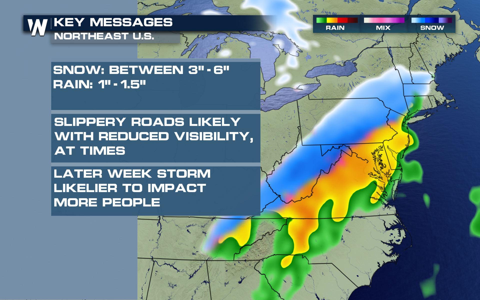
A low pressure system moving through the Mid-Atlantic today will bring heavy rain, but also a chance for some heavy snow from the Appalachians to the Northeast. Here is the latest forecast.
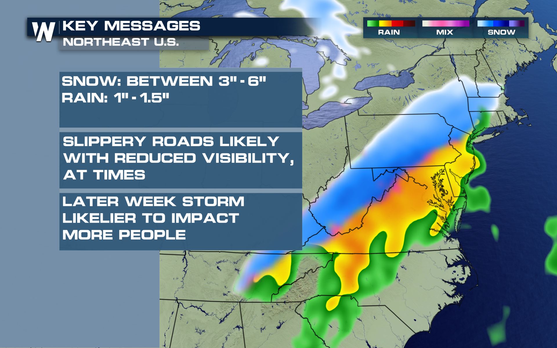 We could see some travel impacts from the wintry weather today, but it looks like the system on the way for Wednesday will have much bigger impacts to many cities in the East.
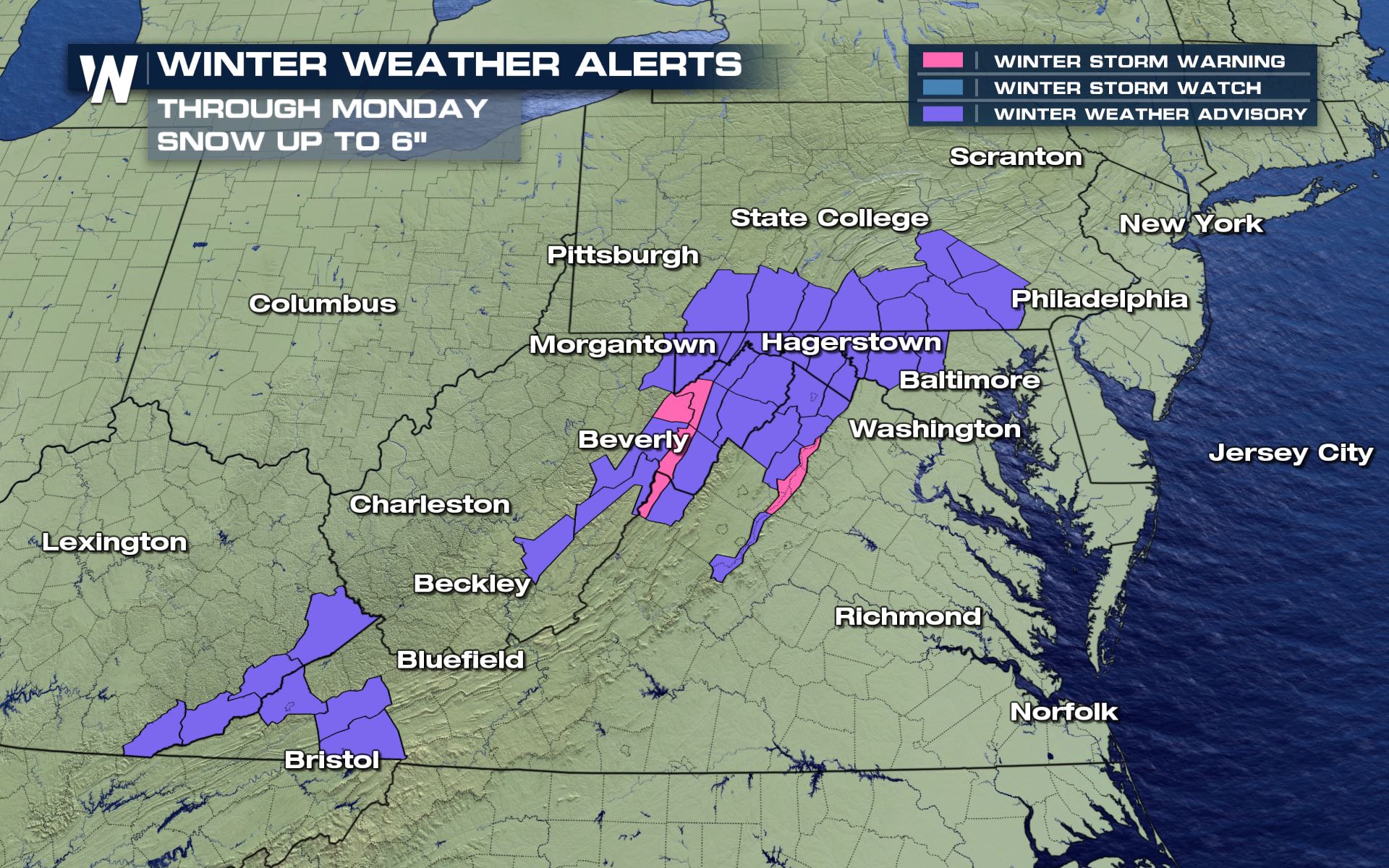 Up to 6" of snowfall will be possible from eastern Kentucky to southern Pennsylvania. Many of these areas are already under winter storm watches for what is on they way by Wednesday and Thursday.
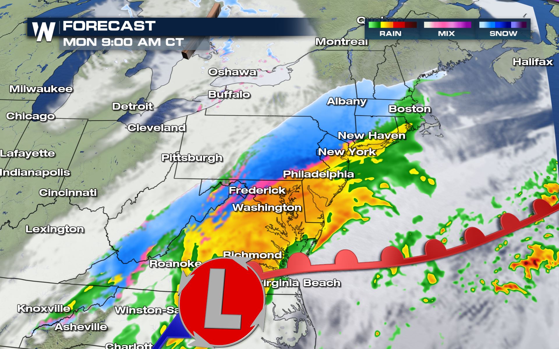
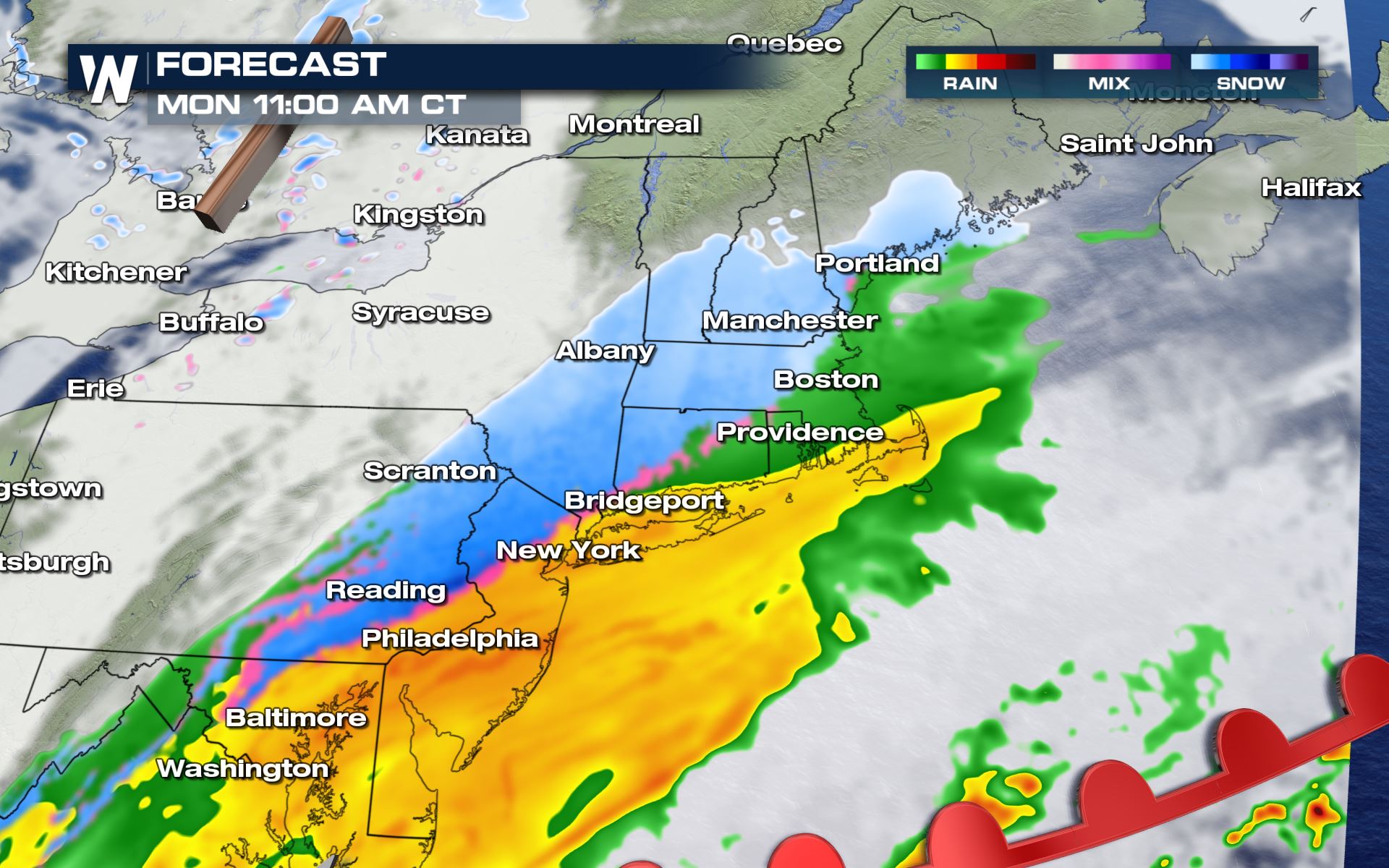
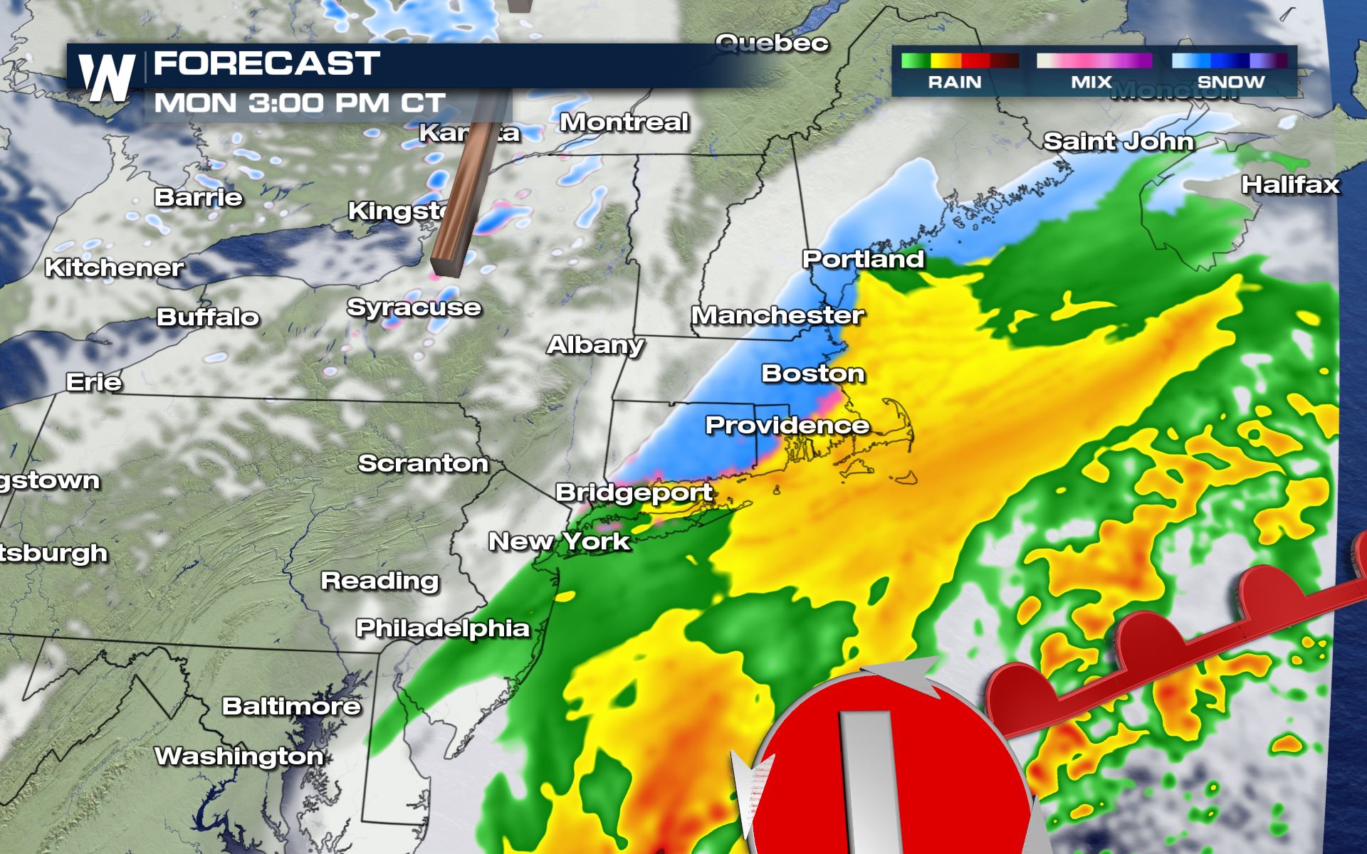
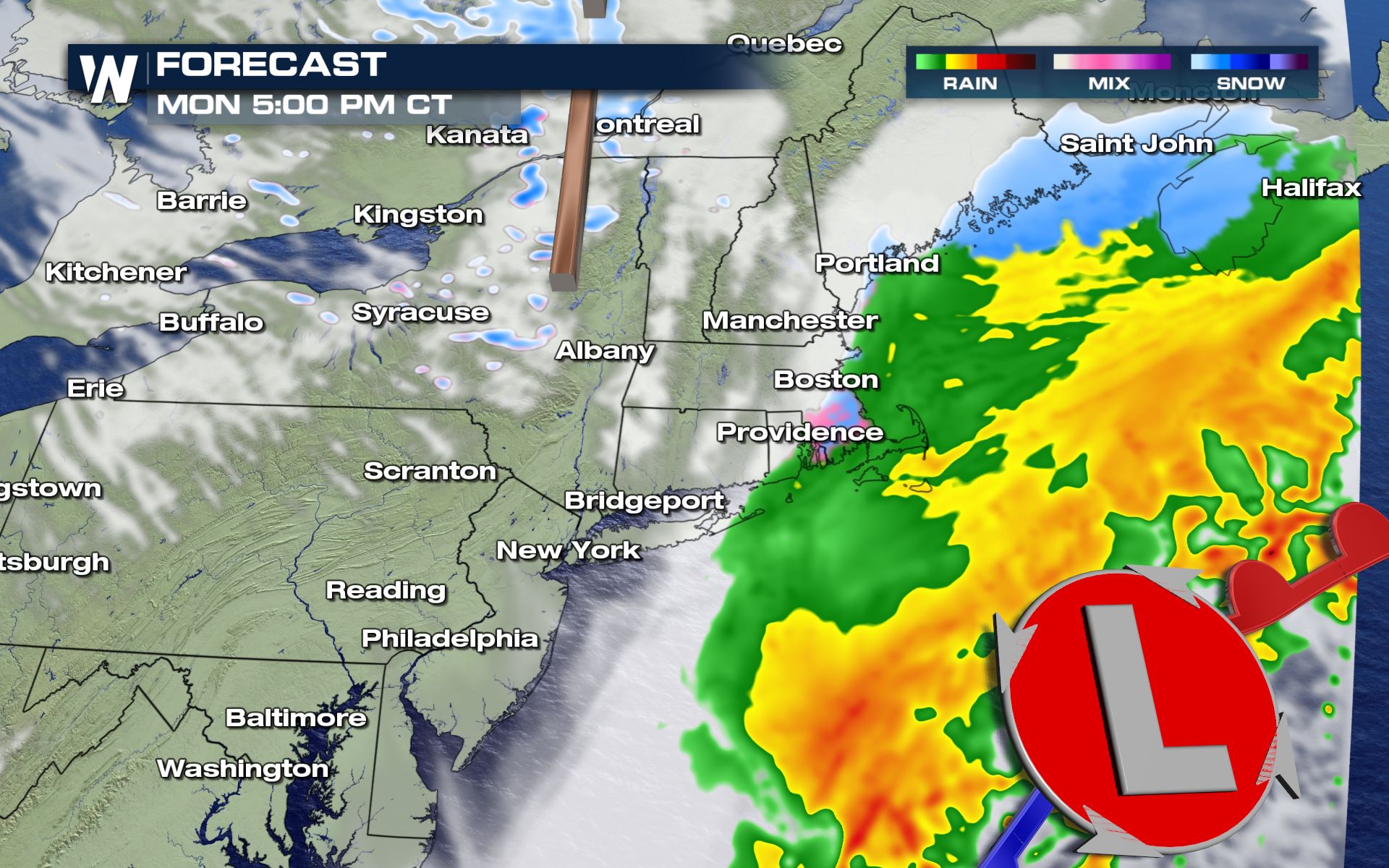 The timing for today's snow and rain will be all morning and through the afternoon. The low pressure system should be out in the Atlantic waters by Monday evening.
Keep it tuned to WeatherNation for the latest on the snow forecast.
The timing for today's snow and rain will be all morning and through the afternoon. The low pressure system should be out in the Atlantic waters by Monday evening.
Keep it tuned to WeatherNation for the latest on the snow forecast.
Key Messages
We could see some travel impacts from the wintry weather today, but it looks like the system on the way for Wednesday will have much bigger impacts to many cities in the East.
Winter Alerts
Up to 6" of snowfall will be possible from eastern Kentucky to southern Pennsylvania. Many of these areas are already under winter storm watches for what is on they way by Wednesday and Thursday.
Forecast
The timing for today's snow and rain will be all morning and through the afternoon. The low pressure system should be out in the Atlantic waters by Monday evening.
Keep it tuned to WeatherNation for the latest on the snow forecast.
All Weather News
More
East Gears Up for Stormy, Wet Weekend
A low pressure system crashing through the Mi
1 Aug 2026 11:35 AM


Flooding, Severe Storms Target the Midwest Again
After an active week of storms across the nor
1 Aug 2026 1:40 AM


After Reaching Category 5, Genevieve Weakens in the Pacific
PacificFausto is now a post-tropical cyclone.
31 Jul 2026 1:30 AM

Flooding Risk Increases as Heavy Rain Targets the Tri-State Area
Tuesday, heavy rainfall moved across the Nort
30 Jul 2026 12:25 AM

Severe Weather: Energy From the Midwest Now in the Southeast
UPPER MIDWEST - Through Monday, dangerous tor
29 Jul 2026 10:30 PM