Snow Comes Sweeping Down the Plains
Special Stories
28 Nov 2018 9:09 AM
FORECAST
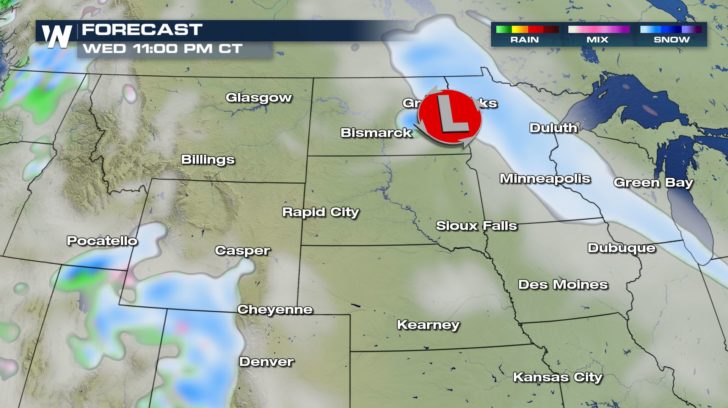
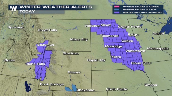 Multiple winter weather advisories are in effect for the high plains, today. Up to 3 inches of snow will be possible for this area. Ice accumulation on the roads will also be another possibility. Drive safely. Visibility will be reduced at times.
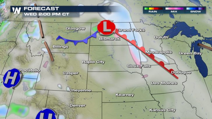
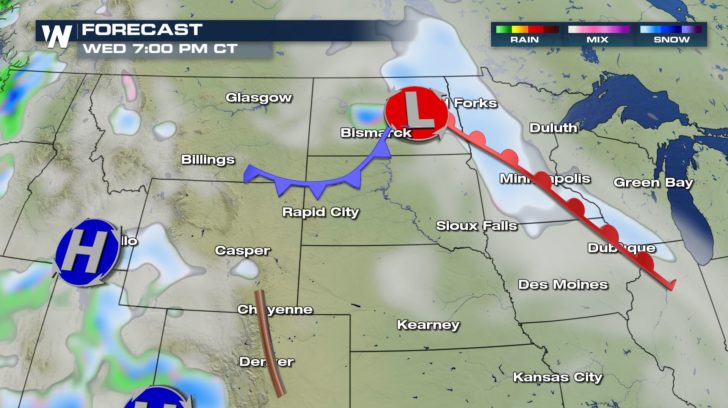
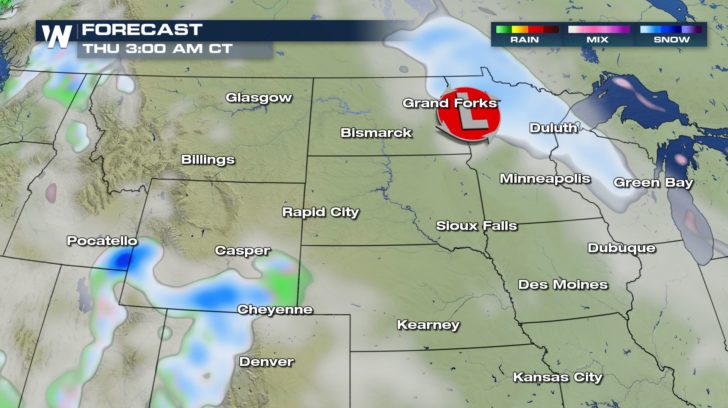 Snow will stick to the same areas all day long and will continue into our Thursday. The dry weather looks to be the first half of the day on Friday before another system brings in very heavy snow Friday night.
SNOWFALL FORECAST
Snow will stick to the same areas all day long and will continue into our Thursday. The dry weather looks to be the first half of the day on Friday before another system brings in very heavy snow Friday night.
SNOWFALL FORECAST
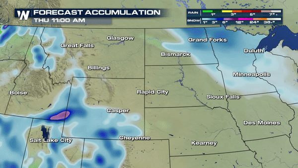
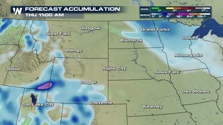 Up to 3 inches of snowfall will be possible during the day today. By Thursday morning, though, some areas could receive 4 to 6 inches of snowfall.
Multiple winter weather advisories are in effect for the high plains, today. Up to 3 inches of snow will be possible for this area. Ice accumulation on the roads will also be another possibility. Drive safely. Visibility will be reduced at times.
Snow will stick to the same areas all day long and will continue into our Thursday. The dry weather looks to be the first half of the day on Friday before another system brings in very heavy snow Friday night.
SNOWFALL FORECAST
Up to 3 inches of snowfall will be possible during the day today. By Thursday morning, though, some areas could receive 4 to 6 inches of snowfall.All Weather News
More
Wildfire Outbreak in the Pacific Northwest
SPOKANE, WA - On Saturday, August 1st, the Ol
3 Aug 2026 1:55 AM

More Storms for the East Through Monday
A low-pressure system that moved through the
3 Aug 2026 1:50 AM


After Reaching Category 5, Genevieve Weakens in the Pacific
PacificGenevieve formed last Friday south of
3 Aug 2026 12:30 AM

Flooding, Severe Storms Target the Midwest Again
After an active week of storms across the nor
1 Aug 2026 1:40 AM

Flooding Risk Increases as Heavy Rain Targets the Tri-State Area
Tuesday, heavy rainfall moved across the Nort
30 Jul 2026 12:25 AM

Severe Weather: Energy From the Midwest Now in the Southeast
UPPER MIDWEST - Through Monday, dangerous tor
29 Jul 2026 10:30 PM