Snow for the Rockies, Avalanche Warnings in Utah
Special Stories
18 Dec 2020 8:00 AM
The active weather pattern continues in the western U.S. as low pressure systems move onshore from the Pacific Ocean. The system working through the West has plenty of moisture as it carries through the interior areas and higher elevations, bringing rounds of snow.
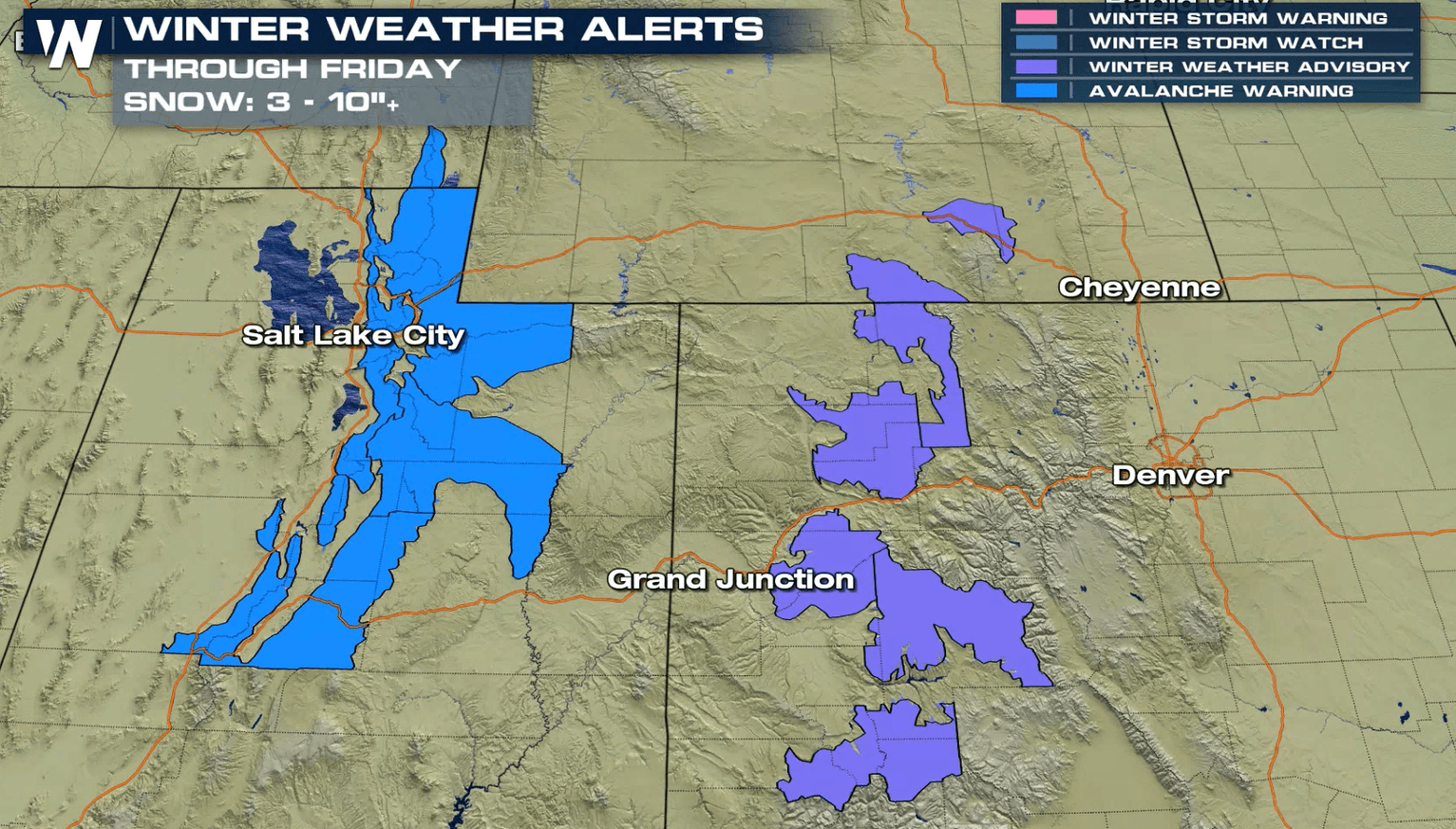
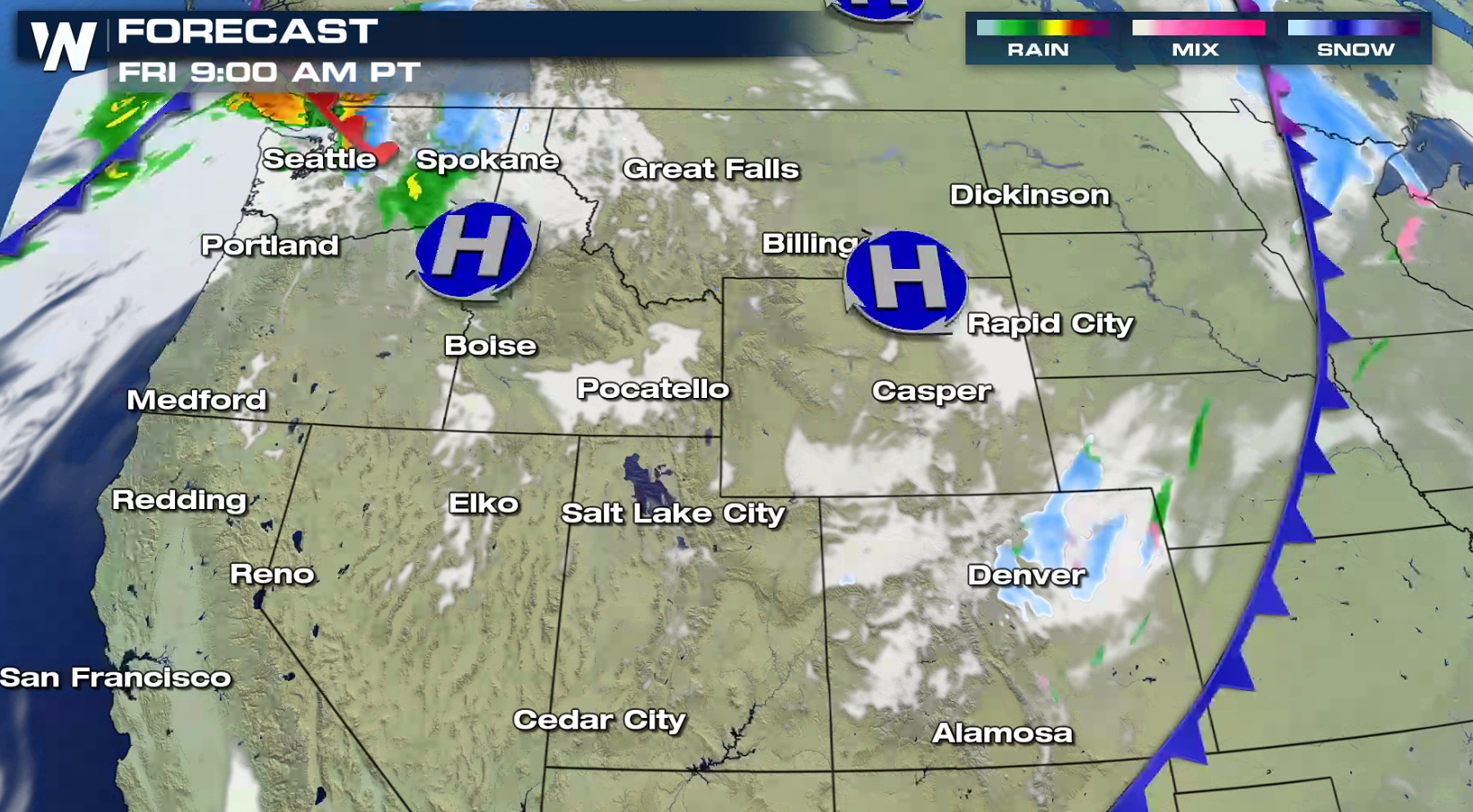
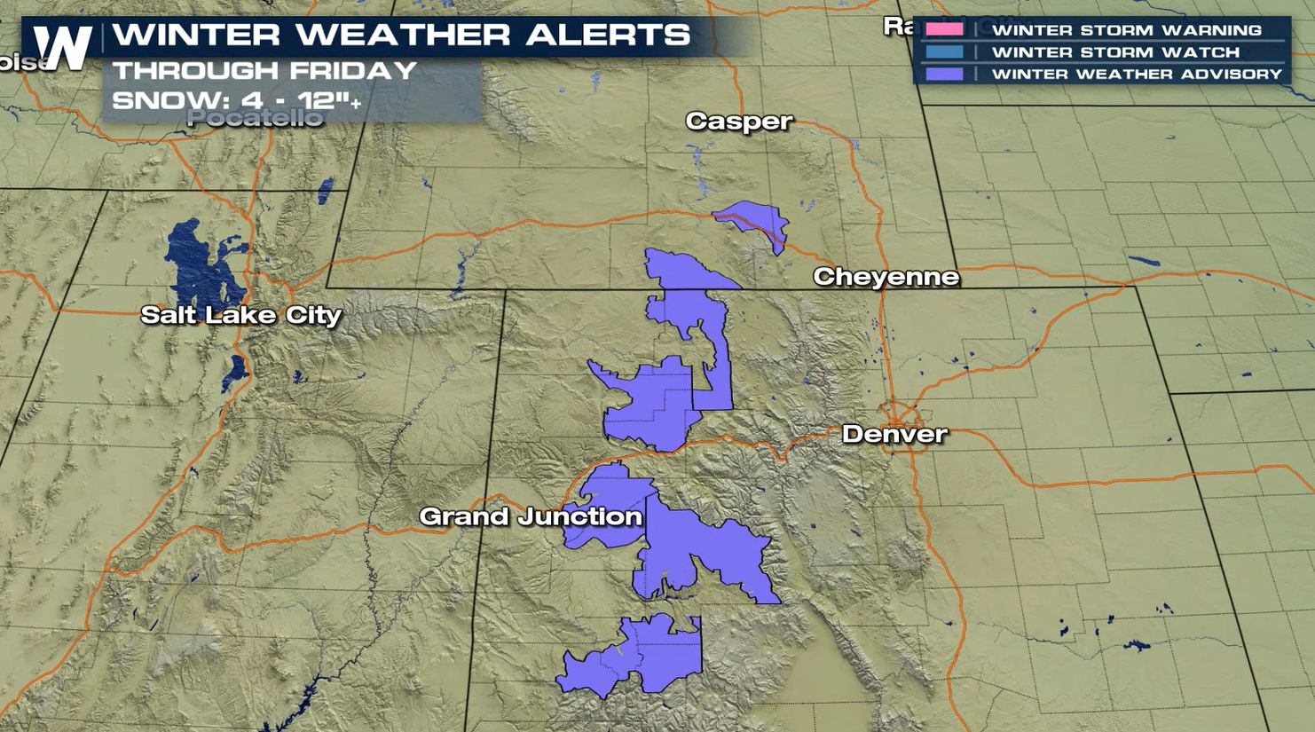 Winter Weather Advisories are in place for much of the high terrain areas of western Colorado into southeastern Wyoming. Snow totals of 4" to 7" are likely, with the highest peaks approaching a foot.
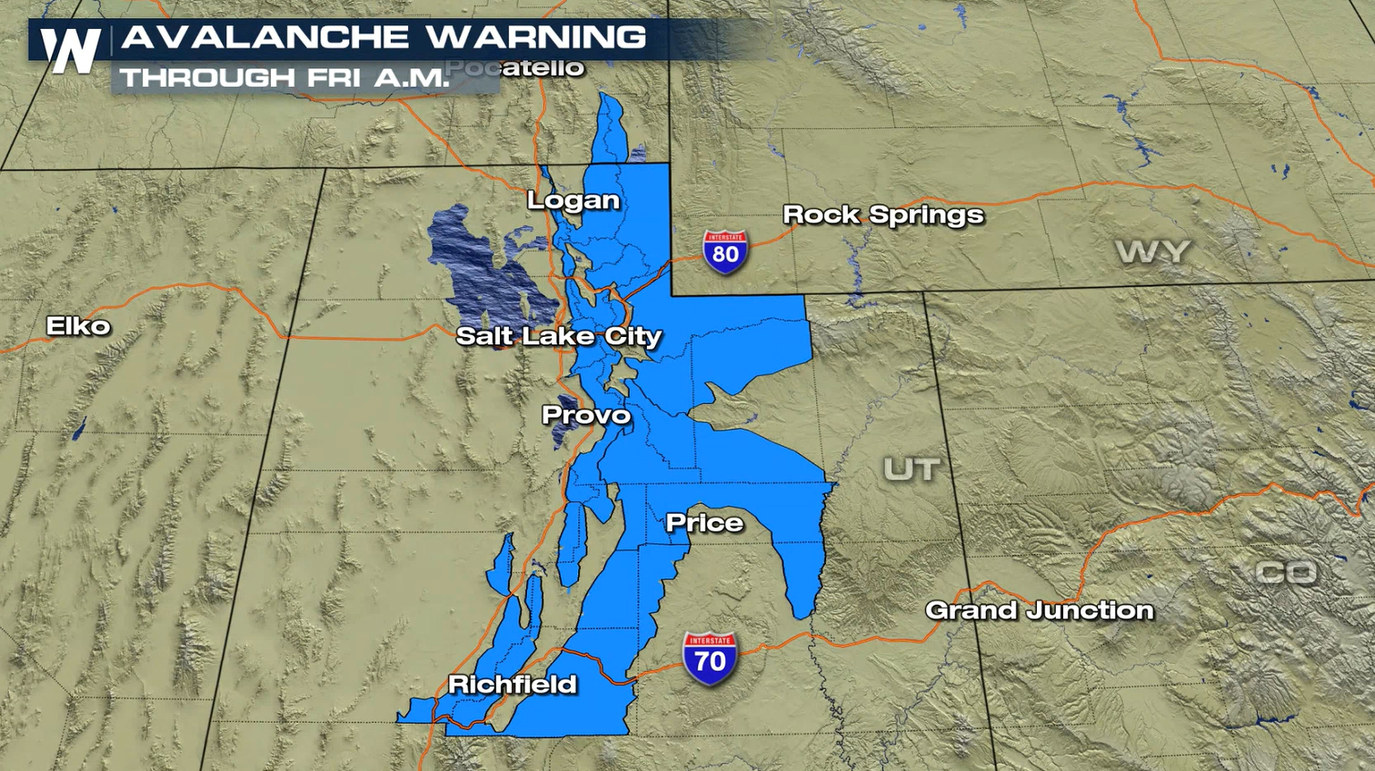
 Avalanche Warnings are in place for parts of Utah and southern Idaho in advance of this system. The Bear River Range, Wasatch Mountains, western Uintas and Manti-Skyline Plateau are included in the warning. Slopes steeper than 30° are the most in danger of avalanches.
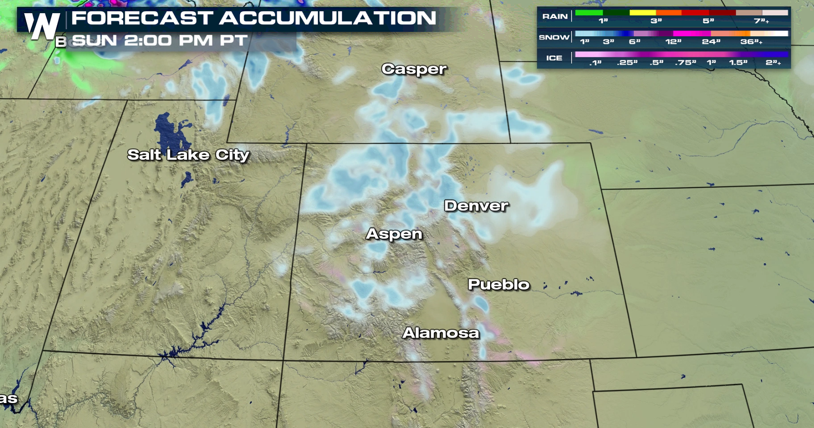
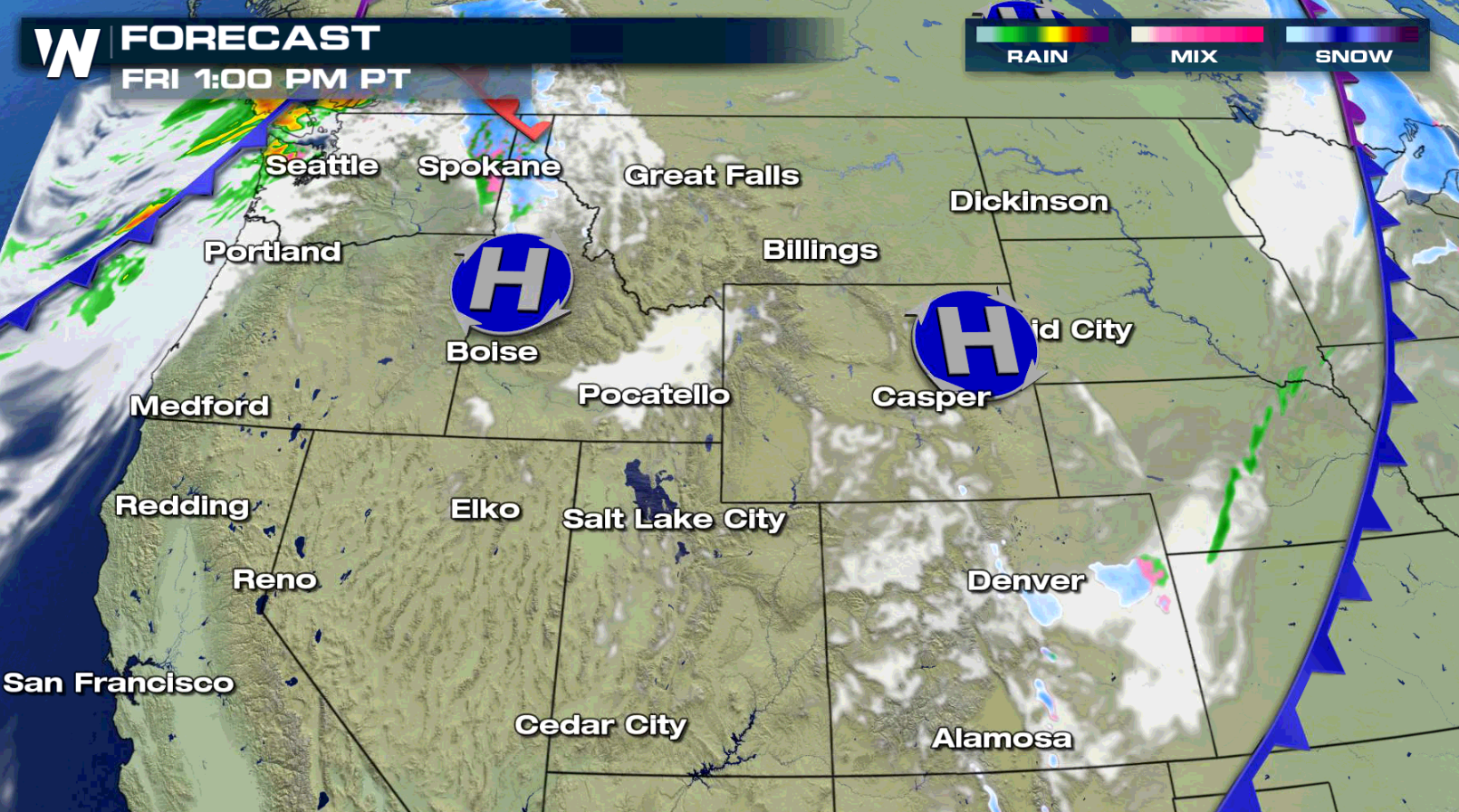
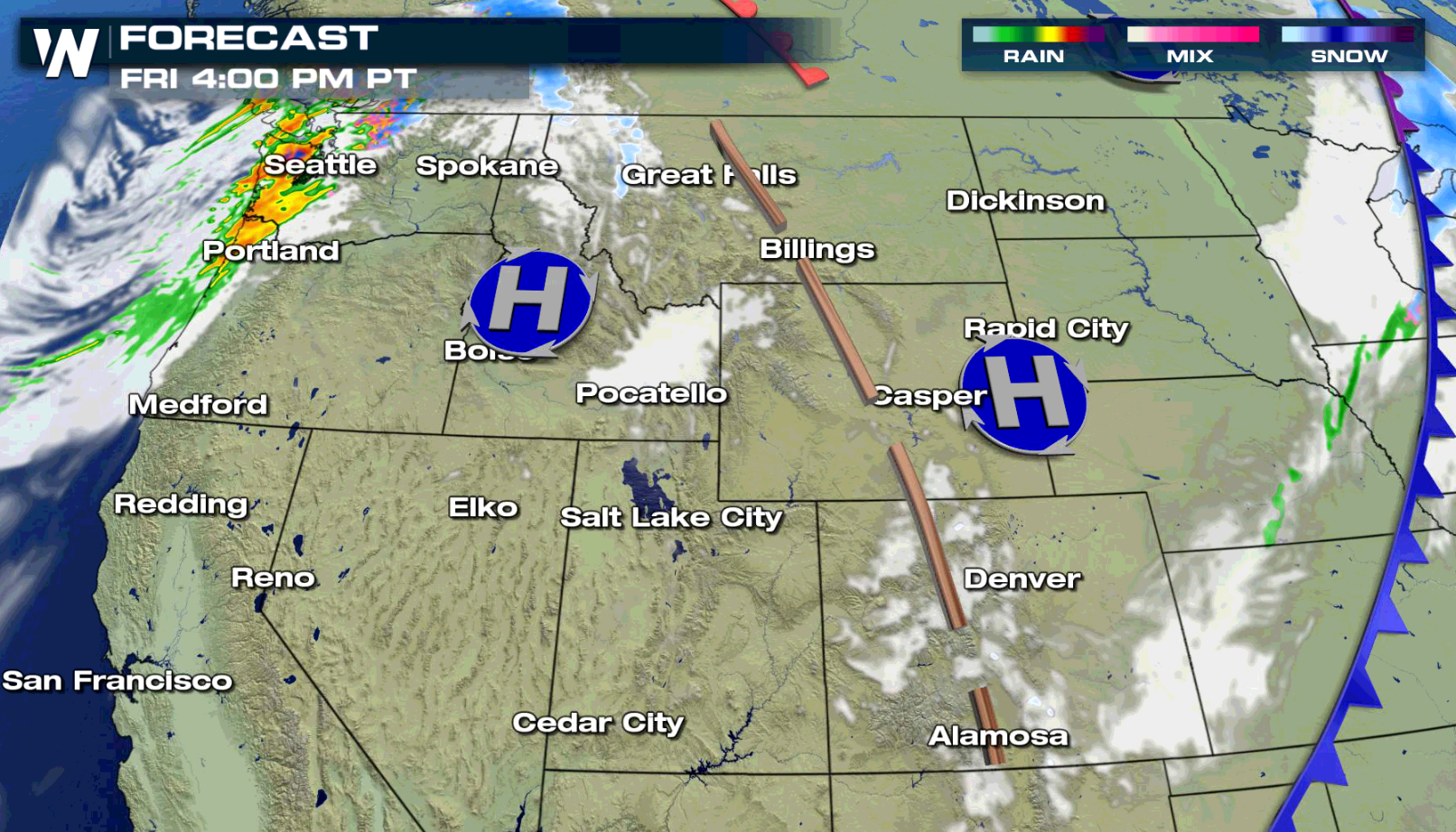
 A cold front has moved through Wyoming and most of Colorado. The heavier snow remains in the mountains western Colorado. Snow will be winding down for Utah by the late morning hours today (Friday). Snow showers remain possible throughout the mountains of Colorado through the early afternoon with a few areas of light snow possible across the eastern plains of Colorado.
 Stay with WeatherNation for the latest updates on this system, the active pattern continuing in the Northwest U.S. next week and other top weather headlines.
Winter Weather Advisories are in place for much of the high terrain areas of western Colorado into southeastern Wyoming. Snow totals of 4" to 7" are likely, with the highest peaks approaching a foot.
Avalanche Warnings are in place for parts of Utah and southern Idaho in advance of this system. The Bear River Range, Wasatch Mountains, western Uintas and Manti-Skyline Plateau are included in the warning. Slopes steeper than 30° are the most in danger of avalanches.
A cold front has moved through Wyoming and most of Colorado. The heavier snow remains in the mountains western Colorado. Snow will be winding down for Utah by the late morning hours today (Friday). Snow showers remain possible throughout the mountains of Colorado through the early afternoon with a few areas of light snow possible across the eastern plains of Colorado.
Stay with WeatherNation for the latest updates on this system, the active pattern continuing in the Northwest U.S. next week and other top weather headlines.All Weather News
More
Wildfire Outbreak in the Pacific Northwest
SPOKANE, WA - On Saturday, August 1st, the Ol
3 Aug 2026 1:55 AM

More Storms for the East Through Monday
A low-pressure system that moved through the
3 Aug 2026 1:50 AM


After Reaching Category 5, Genevieve Weakens in the Pacific
PacificGenevieve formed last Friday south of
3 Aug 2026 12:30 AM

Flooding, Severe Storms Target the Midwest Again
After an active week of storms across the nor
1 Aug 2026 1:40 AM

Flooding Risk Increases as Heavy Rain Targets the Tri-State Area
Tuesday, heavy rainfall moved across the Nort
30 Jul 2026 12:25 AM

Severe Weather: Energy From the Midwest Now in the Southeast
UPPER MIDWEST - Through Monday, dangerous tor
29 Jul 2026 10:30 PM