Spring Snow in the Rocky Mountain States
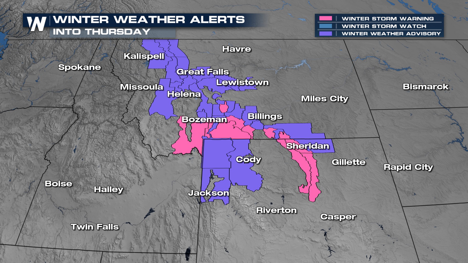
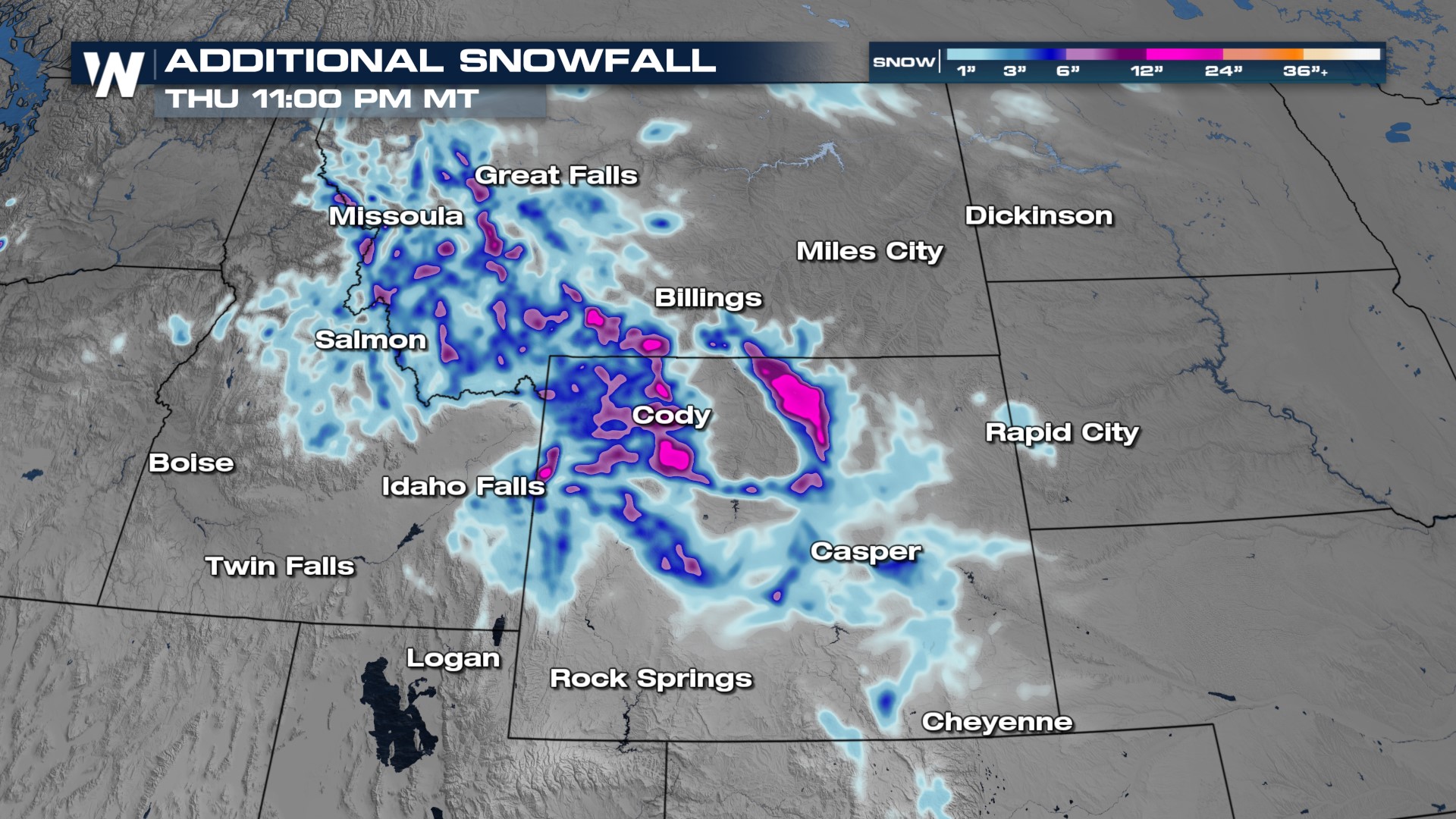
Snow is falling in the northern and central Rockies through the middle of this week with accumulations close to 18" for the highest elevations of Colorado, Montana, Idaho, and Wyoming! As a result, winter alerts remain in effect for portions of Wyoming and Montana. Some of the numbers that have come in from some Colorado ski resorts have been impessive over the past 2 days (above).
 Snowfall totals for portions of Wyoming, the Tetons, Idaho, and Montana could still reach up to an additional foot through the next day or so.

Snowfall will continue in the high terrain for the next couple of days as northwesterly winds combined with low-pressure development lead to orographic (terrain lift) producing snow showers for the highest peaks.
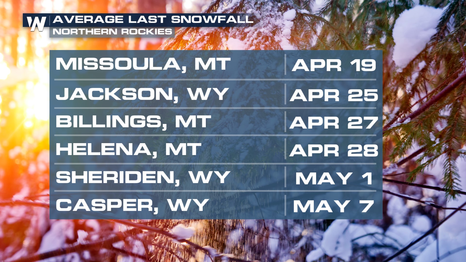
If you think it's pretty late in the season to see snowfall, you may be surprised to learn that many cities in the northern Rockies see their average last snowfall in April and May, and we are right on track!
