Snow Falls Across Parts of Southwest Texas Saturday

Top Stories
5 Dec 2020 8:30 AM
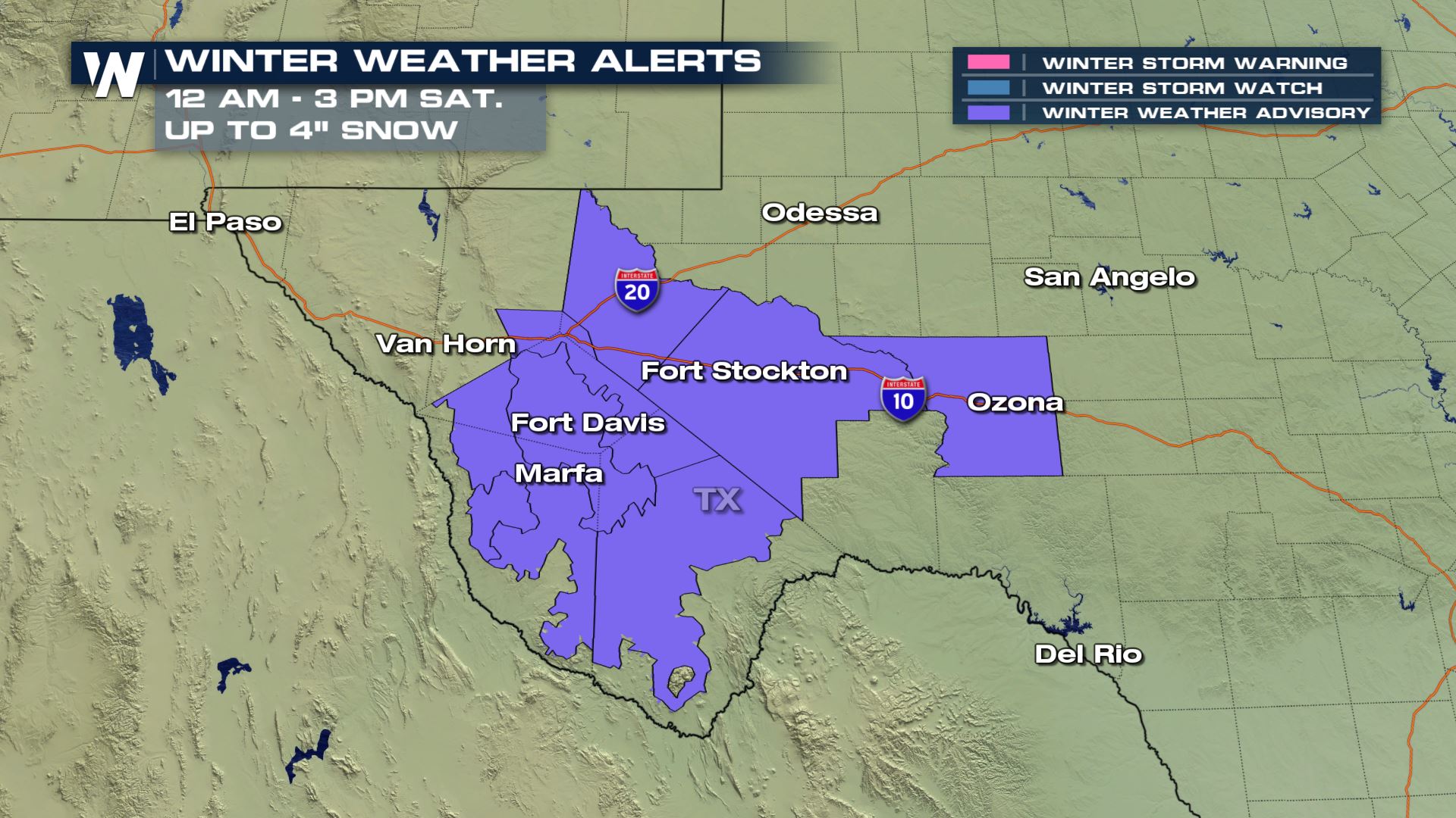
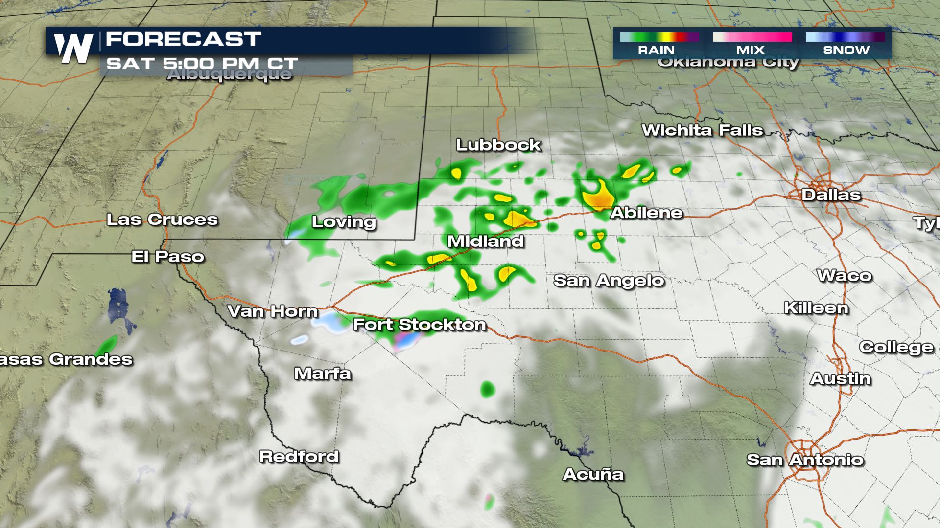
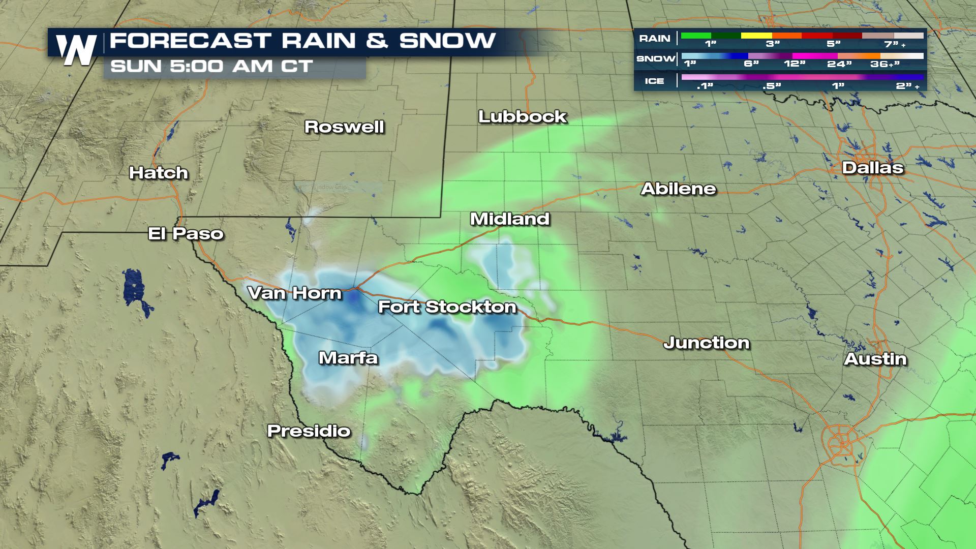
A cold upper low pressure system drifting over southwest Texas is helping to bring wintry weather to the Lone Star State. Most areas outside of extreme Southwest Texas will just see rain, but some locations along I-10 and I-20 could see snow stick, up to several inches through early Saturday afternoon.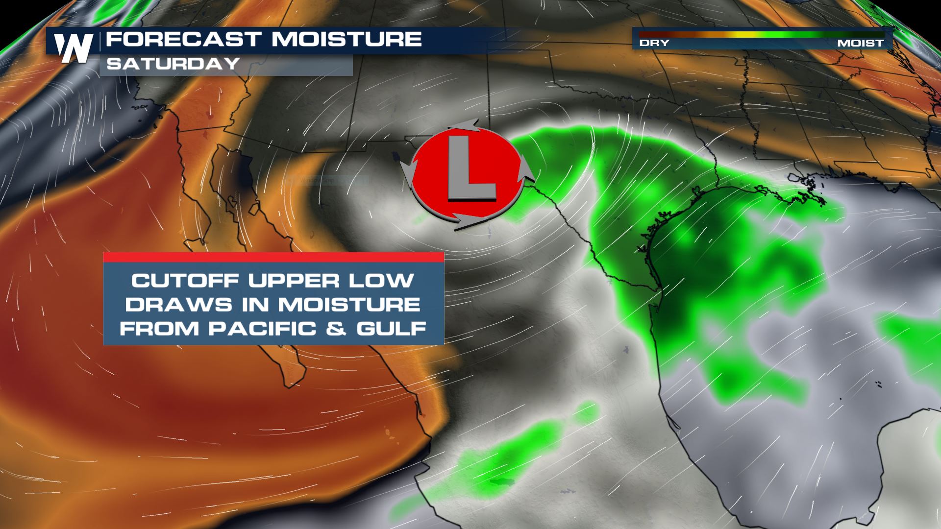 Winter Weather Advisories are in place for the Marfa, Fort Stockton and Van Horn areas. Snow totals could be anywhere from 1-4". Bridges and overpasses and secondary roads will likely be slippery during the day Saturday as snow accumulates. Higher elevation areas will get the most snow, but isolated higher totals can be found in the lower elevation areas if bands of heavy snow set up.
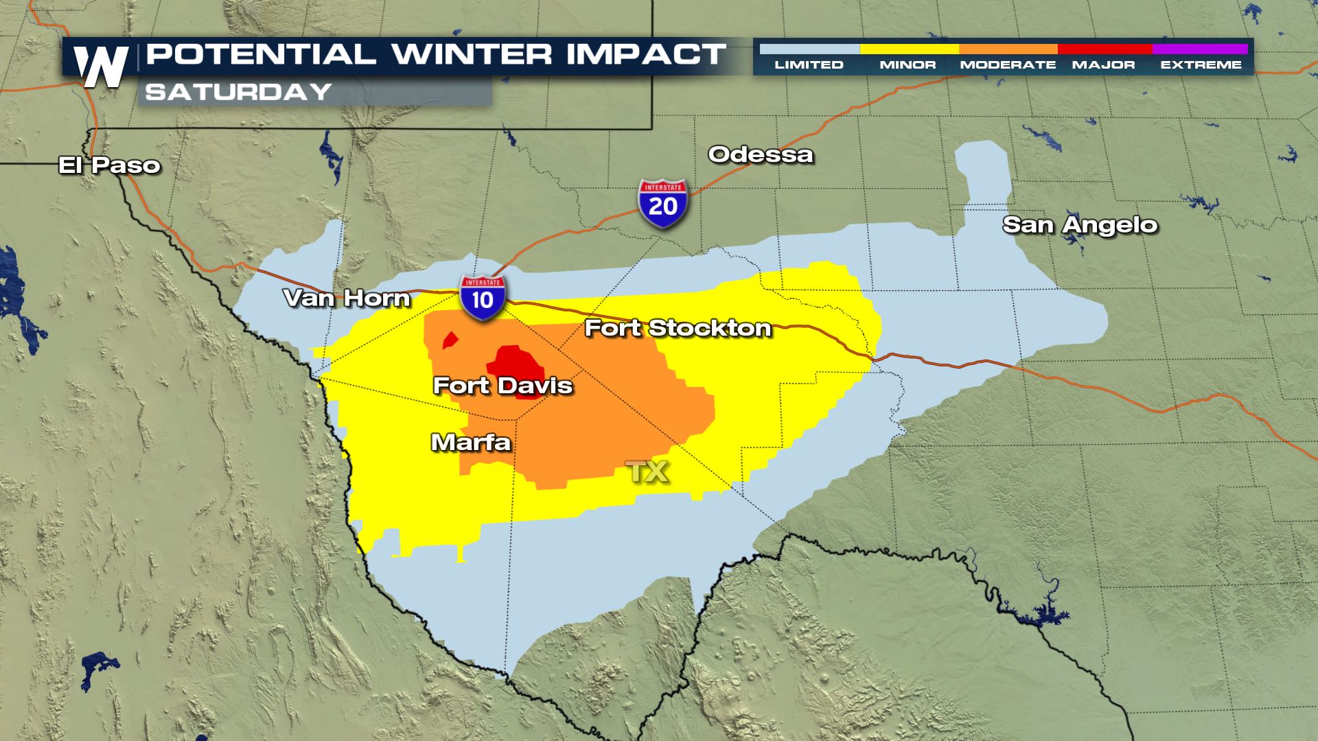
 Impacts on roadways will be the worst along and south of I-10 and in higher elevation areas.
 Initially rain will begin moving in from northwest Mexico overnight, turning to snow by the early morning hours as temperatures fall into the 20s.
By midday the low pressure will be sitting and spinning around the Big Bend area, with snow on the northwest side of the low and rain on the northeast side.
Initially rain will begin moving in from northwest Mexico overnight, turning to snow by the early morning hours as temperatures fall into the 20s.
By midday the low pressure will be sitting and spinning around the Big Bend area, with snow on the northwest side of the low and rain on the northeast side.
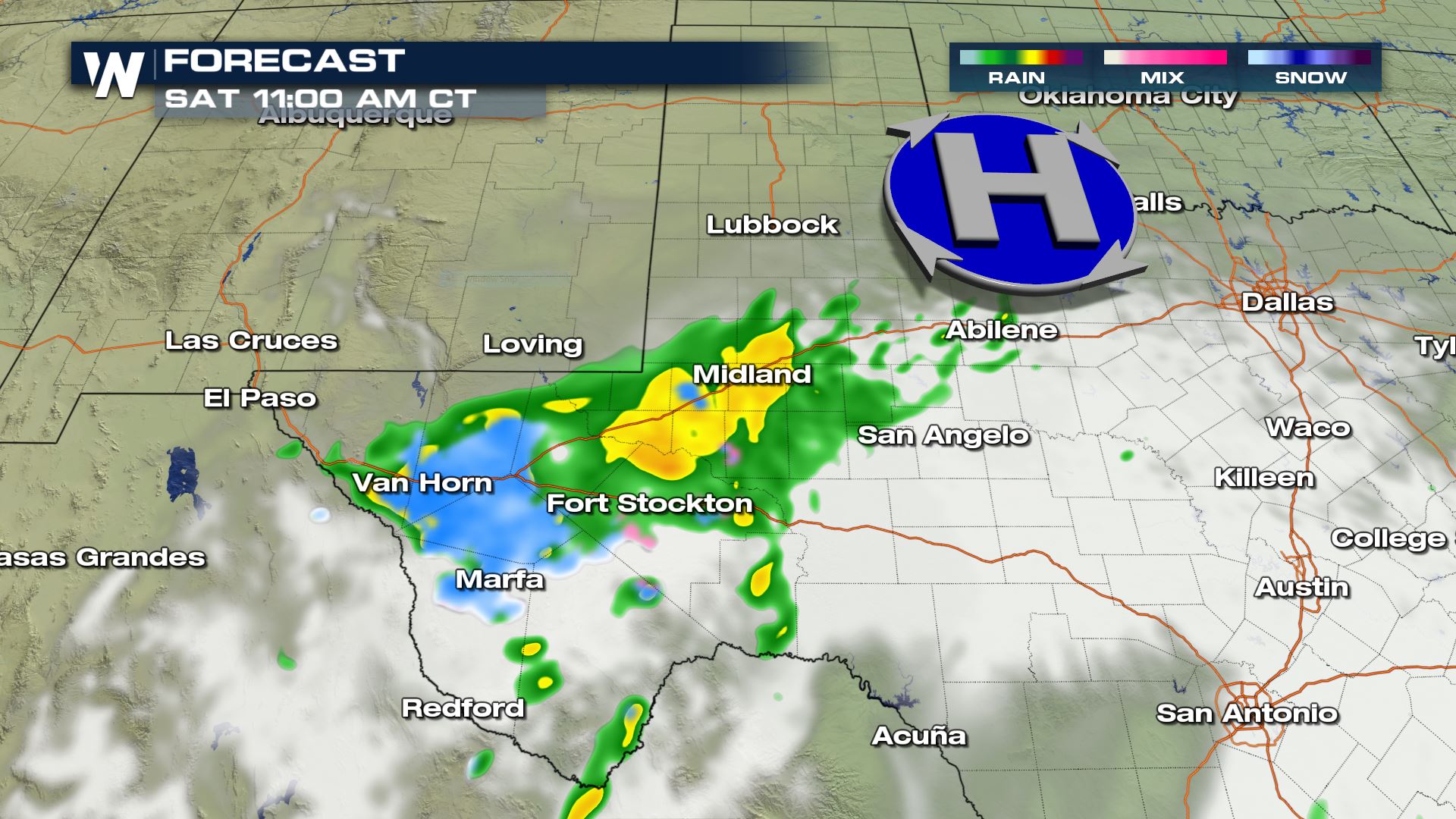 By Saturday afternoon temperatures will be warm enough for most of the snow to change back over into rain, especially near Midland and Abilene. A few areas of light snow may linger along the I-10 corridor near Fort Stockton, but will clear out overnight. A few showers may continue through the Lubbock area overnight.
 Snow totals of 1-4" could bring significant impacts to secondary roads along with bridges and overpasses.
 Stay tuned for changes in this system and how it could affect your weekend, along with other top weather headlines 24/7 on WeatherNation!
Winter Weather Advisories are in place for the Marfa, Fort Stockton and Van Horn areas. Snow totals could be anywhere from 1-4". Bridges and overpasses and secondary roads will likely be slippery during the day Saturday as snow accumulates. Higher elevation areas will get the most snow, but isolated higher totals can be found in the lower elevation areas if bands of heavy snow set up.
Impacts on roadways will be the worst along and south of I-10 and in higher elevation areas.
Initially rain will begin moving in from northwest Mexico overnight, turning to snow by the early morning hours as temperatures fall into the 20s.
By midday the low pressure will be sitting and spinning around the Big Bend area, with snow on the northwest side of the low and rain on the northeast side.
By Saturday afternoon temperatures will be warm enough for most of the snow to change back over into rain, especially near Midland and Abilene. A few areas of light snow may linger along the I-10 corridor near Fort Stockton, but will clear out overnight. A few showers may continue through the Lubbock area overnight.
Snow totals of 1-4" could bring significant impacts to secondary roads along with bridges and overpasses.
Stay tuned for changes in this system and how it could affect your weekend, along with other top weather headlines 24/7 on WeatherNation!All Weather News
More
Fronts Continue To Spark Severe Weather Across the Plains
A cold front that brought record lows to the
18 Jul 2025 10:40 PM

Extreme Heat Impacts for the East Coast & South
Extreme heat continues to impact several area
18 Jul 2025 10:05 PM

Flooding Threat Remains Elevated in the East
A cold front pushing through the Eastern Seab
18 Jul 2025 9:10 PM

EF-2 Firenado from the Deer Creek Fire in Utah
A fire tornado was spotted near La Sal, Utah
18 Jul 2025 7:30 AM

Tropical System Brings Flood Risk to the Central Gulf
Time has run out for notable tropical develop
18 Jul 2025 3:05 AM

Heavy Rain, Flooding Threat Returns to Florida
Keep the rain boots handy in Florida - heavy
13 Jul 2025 12:50 PM

Severe Storm Risk Pushes into the Great Lakes, Ohio Valley
Friday was another busy day with severe weath
12 Jul 2025 8:00 PM