Snow Returns to Utah and Colorado Through Early Tomorrow Morning

Top Stories
7 Feb 2025 8:40 PM
It's been a warm and dry few days in the mountains of Utah and Colorado, but that is changing. The next Pacific storm system hits Utah's Wasatch Mountains (& High Uintas) through today, and Colorado's central and northern mountains late tonight and into Saturday.
Before it arrives in Utah and Colorado, the storm system delivers slightly colder air (forcing the rain/snow line to drop to lower elevations) and additional snow accumulation to Idaho, Montana, and Wyoming's Teton & Wind River mountain ranges.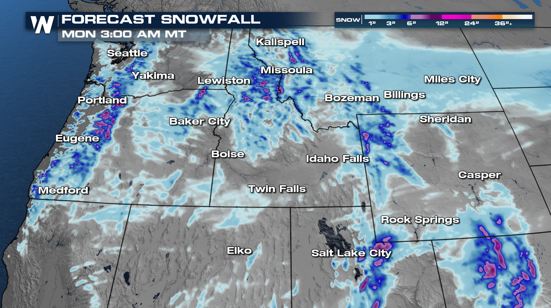
Forecast snow accumulation by early Saturday for Idaho, Wyoming, and Montana.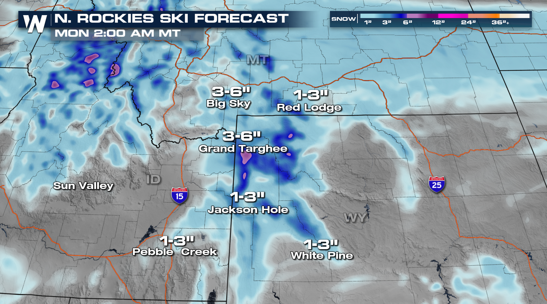
Forecast snow accumulation through early Saturday for Utah and Colorado.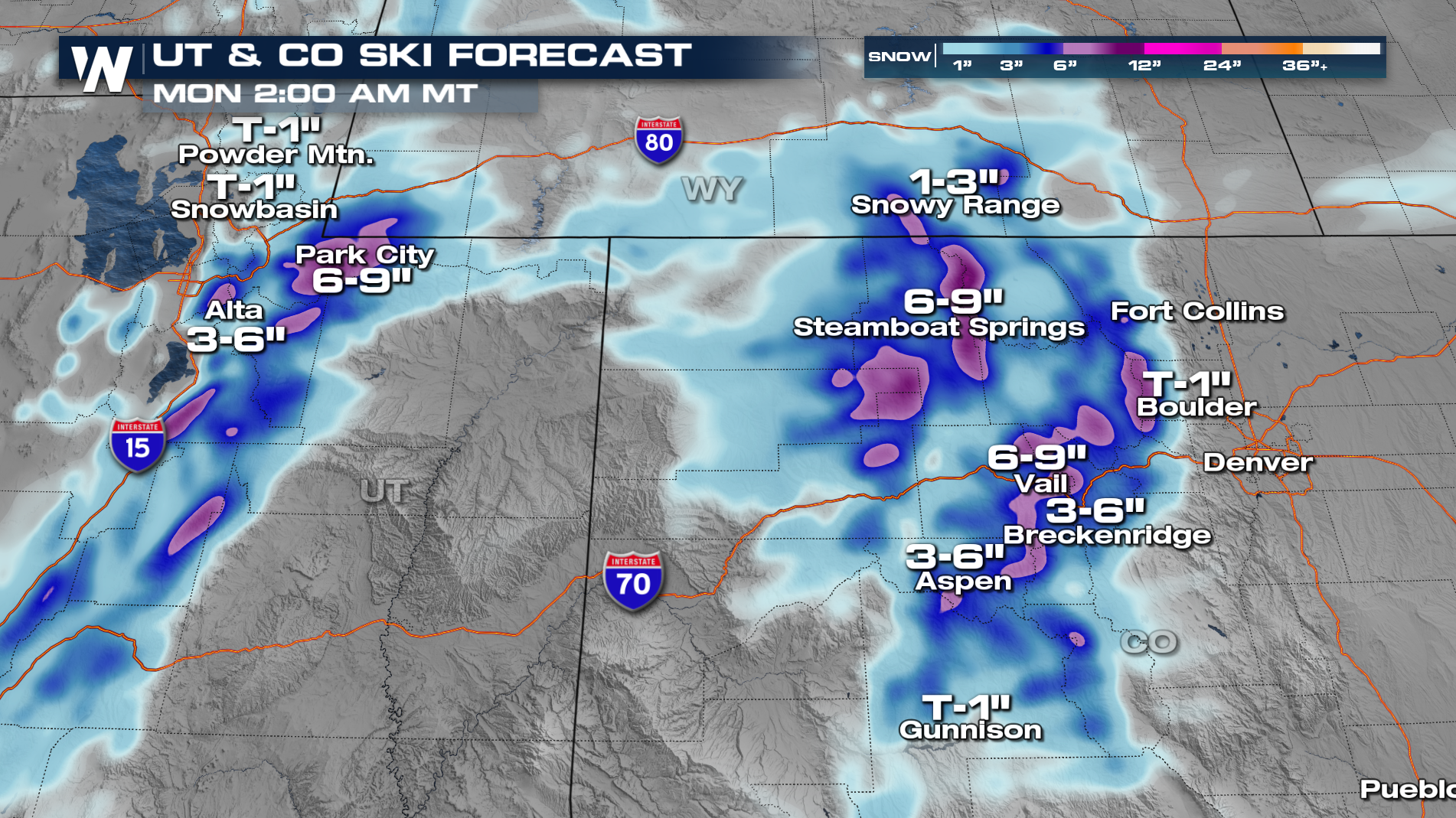 Tune into WeatherNation for the latest updates.
All Weather News
More
More Storms for the East Through Monday
A low-pressure system that moved through the
3 Aug 2026 12:20 PM


After Reaching Category 5, Genevieve Weakens in the Pacific
PacificGenevieve formed last Friday south of
3 Aug 2026 12:30 AM

Flooding, Severe Storms Target the Midwest Again
After an active week of storms across the nor
1 Aug 2026 1:40 AM

Flooding Risk Increases as Heavy Rain Targets the Tri-State Area
Tuesday, heavy rainfall moved across the Nort
30 Jul 2026 12:25 AM

Severe Weather: Energy From the Midwest Now in the Southeast
UPPER MIDWEST - Through Monday, dangerous tor
29 Jul 2026 10:30 PM