More Snow for the Central Appalachians Tonight
Special Stories
17 Jan 2021 3:10 PM
Snow has once again returned to the southern United States. In particular, the chance for wintry precipitation will remain in the weekend forecast for the Central Appalachians and parts of the Ohio and Tennessee Valleys.
This next wave of snow in the Ohio Valley is the next snow making system.
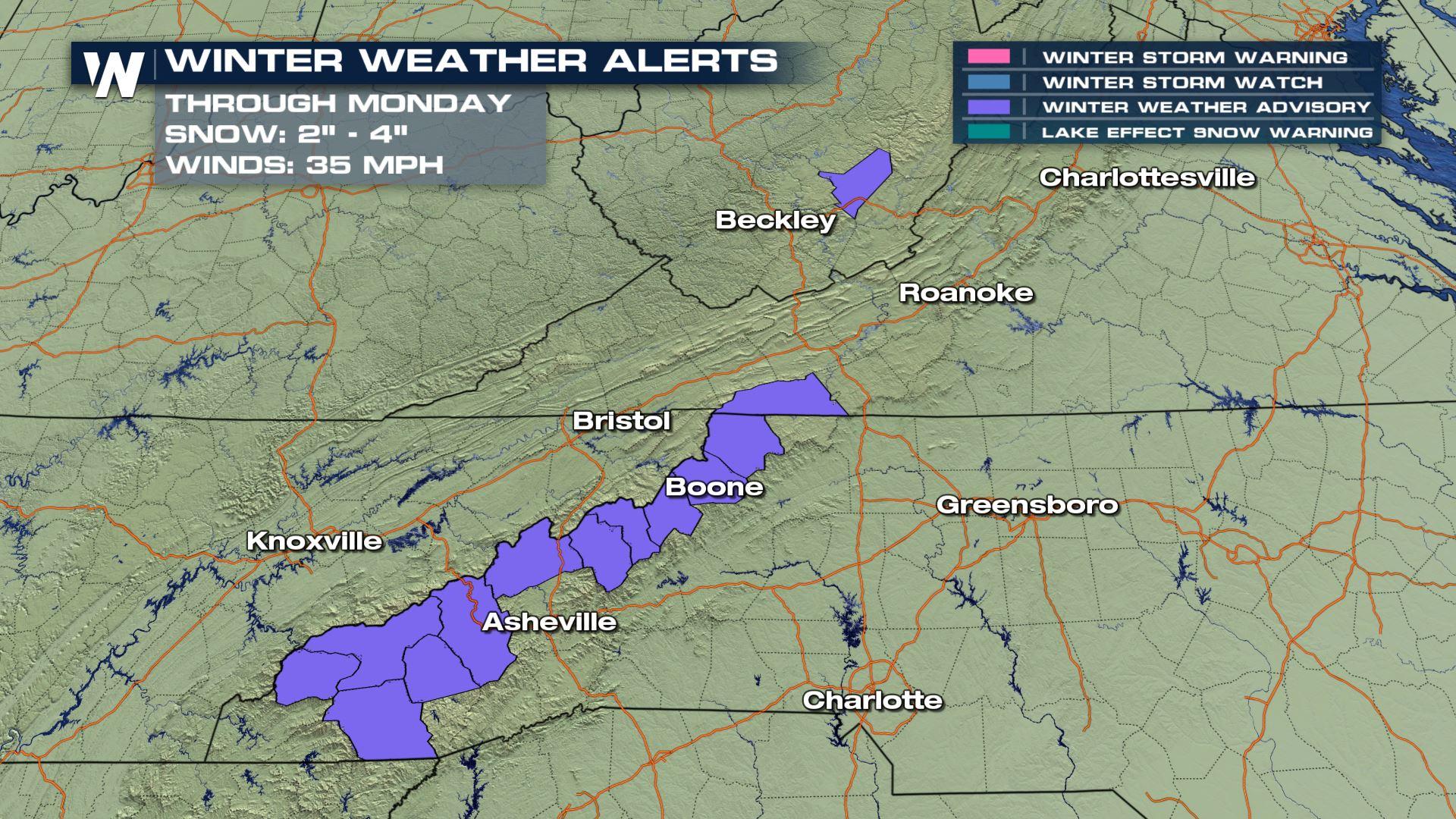
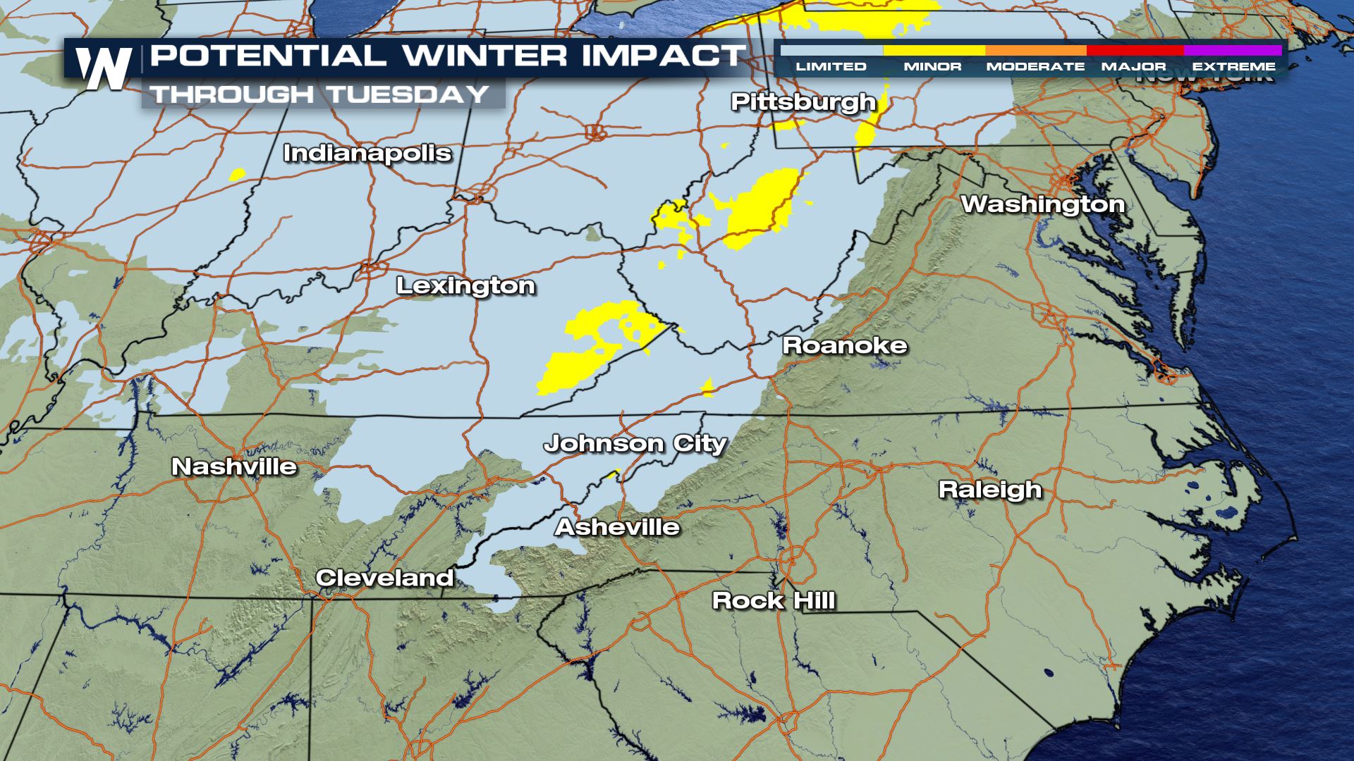
 Winter weather advisories are up tonight for the highest spots in the mountains.
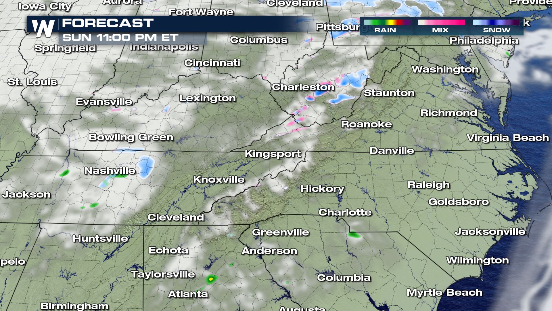
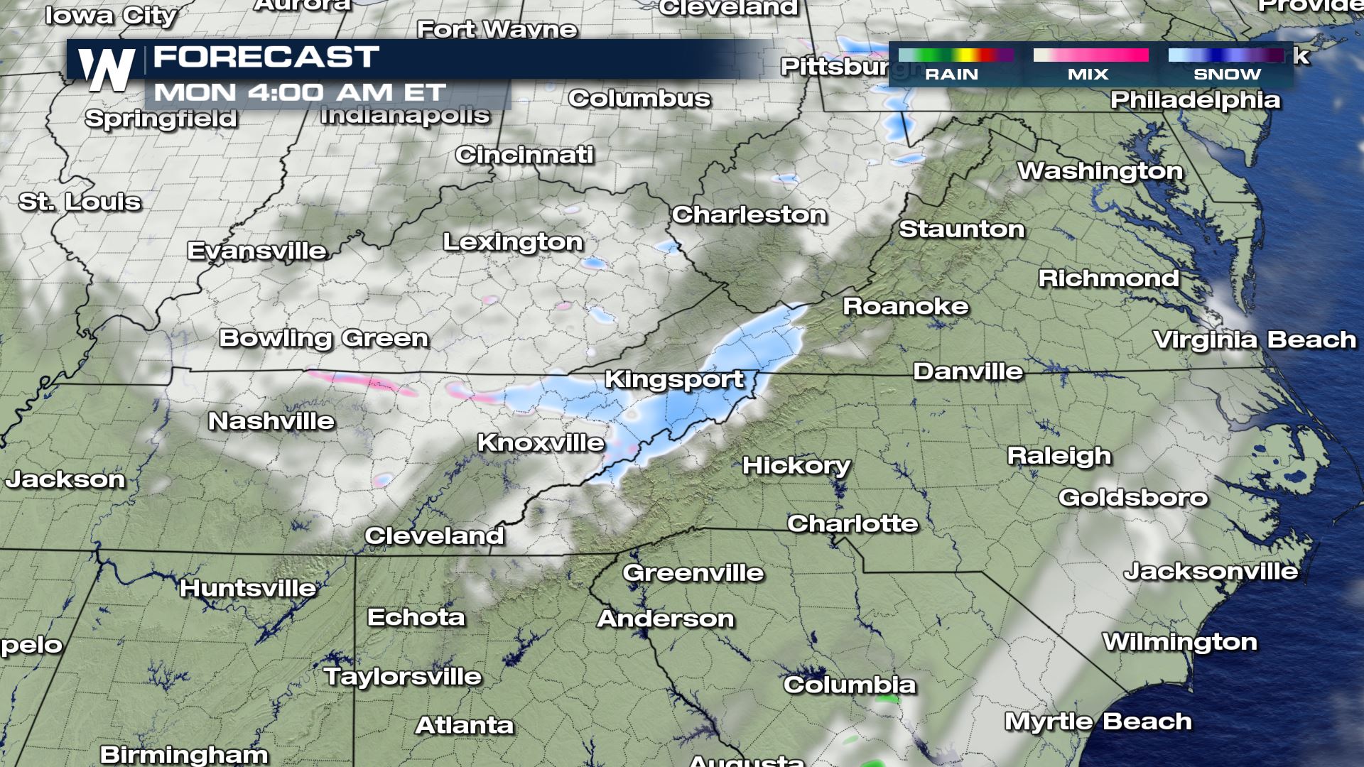
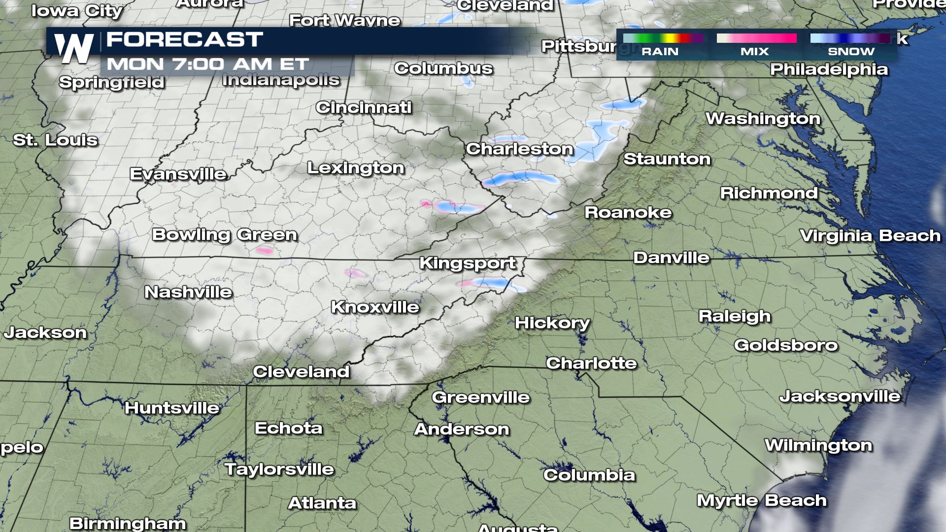
 Here's a timing of when the snow will fall.
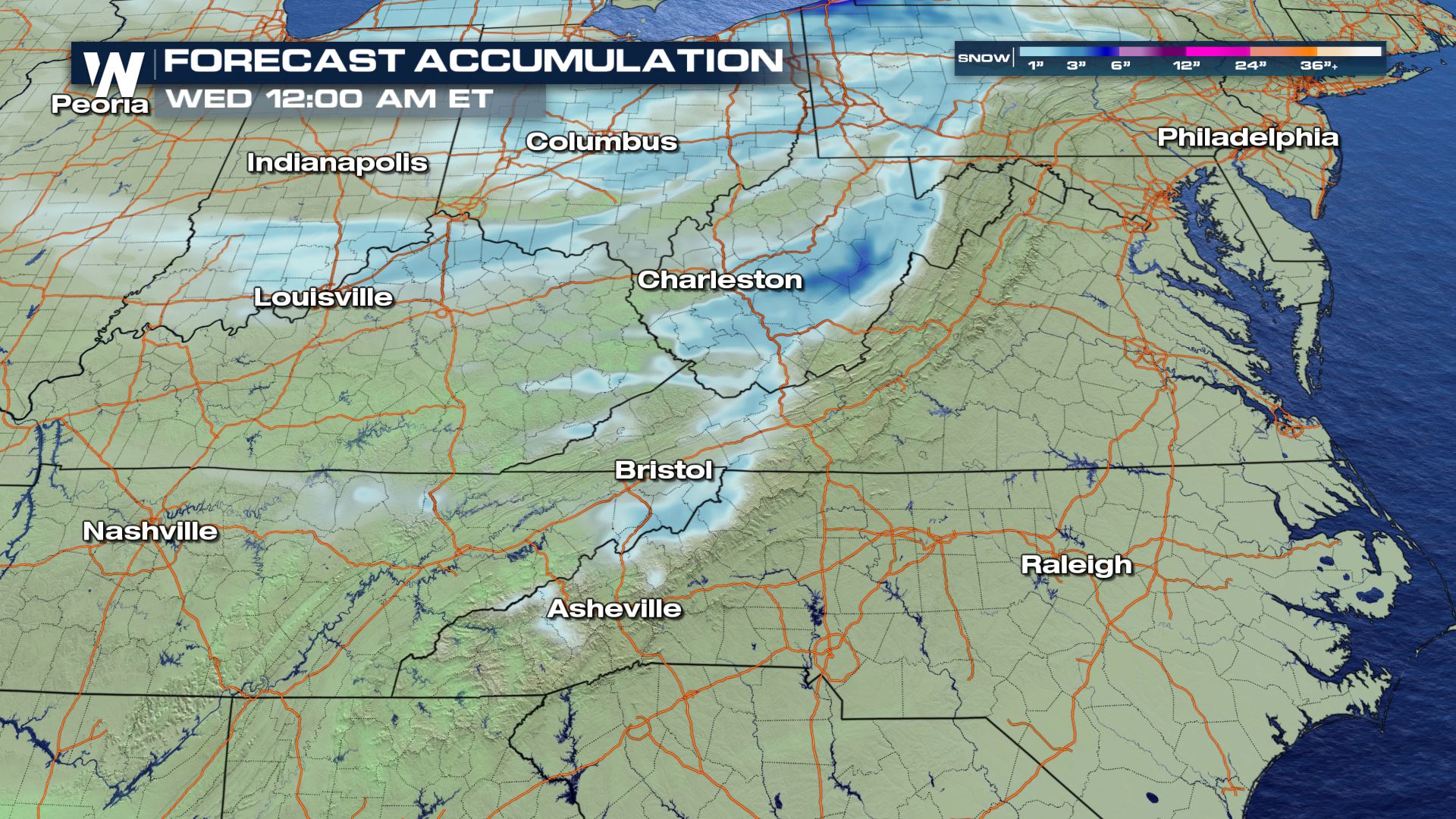
 Totals should come in on the lower end of amounts anticipated in these winter months on average.
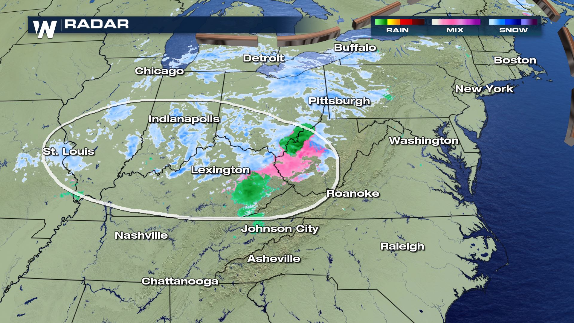
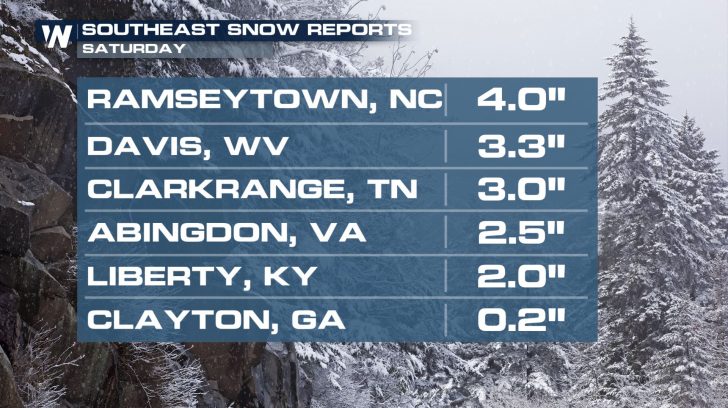
 Snow has already fallen in parts of Tennessee in the past few days.
https://twitter.com/WeatherNation/status/1350510630281728003
On Saturday, several inches of snow was observed in several states in the southern Appalachians region. Snow accumulated in the Louisville, Kentucky area and as far south as north Georgia and upstate South Carolina.
Snow has already fallen in parts of Tennessee in the past few days.
https://twitter.com/WeatherNation/status/1350510630281728003
On Saturday, several inches of snow was observed in several states in the southern Appalachians region. Snow accumulated in the Louisville, Kentucky area and as far south as north Georgia and upstate South Carolina.
 Impacts of the snow should be minimal. However, a brief snow squall or two may reduce visibility from time to time. Another concern may be wet roadways freezing during the overnight hours as temperatures drop off. Some patches of black ice will be possible.
 Be sure to join WeatherNation all weekend long as we track your top weather headlines from coast to coast.
Winter weather advisories are up tonight for the highest spots in the mountains.
Here's a timing of when the snow will fall.
Totals should come in on the lower end of amounts anticipated in these winter months on average.
Snow has already fallen in parts of Tennessee in the past few days.
https://twitter.com/WeatherNation/status/1350510630281728003
On Saturday, several inches of snow was observed in several states in the southern Appalachians region. Snow accumulated in the Louisville, Kentucky area and as far south as north Georgia and upstate South Carolina.
Impacts of the snow should be minimal. However, a brief snow squall or two may reduce visibility from time to time. Another concern may be wet roadways freezing during the overnight hours as temperatures drop off. Some patches of black ice will be possible.
Be sure to join WeatherNation all weekend long as we track your top weather headlines from coast to coast.All Weather News
More
Wildfire Outbreak in the Pacific Northwest
SPOKANE, WA - On Saturday, August 1st, the Ol
2 Aug 2026 7:20 PM

More Storms for the East Through Monday
A low-pressure system that moved through the
2 Aug 2026 7:20 PM


After Reaching Category 5, Genevieve Weakens in the Pacific
PacificGenevieve formed on last Friday south
2 Aug 2026 6:25 PM

Flooding, Severe Storms Target the Midwest Again
After an active week of storms across the nor
1 Aug 2026 1:40 AM

Flooding Risk Increases as Heavy Rain Targets the Tri-State Area
Tuesday, heavy rainfall moved across the Nort
30 Jul 2026 12:25 AM

Severe Weather: Energy From the Midwest Now in the Southeast
UPPER MIDWEST - Through Monday, dangerous tor
29 Jul 2026 10:30 PM