Snowpack Impacts of Stagnant Winter Pattern
Special Stories
20 Feb 2019 6:35 PM
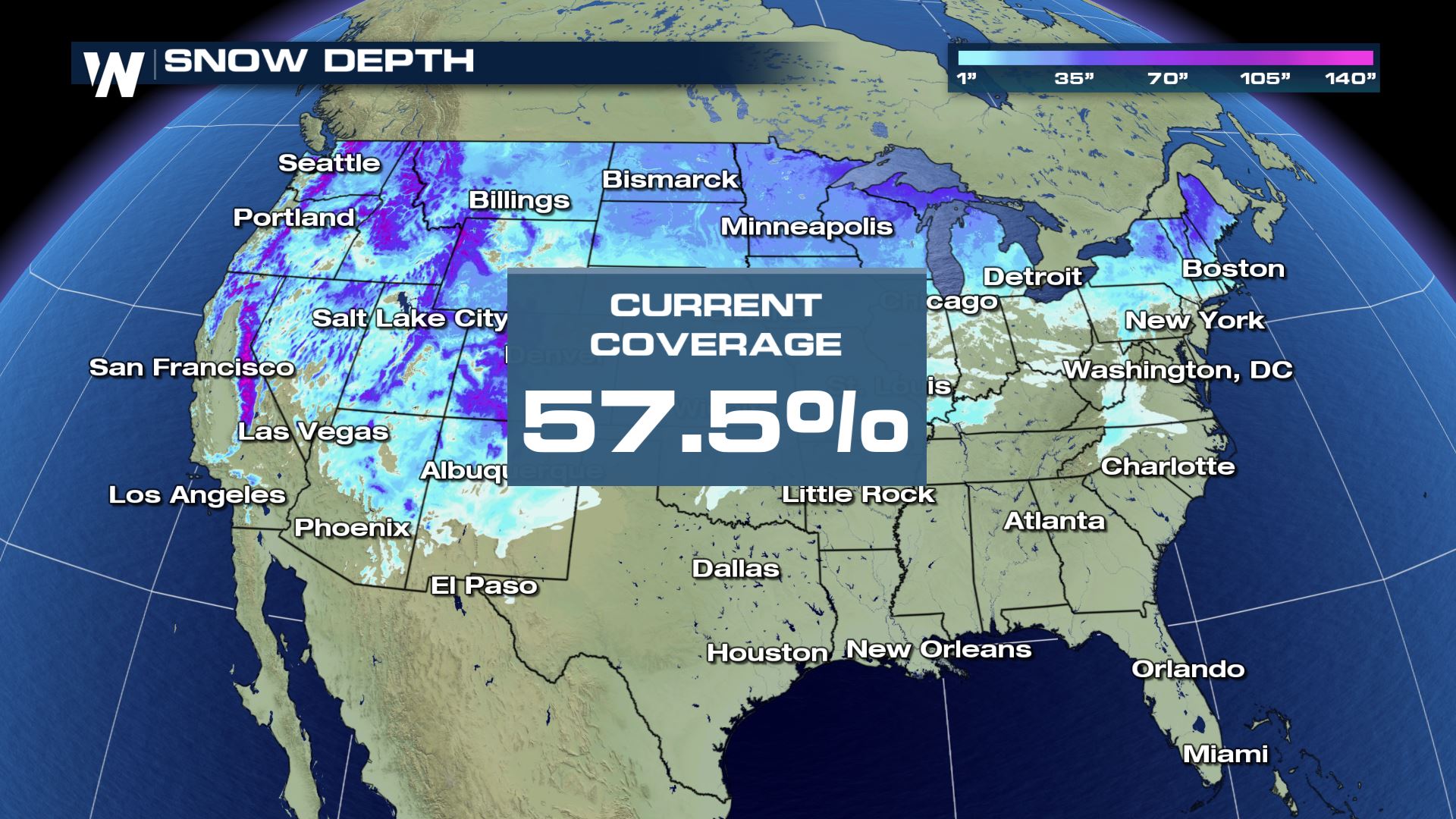
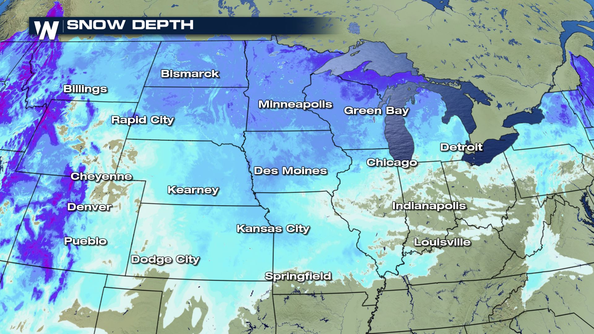
With the forecast pattern remaining relatively unchanged over the past week, a lot of the same areas from California to the southeast have seen relentless rain and snow. In terms of snow, its really starting to add up. In fact, Tuesday February 19, 2019 saw the highest snow coverage for that date in 16 years of recorded history. On February 20, 2019, 57.5% of the United States had measurable snow on the ground.
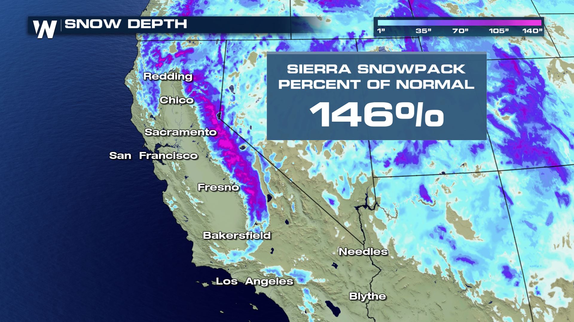
 For many, it's meant driving headaches and a seemingly endless winter. For others, it's money in the bank. Mountain snowpack is a major contributor to spring and summer drinking water. The Sierra Nevada snowpack jumped above average at the beginning of February. Since then, the mountain range is now up to 146% of average. Sierra snowmelt is responsible for 30% of California's drinking water.
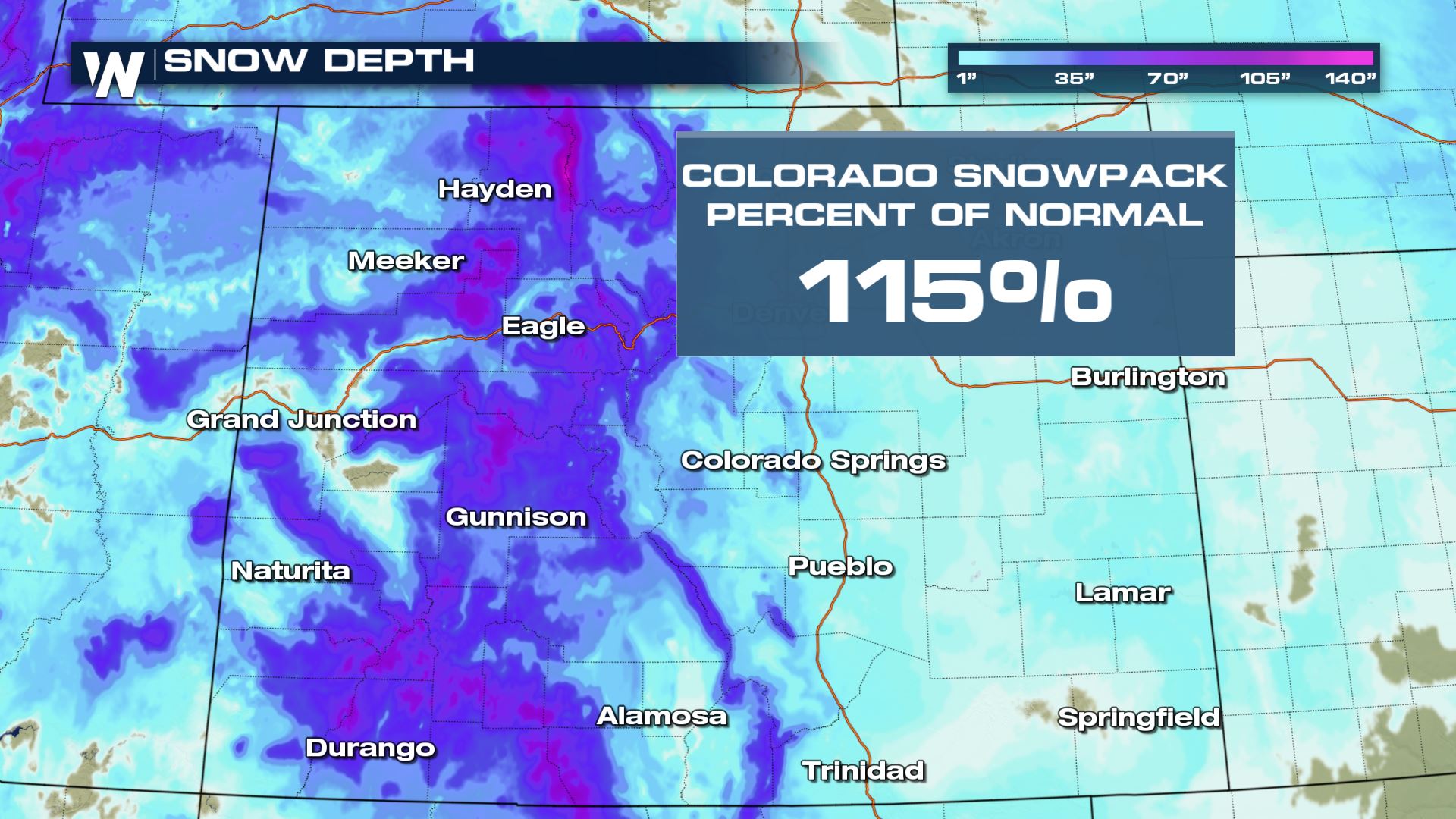
Statewide snowpack in Colorado got off to a sluggish start, but recent snow events have pushed every basin above the year to date average. These numbers will be crucial leading into spring. As of February 12, more than 20% of Colorado was experiencing extreme or exceptional drought.
For many, it's meant driving headaches and a seemingly endless winter. For others, it's money in the bank. Mountain snowpack is a major contributor to spring and summer drinking water. The Sierra Nevada snowpack jumped above average at the beginning of February. Since then, the mountain range is now up to 146% of average. Sierra snowmelt is responsible for 30% of California's drinking water.
Statewide snowpack in Colorado got off to a sluggish start, but recent snow events have pushed every basin above the year to date average. These numbers will be crucial leading into spring. As of February 12, more than 20% of Colorado was experiencing extreme or exceptional drought.
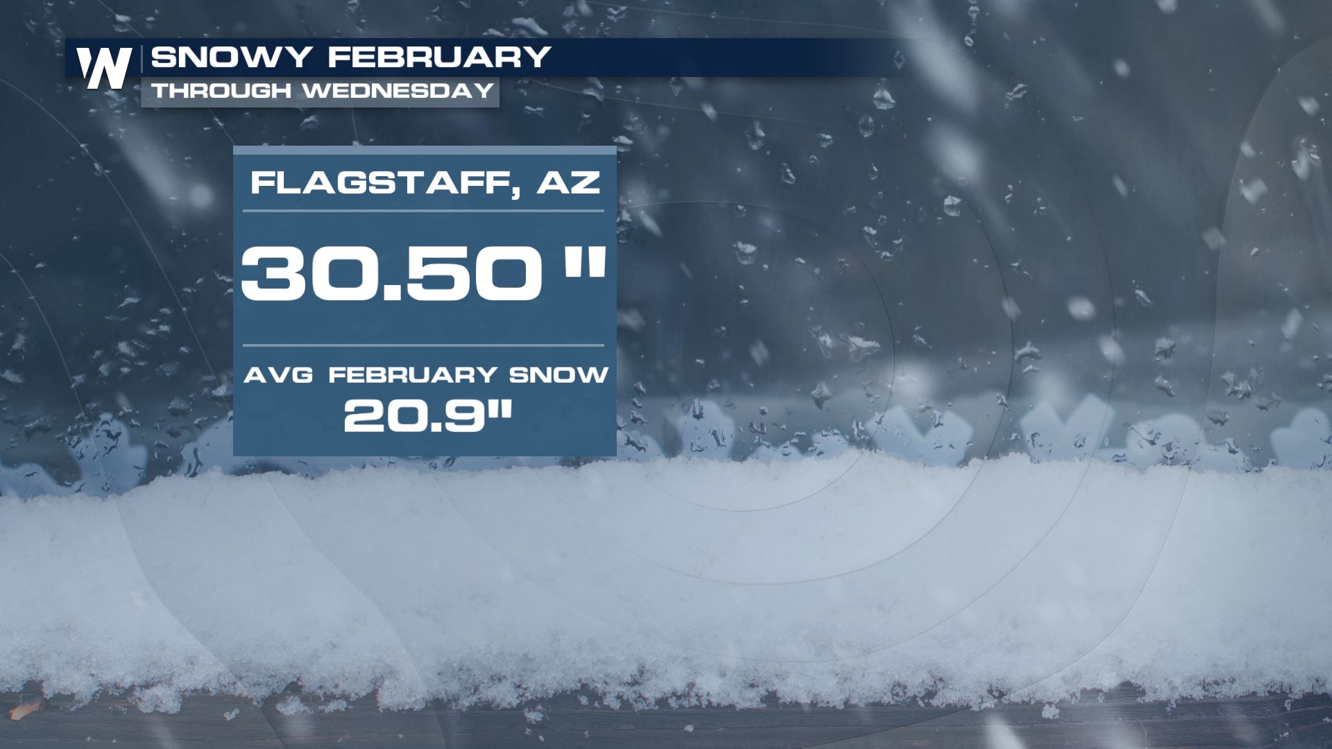
 Arizona has seen an abundance of recent snowfall, with much more on the way. Normally, Flagstaff sees around 21" of snow for the entire month of February. They have already seen 30.5" with a forecast of 1-2 feet by the weekend.
 The Jetstream pattern has generally led these storm systems from coast to coast. For several cities in the north central US, that has meant their snowiest February on record. Here are a few records broken after the latest round of snow in the Upper Midwest:
Twin Cities, MN: 31.5" (tenth snowiest month on record)
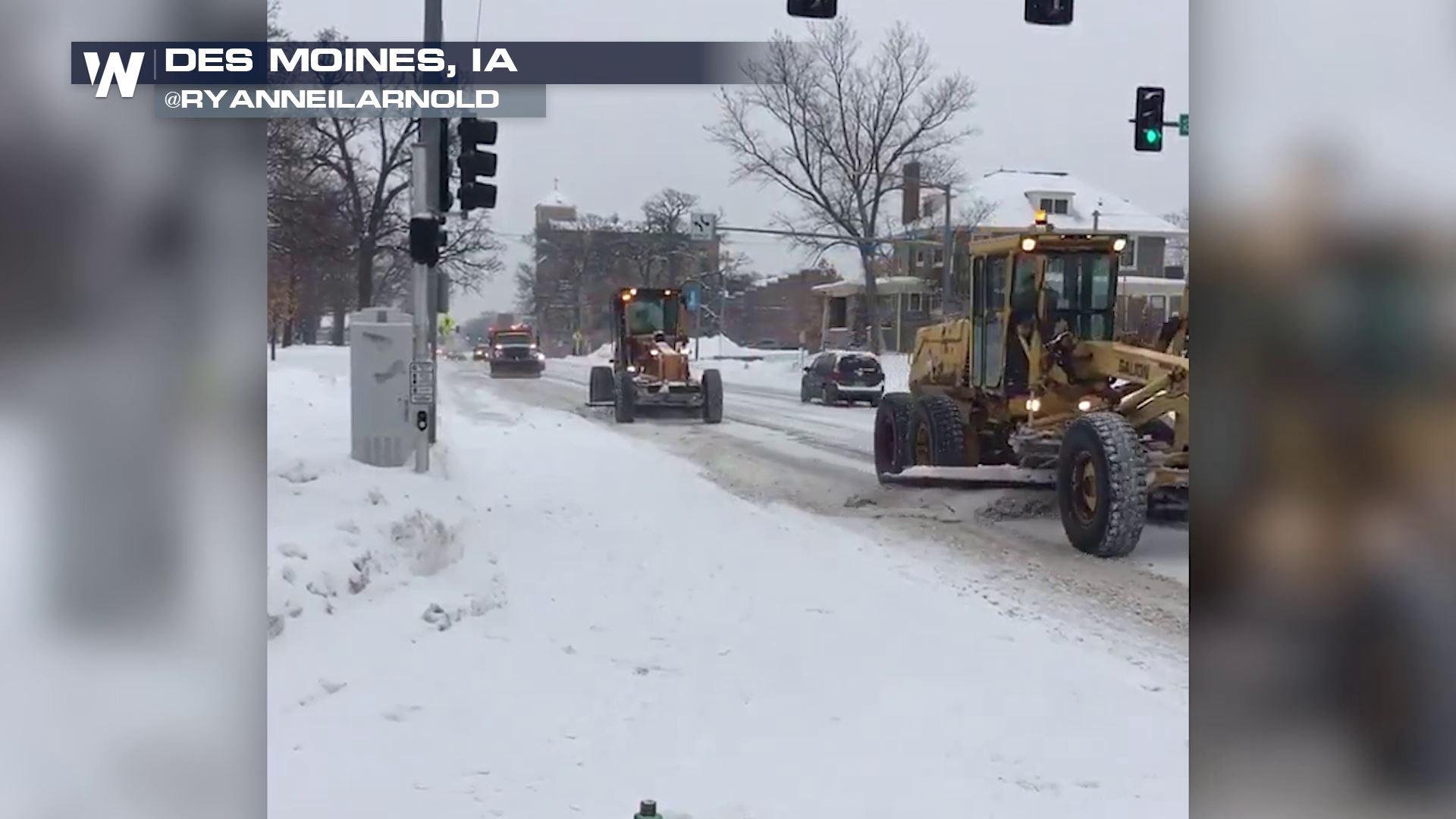
Des Moines, IA: 22.9"
St. Cloud, MN: 23.4"
Eau Claire, WI: 33.5"
Wasau, WI: 38.5" (also snowiest month on record)
The Jetstream pattern has generally led these storm systems from coast to coast. For several cities in the north central US, that has meant their snowiest February on record. Here are a few records broken after the latest round of snow in the Upper Midwest:
Twin Cities, MN: 31.5" (tenth snowiest month on record)
Des Moines, IA: 22.9"
St. Cloud, MN: 23.4"
Eau Claire, WI: 33.5"
Wasau, WI: 38.5" (also snowiest month on record)
 For WeatherNation, Meteorologist Karissa Klos.
For many, it's meant driving headaches and a seemingly endless winter. For others, it's money in the bank. Mountain snowpack is a major contributor to spring and summer drinking water. The Sierra Nevada snowpack jumped above average at the beginning of February. Since then, the mountain range is now up to 146% of average. Sierra snowmelt is responsible for 30% of California's drinking water.
Statewide snowpack in Colorado got off to a sluggish start, but recent snow events have pushed every basin above the year to date average. These numbers will be crucial leading into spring. As of February 12, more than 20% of Colorado was experiencing extreme or exceptional drought.
Arizona has seen an abundance of recent snowfall, with much more on the way. Normally, Flagstaff sees around 21" of snow for the entire month of February. They have already seen 30.5" with a forecast of 1-2 feet by the weekend.
The Jetstream pattern has generally led these storm systems from coast to coast. For several cities in the north central US, that has meant their snowiest February on record. Here are a few records broken after the latest round of snow in the Upper Midwest:
Twin Cities, MN: 31.5" (tenth snowiest month on record)
Des Moines, IA: 22.9"
St. Cloud, MN: 23.4"
Eau Claire, WI: 33.5"
Wasau, WI: 38.5" (also snowiest month on record)
For WeatherNation, Meteorologist Karissa Klos.All Weather News
More
Wildfire Outbreak in the Pacific Northwest
Conditions have been incredibly dry out west.
2 Aug 2026 1:30 PM

After Reaching Category 5, Genevieve Weakens in the Pacific
PacificGenevieve formed on last Friday south
2 Aug 2026 1:25 PM

More Storms for the East Sunday and Monday
A low-pressure system crashing through the Mi
2 Aug 2026 1:25 PM


Flooding, Severe Storms Target the Midwest Again
After an active week of storms across the nor
1 Aug 2026 1:40 AM

Flooding Risk Increases as Heavy Rain Targets the Tri-State Area
Tuesday, heavy rainfall moved across the Nort
30 Jul 2026 12:25 AM

Severe Weather: Energy From the Midwest Now in the Southeast
UPPER MIDWEST - Through Monday, dangerous tor
29 Jul 2026 10:30 PM