Southeast Deals with More Storms & Heat
If you're wondering if Beryl will impact Southeast states, the threat stays mostly west of the Mississippi River, but southerly flow enhances moisture and dewpoints across the area, raising heat index values and contributing to a few "tropical-esq" thunderstorms. The heat mixed with some ambient moisture creates a setup to see afternoon storms and showers around for much of our Monday. Don't be too surprised if scattered afternoon showers become a bit of a trend as we head into the middle of the week.
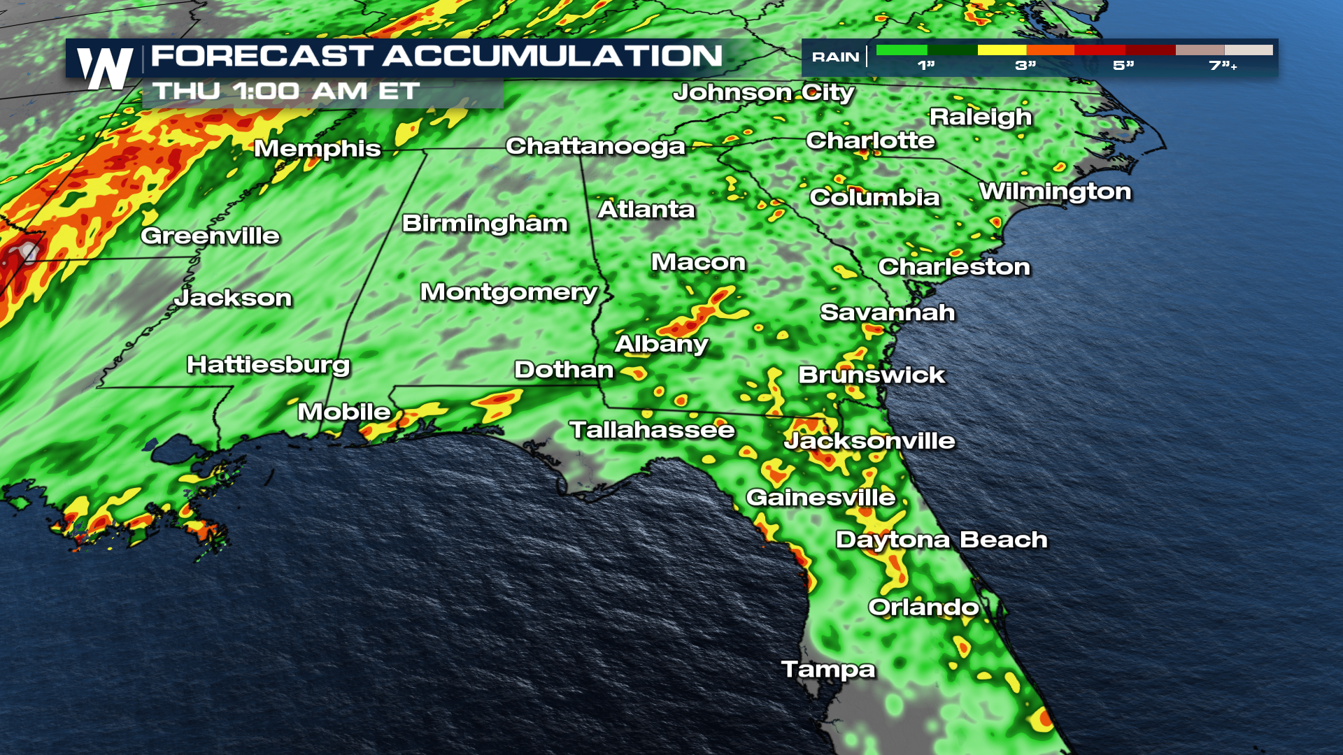
Many places have already piled up 1-3" of rain in the last 24 hours. In addition to the rain that has already fallen, some spots could see 2-4" of more rain by Wednesday evening. Localized flash flooding concerns will be an issue for a few places. Pay extra attention to the forecast if you live in a more flood-prone area.
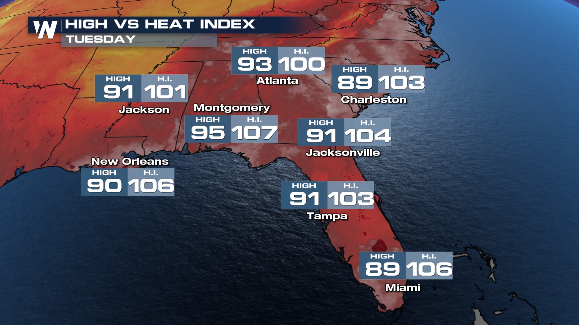
 Heat index values will remain well into the 100s on Tuesday as dew points remain in the 70s and even the 80s. Take care of yourself in these hot temperatures and avoid spending too much time outside.
