Southeast Severe Threat
Special Stories
29 Dec 2020 11:14 AM
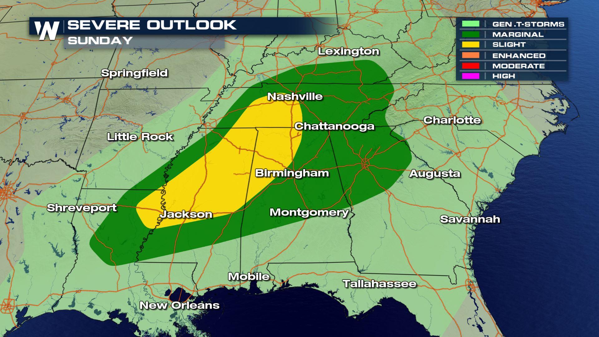
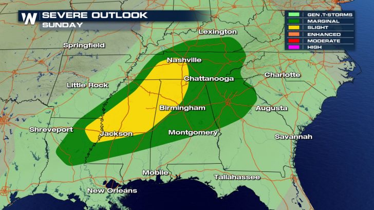
SEVERE OUTLOOK
 Areas in the southeast will have a severe weather threat for today.
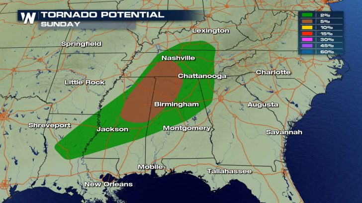
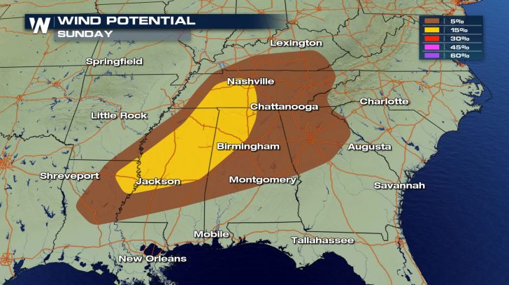
The main threats will be the risk for damaging winds and isolated tornadoes.
Winds could reach up to 70 mph within some of these storms.
Areas in the southeast will have a severe weather threat for today.
The main threats will be the risk for damaging winds and isolated tornadoes.
Winds could reach up to 70 mph within some of these storms.
FORECAST
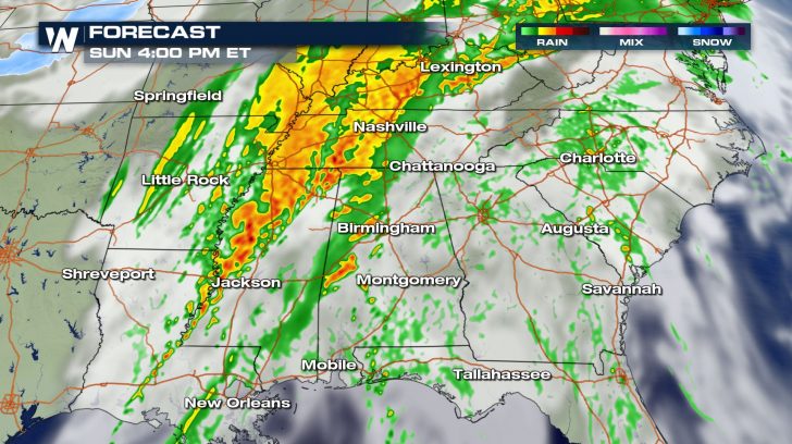
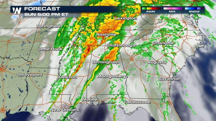
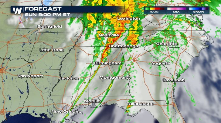 Storms will likely start up around 3 PM and last until 9 PM.
These storms could also come with heavy downpours, so ponding on roads might be possible.
Low visibility could also be possible so drive slowly through these storms.
Storms will likely start up around 3 PM and last until 9 PM.
These storms could also come with heavy downpours, so ponding on roads might be possible.
Low visibility could also be possible so drive slowly through these storms.
FORECAST RAINFALL
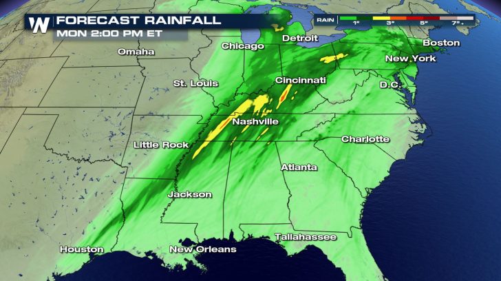 Rainfall totals will not be extremely high but up to 3 inches will be possible, especially through northern Mississippi, Tennessee, and Kentucky.
All Weather News
More
Fronts Continue To Spark Severe Weather Across the Plains
A cold front that brought record lows to the
18 Jul 2025 10:40 PM

Extreme Heat Impacts for the East Coast & South
Extreme heat continues to impact several area
18 Jul 2025 10:05 PM

Flooding Threat Remains Elevated in the East
A cold front pushing through the Eastern Seab
18 Jul 2025 9:10 PM

EF-2 Firenado from the Deer Creek Fire in Utah
A fire tornado was spotted near La Sal, Utah
18 Jul 2025 7:30 AM

Tropical System Brings Flood Risk to the Central Gulf
Time has run out for notable tropical develop
18 Jul 2025 3:05 AM

Heavy Rain, Flooding Threat Returns to Florida
Keep the rain boots handy in Florida - heavy
13 Jul 2025 12:50 PM

Severe Storm Risk Pushes into the Great Lakes, Ohio Valley
Friday was another busy day with severe weath
12 Jul 2025 8:00 PM