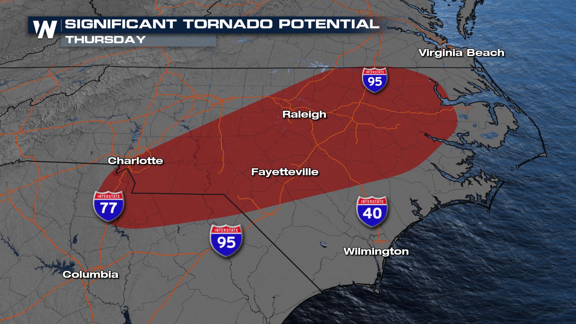
Carolinas Severe Weather Threat Thursday
Special Stories
18 Mar 2021 7:00 AM
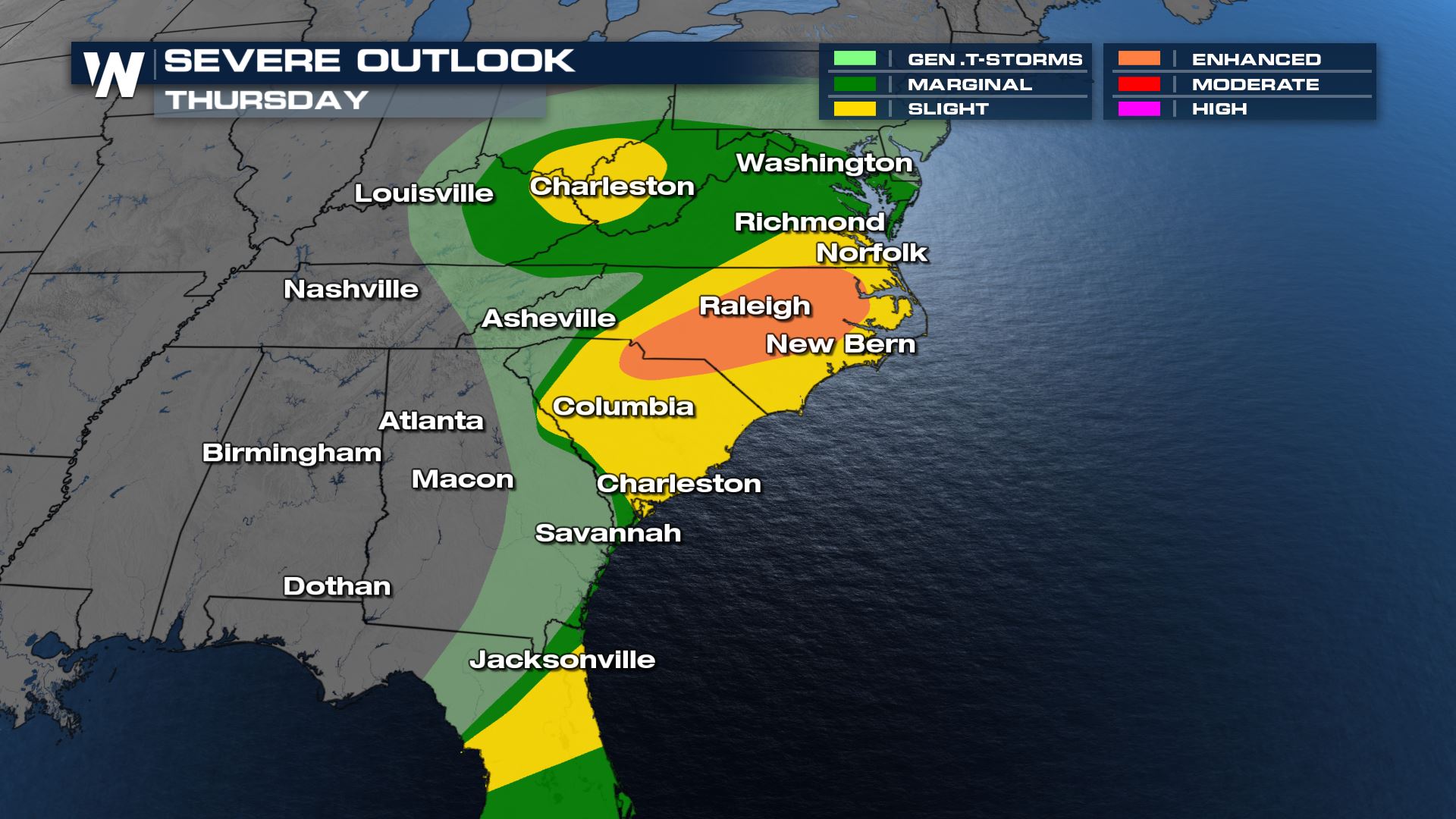
A strong low pressure system spawned tornadoes and severe weather across the Deep South over the last 24 hours. This storm system will provide a risk for severe thunderstorms once again today (Thursday). The Storm Prediction Center has shrunk the enhanced for severe storms because based on the latest track, as the system is moving quicker than our earlier forecast models.
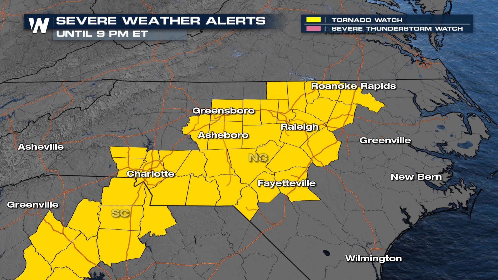
This means that the front will be in the Atlantic Ocean quicker and therefore less opportunity to tap into daytime heating for severe storms. A Tornado Watch is in effect for central North Carolina through 9 PM ET.
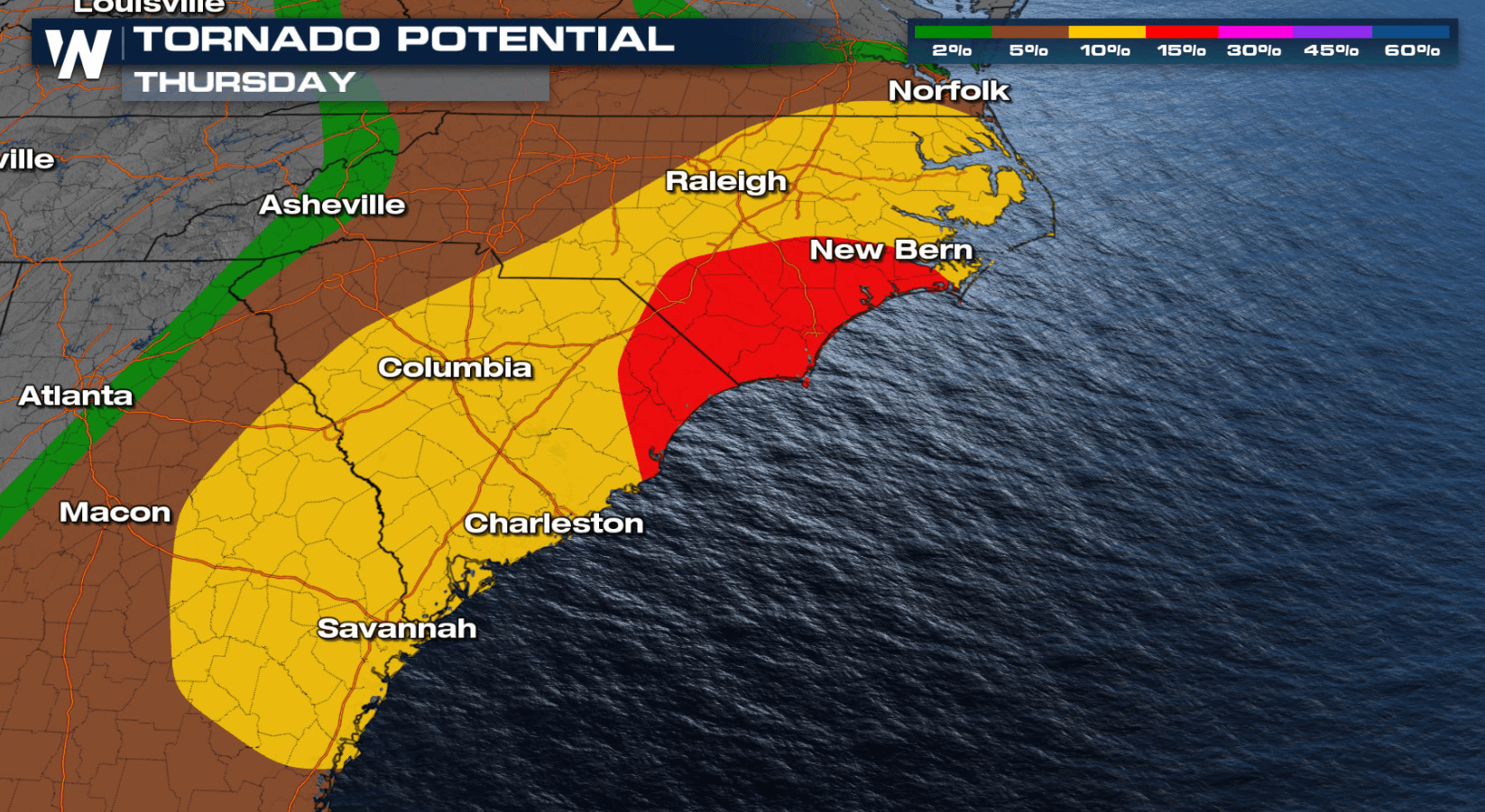
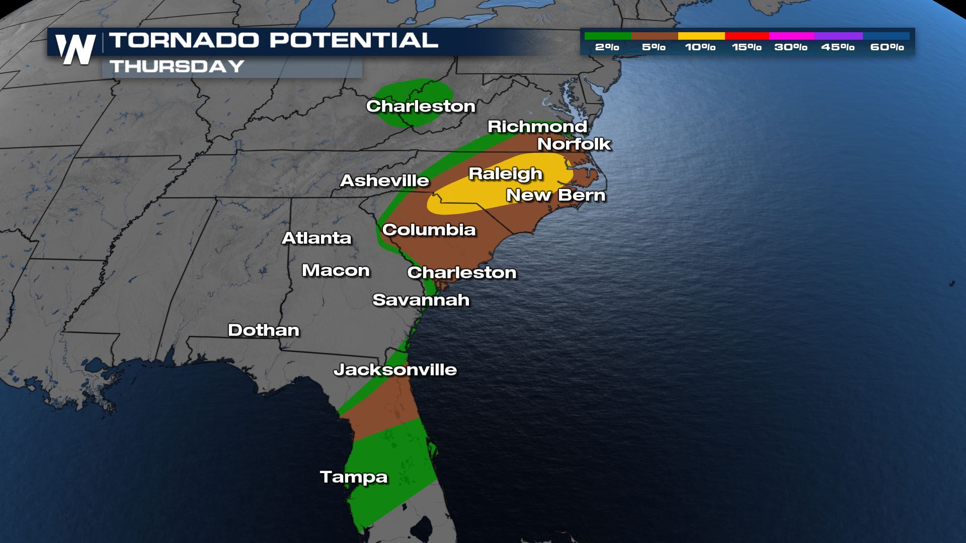 Supercells are possible with the potential for isolated, but significant tornadoes. Impressive wind shear (wind direction changing with height) is forecast to be present, sustaining severe thunderstorms and aiding in tornado development. As the evening progresses, the tornado threat is really concentrated into central North Carolina.
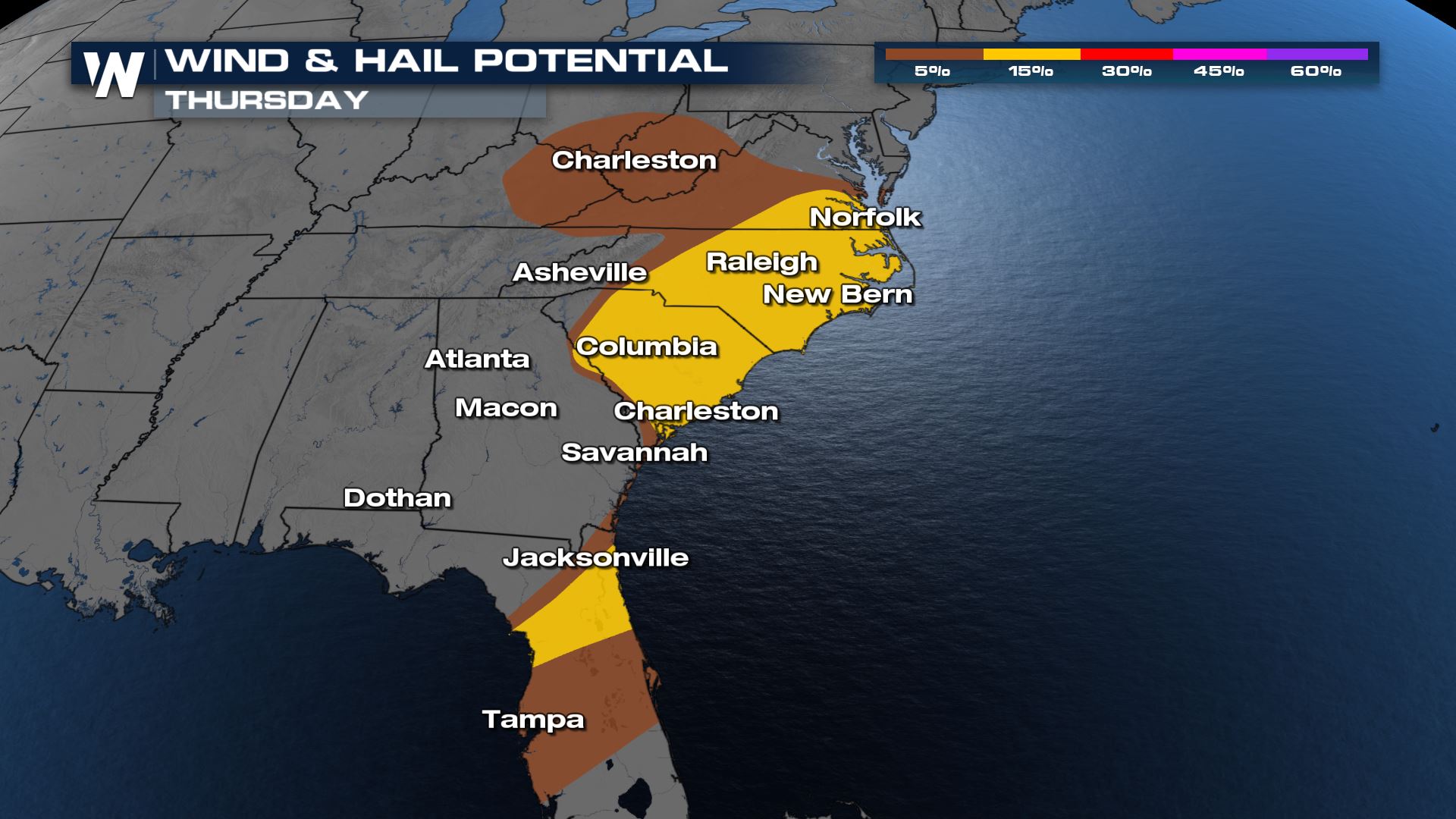 Damaging wind gusts, greater than 58 mph, are the biggest threat on Thursday. Large hail is also a concern, greater than 1" in diameter.
 WeatherNation will keep you updated on the potential for severe thunderstorms across the Southeast.
Tornado Potential
Supercells are possible with the potential for isolated, but significant tornadoes. Impressive wind shear (wind direction changing with height) is forecast to be present, sustaining severe thunderstorms and aiding in tornado development. As the evening progresses, the tornado threat is really concentrated into central North Carolina.
Wind and Hail Threat
Damaging wind gusts, greater than 58 mph, are the biggest threat on Thursday. Large hail is also a concern, greater than 1" in diameter.
Forecast
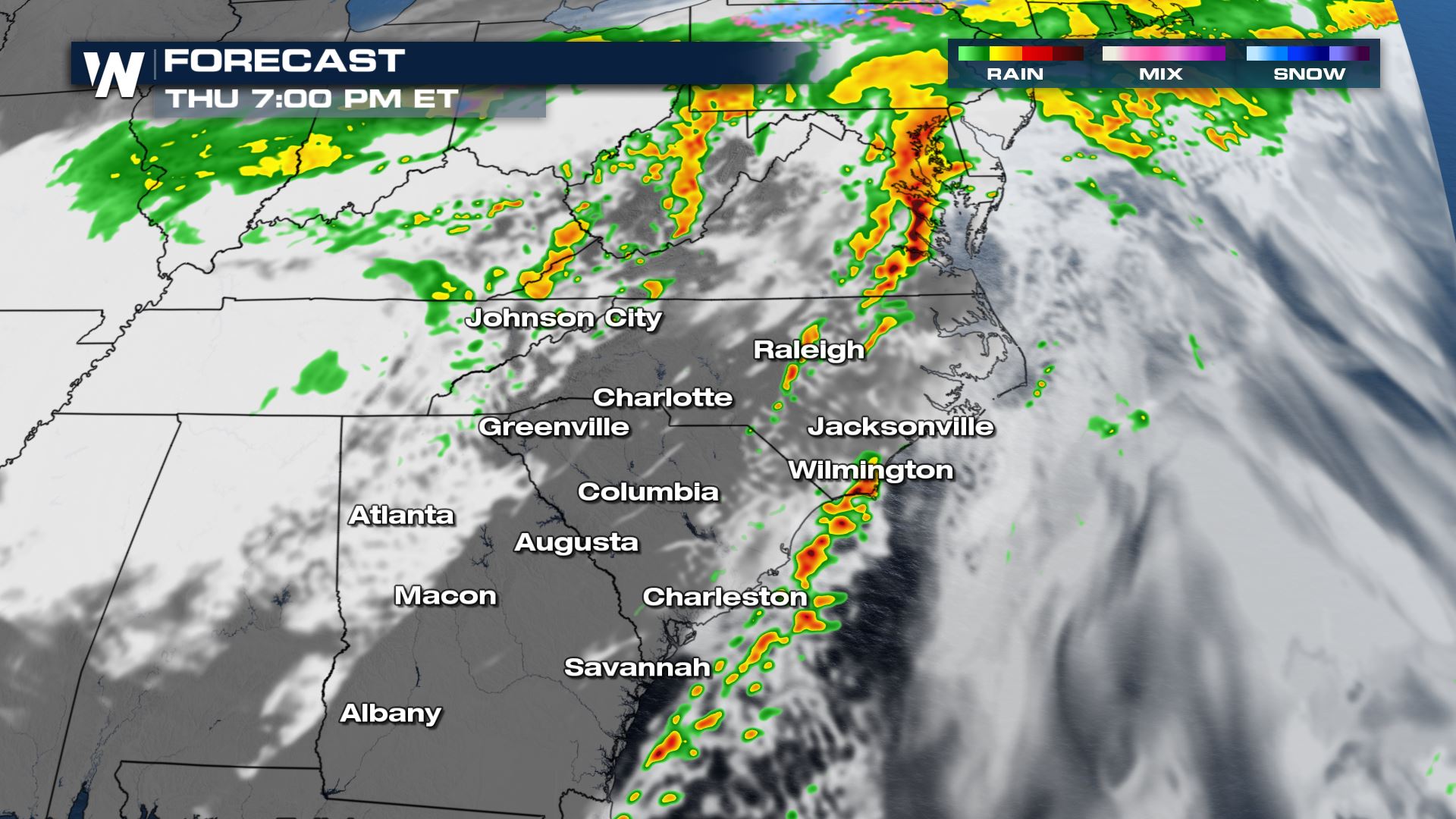
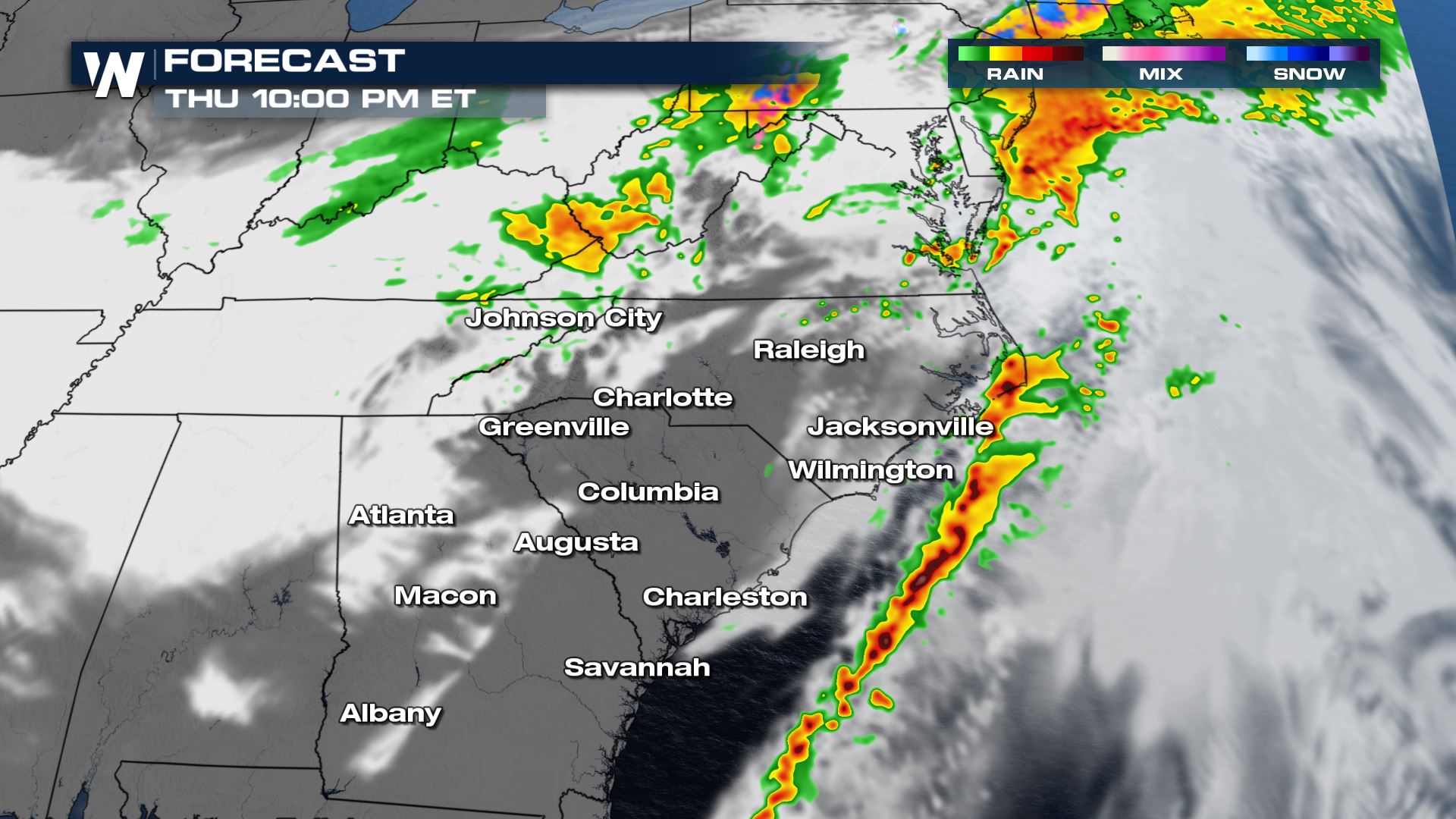
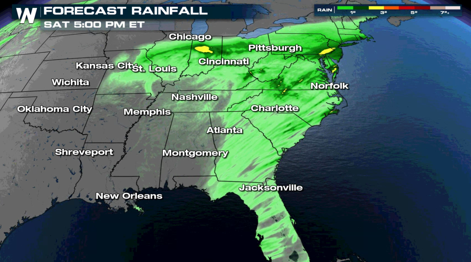
Storms will continue to move east this evening, finally pushing offshore by midnight ET. Heavy rain is expected from DC through the Carolinas, but the severe threat will be focused south of Virgina.
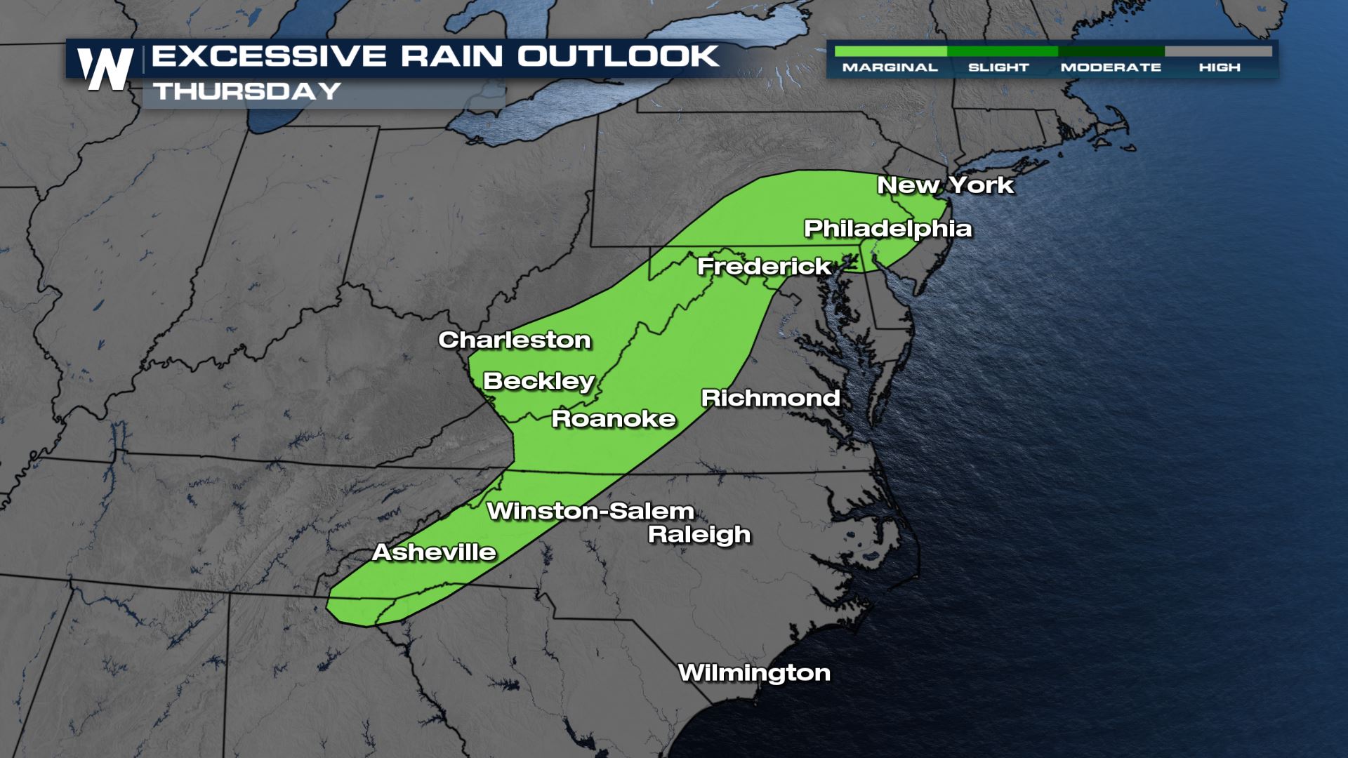
Rainfall and Flooding
The forecast not only includes severe thunderstorm chances, but also soaking rainfall. Flooding is a concern for areas that see multiple lines of thunderstorms.
WeatherNation will keep you updated on the potential for severe thunderstorms across the Southeast.All Weather News
More
Fronts Continue To Spark Severe Weather Across the Plains
A cold front that brought record lows to the
18 Jul 2025 10:40 PM

Extreme Heat Impacts for the East Coast & South
Extreme heat continues to impact several area
18 Jul 2025 10:05 PM

Flooding Threat Remains Elevated in the East
A cold front pushing through the Eastern Seab
18 Jul 2025 9:10 PM

EF-2 Firenado from the Deer Creek Fire in Utah
A fire tornado was spotted near La Sal, Utah
18 Jul 2025 7:30 AM

Tropical System Brings Flood Risk to the Central Gulf
Time has run out for notable tropical develop
18 Jul 2025 3:05 AM

Heavy Rain, Flooding Threat Returns to Florida
Keep the rain boots handy in Florida - heavy
13 Jul 2025 12:50 PM

Severe Storm Risk Pushes into the Great Lakes, Ohio Valley
Friday was another busy day with severe weath
12 Jul 2025 8:00 PM