Southeast Storm Risk on Memorial Day
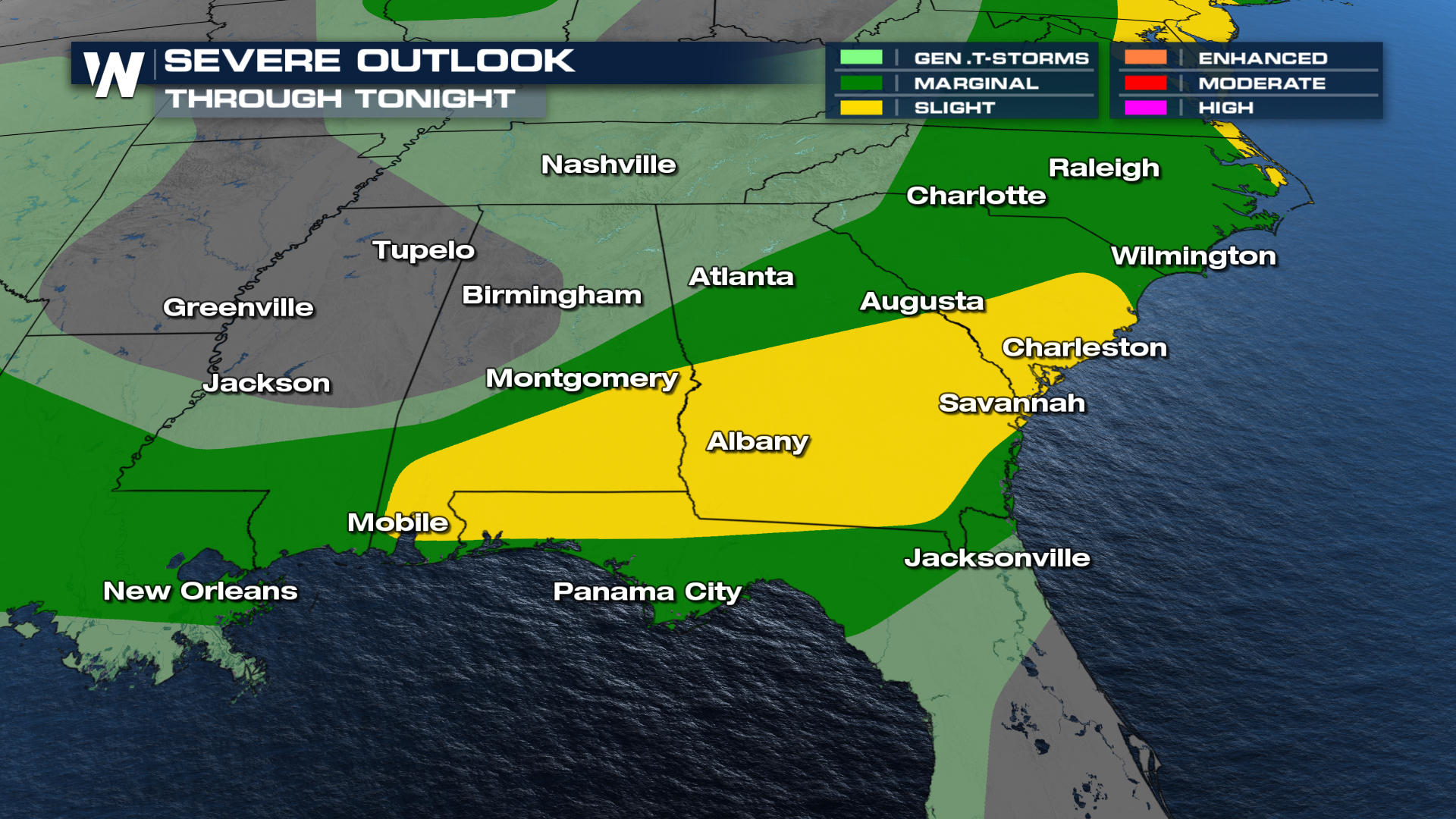
The Storm Prediction Center has kept a SLIGHT (level 2 out of 5) risk for severe storms through tonight across the southeastern United States. Severe thunderstorm watches and tornado watches have been issued from Alabama through North Carolina.
Large hailstones, strong damaging winds, and tornadoes will all be possible. Please don't let severe weather fatigue get to you - have a plan for storms. It only takes one storm to impact you.
 In the wake of yesterday's storms, ongoing storms have been pushing through portions of the southeast. We expect the incoming cold front to trigger additional storm development through the overnight hours. This includes the potential for supercells capable of producing large hail, before possibly organizing into multicell clusters or lines through tonight.
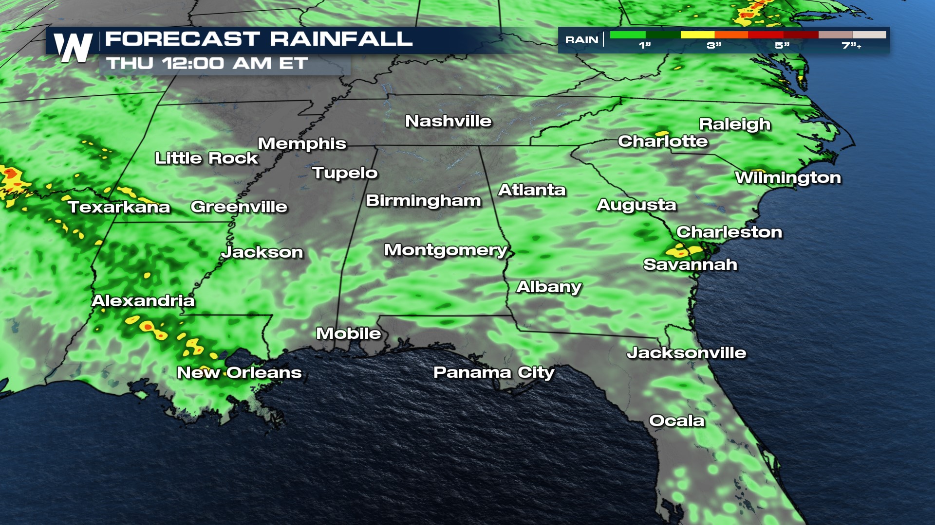
Localized flash flooding does pose a threat throughout the day. We have marginal and slight risks issued by the Weather Prediction Center (WPC). Some places run the risk of seeing upwards of 3+" of rain over the next few days. Not only is flash flooding possible in localized areas, but more flood-prone areas could easily run into some problems. Remember to turn around, don't drown!

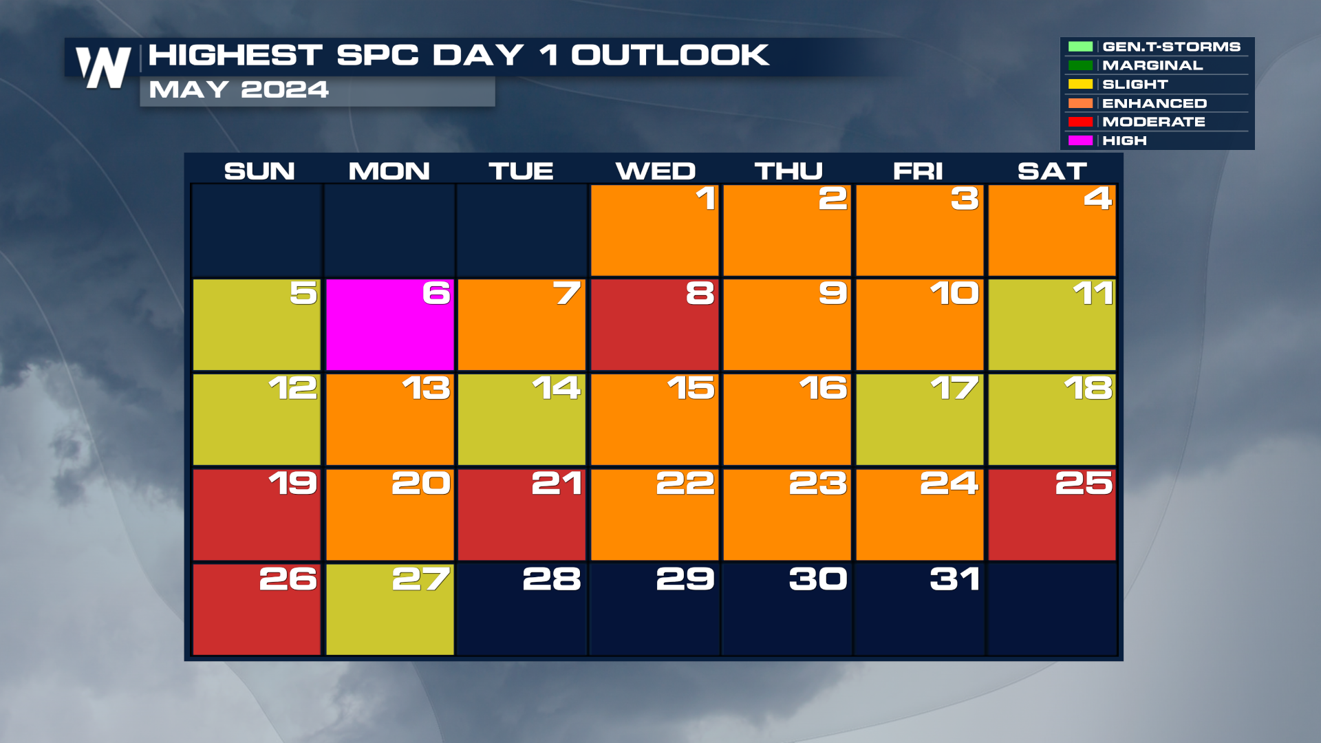
While we typically see our most active severe weather months in April and May, this year has been extremely active, with the second most tornadoes on record, after the historic 2011 season. So far there have been 904 tornadoes since January 1st with 80% of them occurring in the last two months of April and May. Every single day this month has brought a risk of severe weather, most at a level 3 out of 5 or higher.
