Southern Plains Severe Storm Risk Wednesday
Top Stories
9 Oct 2019 11:19 AM
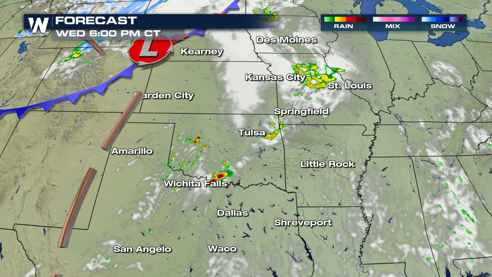
The large trough moving through the Rockies will allow energy to build over the Southern Plains Wednesday afternoon and evening. This particular set-up could lead to a risk of severe storms from northwest Texas into the Mississippi Valley. Here is the very latest.
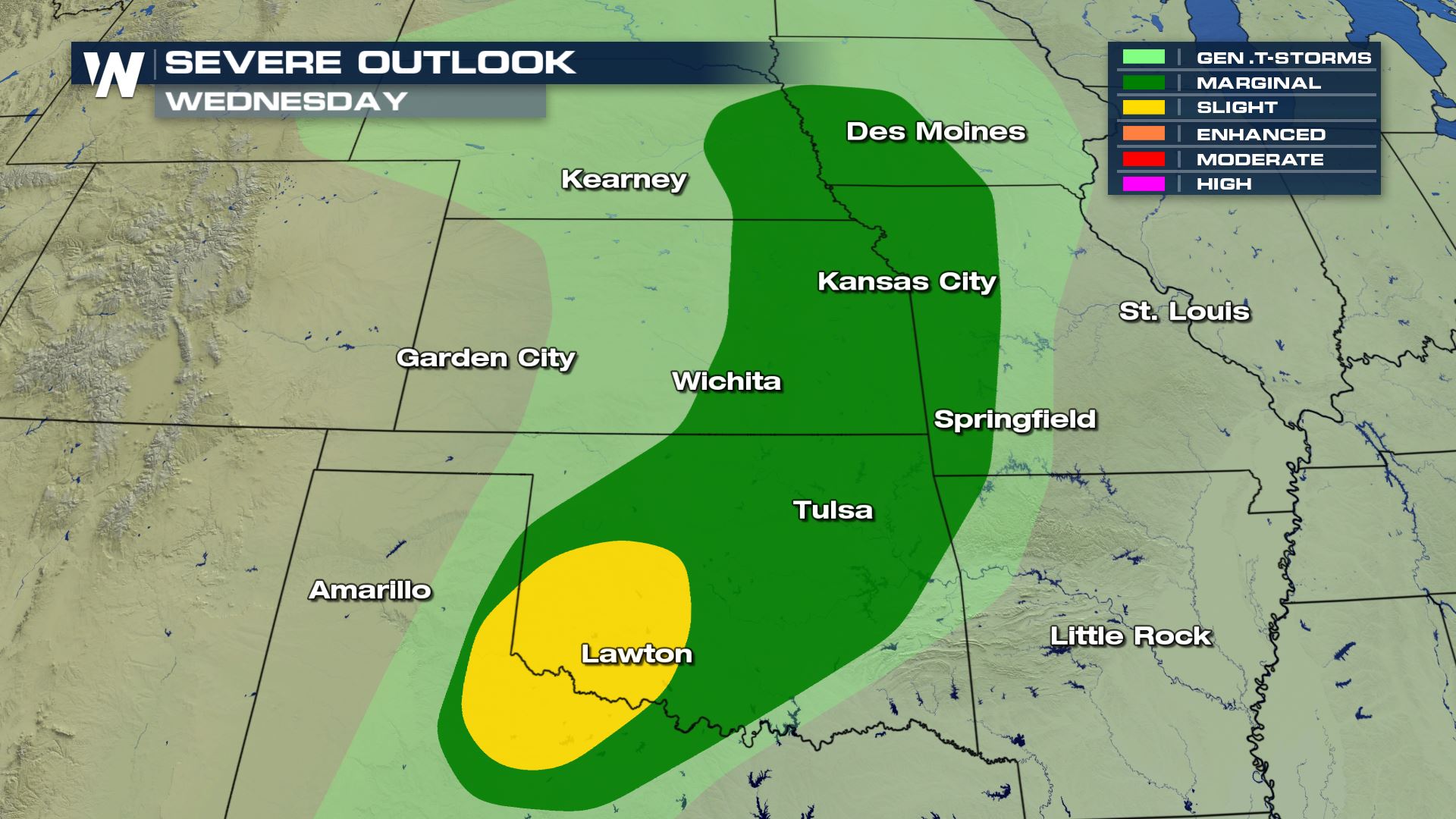 The highest risk for severe storms today will be located over SW Oklahoma and NW Texas. This is the area where all modes of severe weather will be possible, including the risk of a tornado.
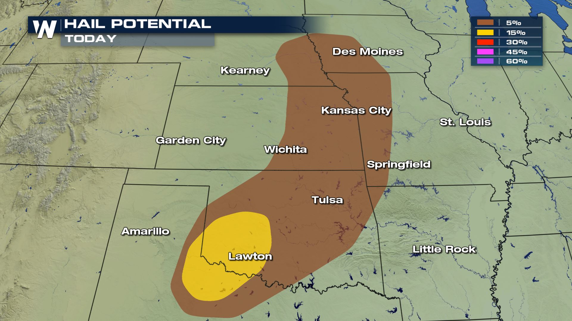
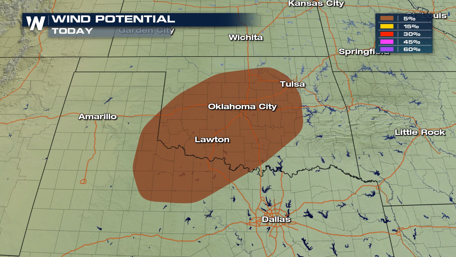
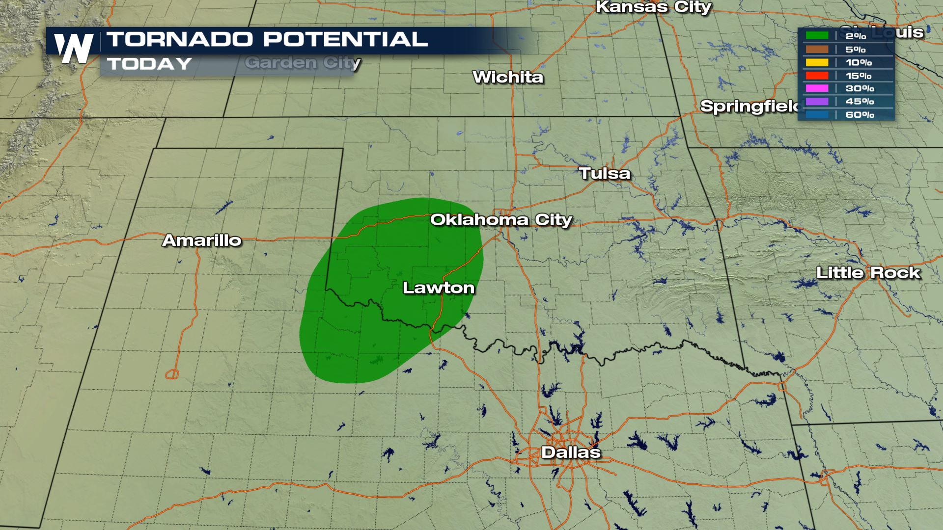 Large hail, damaging winds and an isolated tornado will all be possible with the storms that fire up today. If you are in these areas you will want to be weather aware and have plan in place in case you have to take cover.
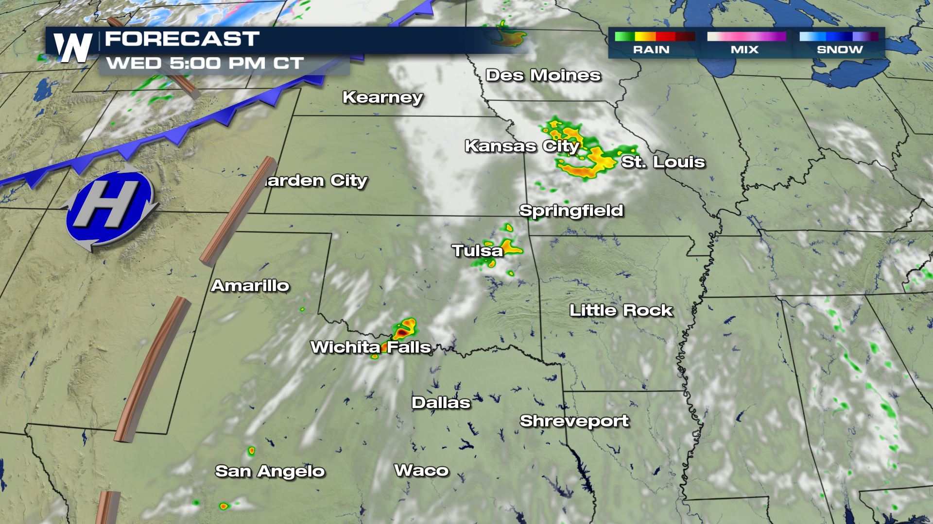
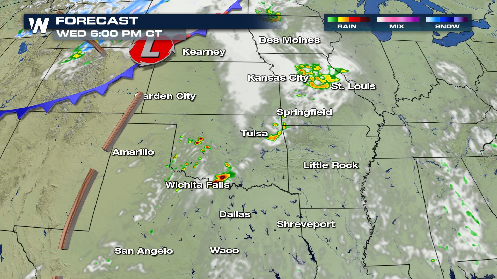
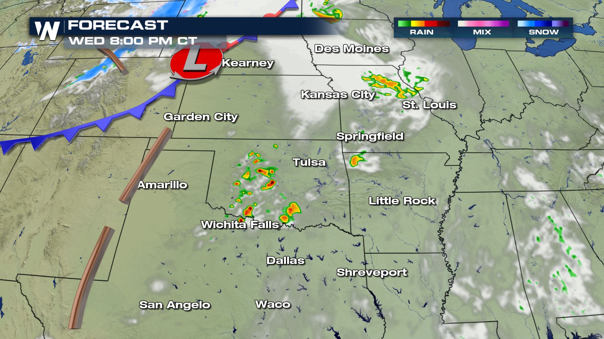 The timing of today's storms will be mainly for the afternoon and evening, but the severe risk could push into the Mississippi Valley late tonight and early Thursday morning.
WeatherNation will be covering today's severe weather. There are so many ways you can stream WeatherNation. Take a look---> How to stream WeatherNation
The timing of today's storms will be mainly for the afternoon and evening, but the severe risk could push into the Mississippi Valley late tonight and early Thursday morning.
WeatherNation will be covering today's severe weather. There are so many ways you can stream WeatherNation. Take a look---> How to stream WeatherNation
Severe Outlook
The highest risk for severe storms today will be located over SW Oklahoma and NW Texas. This is the area where all modes of severe weather will be possible, including the risk of a tornado.
Severe Risks
Large hail, damaging winds and an isolated tornado will all be possible with the storms that fire up today. If you are in these areas you will want to be weather aware and have plan in place in case you have to take cover.
Forecast
The timing of today's storms will be mainly for the afternoon and evening, but the severe risk could push into the Mississippi Valley late tonight and early Thursday morning.
WeatherNation will be covering today's severe weather. There are so many ways you can stream WeatherNation. Take a look---> How to stream WeatherNation
All Weather News
More

Flooding, Severe Storms Target the Midwest Again
After an active week of storms across the nor
31 Jul 2026 11:15 PM


After Reaching Category 5, Genevieve Weakens in the Pacific
PacificFausto is now a post-tropical cyclone.
31 Jul 2026 1:30 AM

Flooding Risk Increases as Heavy Rain Targets the Tri-State Area
Tuesday, heavy rainfall moved across the Nort
30 Jul 2026 12:25 AM

Severe Weather: Energy From the Midwest Now in the Southeast
UPPER MIDWEST - Through Monday, dangerous tor
29 Jul 2026 10:30 PM