Deep South Severe Storm Outlook Mid Week
Special Stories
6 Apr 2021 12:45 PM
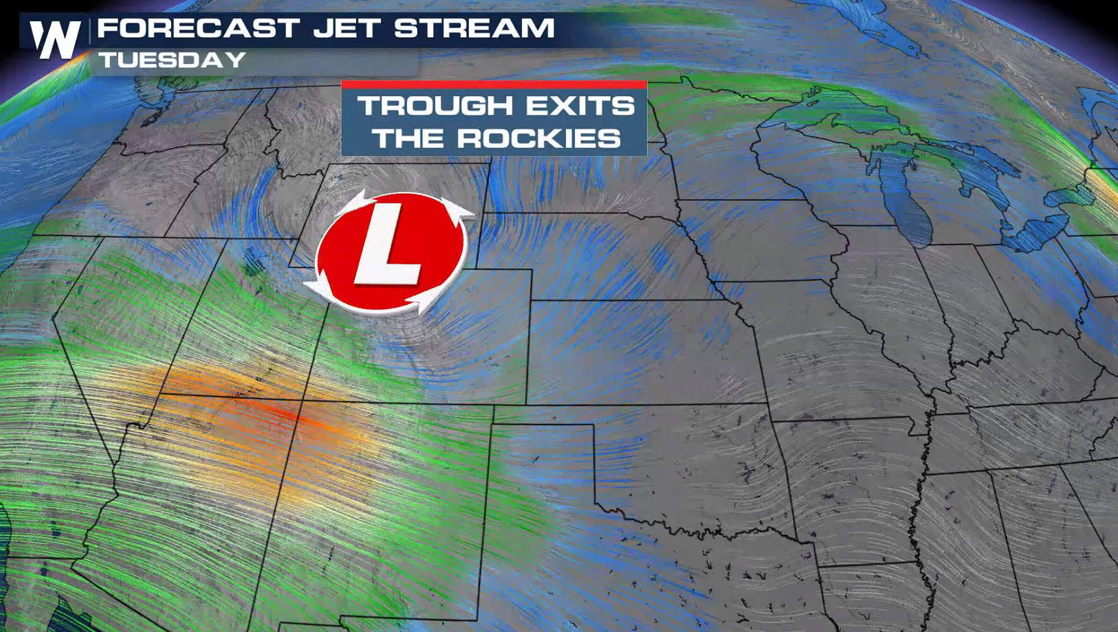
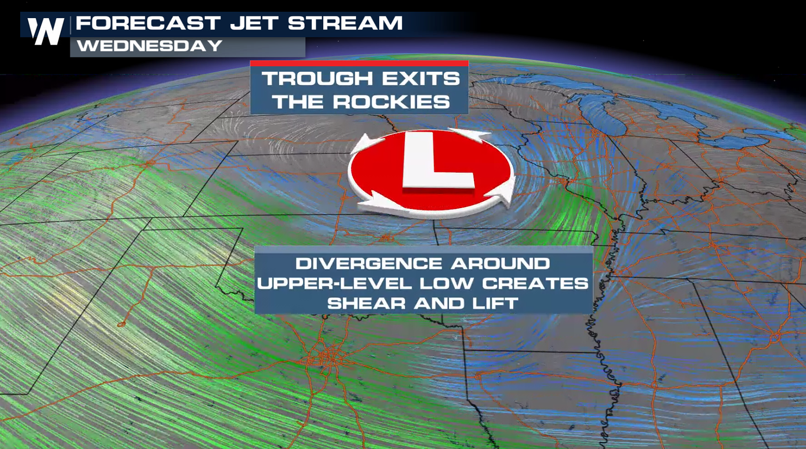
As we head into the work week, a set-up in the Southern and Central United States brings the potential risk for strong to severe thunderstorms for the next few days. The Storm Prediction Center has highlighted several areas for Wednesday and Thursday as an incoming upper level trough exits the Rockies and pushes into the Central and Southern Plains.
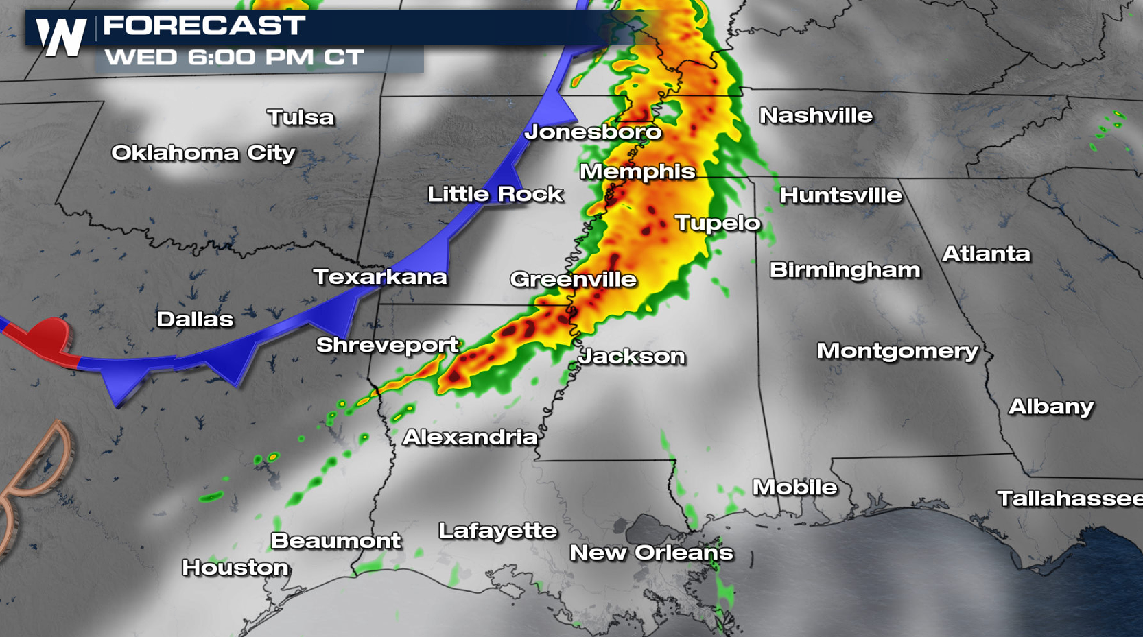
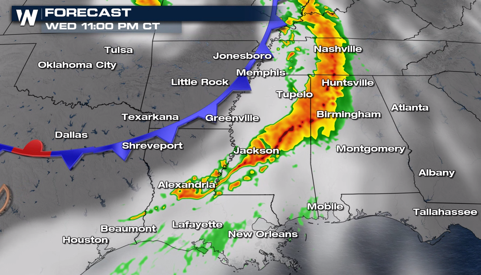
 A few tornadoes are possible in the late afternoon and evening, along with damaging wind gusts and large hail.
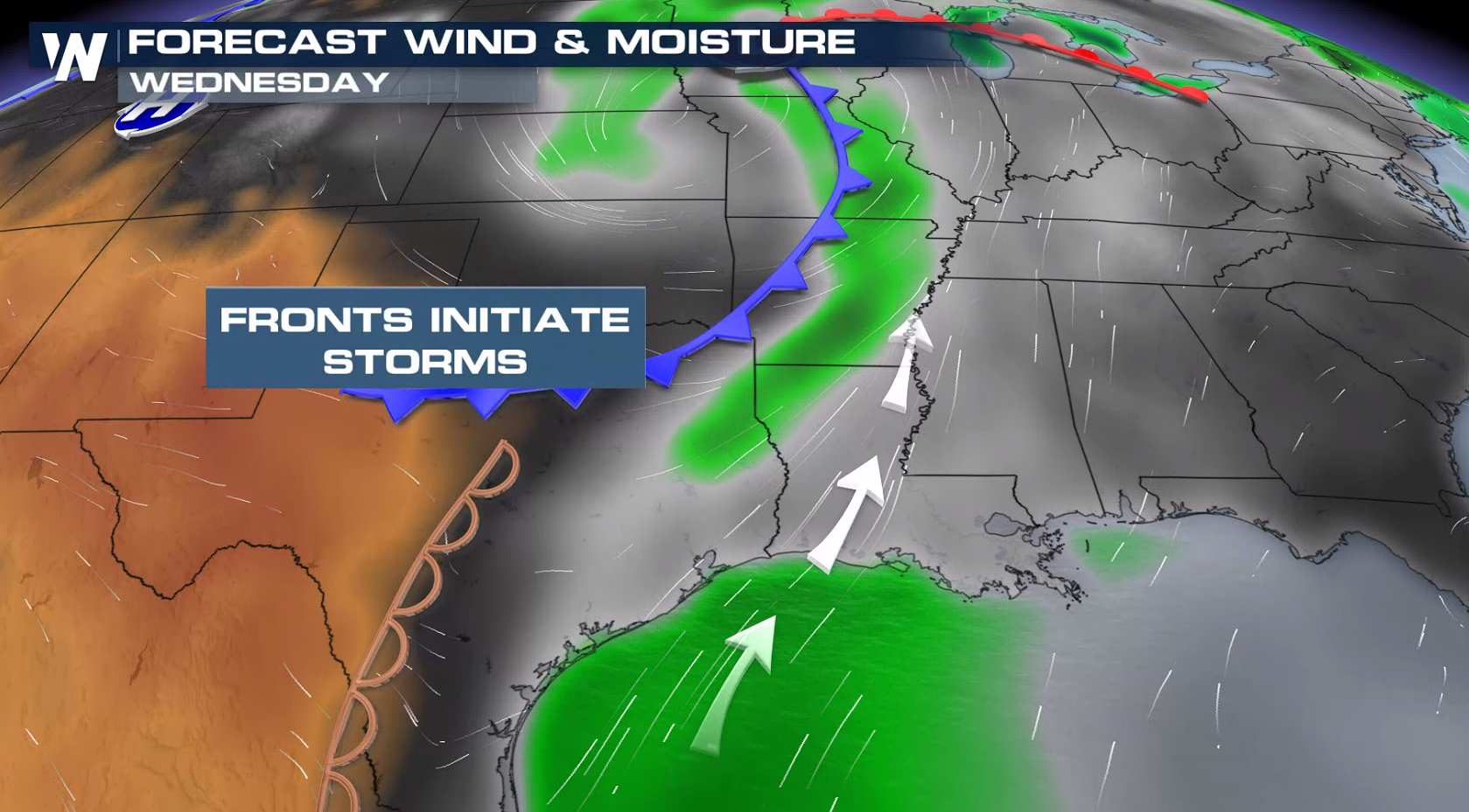
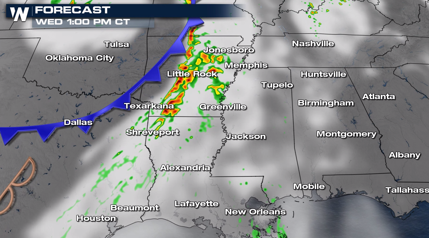
 As the low pressure center and cold front pushes eastward, a line of storms will fire as it moves into a moisture-rich and warm environment. Severe weather will be possible in the late afternoon and evening.
 For the latest on this severe potential, be sure to tune into WeatherNation!
Set-Up
As an upper level trough digs in, a surface low brings in a dryline set-up that will ignite thunderstorms in west Texas. There is still some low confidence on how quickly these storms will develop, based on how much capping we have in the atmosphere. Once storms bubble up, there is a risk that they will become severe with a hail and wind threat.
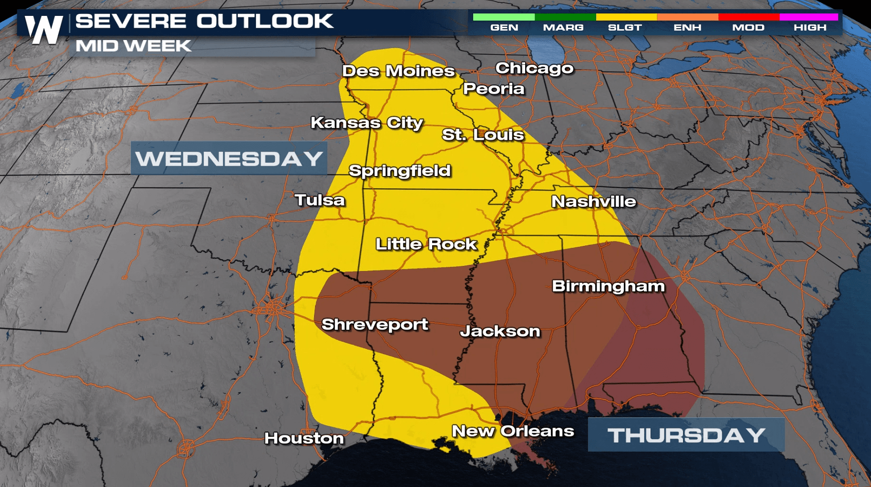
Wednesday
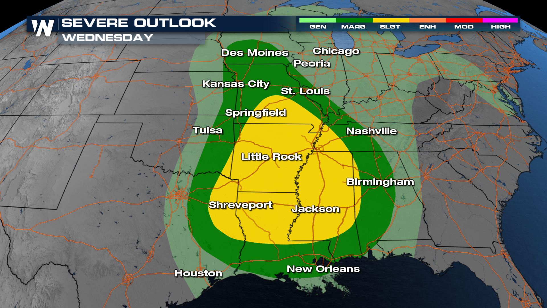
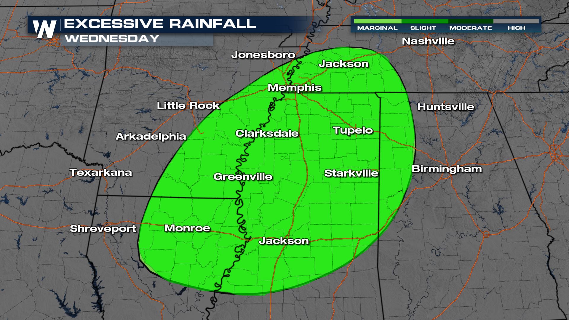
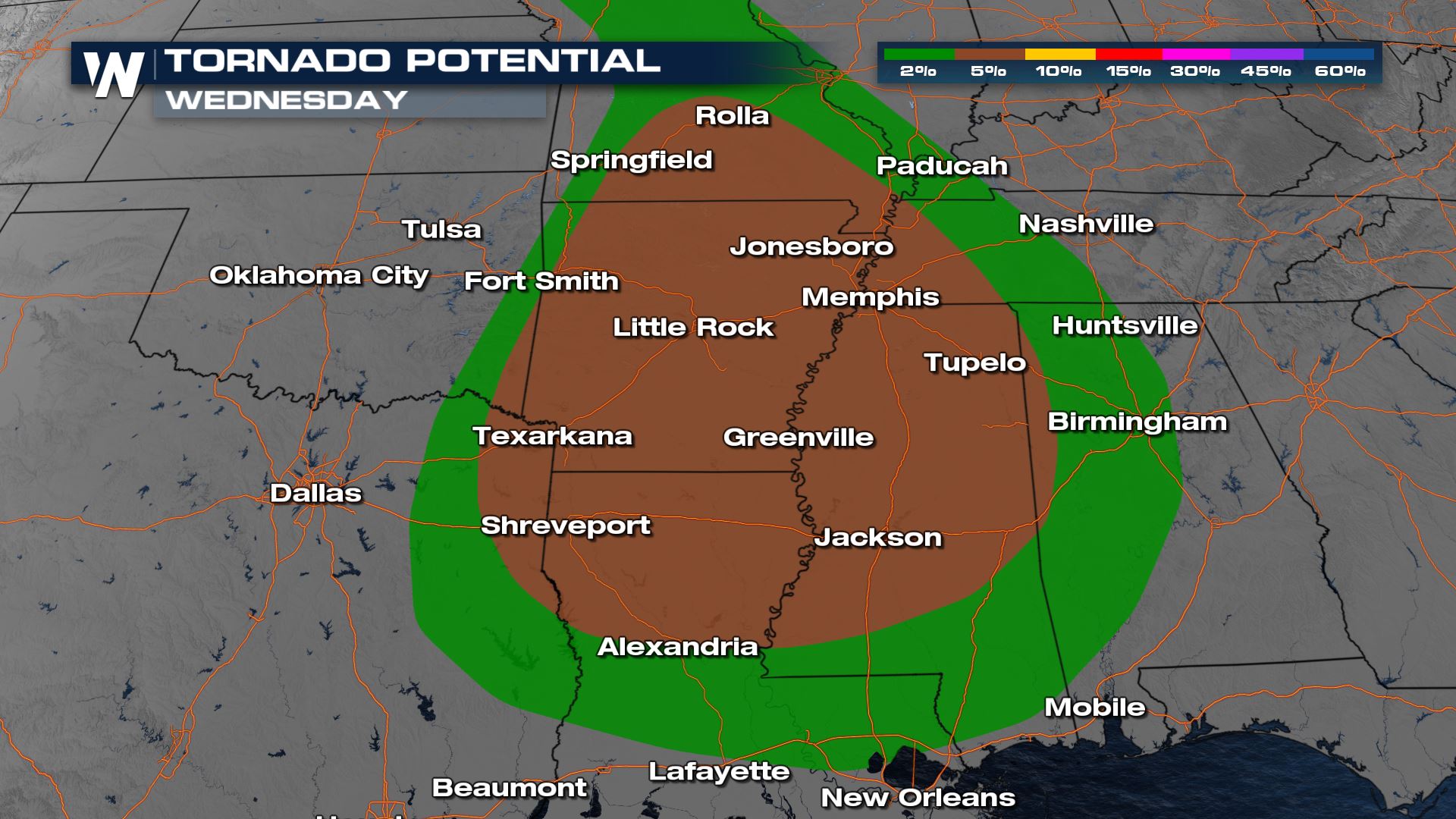
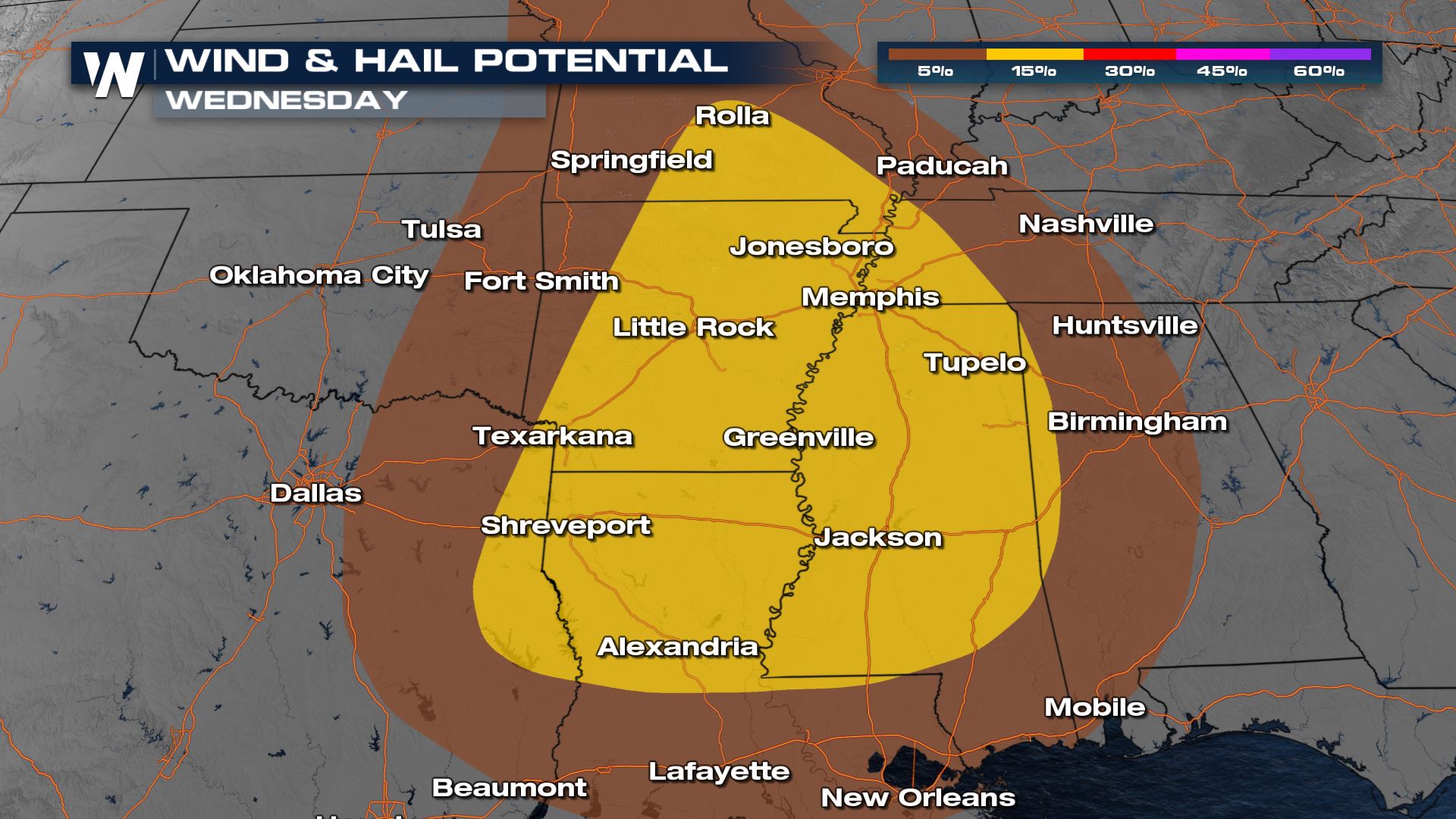
For Wednesday, a cold front will move into the Tennessee and Lower Mississippi River Valleys. It will bring a risk for strong to severe thunderstorms. There is a slight risk (level 2 on a scale of 1 to 5) for the Arklatex eastward to the Mississippi Delta. Heavy rain will also be a concern.
A few tornadoes are possible in the late afternoon and evening, along with damaging wind gusts and large hail.
As the low pressure center and cold front pushes eastward, a line of storms will fire as it moves into a moisture-rich and warm environment. Severe weather will be possible in the late afternoon and evening.
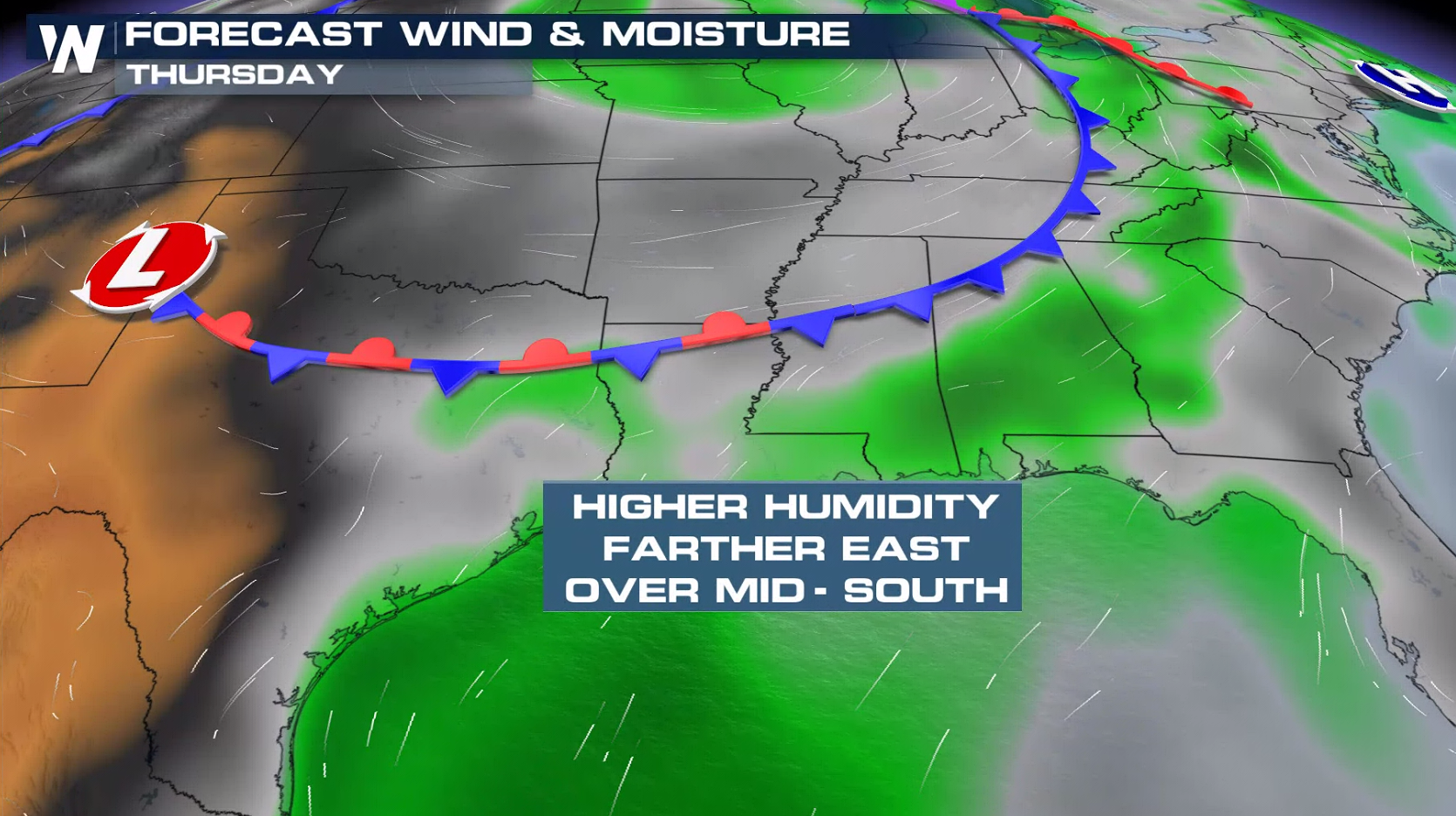
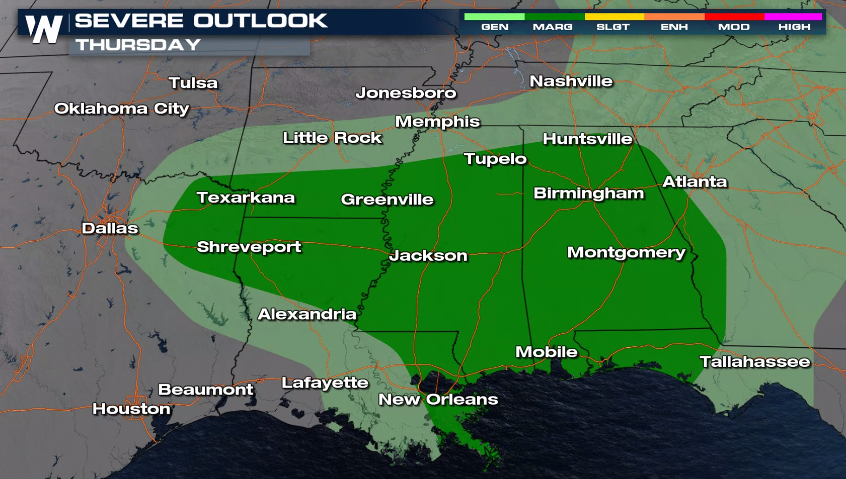
Thursday
There is a marginal risk for severe thunderstorms Thursday from eastern Texas to the Florida Panhandle. A few severe storms may be possible in the morning before diminishing along the cold front. Additional storms will develop Thursday night that may become severe.
For the latest on this severe potential, be sure to tune into WeatherNation!All Weather News
More
Wildfire Outbreak in the Pacific Northwest
SPOKANE, WA - On Saturday, August 1st, the Ol
3 Aug 2026 1:55 AM

More Storms for the East Through Monday
A low-pressure system that moved through the
3 Aug 2026 1:50 AM


After Reaching Category 5, Genevieve Weakens in the Pacific
PacificGenevieve formed last Friday south of
3 Aug 2026 12:30 AM

Flooding, Severe Storms Target the Midwest Again
After an active week of storms across the nor
1 Aug 2026 1:40 AM

Flooding Risk Increases as Heavy Rain Targets the Tri-State Area
Tuesday, heavy rainfall moved across the Nort
30 Jul 2026 12:25 AM

Severe Weather: Energy From the Midwest Now in the Southeast
UPPER MIDWEST - Through Monday, dangerous tor
29 Jul 2026 10:30 PM