SW Pattern Change: Tracking Rain & Snow

While much of the country, and in particular the Southwest, baked underneath a historic heatwave in March, a shift in the jet stream has brought cooler and wetter weather back to the area.
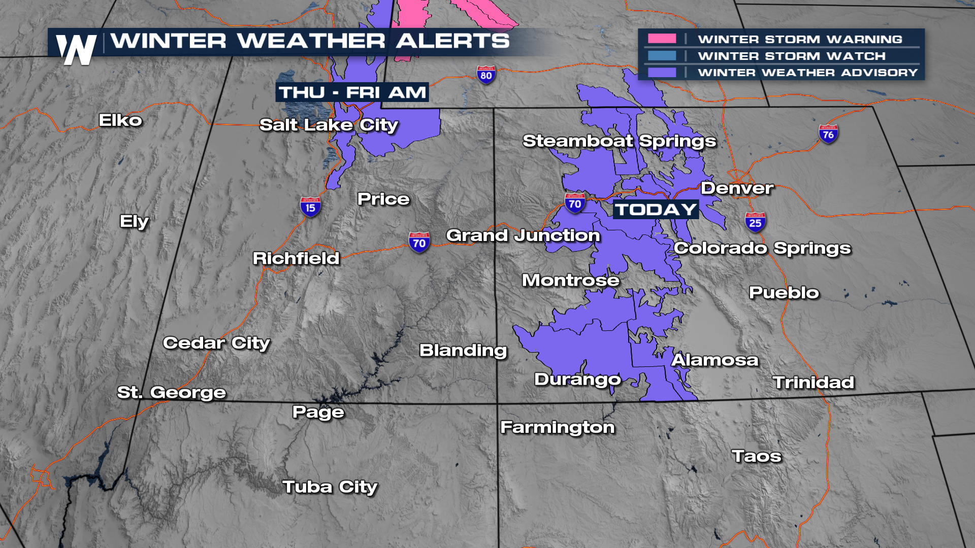
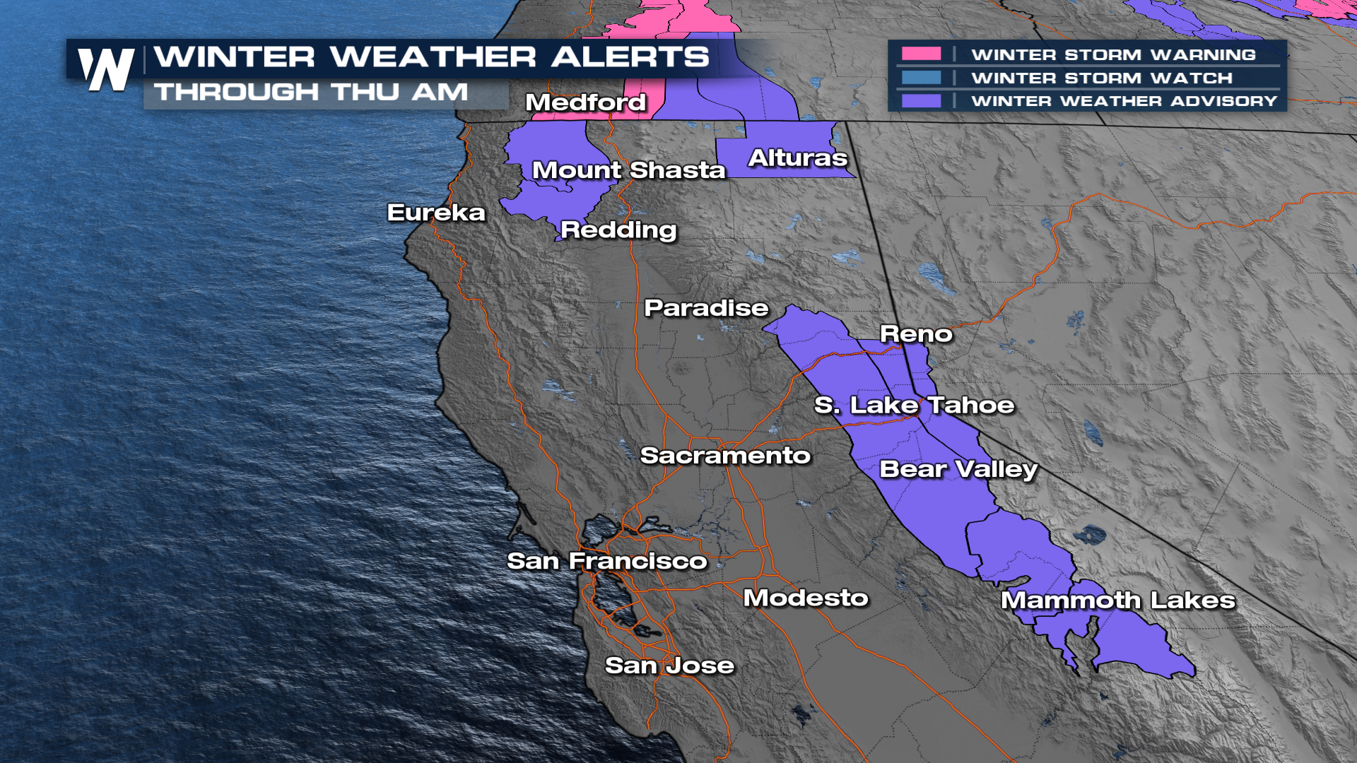
Alerts
Winter alerts are in effect across the higher elevations of Utah and Colorado. Some areas are expecting a foot of snowfall, with isolated locations seeing higher totals. Winds will also be gusty across the higher terrain. Winter Weather Advisories were reissued across northern Utah for another round expected on Thursday.
The Sierra Nevada Mountains also have winter alerts in place that will continue through most of Thursday morning. Travel delays and slick roadways are likely. Stay safe as this much-needed moisture arrives across the higher terrain.
Forecast Timing
While one system is departing, another area of disturbance will move across Northern California and back into Utah and Colorado. This system will continue to bring impacts through Friday morning.
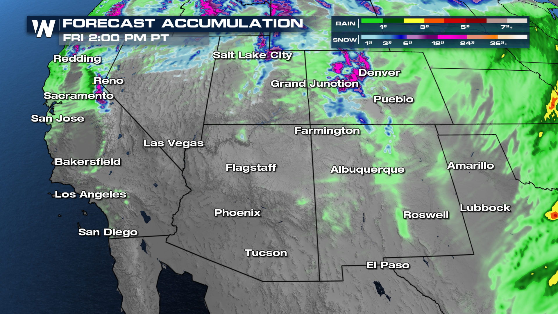 Although not a "drought buster" by any means, these systems will at least help put a dent into the record-low snowpack across the West, along with some relief from the heat!


