Julio Forms, Still Multiple Waves in the Pacific

JULIO & ISELLE
Tropical Storm Julio formed Tuesday morning in the Eastern Pacific. Interestingly, could be short lived. The National Hurricane Center forecasting that Julio could merge with Iselle just to it's north. After some brief strengthening Tuesday, Julio will move north and be absorbed into Iselle's outer circulation Wednesday.
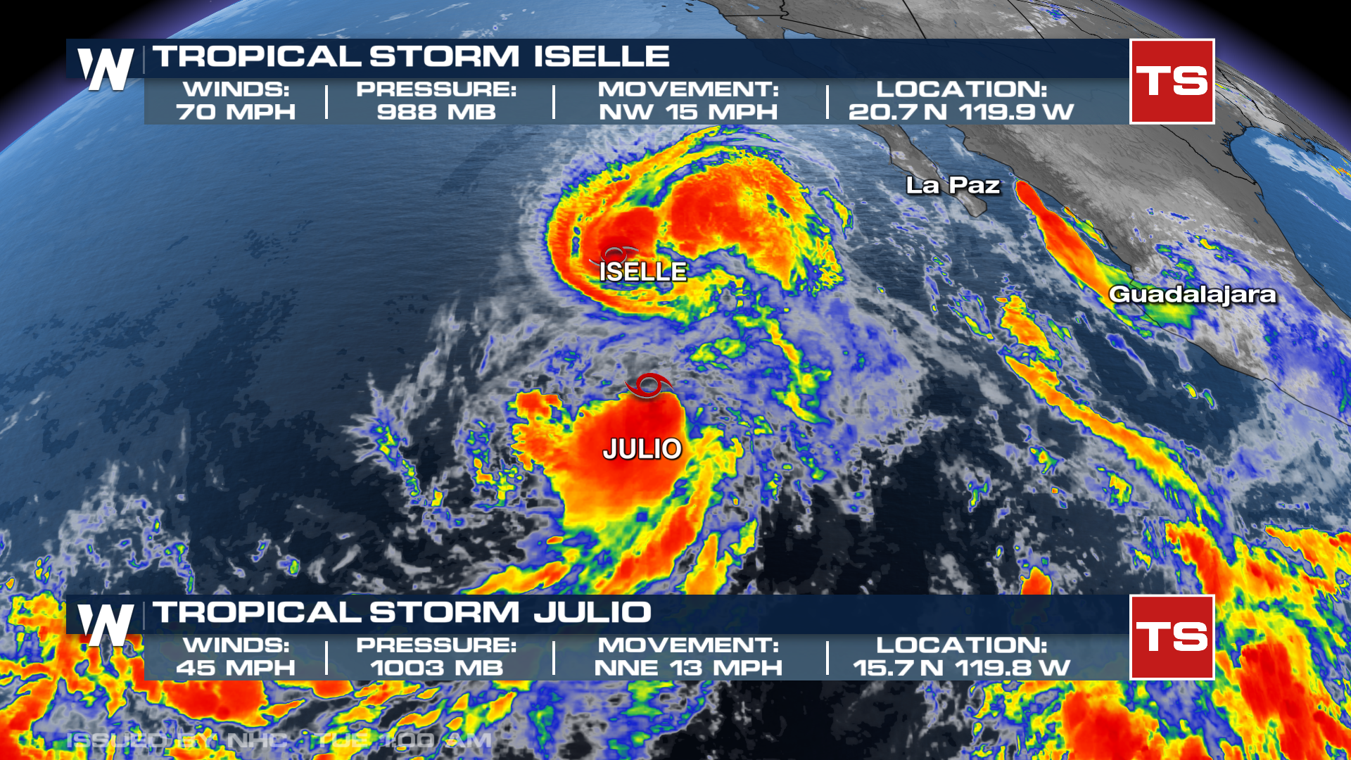
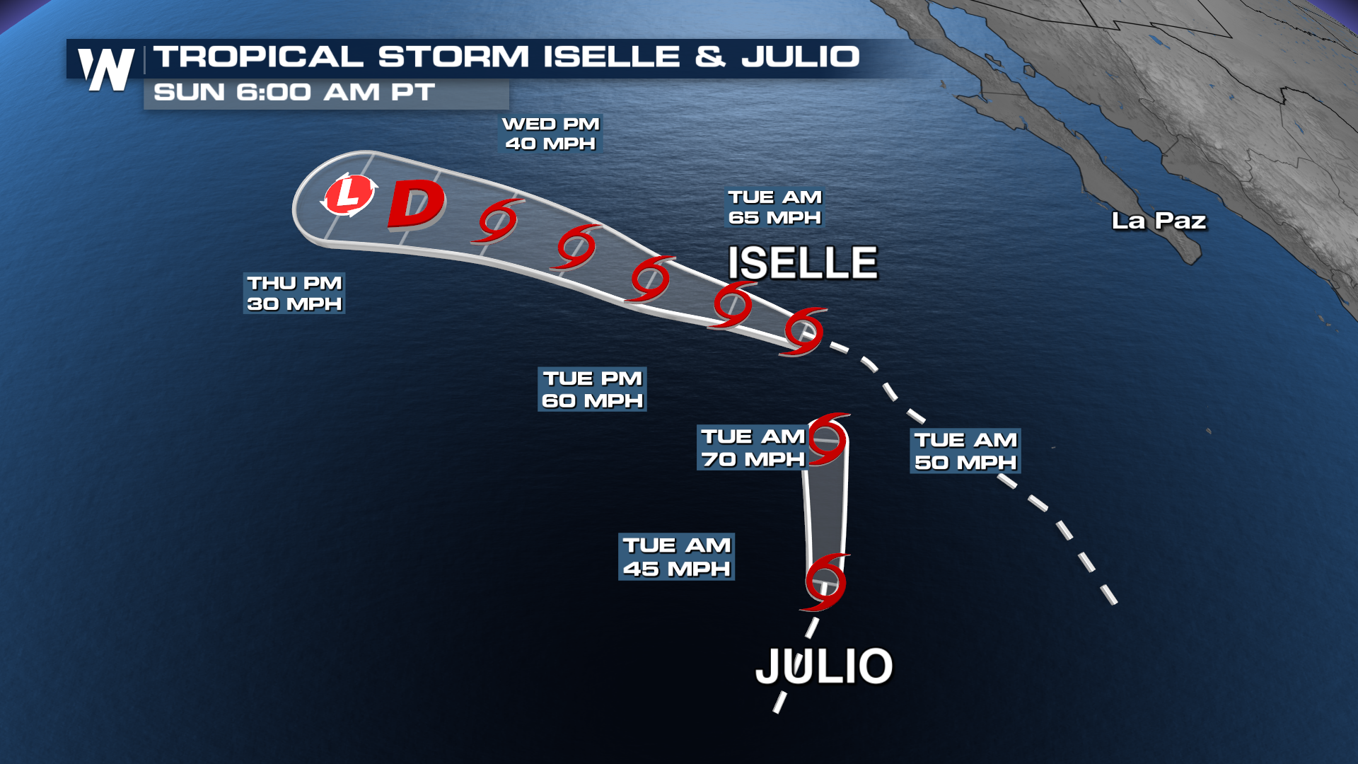 Waves from these systems could make it far enough north to impact the coast of southern California. Interests there should watch for a high rip current risk through the end of the week.
With multiple other areas of development, we expect additional storms to come off the factory line and move west and northwest into the Pacific. El Nino is traditionally very active for the Pacific basin, and this year has proved it. Lala continues as a Tropical Storm northwest of the Hawaiian Islands. Moke is post-tropical and fizzling out.
RECAPPING LALA
While Lala did not make a direct landfall on the Hawaiian Islands, it still brought significant impacts. The Hawaii Department of Transportation reported that parts of Highway 11 on the Big Island were shut down due to flooding. More than 130,000 customers lost power Saturday at the height of the storm. WeatherNation's field correspondent, Jonathan Petramala, was there bringing the views on the ground.
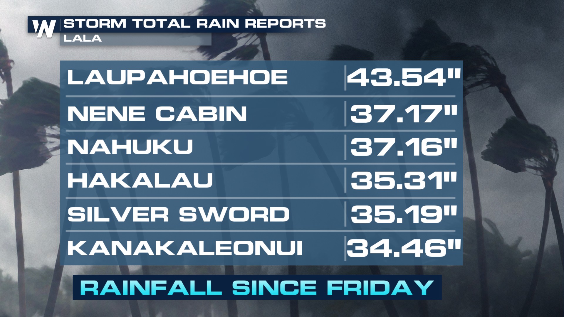
Rainfall totals exceeded 30+ inches in many locations.
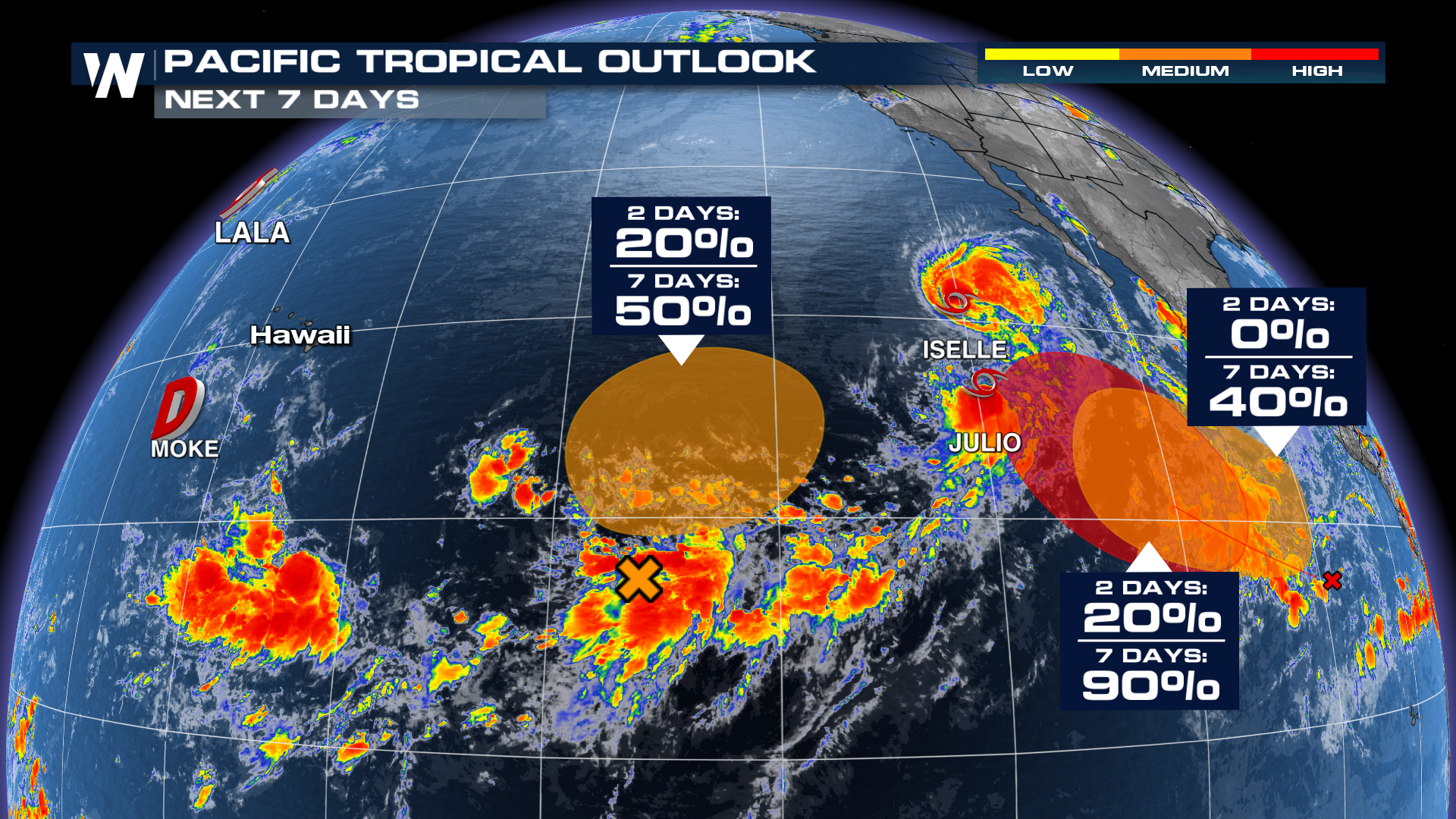
As for the rest of the Pacific, we are monitoring multiple areas of interest for tropical development, including Tropical Storm Iselle. Iselle is set to remain out in open waters, but can impact wave heights and rip currents along the West Coast later this week.
Click here for more on what is happening in the Atlantic Basin: Atlantic Tropics.


