Spring Snow for the Central Rockies
Top Stories
12 Apr 2022 12:35 PM
Heavy snow is impacting the Pacific Northwest through Tuesday. As the storm system moves inland, snow will become a lot more widespread for the Intermountain West of Colorado and Utah.
Related Articles - Blizzard Conditions for the High Plains and Western US: Rain and Snow from Cascades through Sierra
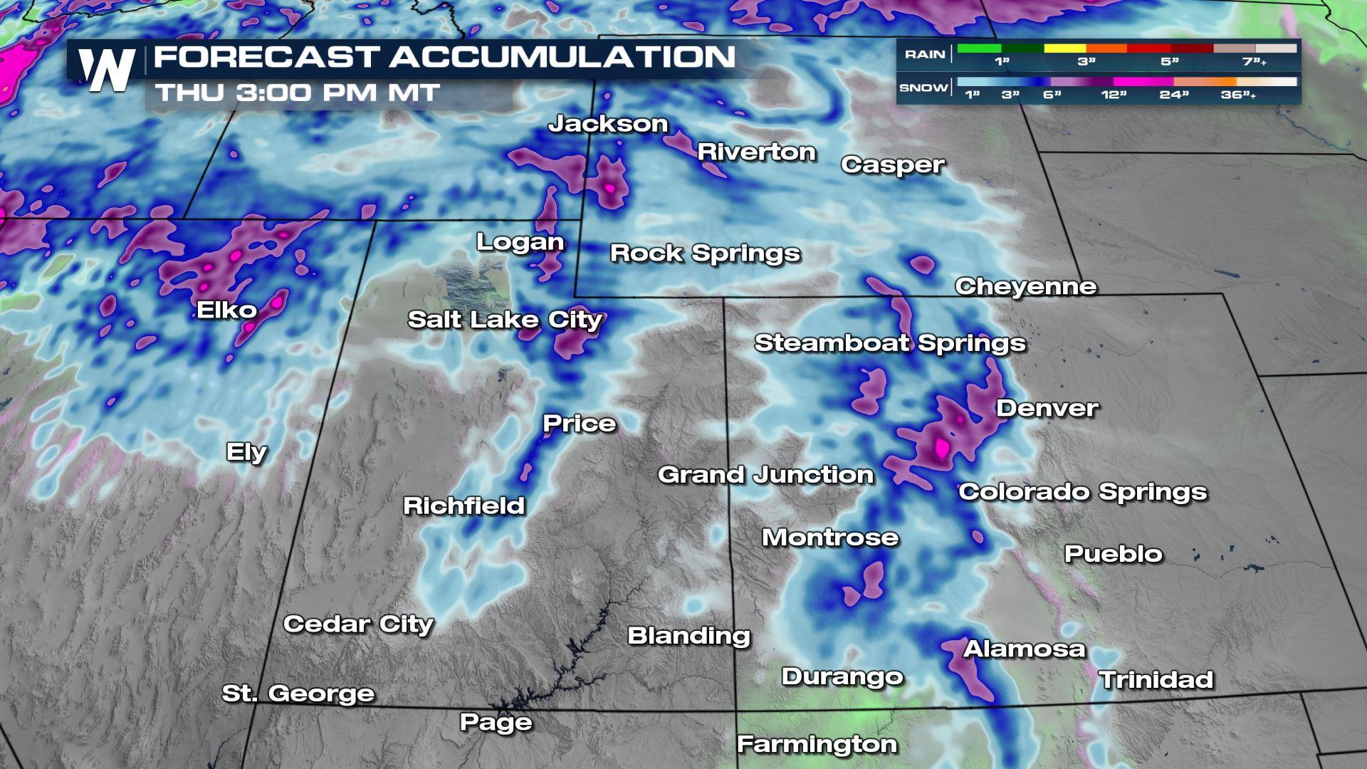
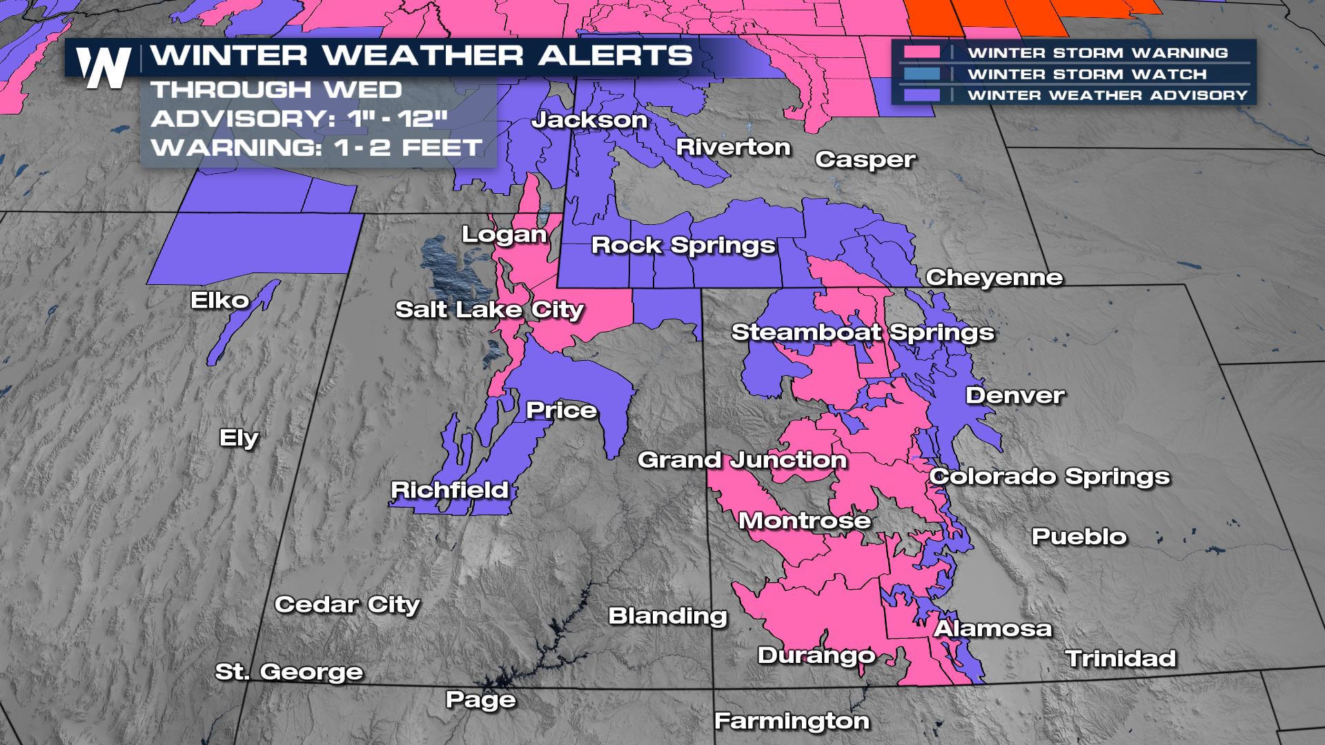
Snow alerts carry all the way into the Intermountain West of Colorado, Wyoming and Utah through Thursday. Again, up to 20" of snow will be possible for the high country, with blowing snow creating difficult travel on I-70, I-80 and I-15.
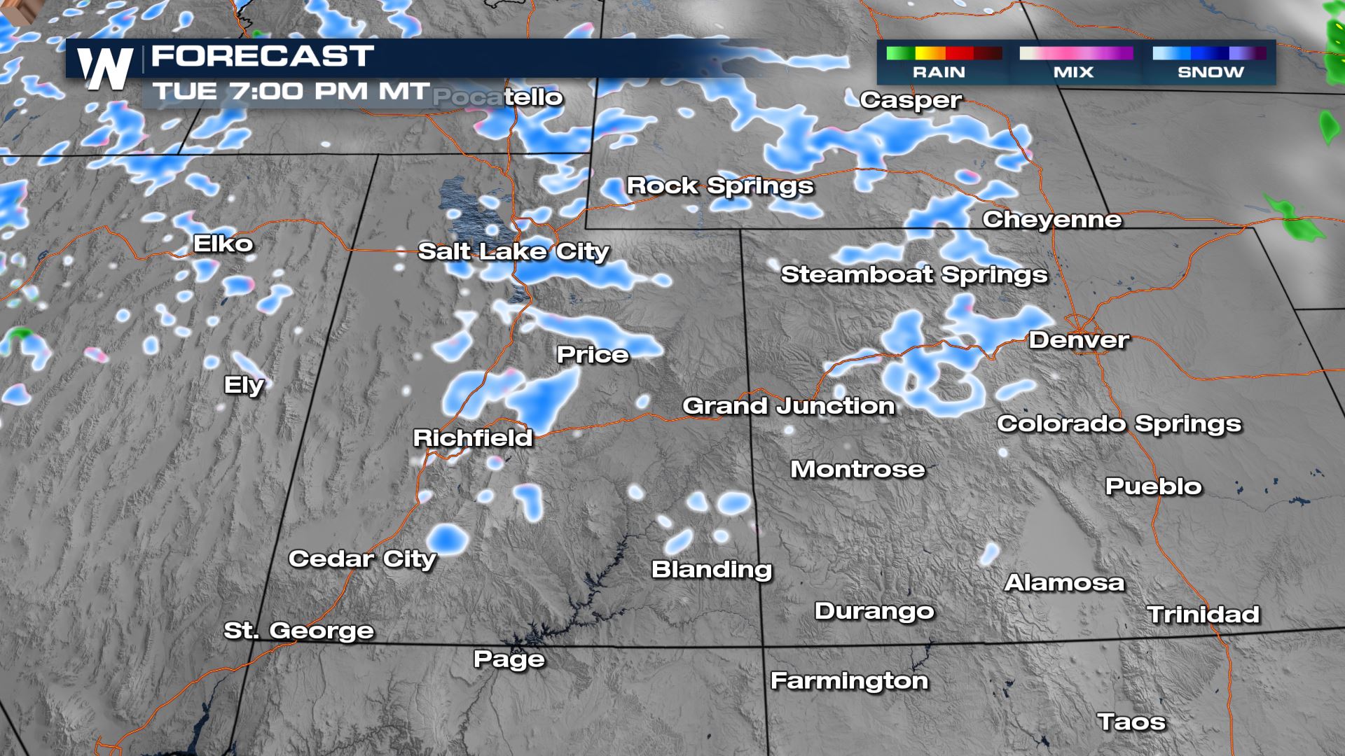
 By Tuesday afternoon/evening snow showers will be a lot more widespread across the Rockies. Still, the isolated snow showers can create difficult travel and quick accumulation. The Front Range of Colorado should stay mainly dry, as the mountains eat up a lot of the incoming moisture. A few snow showers can't be ruled out along and east of I-25 but the bigger story will be gusty winds and high fire danger east of the Rockies.
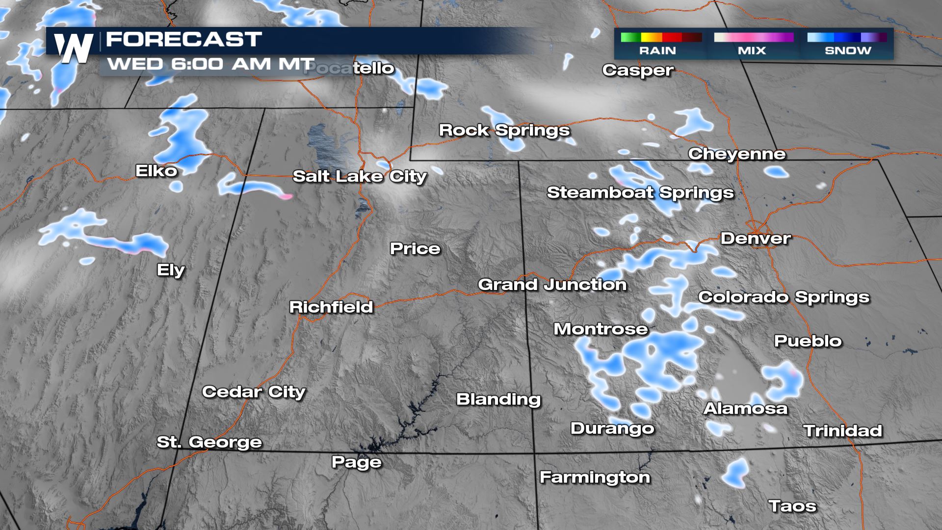
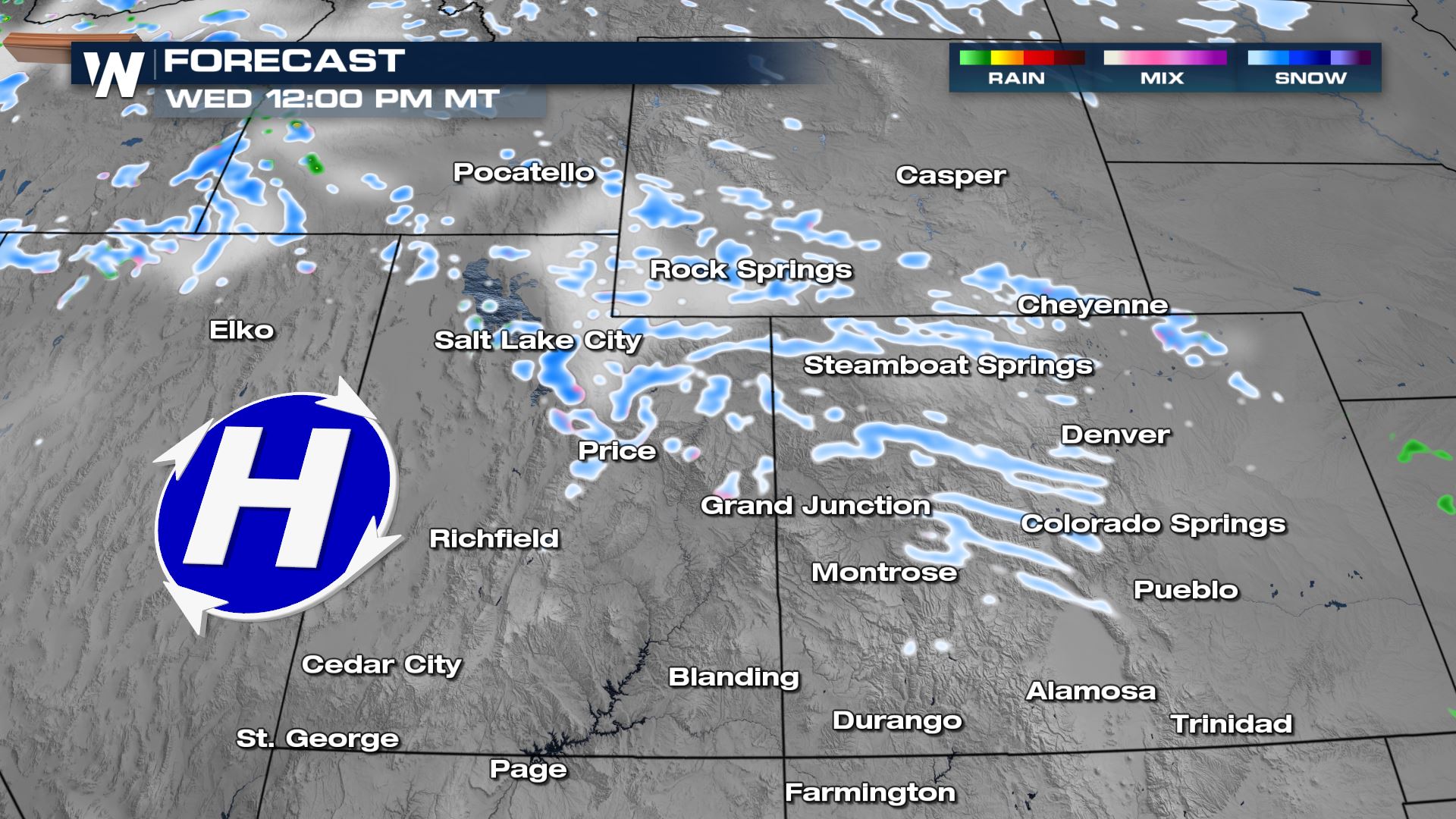
 We will see this pattern continue into Wednesday, where snow showers continue to impact the Intermountain West. Great news for Spring skiiers, not so great for travelers.
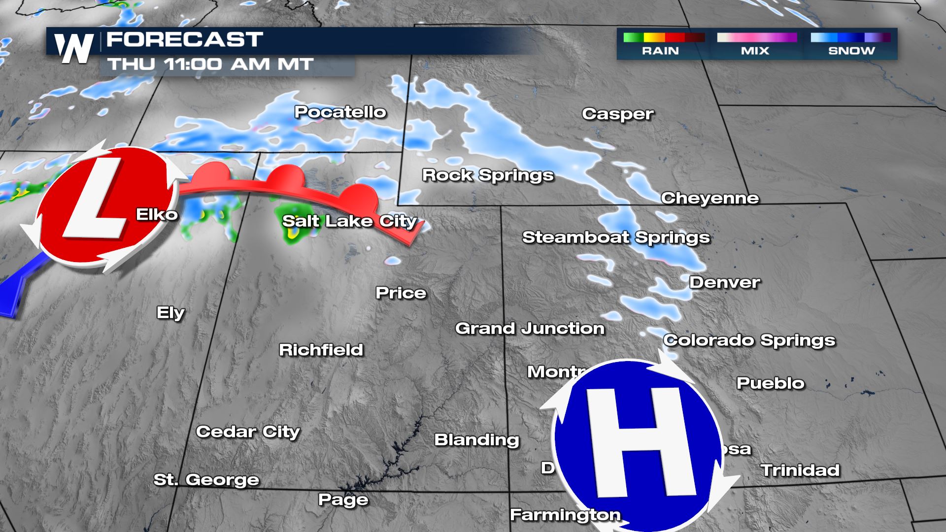
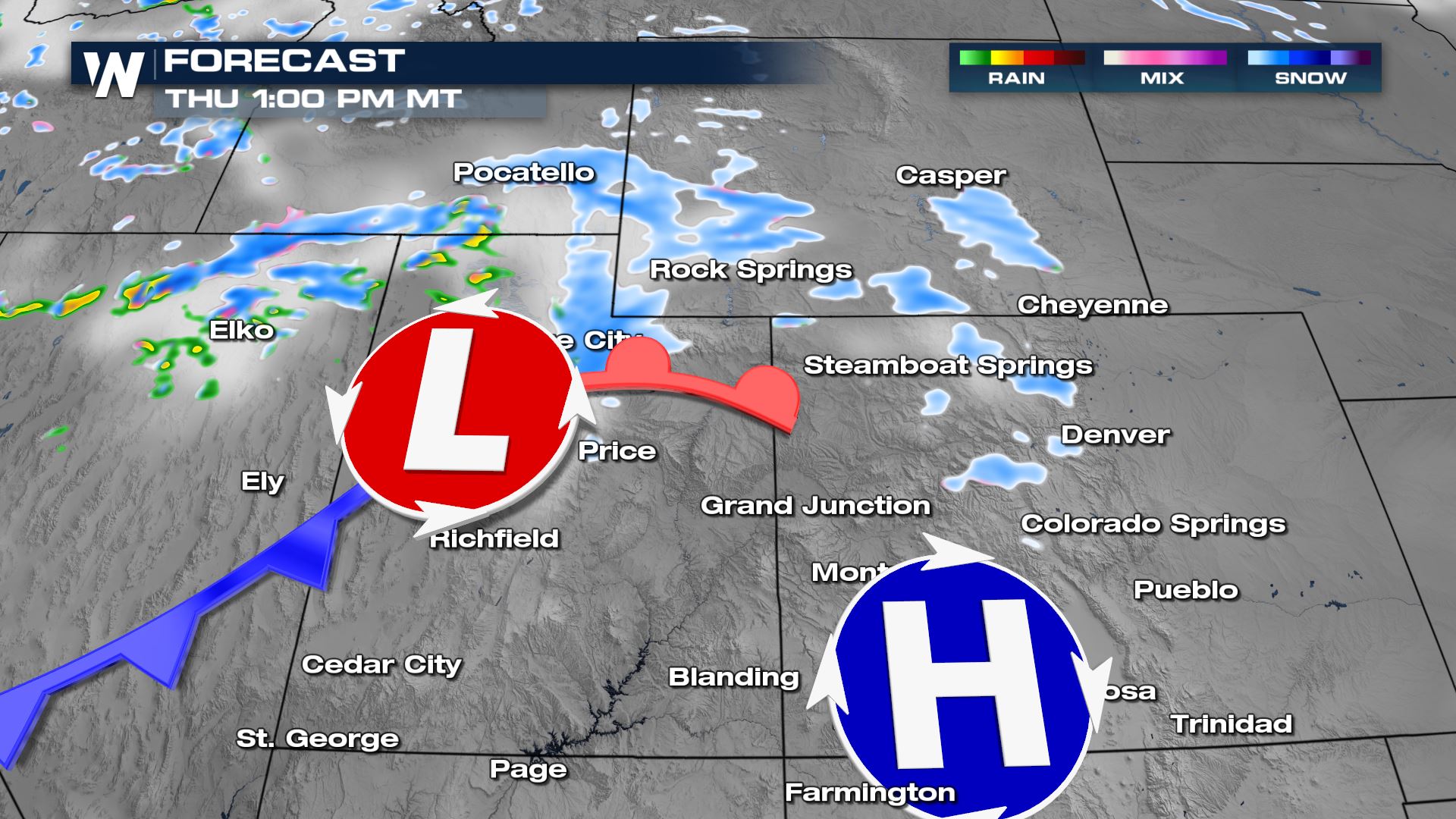
 We will be mainly dry on Wednesday afternoon and into Thursday morning. Another burst of snow arrives Thursday afternoon and evening for the high country leading to additional accumulation.
 In terms of accumulation, you can see the mountains will do the best with the multiday snow opportunity. We will see the bulk of the accumulation now through early Wednesday morning with the burst of snow coming on Thursday not yet making too much of an impact in this particular forecast.
 Stay with WeatherNation as we track the latest in the conditions for the Rockies. For more on this and the western regional forecast, join us at :50 past the hour.
By Tuesday afternoon/evening snow showers will be a lot more widespread across the Rockies. Still, the isolated snow showers can create difficult travel and quick accumulation. The Front Range of Colorado should stay mainly dry, as the mountains eat up a lot of the incoming moisture. A few snow showers can't be ruled out along and east of I-25 but the bigger story will be gusty winds and high fire danger east of the Rockies.
We will see this pattern continue into Wednesday, where snow showers continue to impact the Intermountain West. Great news for Spring skiiers, not so great for travelers.
We will be mainly dry on Wednesday afternoon and into Thursday morning. Another burst of snow arrives Thursday afternoon and evening for the high country leading to additional accumulation.
In terms of accumulation, you can see the mountains will do the best with the multiday snow opportunity. We will see the bulk of the accumulation now through early Wednesday morning with the burst of snow coming on Thursday not yet making too much of an impact in this particular forecast.
Stay with WeatherNation as we track the latest in the conditions for the Rockies. For more on this and the western regional forecast, join us at :50 past the hour.All Weather News
More


More Storms for the East Sunday and Monday
A low-pressure system crashing through the Mi
2 Aug 2026 2:20 AM

After Reaching Category 5, Genevieve Weakens in the Pacific
PacificGenevieve formed on last Friday south
2 Aug 2026 1:30 AM

Flooding, Severe Storms Target the Midwest Again
After an active week of storms across the nor
1 Aug 2026 1:40 AM

Flooding Risk Increases as Heavy Rain Targets the Tri-State Area
Tuesday, heavy rainfall moved across the Nort
30 Jul 2026 12:25 AM

Severe Weather: Energy From the Midwest Now in the Southeast
UPPER MIDWEST - Through Monday, dangerous tor
29 Jul 2026 10:30 PM