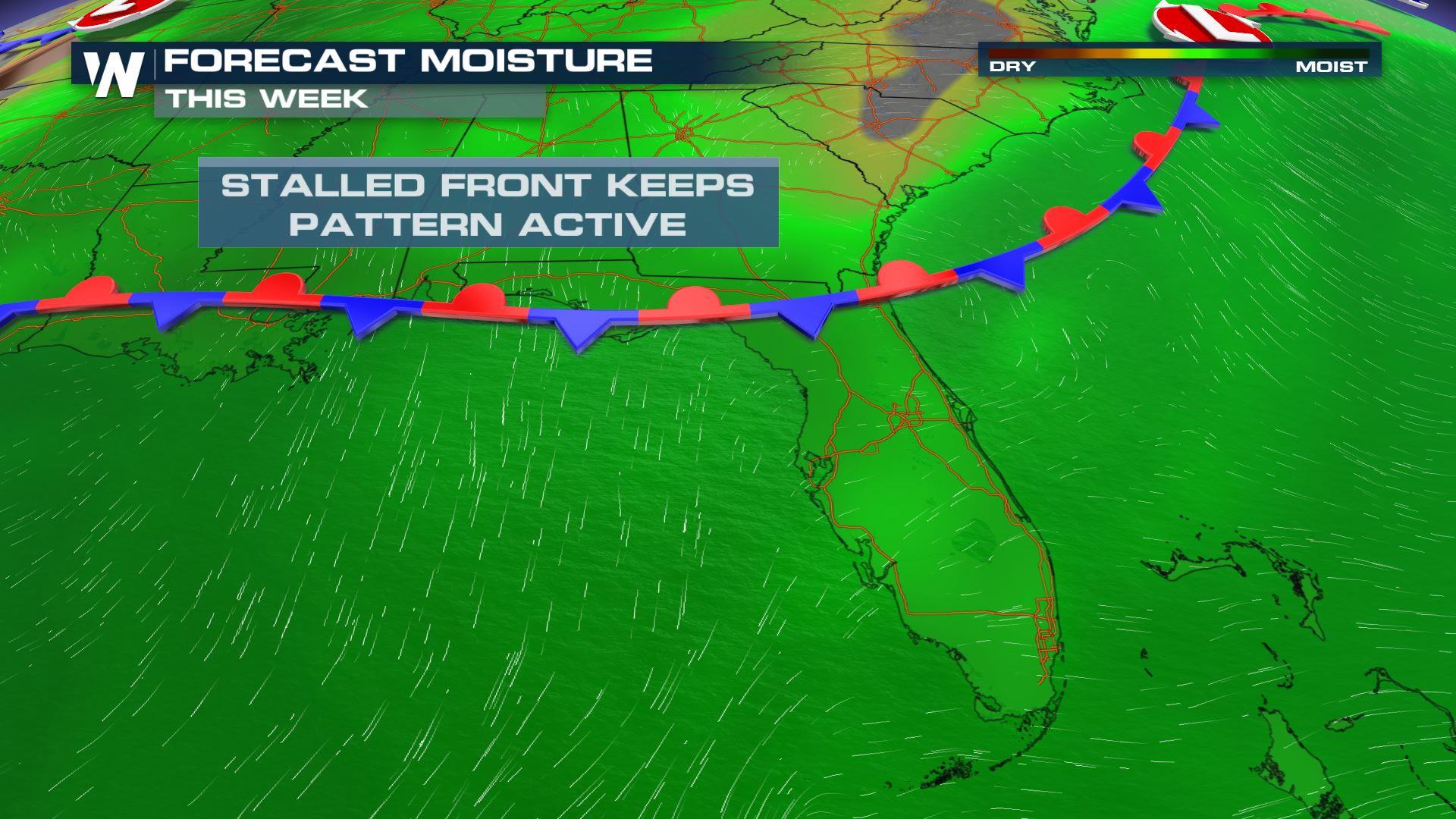
Stalled Front Keeps Florida A Bit Cloudier, Wetter
Top Stories
24 Jun 2021 4:00 AM
Folks flocking to the beaches of the Sunshine State will have to dodge a few clouds, showers, and thunderstorms in order to enjoy that Vitamin D! A stalled frontal boundary across northern Florida will help organize moisture and that will lead to building clouds and rain.
 The stalled frontal boundary in northern Florida will remain locked in place today (Thursday), resulting in a day that begins sunny to partly cloudy, then turns cloudier and wetter in the afternoon. Showers will be most likely along Florida's east coast in the morning and midday, then Florida's west coast in the afternoon and evening.
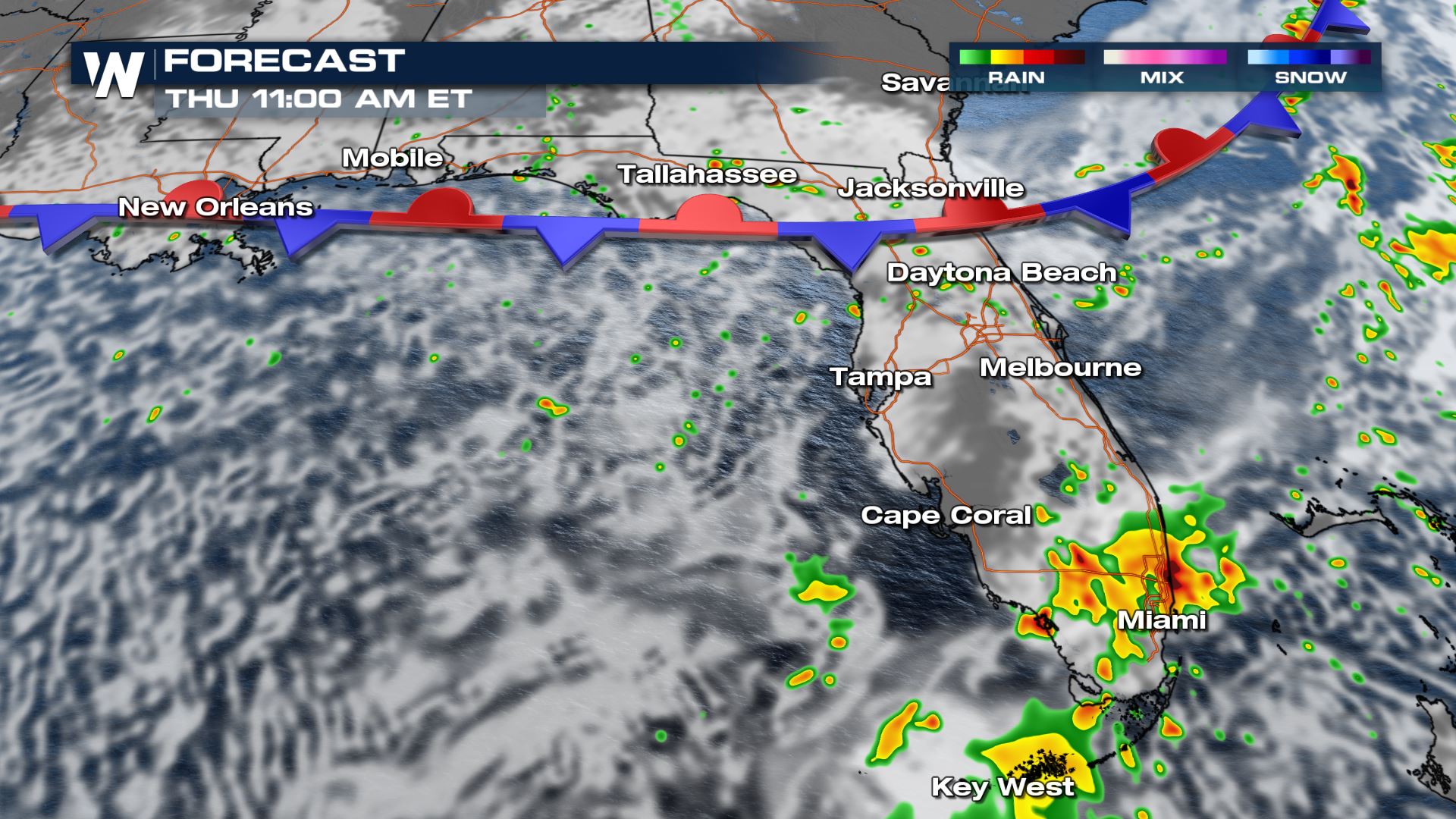 The forecast at 11 a.m. ET Thursday, June 24 showing rain in southeast Florida.
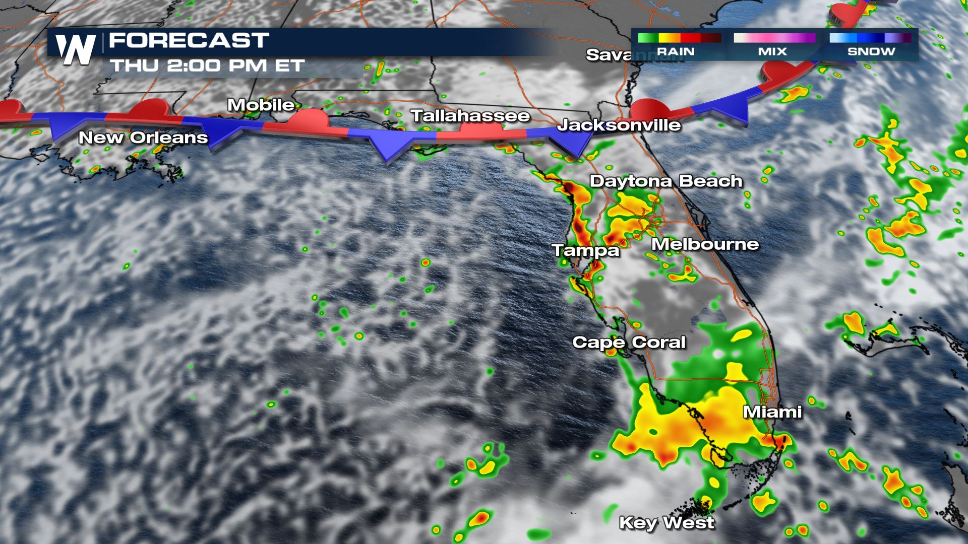 The forecast at 2 p.m. ET Thursday, June 24 showing rain in western Florida.
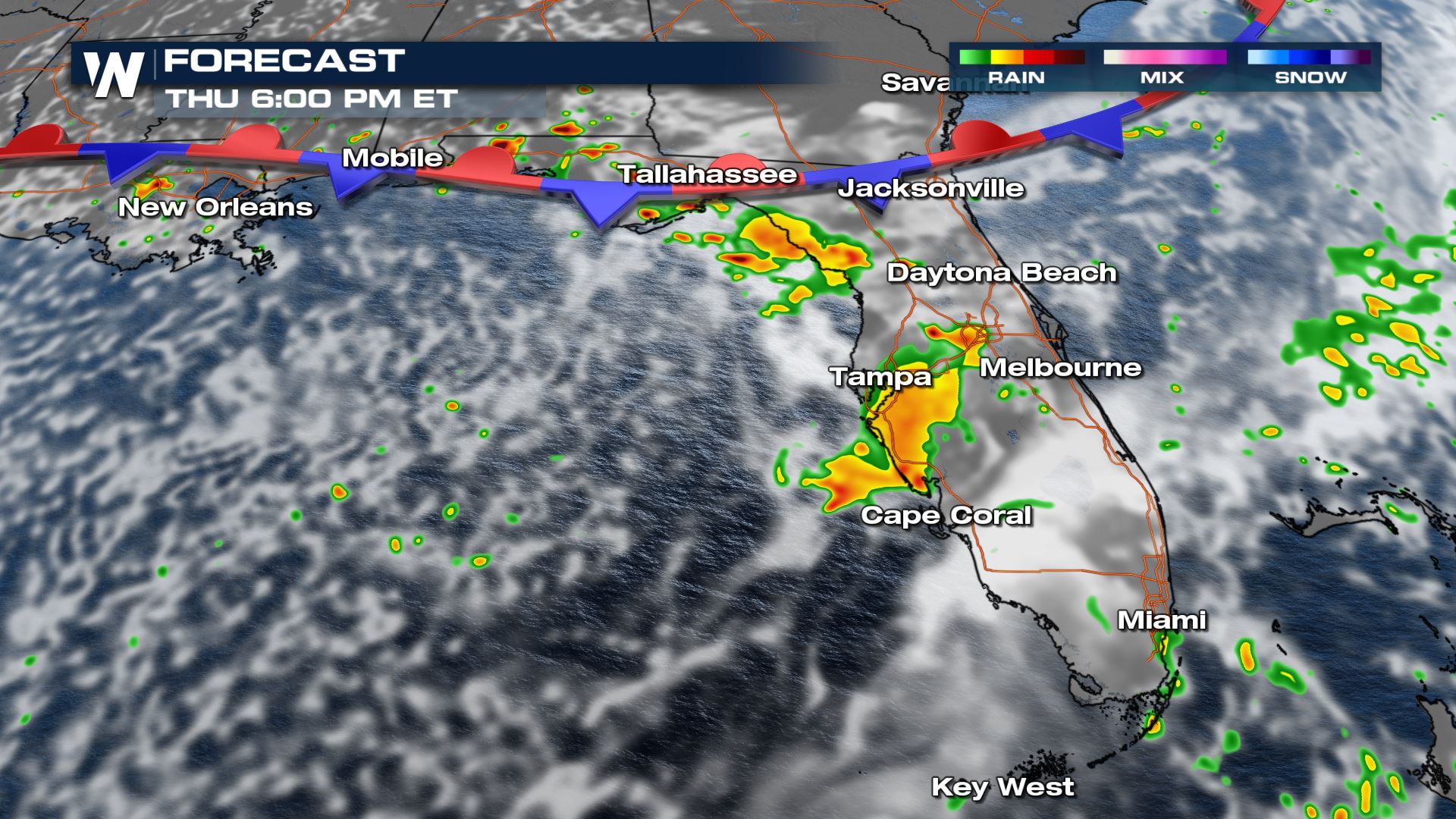 The forecast at 6 p.m. ET Thursday, June 24 showing rain in western Florida.
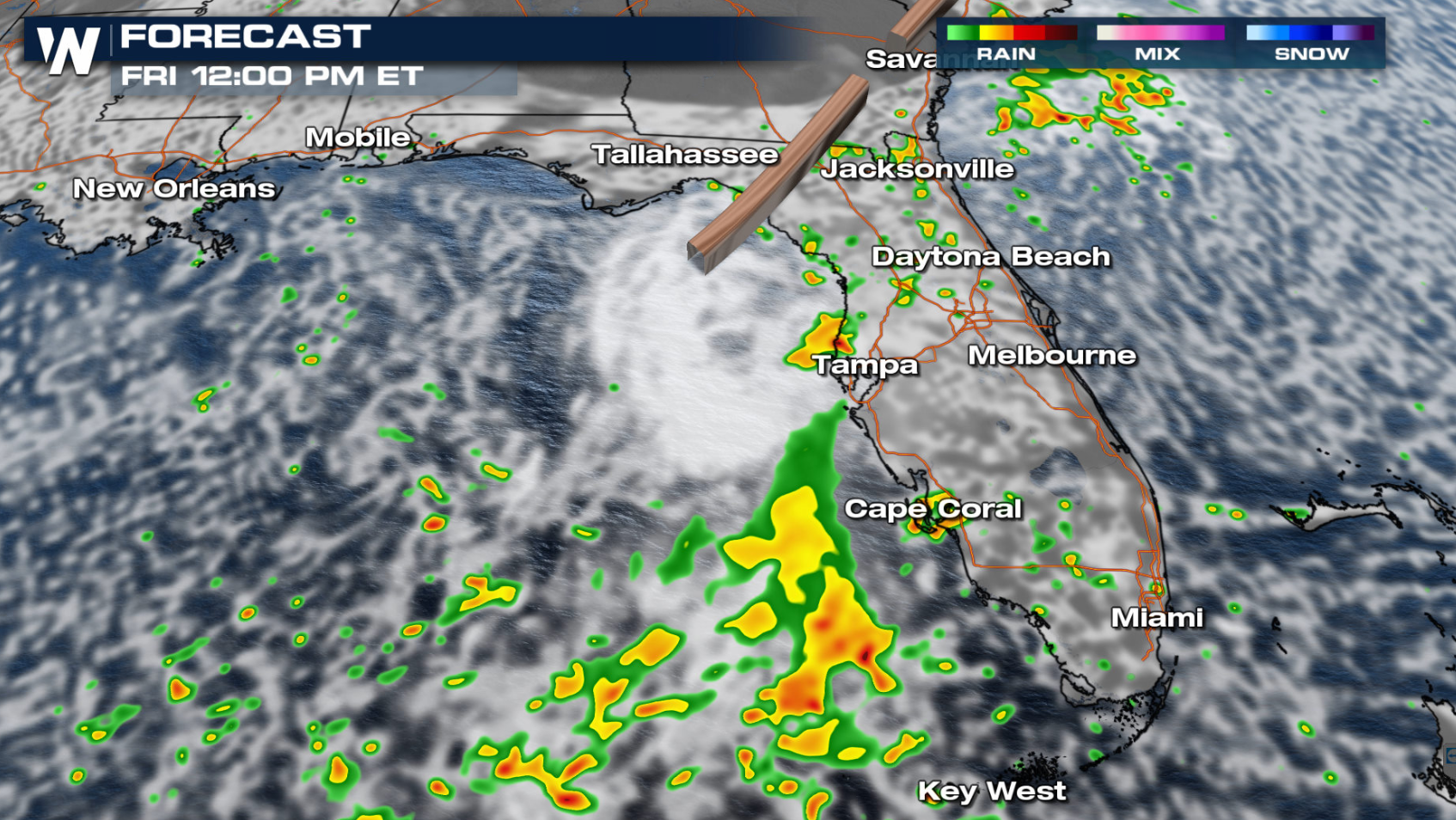
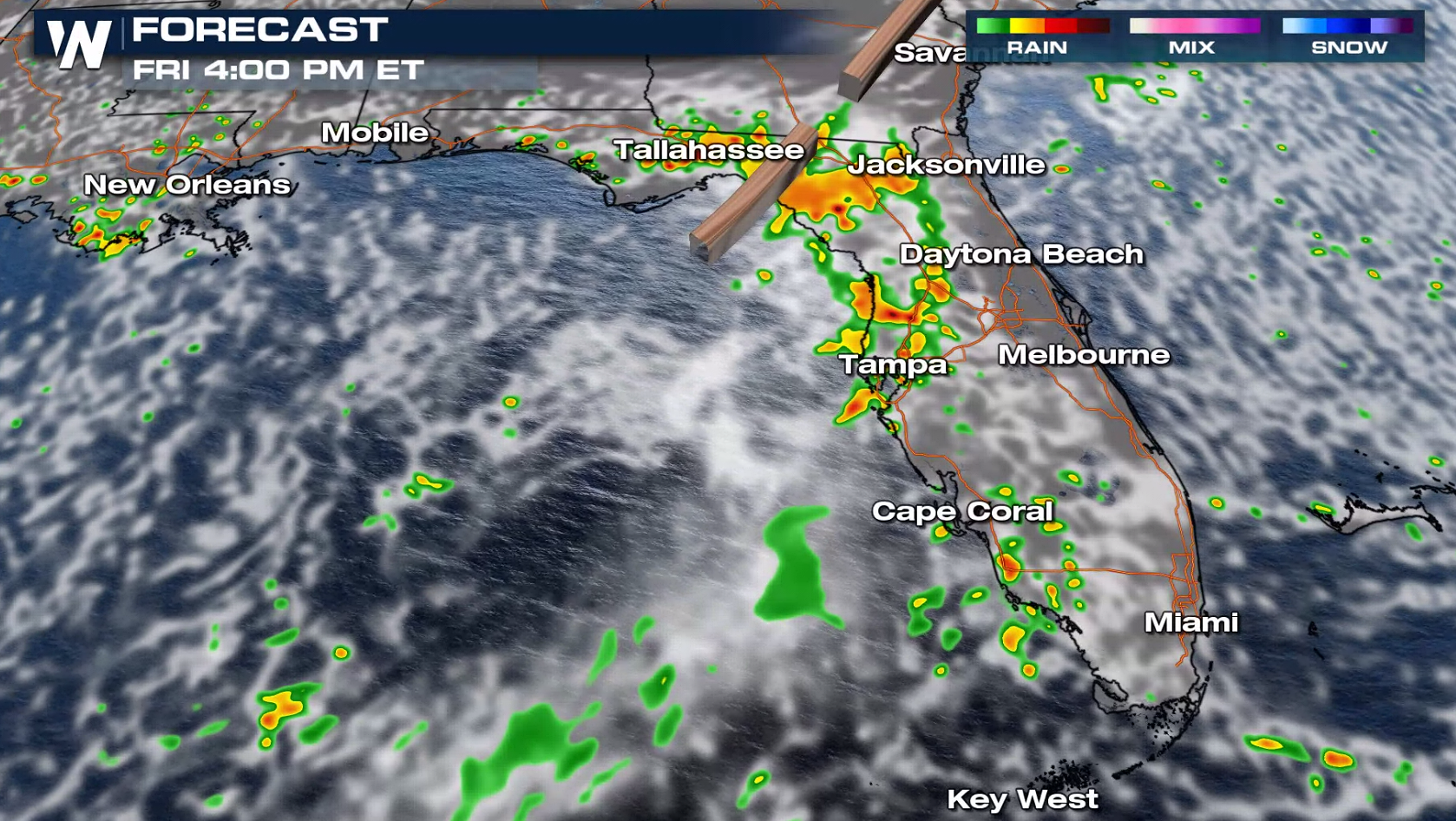
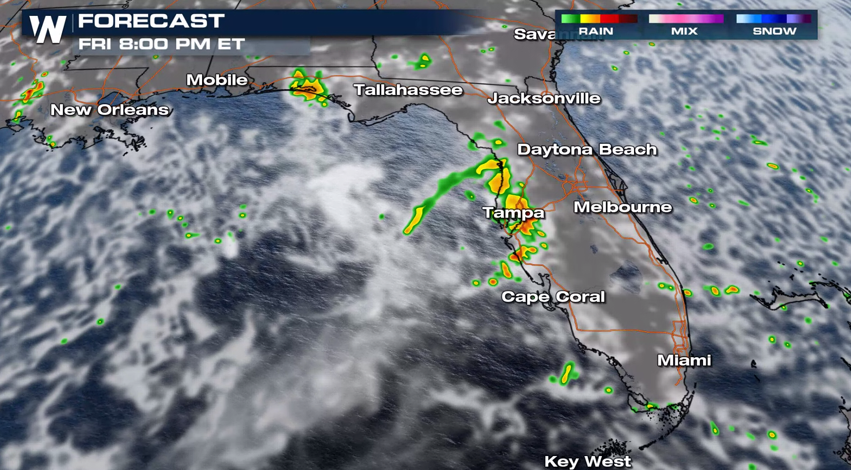
On Friday, *some* drier air will begin working its way in and help reduce the rain chances and shower coverage. Still, showers and thunderstorms will be possible and will favor the west coast of the state.
The forecast at 6 p.m. ET Thursday, June 24 showing rain in western Florida.
On Friday, *some* drier air will begin working its way in and help reduce the rain chances and shower coverage. Still, showers and thunderstorms will be possible and will favor the west coast of the state.
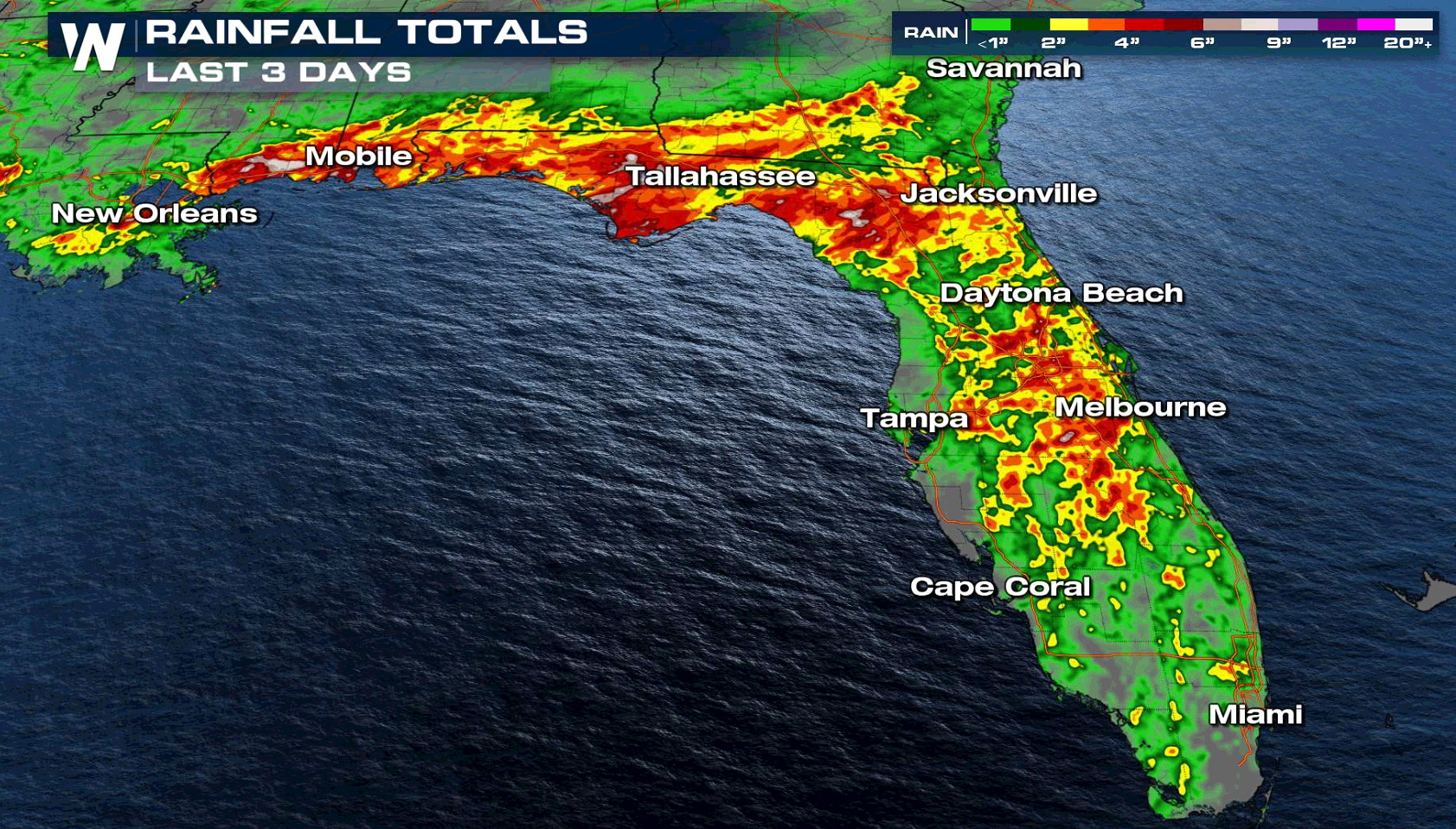
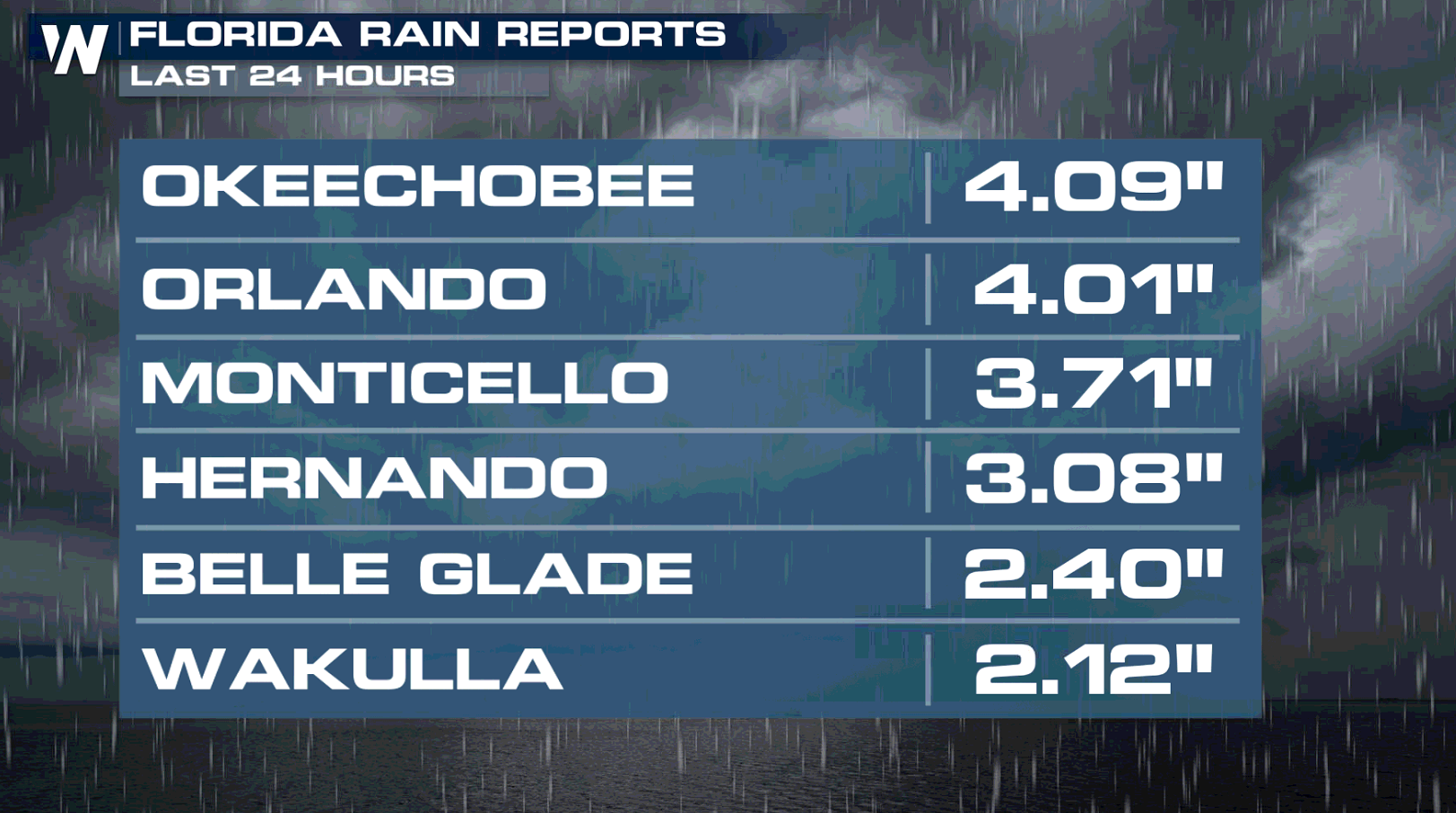
 In all, one to three inches of rainfall is likely through the end of the week for many Florida cities, with isolated amounts up to three to six inches! Listen for thunder and when it roars, go indoors. If you encounter flooding turn around, don't drown.
 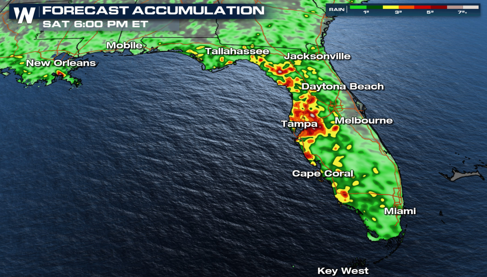 Stay up-to-date with the latest weather information here at weathernationtv.com, your local National Weather Service office, or your trusted source of weather information.
The stalled frontal boundary in northern Florida will remain locked in place today (Thursday), resulting in a day that begins sunny to partly cloudy, then turns cloudier and wetter in the afternoon. Showers will be most likely along Florida's east coast in the morning and midday, then Florida's west coast in the afternoon and evening.
The forecast at 11 a.m. ET Thursday, June 24 showing rain in southeast Florida.
The forecast at 2 p.m. ET Thursday, June 24 showing rain in western Florida.
The forecast at 6 p.m. ET Thursday, June 24 showing rain in western Florida.
On Friday, *some* drier air will begin working its way in and help reduce the rain chances and shower coverage. Still, showers and thunderstorms will be possible and will favor the west coast of the state.
In all, one to three inches of rainfall is likely through the end of the week for many Florida cities, with isolated amounts up to three to six inches! Listen for thunder and when it roars, go indoors. If you encounter flooding turn around, don't drown.
Stay up-to-date with the latest weather information here at weathernationtv.com, your local National Weather Service office, or your trusted source of weather information.All Weather News
More
Severe Storms Target the Midwest to the Northeast
UPPER MIDWEST - Through Monday, dangerous tor
28 Jul 2026 10:25 AM

Tropics: Fausto Heads towards Hawaii; Genevieve Cat 4 Hurricane
PacificHurricane Fausto continues to track we
28 Jul 2026 1:45 AM


Southeast Flood Risk Lingers Near Stalled Front
A stalled boundary over the Southeast will ke
25 Jul 2026 10:55 AM

Another Round of Storms Targets the Northeast
Tuesday brought severe weather again across p
23 Jul 2026 1:15 AM

Another Round of Severe Weather for the Upper Midwest and Great Lakes
The upper-level low train continues to keep t
21 Jul 2026 1:45 AM