Starting the Week with a Likelihood of Severe Storms in the Plains
Special Stories
11 Jun 2018 11:44 AM
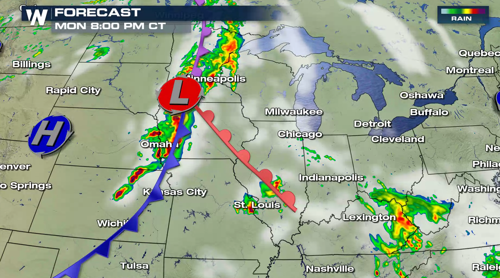
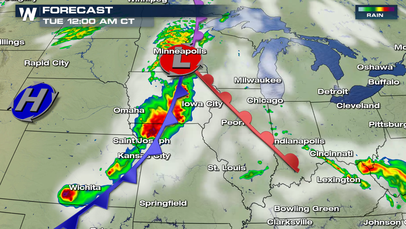
A sharp cold front will bring a risk for severe thunderstorms across the Plains this afternoon and evening (Monday). An enhanced risk for severe weather extends from western Iowa southward into Kansas. A slight risk covers nine states in the middle of the nation. Very large hail, golf ball sized and larger, along with a few tornadoes are possible. Strong wind gusts are a concern later tonight into early Tuesday.
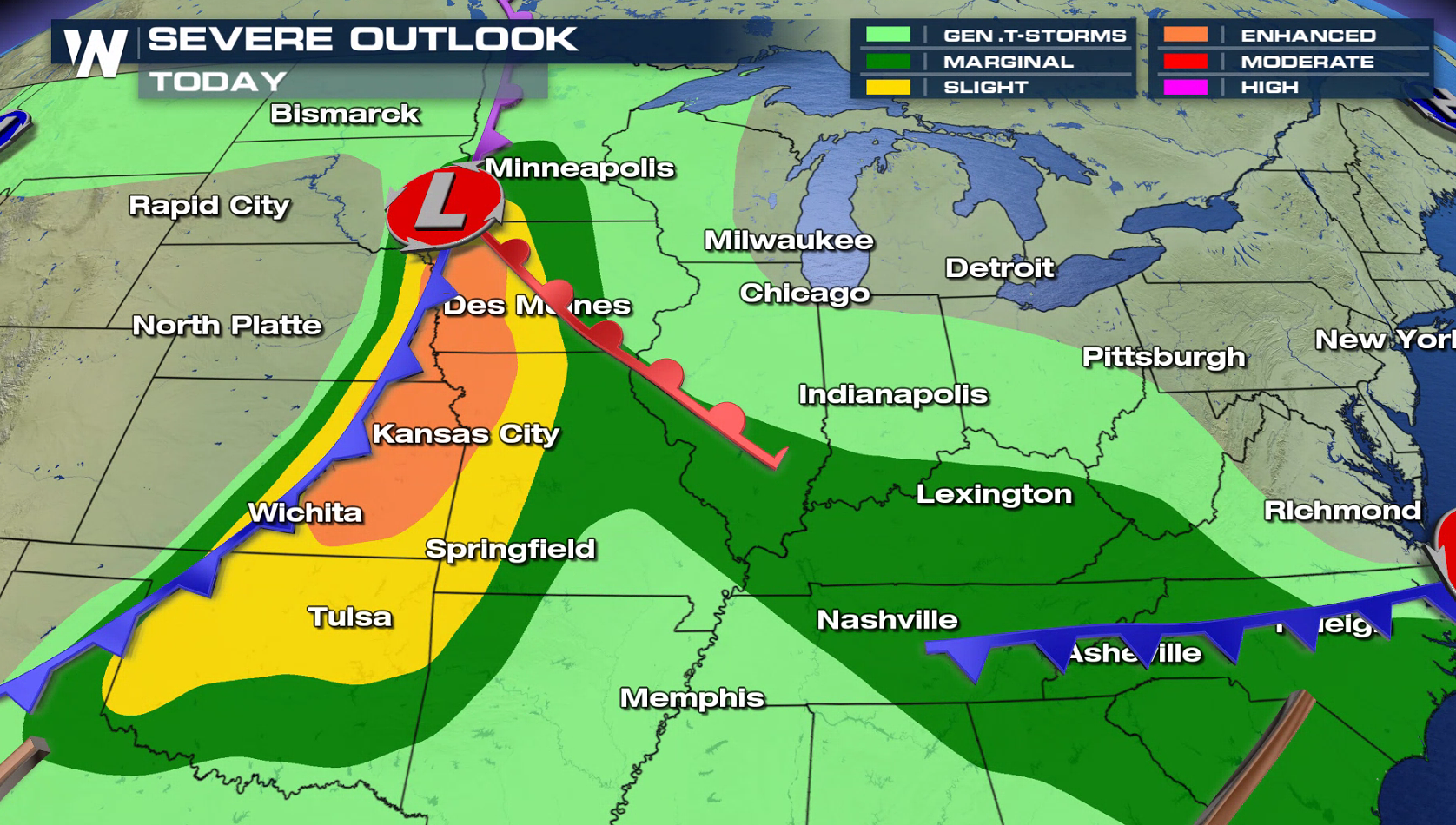
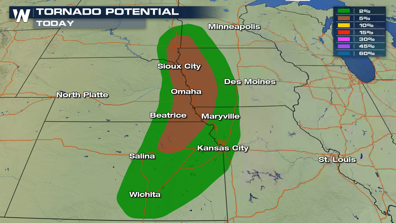
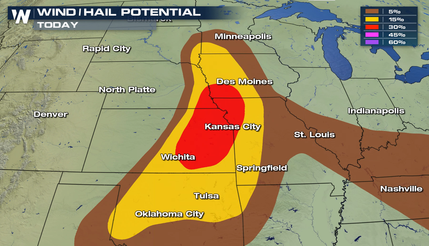 A cold front and low pressure center will be the focus for thunderstorm development during the afternoon. With warm temperatures and increasing humidity, instability will be high, fueling storms. Initial development will favor supercells with large hail and isolated tornadoes. A complex of thunderstorms later tonight may lead to damaging wind gusts.
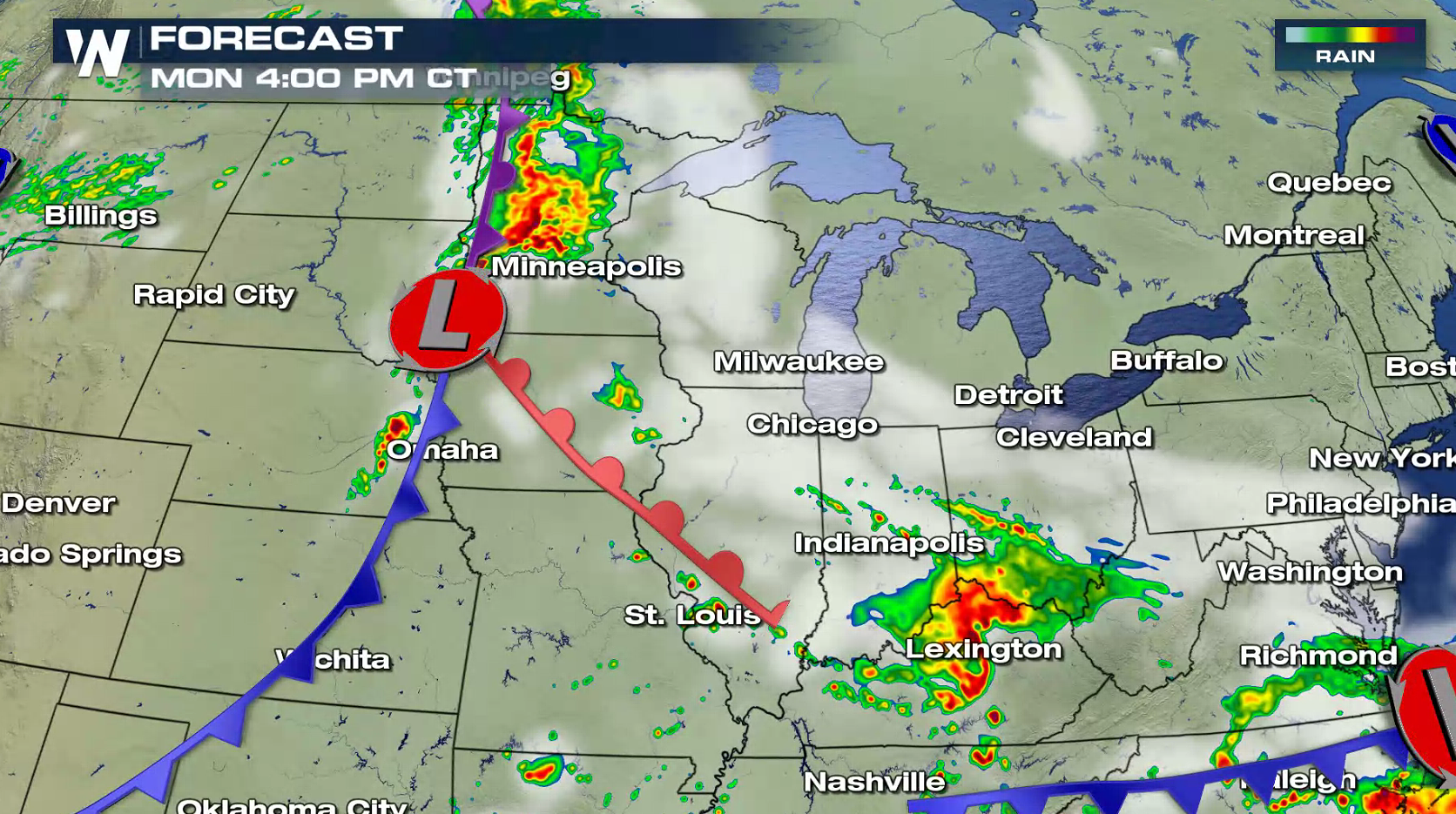
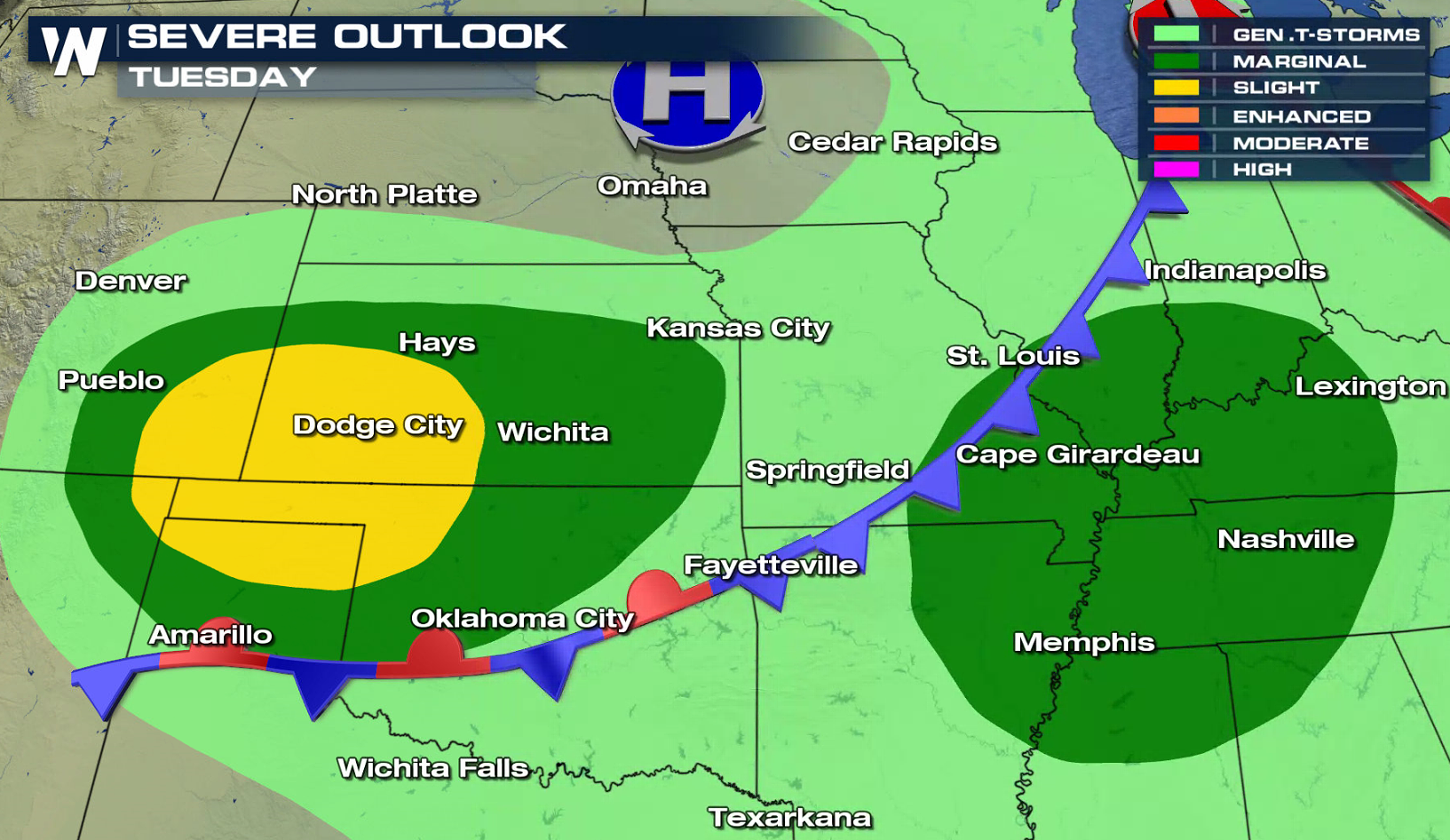
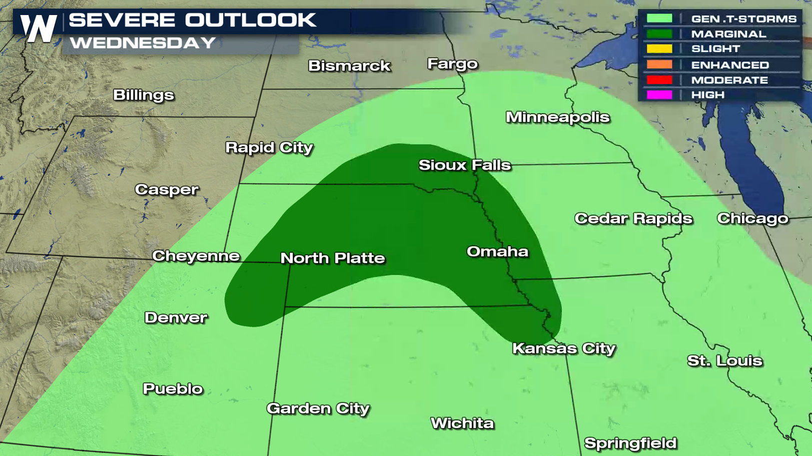
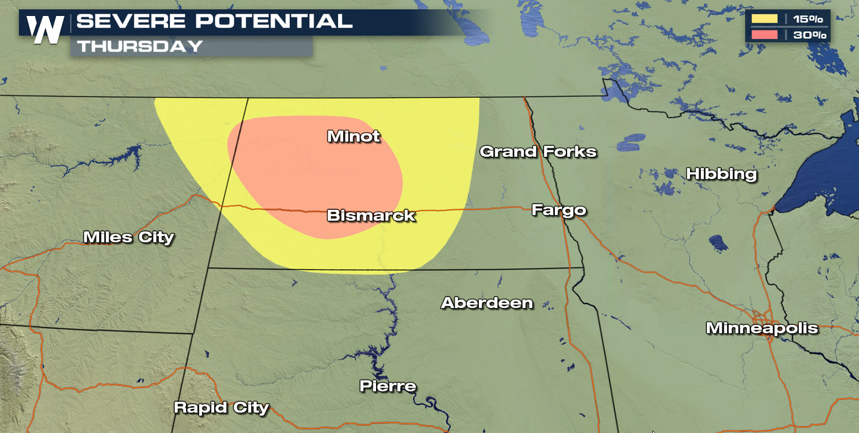
 Severe weather chances will continue across the Plains throughout much of the week. Risk areas extend from North Dakota to the Texas Panhandle. Stay tuned to WeatherNation on-air and online for up-to-date severe weather information and live reports in the field.
 For WeatherNation: Meteorologist Mace Michaels


 A cold front and low pressure center will be the focus for thunderstorm development during the afternoon. With warm temperatures and increasing humidity, instability will be high, fueling storms. Initial development will favor supercells with large hail and isolated tornadoes. A complex of thunderstorms later tonight may lead to damaging wind gusts.


 Severe weather chances will continue across the Plains throughout much of the week. Risk areas extend from North Dakota to the Texas Panhandle. Stay tuned to WeatherNation on-air and online for up-to-date severe weather information and live reports in the field.


 For WeatherNation: Meteorologist Mace Michaels
All Weather News
More