Storms, Flooding in the High Plains
Special Stories
22 May 2018 5:04 PM
Several more rounds of showers and thunderstorms are in the works for the northern Rockies and High Plains. Through the end of the week, wet weather may put a damper on your outdoor plans.
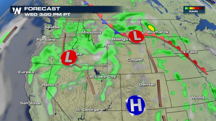
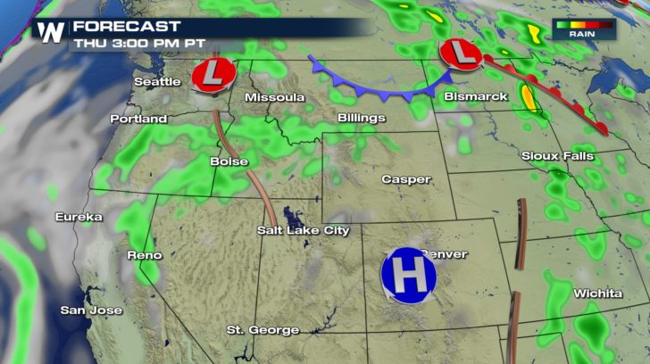
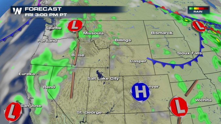 With the chance for thunderstorms comes the risk of severe weather and flooding. In fact, areas east of the Rocky Mountains have a chance for large hail and gusty winds Wednesday afternoon and evening.
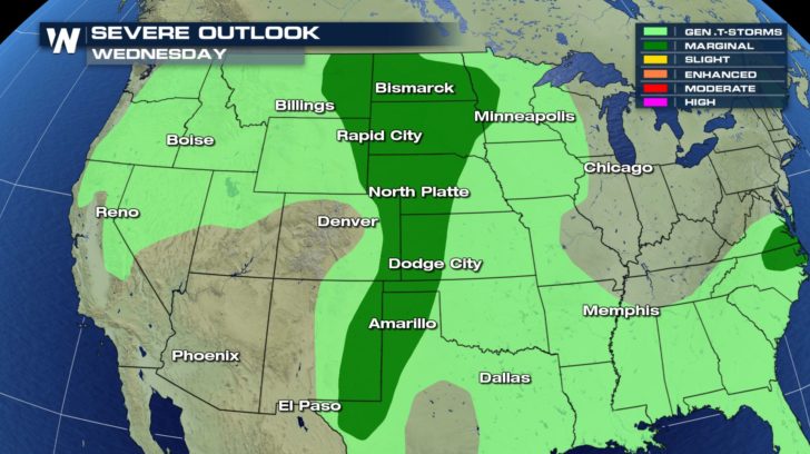 Flood Watches have been posted through Thursday morning in Montana and Wyoming.
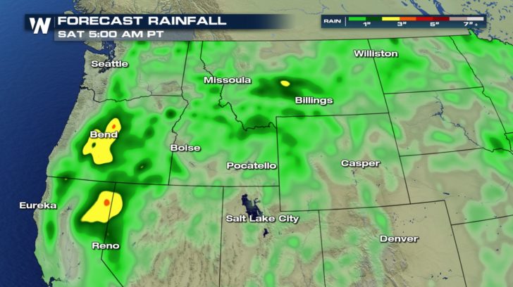
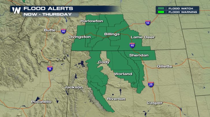 Rainfall of 0.50 to 1.50 inches is possible in areas such as Wyoming's Wind River Mountains and Basin, Big Horn Mountains and Basin, and the Absaroka Mountains. South central Montana, including Billings, will also pick up significant rain.
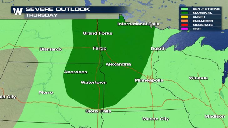
 By Thursday, this system will push east into the Dakotas and Upper Midwest, bringing the risk of severe weather to cities like Fargo.
 Keep it tuned to WeatherNation for the latest forecast information.
-Meteorologist Joe Astolfi


 With the chance for thunderstorms comes the risk of severe weather and flooding. In fact, areas east of the Rocky Mountains have a chance for large hail and gusty winds Wednesday afternoon and evening.
 Flood Watches have been posted through Thursday morning in Montana and Wyoming.
 Rainfall of 0.50 to 1.50 inches is possible in areas such as Wyoming's Wind River Mountains and Basin, Big Horn Mountains and Basin, and the Absaroka Mountains. South central Montana, including Billings, will also pick up significant rain.
 By Thursday, this system will push east into the Dakotas and Upper Midwest, bringing the risk of severe weather to cities like Fargo.
 Keep it tuned to WeatherNation for the latest forecast information.
-Meteorologist Joe Astolfi
Keep it tuned to WeatherNation for the latest forecast information.
-Meteorologist Joe AstolfiAll Weather News
More