Storms near the Great Lakes moving east

Special Stories
29 Jul 2020 1:44 PM
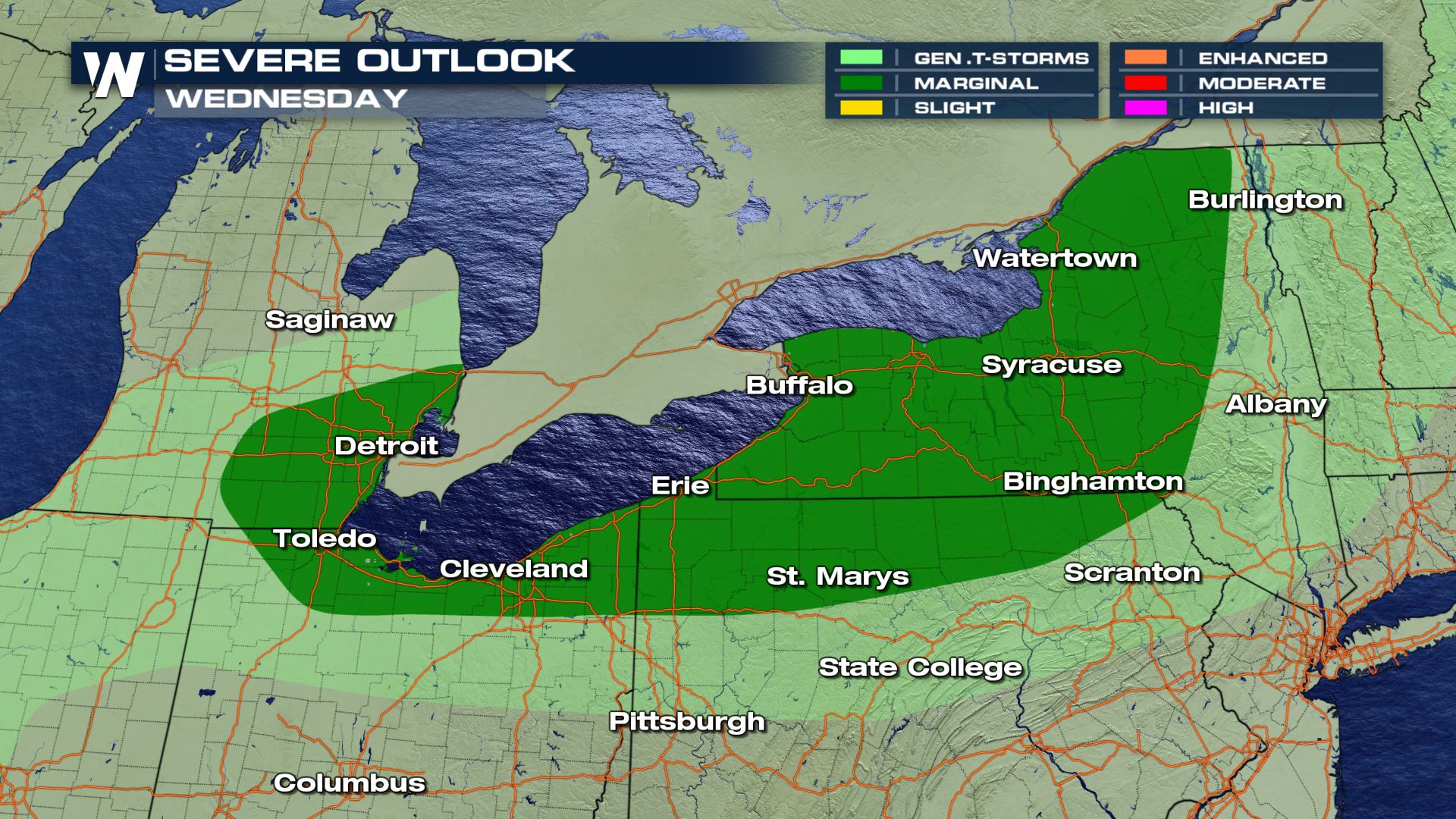
With a cold front moving over the Great Lakes our chances for severe weather continues into the afternoon. Ongoing storms continue to impact areas of New York and the northern edge of Pennsylvania. These storms are gaining strength from the moisture off of Lake Erie as well as running into warm air east of the lakes. As the do so, our cold front will help navigate more storms into the Great Lake States.
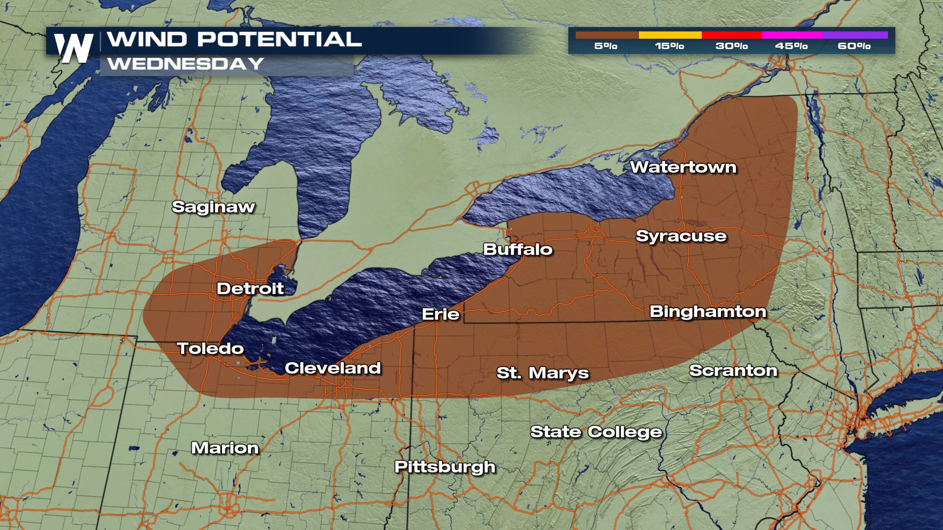
The Storm Prediction Center has portions of the Great Lakes under a marginal (level 1 out of 5) risk for severe weather with strong gusty winds up to 60 mph as our primary threat.
 As these storms lose a bit of daytime heating they will slow down into the late evening and overnight before moving towards the Atlantic seaboard. Our forecast models show this continuing to move east-bound towards the Atlantic by Thursday.
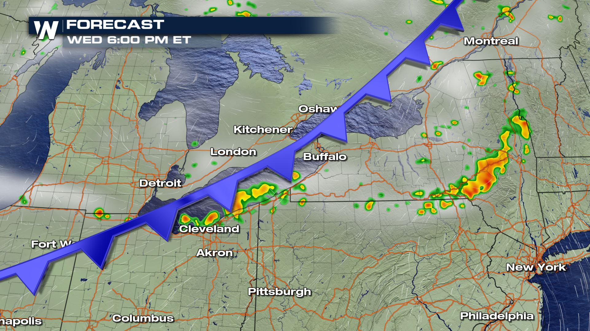 One of the interesting dynamics, in combination with the cold front, is that some of these storms are impacted by the Lake Breeze. What does that mean? Meteorologist Joe Astolfi explains below:
[embed]https://www.youtube.com/watch?v=79acHURtN3E[/embed]
For more information keep checking back in with WeatherNation or follow us on twitter @WeatherNation.
One of the interesting dynamics, in combination with the cold front, is that some of these storms are impacted by the Lake Breeze. What does that mean? Meteorologist Joe Astolfi explains below:
[embed]https://www.youtube.com/watch?v=79acHURtN3E[/embed]
For more information keep checking back in with WeatherNation or follow us on twitter @WeatherNation.
As these storms lose a bit of daytime heating they will slow down into the late evening and overnight before moving towards the Atlantic seaboard. Our forecast models show this continuing to move east-bound towards the Atlantic by Thursday.
One of the interesting dynamics, in combination with the cold front, is that some of these storms are impacted by the Lake Breeze. What does that mean? Meteorologist Joe Astolfi explains below:
[embed]https://www.youtube.com/watch?v=79acHURtN3E[/embed]
For more information keep checking back in with WeatherNation or follow us on twitter @WeatherNation.All Weather News
More

Flooding, Severe Storms Target the Midwest Again
After an active week of storms across the nor
1 Aug 2026 1:40 AM


After Reaching Category 5, Genevieve Weakens in the Pacific
PacificFausto is now a post-tropical cyclone.
31 Jul 2026 1:30 AM

Flooding Risk Increases as Heavy Rain Targets the Tri-State Area
Tuesday, heavy rainfall moved across the Nort
30 Jul 2026 12:25 AM

Severe Weather: Energy From the Midwest Now in the Southeast
UPPER MIDWEST - Through Monday, dangerous tor
29 Jul 2026 10:30 PM