Storms Return From the Front Range to Texas

Top Stories
12 Jul 2025 2:50 AM
Moisture is moving back into the Central and Southern tier of the Rockies and Plains states, bringing flood chances back to the forecast, including Texas this weekend.
A low-pressure system will ride around a ridge of high pressure, increasing wind shear in the region, which will help to organize a few severe thunderstorms with severe weather outlooks in place through Saturday.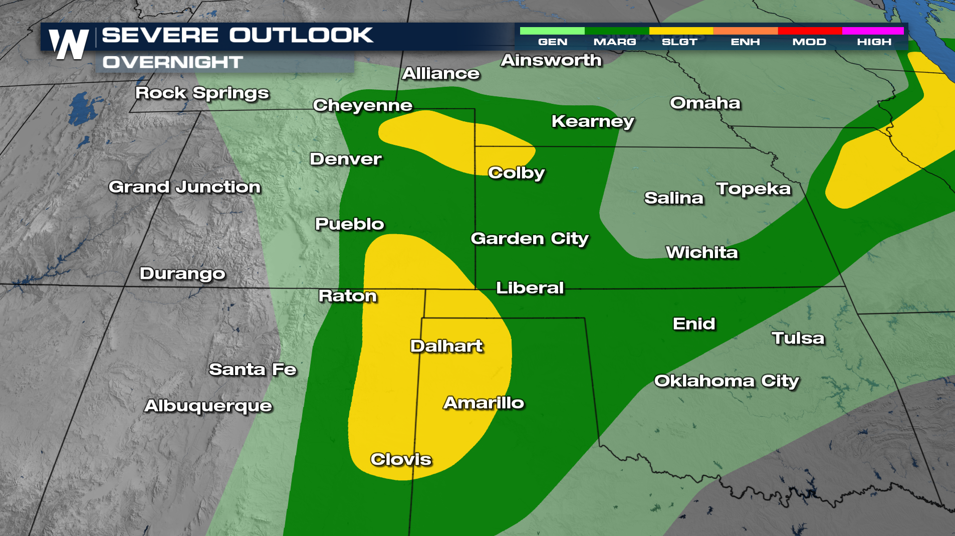
Flood Potential
Heavy rain will return with thunderstorms, particularly between I-20 and I-40 where flood potential will be elevated. 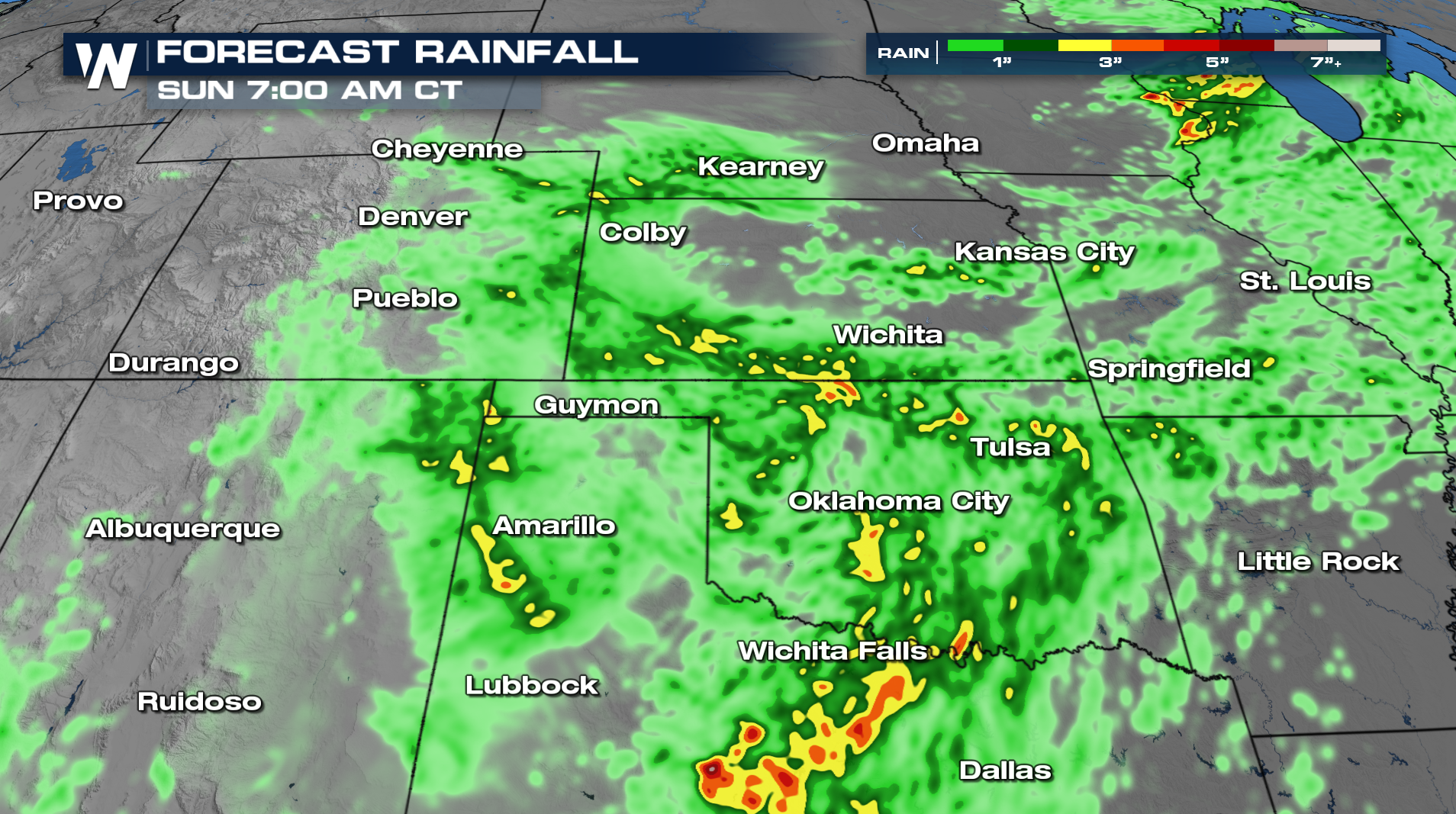
Forecast / Timing
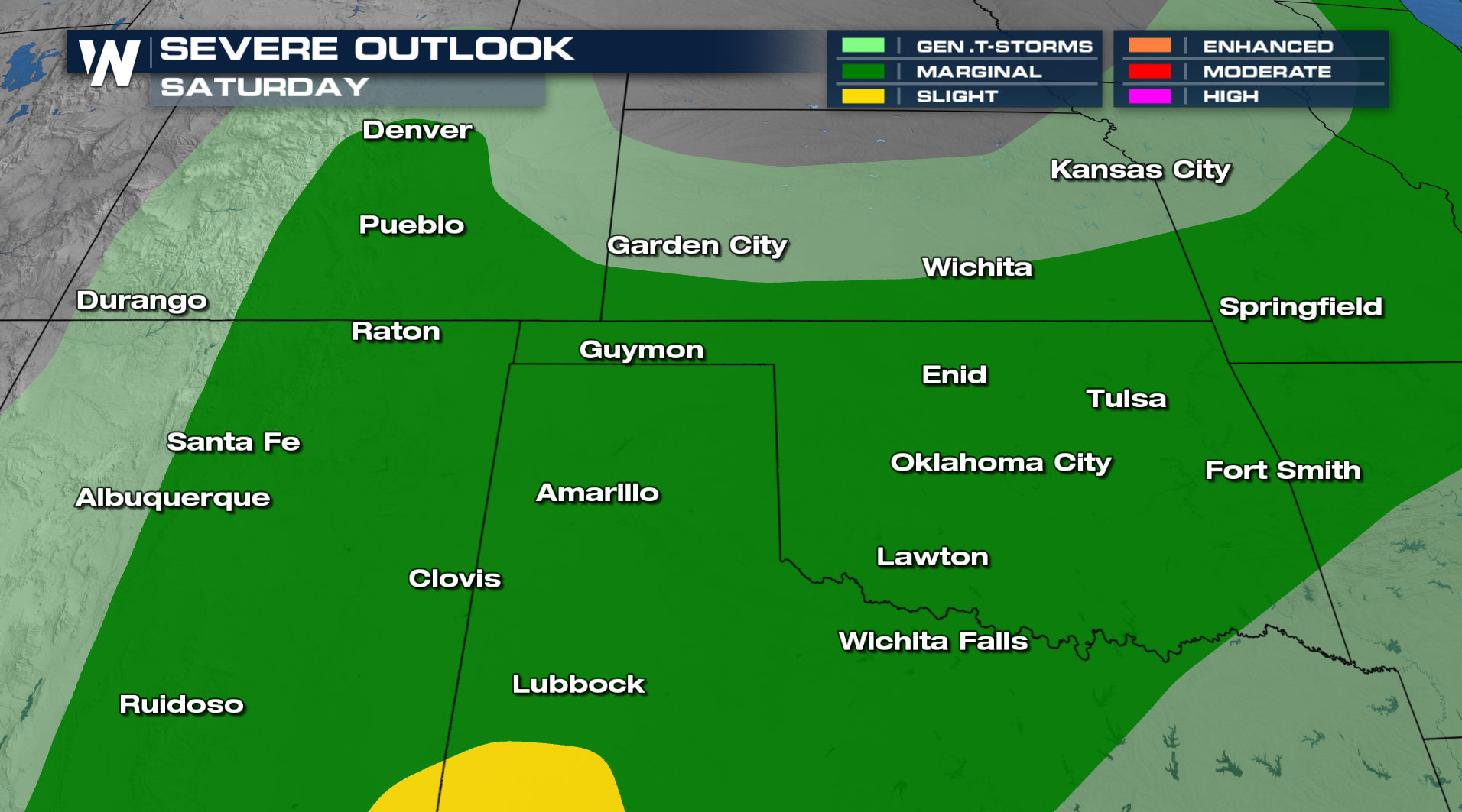
Saturday, we will see more scattered showers and storms closer to the cold front in SE Colorado, New Mexico, and Oklahoma.
Tune into the central regional forecast :30 past the hour for the latest updates.
All Weather News
More

Severe Storms, Flash Flooding Overnight In Midwest
WHAT TO EXPECTIt was a very active day across
22 Jun 2026 1:50 AM


Summer Solstice Kicks Off Father's Day Sunday
Fathers across the country will have to share
21 Jun 2026 5:20 PM

Flood Risk Continues This Weekend for the Gulf Coast States
Numerous flash flood warnings were issued as
21 Jun 2026 1:15 PM

Dry T-Storms & Fire Danger in the West
A weak low-pressure system moving through the
20 Jun 2026 1:40 PM

Tornadoes Tear Through The Midwest, Isolated Severe Storms in the South
EARLIER THIS WEEKMONTROSE, IL - A dangerous t
20 Jun 2026 1:30 AM