Storms to Soak St. Louis

Special Stories
8 Aug 2020 8:08 PM
Slow-moving thunderstorms will bring the potential for heavy rainfall and flash flooding overnight and into the morning hours of Sunday across the Mid-Mississippi River Valley. The city of St. Louis and surrounding communities on both sides of the river---in Missouri and Illinois---should brace for the possibility of inclement weather.
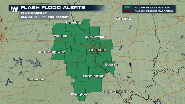
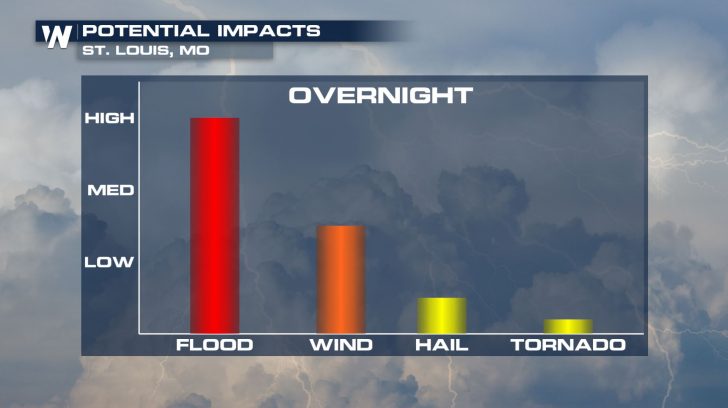 These thunderstorms will generally move in a northwest-to-southeast direction and will "train" over the same locations in a short period of time. Training thunderstorms are capable of producing excessive rainfall totals. Because of this, a Flash Flood Watch is in effect for parts of eastern Missouri and western Illinois through mid-morning Sunday.
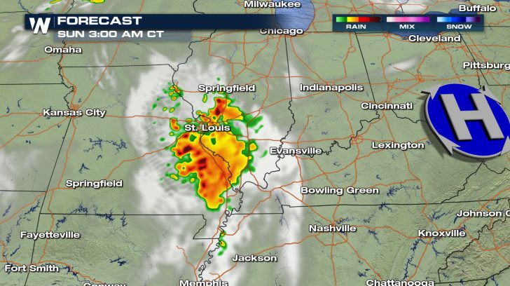
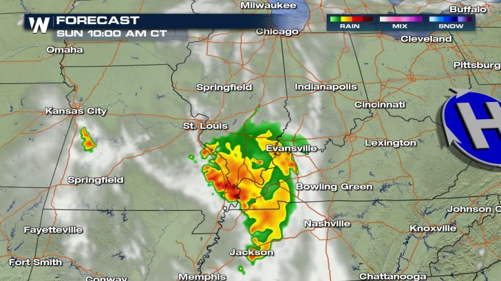
 Morning thunderstorms will give way to sunshine by Sunday afternoon. Unfortunately, more rain is in the forecast. Rounds of thunderstorms---leading to the possibility of more heavy rain and flash flooding---will impact the central United States in the days ahead. A cold front positioned to the north that will bring the risk of severe thunderstorms to the Upper Midwest on Sunday will increase the threat on Monday from Kansas to Michigan.
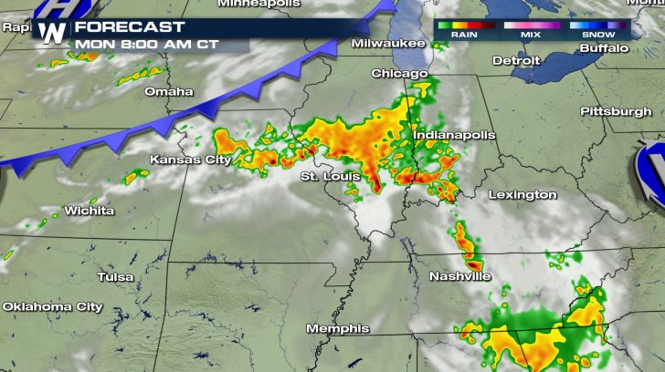
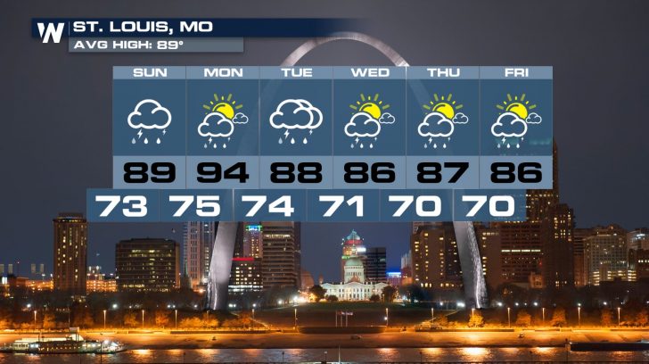
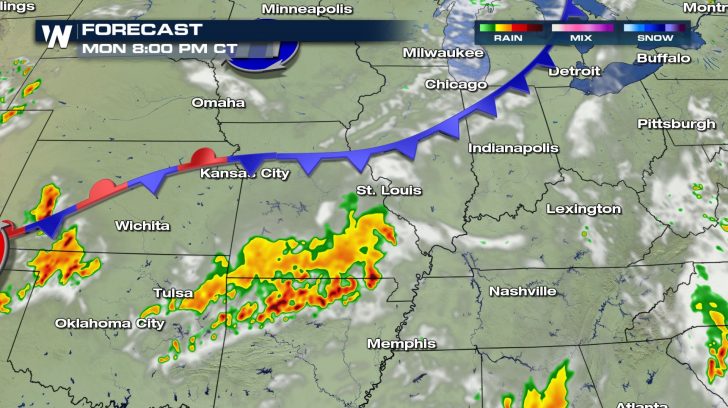 Rain totals will likely range between 2 and 5 inches, but may exceed 6 or 7 inches in a few isolated areas. The week ahead will include several chances for showers and thunderstorms in cities such as St. Louis.
 Be sure to follow WeatherNation for the very latest forecast.
These thunderstorms will generally move in a northwest-to-southeast direction and will "train" over the same locations in a short period of time. Training thunderstorms are capable of producing excessive rainfall totals. Because of this, a Flash Flood Watch is in effect for parts of eastern Missouri and western Illinois through mid-morning Sunday.
Morning thunderstorms will give way to sunshine by Sunday afternoon. Unfortunately, more rain is in the forecast. Rounds of thunderstorms---leading to the possibility of more heavy rain and flash flooding---will impact the central United States in the days ahead. A cold front positioned to the north that will bring the risk of severe thunderstorms to the Upper Midwest on Sunday will increase the threat on Monday from Kansas to Michigan.
Rain totals will likely range between 2 and 5 inches, but may exceed 6 or 7 inches in a few isolated areas. The week ahead will include several chances for showers and thunderstorms in cities such as St. Louis.
Be sure to follow WeatherNation for the very latest forecast.All Weather News
More
Texas Facing Major Flood Threat This week
Texas is facing a major flooding threat this
15 Jul 2026 1:45 AM

Canadian Wildfires to Send Thick Dense Smoke Across The Northern U.S.
As temperatures have soared across the Northe
15 Jul 2026 1:45 AM

Rare Enhanced Severe Threat For New England
WHAT TO EXPECT The SPC has issued a severe ou
15 Jul 2026 1:35 AM

Historic Heatwave Hits the Northern Rockies, California Heat Expands
Dangerous heat and record high temperatures c
15 Jul 2026 1:30 AM

Monsoon Moisture Returns to the Southwest, Increasing Storm and Flash Flood Potential
After weeks of hot and mostly dry weather, th
14 Jul 2026 4:15 PM

Saharan Dust and Excessive Heat Impact the Southeast
Hazy skies will be hovering over portions of
14 Jul 2026 10:05 AM

Another Day of Storms for the Plains & Front Range
Several rounds of severe weather have been ro
11 Jul 2026 1:50 AM